It’ll be a breezy one today. And cooler. Cold air continues to move in following the passage of a cold front. A weather system coming from the northern states toward the Ohio River Valley will bring a strong high-pressure system with it, which will push away any remaining moisture and clouds from the previous weather system.
As this high-pressure system builds, we can anticipate brisk north winds, making the temperatures feel even colder. Overnight, temperatures will drop significantly, falling into the 20s for most areas. With the wind continuing, wind chill values could plummet to around 0 to 5 degrees above zero north of I-20 and around 5 to 10 degrees south of I-20.
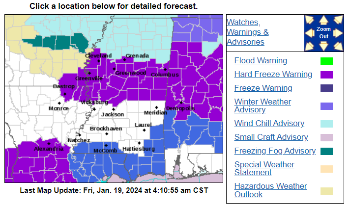
Because of these conditions, a Wind Chill Advisory is in effect for most of the area tonight through tomorrow morning. There are a potpourri of other Warnings and Advisories in place, too.
Over the weekend, the chilly weather will continue. Saturday many areas north of Interstate 20 will struggle to reach the freezing mark during the day. Saturday night is expected to be the coldest night of the weekend, with temperatures dropping back into the teens and 20s again, especially if there are no significant clouds.
On Sunday, temperatures will begin to moderate as the colder air retreats, and most areas will see temperatures back into the 40s. However, another freeze is anticipated for Sunday night, except in some parts of southwest Mississippi and northeast Louisiana, where clouds and warmer air will limit the cooling. While there’s a chance of precipitation as a new storm system approaches, it’s expected to arrive after temperatures have risen above freezing on Monday morning.
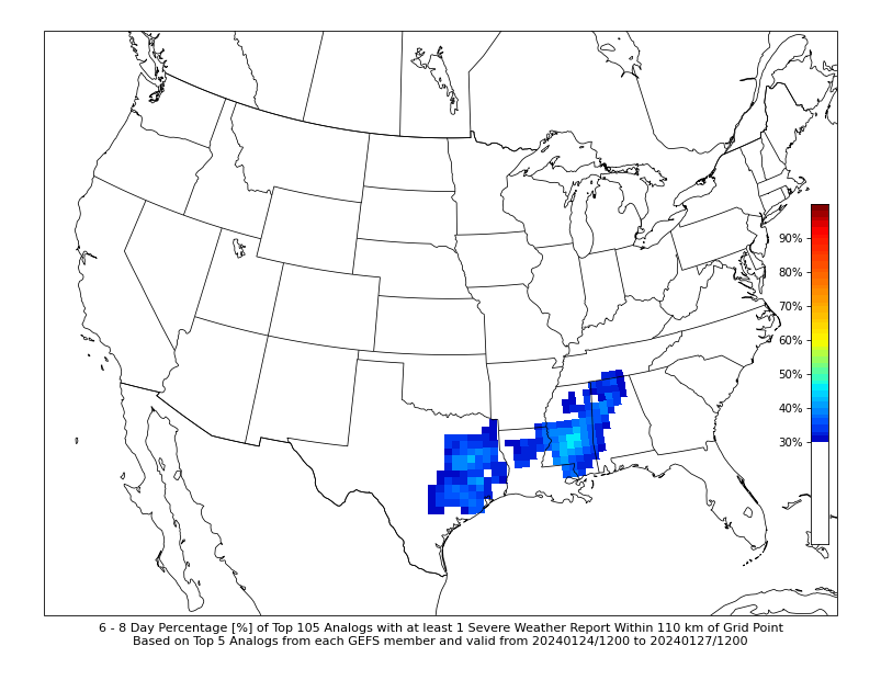
Looking ahead to the coming week (Monday through Thursday), the weather pattern will shift from cold and dry to wet and milder. And we may see a shot for some pretty heavy rain at times. There’s some uncertainty about the exact locations of the heaviest rain, but it could lead to localized flooding. Plus there will be a chance for a few severe storms.
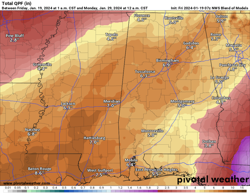
I think the rainfall totals shown above are probably a bit aggressive, but I think by the time things are all said and done next weekend, many spots could see rainfall totals of 4″ to 5″ with a few spots closer to 7″ or 8″ of rain.
REIGONAL DAY TO DAY FORECAST
Friday: Mostly sunny. Highs in the lower 50s. North winds 10 to 15 mph with gusts up to 30 mph.
Friday Night: Clear. Much colder with lows in the lower 20s. North winds 10 to 15 mph.
Saturday: Sunny, cooler with highs in the lower 40s. North winds 10 to 15 mph.
Saturday Night: Mostly clear in the evening, then becoming partly cloudy. Cold with lows around 19. Northeast winds 5 to 10 mph.
Sunday: Mostly sunny. Highs in the mid 40s.
Sunday Night: Mostly cloudy. Not as cold with lows around 30.
Monday: Partly sunny in the morning, then becoming mostly cloudy. Not as cool with highs around 60.
Monday Night: Mostly cloudy. A slight chance of showers in the evening, then a chance of showers with a slight chance of thunderstorms after midnight. Not as cool. Near steady temperature in the mid 50s. Chance of rain 40 percent.
Tuesday: Mostly cloudy with a slight chance of thunderstorms. A chance of showers in the morning, then showers likely in the afternoon. Highs in the upper 60s. Chance of rain 60 percent.
Tuesday Night: Showers likely with a slight chance of thunderstorms. Near steady temperature in the lower 60s. Chance of rain 60 percent.
Wednesday: Showers likely with a slight chance of thunderstorms. Highs in the lower 70s. Chance of rain 60 percent.
Wednesday Night: Showers likely with a slight chance of thunderstorms. Near steady temperature in the mid 60s. Chance of rain 60 percent.
Thursday: Showers likely with a slight chance of thunderstorms. Highs in the lower 70s. Chance of rain 70 percent.


