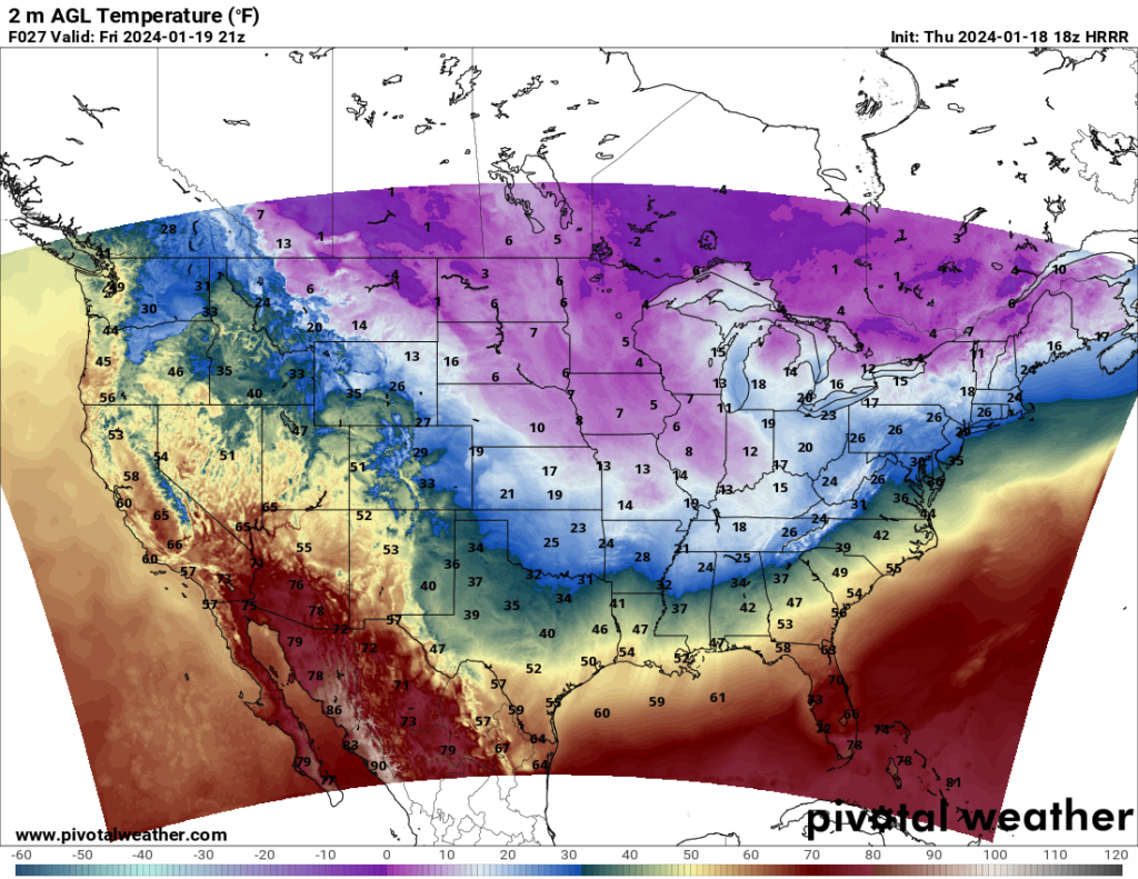
The forecast for the weekend can be summed up in one word: frigid. An Arctic air mass is currently moving south across the eastern and central part of the country, bringing very cold temperatures, even dangerously cold temperatures in some areas. The Midwest will get the worst of it, with highs in the single digits and the lows in the negative 10s in some places.
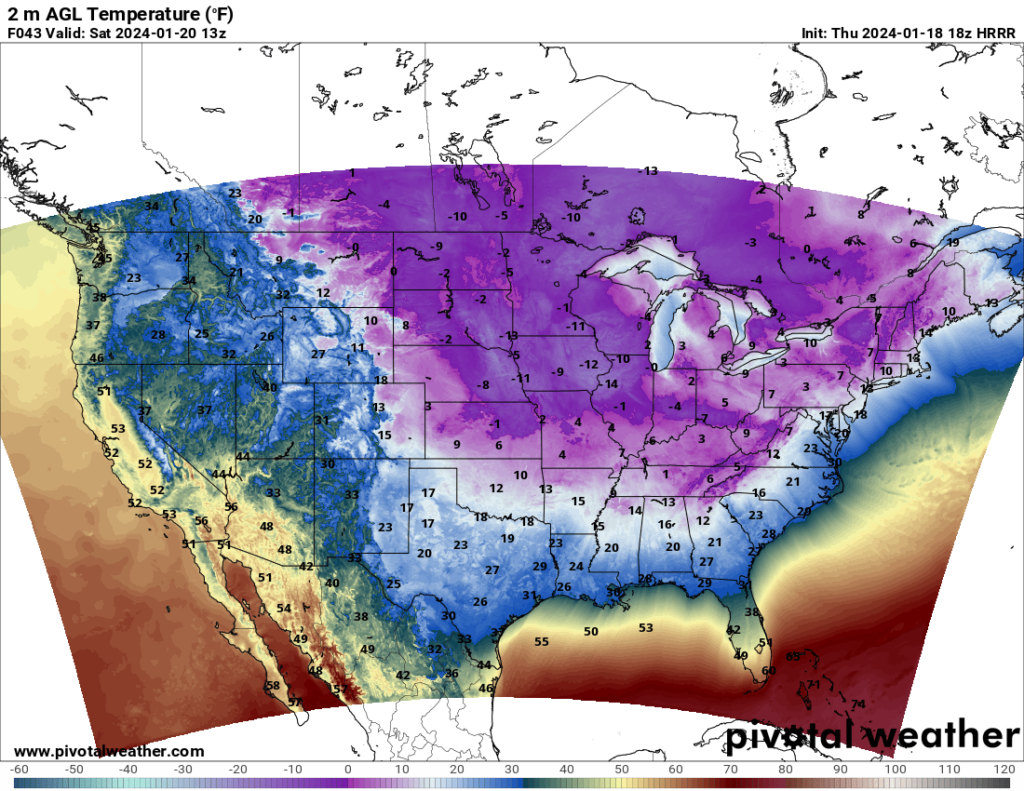
Things will start to get better Sunday, but “better” is a relative term here, as temperatures will still be very cold in the eastern half of the country. It won’t be until next week that the temperatures warm up more significantly.
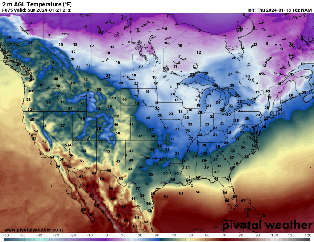
As for the rest of the CONUS, rain and snow (depending on elevation) is forecast over quite a bit of the western third of the country, but they will be spared the extreme cold the rest of the country is facing.


