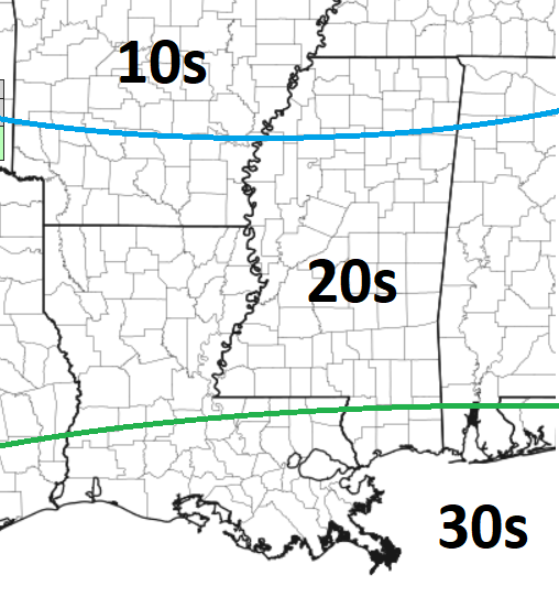
Looking toward the weekend, it looks like we’ve got a brief cooldown coming, but certainly nothing like we just saw move through. This weekend, overnight lows will be down into the 20s across much of the region. The teens will be stuck to the north and 30s will be realized closer to the coast.
We start to warm things up next week again with another shot for showers and storms. And, looking at the latest data, it looks like a fair bit of rain will be possible with the chance for some severe weather, too.
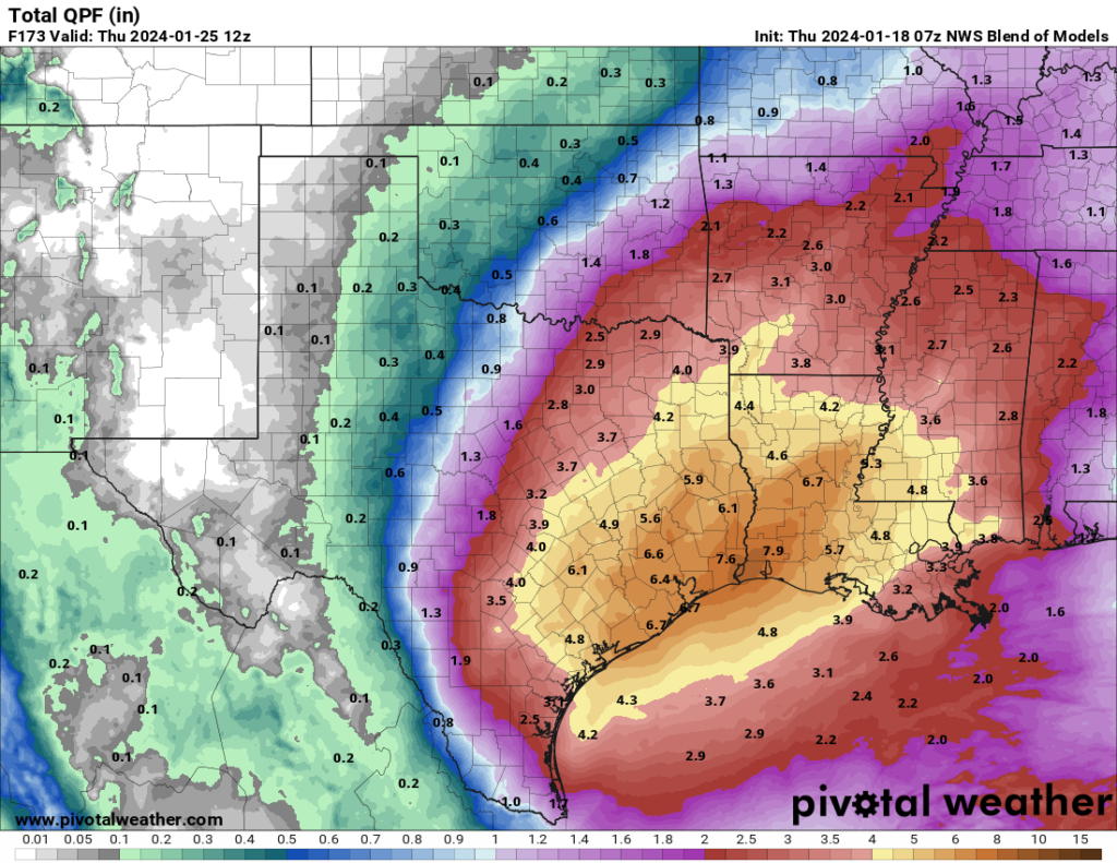
The “National Blend of Models” from the NWS shows the biggest slug of rainfall closer to Houston, but parts of Louisiana, Mississippi and Alabama are looking at 3″ to 5″ of rain next week.
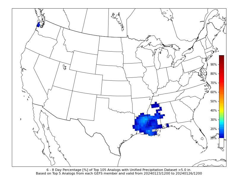
Looking at the CIPS Analogs, it shows the risk for the highest rainfall totals across parts of northern Louisiana. The map below, on the left, is the percentage of analogs that show more than 5″ of rain.
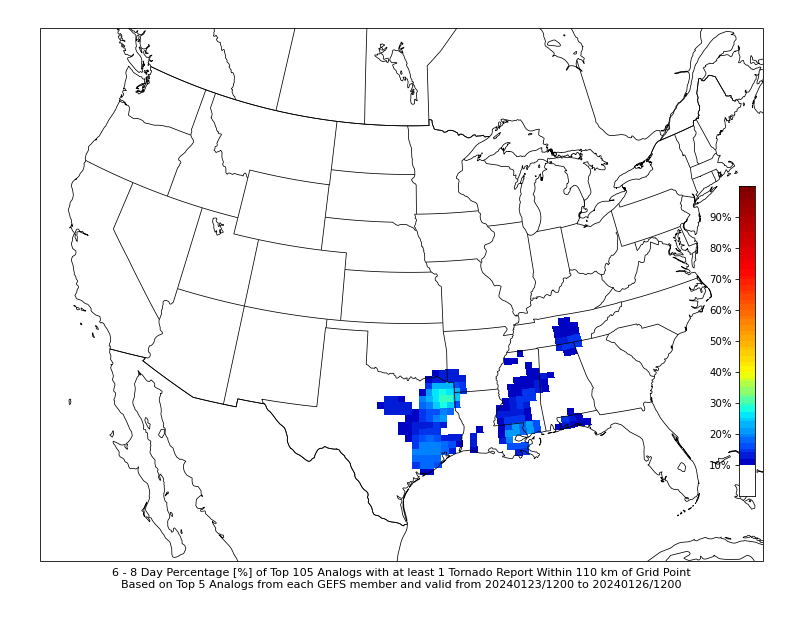
The map above, and on the right, shows the percent chance of at least one tornado. In this case the bullseye is across parts of northeast Texas and southeastern Louisiana.
The timeline on this rain would likely be between late Monday night and early Friday morning. It will likely come in a few batches, and won’t be a washout every day. But keep the umbrella handy next week and I’ll continue to try and hone in on when the biggest risk for severe weather might be. As of now, I’d estimated Thursday night.
REGIONAL DAY TO DAY FORECAST
Today
Partly sunny with a slight chance of rain showers this morning, then mostly cloudy with a chance of rain showers this afternoon. Not as cool with highs in the upper 50s. Southeast winds 5 to 10 mph. Chance of rain 40 percent.
Tonight
Mostly cloudy. A chance of showers in the evening. Not as cool with lows in the upper 30s. Southwest winds 5 to 10 mph, becoming northwest after midnight. Chance of rain 30 percent.
Friday
Sunny. Highs around 50. North winds 15 to 20 mph.
Friday Night
Clear. Much colder with lows in the lower 20s. North winds 10 to 15 mph.
Saturday
Sunny. Highs in the lower 40s. North winds 10 to 15 mph.
Saturday Night
Mostly clear. Cold with lows in the lower 20s.
Sunday
Mostly sunny. Highs in the upper 40s.
Sunday Night
Partly cloudy. Cold with lows around 30.
Monday
Partly sunny in the morning, then becoming mostly cloudy. Not as cool with highs in the upper 50s.
Monday Night
Mostly cloudy. A slight chance of showers in the evening, then a chance of showers after midnight. Not as cool with lows in the upper 40s. Chance of rain 40 percent.
Tuesday
Mostly cloudy with a 50 percent chance of showers. Highs in the mid 60s.
Tuesday Night
Showers likely with a slight chance of thunderstorms. Lows in the upper 50s. Chance of rain 40 percent.
Wednesday
Showers likely with a slight chance of thunderstorms. Highs in the upper 60s. Chance of rain 40 percent.


