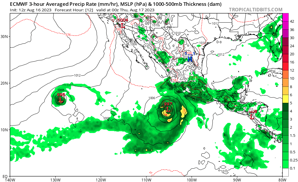
Things are beginning to get really active for both basins in this 2023 hurricane seasons. Over in the Pacific Ocean, we currently have three named storms, with the potential for a fourth down the road, and over in the Atlantic we have multiple different areas we are watching for tropical development over the next week. Instead of looking at the basins in general this time (with the exception of the Atlantic), we will go through each storm and forecast its current track and intensity down the road into the long-term period.
New information will constantly be coming out on these storms, and any potential new ones, so be sure to check in daily on here or at the National Hurricane Center’s website for the latest updates and information.
[wpcode id=”41149″]
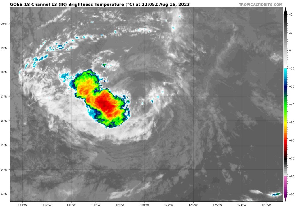
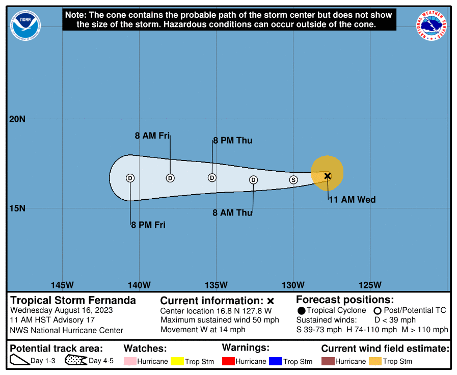
Tropical Storm Fernanda
Starting out with Tropical Storm Fernanda, as of 10:00am CDT on Wednesday the 16th, this disturbance is currently located several hundred miles to the southwest of Baja California moving to the west at 14 mph. Fernanda currently carries sustained winds of 55 mph, but this system is expected to steadily weaken as it progresses further westward throughout the rest of the week and into the weekend. A further downgrade to a tropical depression is expected by the morning hours. Looking as to why this is the case, very dry air has currently enveloped the entire storm and recent satellite imagery has shown the only presence of convection being on the storm’s southwest quadrant.
It remains to be seen how much moisture this system will bring towards the Hawaiian Islands as it closes in by early/mid next week, but the overall disturbance is expected to fully weaken below tropical depression limits by that point.
[wpcode id=”41149″]
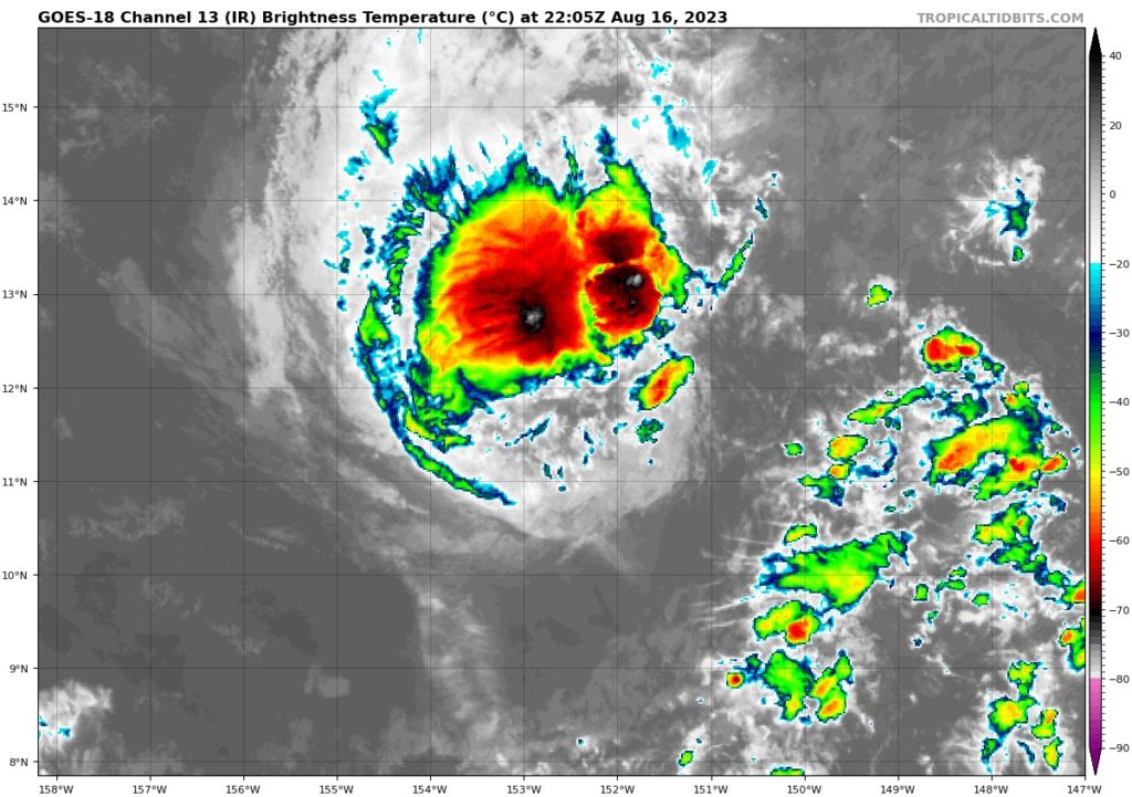
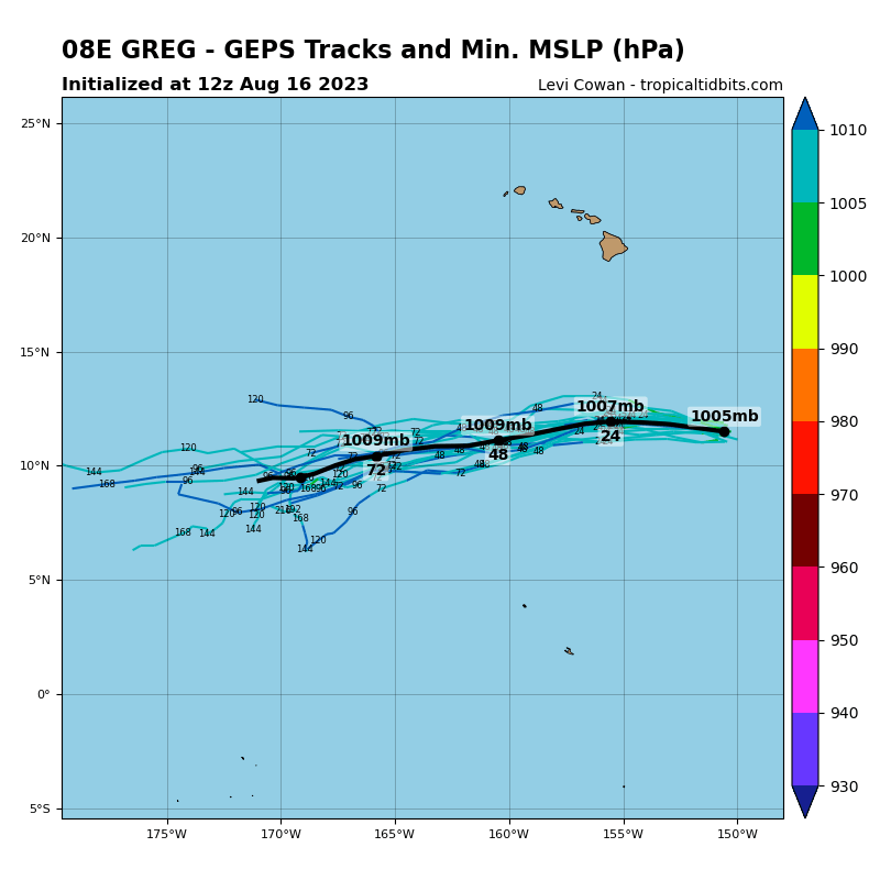
Tropical Storm Greg
Moving to the west of Fernanda, Tropical Storm Greg, as of 10:00am CDT was located about 700 miles southeast of Honolulu, Hawaii and moving off to the west at 14 mph. Greg currently is packing sustained winds of 45 mph and it too is expected to gradually weaken as to traverses westward through the week. Greater interaction with dry air, as well as running into increased upper-level wind shear, will help to significantly disrupt the system, and should in turn see a transition to a tropical depression by tomorrow evening. At this time, Greg does not show any signs of re-intensification and should gradually fall apart over open waters of the Central/Western Pacific.
[wpcode id=”41149″]
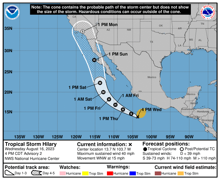
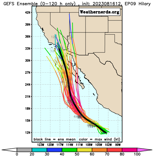
Hurricane Hillary
Currently a tropical storm as of writing this, Hillary is expected to intensify to hurricane strength by tomorrow morning/afternoon. Currently, Hillary is located a few hundred miles off the southwest coast of Mexico moving to the northwest at 15 mph. Hillary currently has sustained winds of 40 mph and is expected to intensify to hurricane strength by this morning/afternoon. Relatively weaker wind shear, relatively warm SSTs, and ample atmospheric moisture will help to intensify and sustain this storm over the period of its life.
Further intensification to major hurricane status is expected by Friday before the hurricane takes a right turn and takes potential aim at Baja California. It will be noted that this system may impact portions of southern California and Arizona with heavy rainfall by early next week. Exact impacts are still a little too early to determine for sure at this time, but this system will have to be watched closely as it nears the southwestern US.
[wpcode id=”41149″]
Additional development in the Eastern Pacific
Further formation of tropical disturbances may take place over the next 7 days in the Eastern Pacific off the southwestern Mexican coast. Hints at a developing low-pressure system in the region are being suggested and somewhat favorable conditions will be present, with very warm ocean temperatures and a very moist atmosphere to work with. Wind shear may affect any opportunistic system, so at this current time, the odds of development are low, but this can change over the course of a day.
[wpcode id=”41149″]
Atlantic Ocean
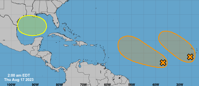
Things will look to get a little more active in the Atlantic Ocean, mostly over the long-term period. A couple tropical waves off the coast of western Africa will remain in an environment that may be supportive for any opportunistic tropical systems, largely stemming from a relatively moist atmosphere, decreased wind shear, and very warm ocean waters. This potential area of development may be limited though with stronger wind shear being present off to the north of these tropical waves.
Closer to home, we will be monitoring the Gulf of Mexico for the possibility of development closer to home over the next week. The very dry air that has permeated the region as of late will relent somewhat as well as the overall reduction of upper-level wind shear may provide enough of a favorable environment for some development to occur. It remains to be seen if this will be the case, but as of right now, the odds are relatively low.
[wpcode id=”41149″]
Conclusion
Capping off an active update, we have three named storms out in the Pacific Ocean, with the potential for a fourth over the next 7 days. The storm with greatest concern to the mainland US will be Tropical Storm/Hurricane Hillary, which may bring substantial to torrential rainfall to portions of southern California and Arizona by the start of next week. this situation will need to be watched closely as the days progress. Out in the Atlantic, things will remain mostly quiet over the next couple of days, but development off the coast of western Africa and in the Gulf of Mexico may be possible over the next week and should be watched closely.


