Tropical Storm Bertha made her second landfall near the Texas-Louisiana border around 2 p.m. EST today, less than 24 hours after making landfall in St. Bernard Parish, Louisiana, yesterday.
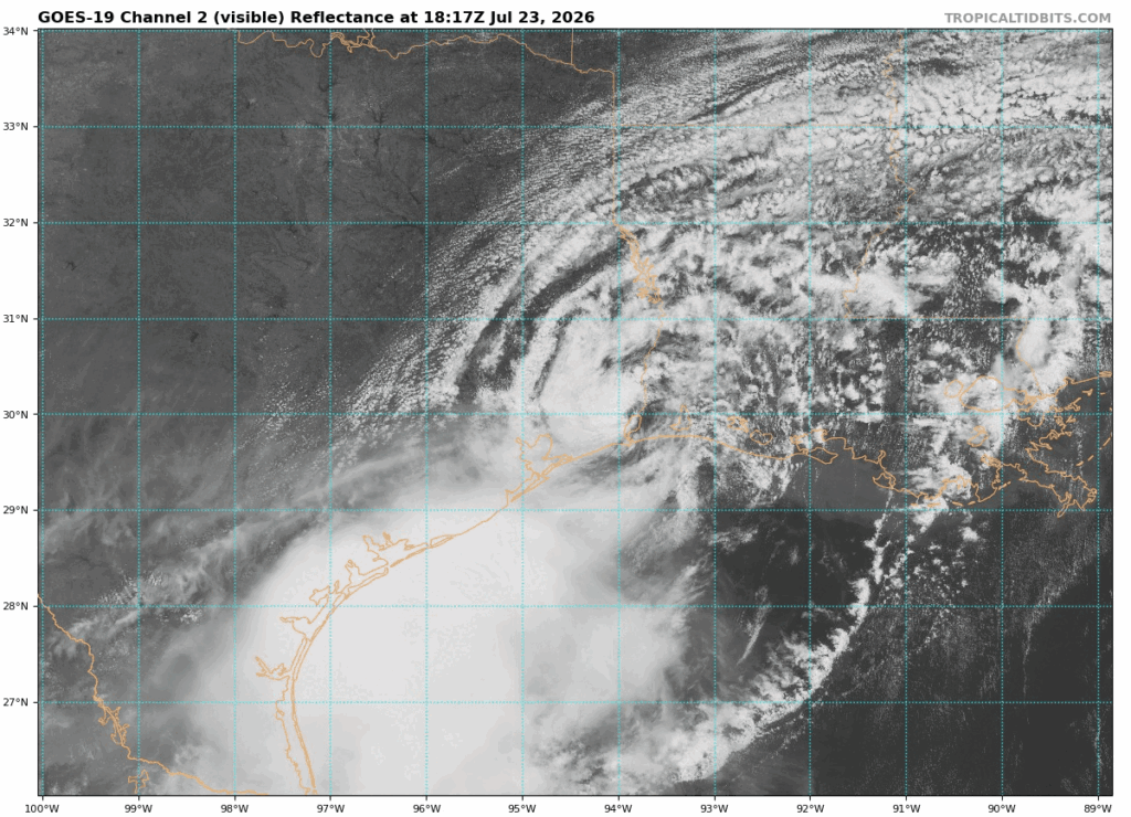
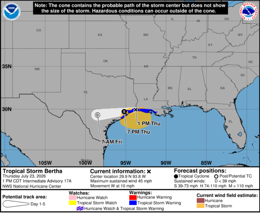
Bertha is currently located between Lake Charles, Louisiana, and Beaumont, Texas, and is moving west at around 10 mph, with maximum sustained winds of 46 mph and gusts up to 58 mph. The storm is forecast to track across the Houston and San Antonio metro areas before dissipating just west of San Antonio Friday morning. Bertha is expected to bring very little rainfall to our area due to its displaced convection. The storm is also expected to weaken into a remnant low as it moves farther inland.
Bertha’s convection, or thunderstorms, has been displaced well south of the storm’s center, leaving the low-level circulation exposed. Bertha has been battling strong wind shear, which has pushed its thunderstorms away from the center, and its recent landfall has also cut the storm off from the warm Gulf waters that help fuel tropical systems. As a result, the low-level circulation is weakening, and Bertha is expected to continue losing power as it moves farther inland.
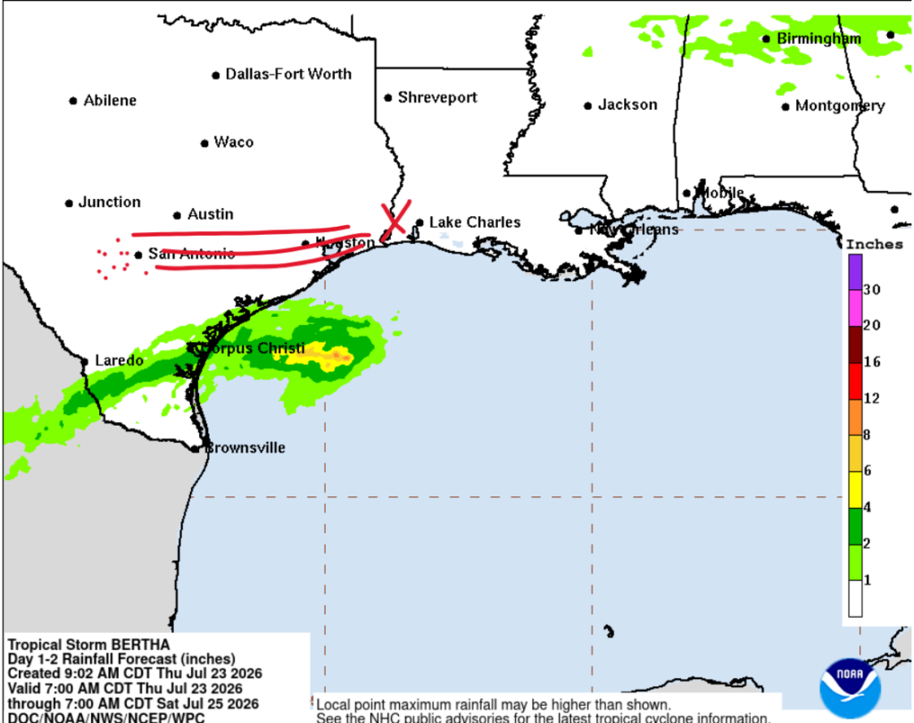
Below, we can see the Weather Prediction Center’s rainfall forecast. And, well, it’s kind of embarrassing for a tropical storm, considering the center is where I placed the red X. We can clearly see the leftover convection from Bertha down to the south, where areas around Corpus Christi and farther inland could actually see more rainfall impacts than the areas directly affected by Bertha’s center. Overall, rainfall is not a major concern with this system, especially across the Houston –> San Antonio region of Texas.
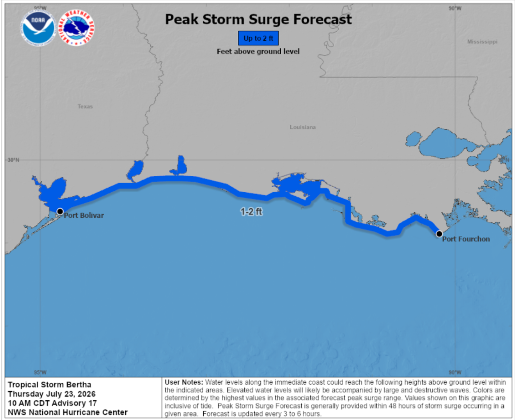
On the other hand, wind and storm surge will mean a little bit more to y’all. Both landfalls have already occurred, meaning the storm surge threat has mostly passed. Even so, I included the NHC graphic below showing the estimated storm surge heights along the Texas and Louisiana coastline.
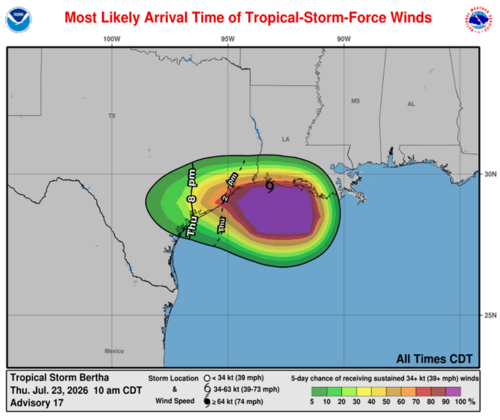
Wind will still remain a concern, as we can’t forget why Bertha is still classified as a Tropical Storm. With maximum sustained winds of 46 mph and gusts up to 58 mph, be on the lookout for downed trees and, if conditions worsen, possible damage to buildings and vehicles. Currently, winds are around 5 mph in Beaumont, Texas, with the NWS forecasting gusts up to 25 mph throughout the rest of the day. However, as Bertha continues weakening over land, winds will gradually decrease as the storm loses its tropical potential and dissipates into a remnant low.
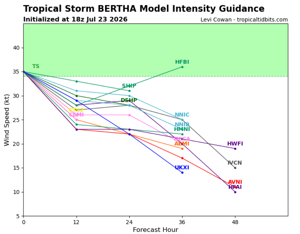
I also thought it was cool to track the intensity of the storm, and we see it should be dropping out of the Tropical Storm wind parameters very, very soon.
While it’s definitely not the strongest or most organized tropical storm we’ve ever seen, Bertha still has the potential to bring some impacts. Be on the lookout across Corpus Christi, the barrier islands, and the bayous, as this storm will bring a little bit of rain to the area. Overall, Bertha is a relatively weak system, but it could still make for a wet or breezy end to the week. That’s all for now, and we’ll keep you updated as Bertha continues to move inland.


