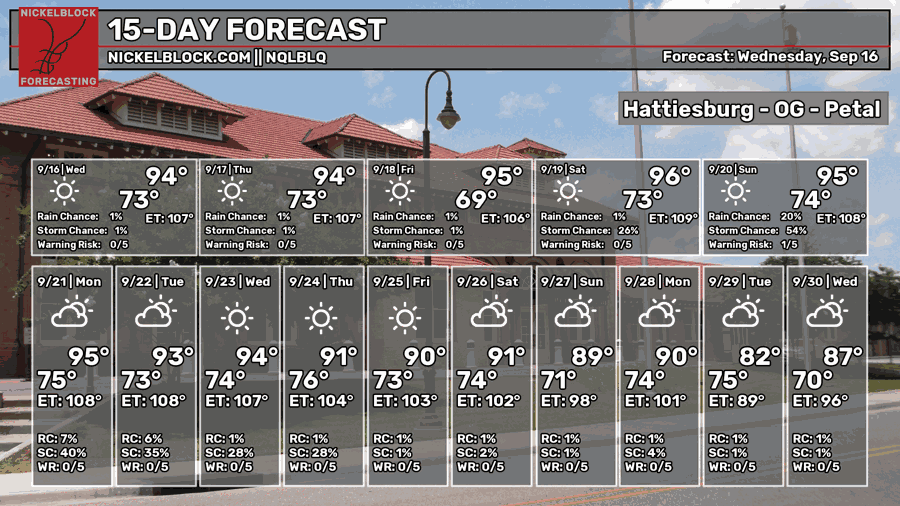
I’m sure a few of noticed a less oppressive heat today with more northeasterly winds moving in. I was out in the heat for a little while doing my job and it didn’t feel like a wall of air was pressing on me, which is quite nice! We still have a ways to go for Summer to mosey out, so we’re stuck with more hot weather by the weekend.

Tonight and Tomorrow
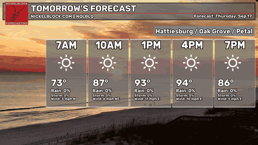
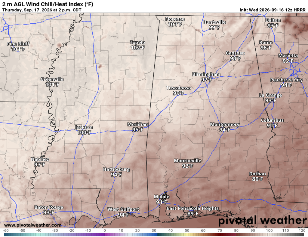
It’ll be another clear, warm night ahead with winds out of the north. Lows will fall into the low 70s before sunrise. Tomorrow, we’ll have a clear day ahead with little rain to speak of. Highs will be in the mid 90s. Winds will be moving out of the east by the afternoon around 5-10mph and a few wind gusts. The heat index will stay in the mid to upper 90s during the day, so not as miserable! Overnight, the low will fall into the upper 60s to around 70.

Friday
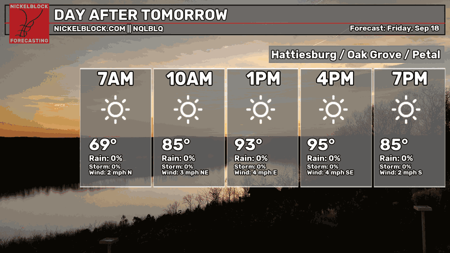
Those easterly winds are here to stay for another day drying things out! We start off a little cooler in the morning, then reach the low to mid 90s with the heat index just under 100 for most of us. The further north you are, the hotter. For those going to the football game, it won’t be too bad after the sun goes down!
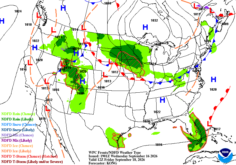
If you look at the map above, we’re right in the middle of a large high pressure system that’s pulling more easterly dry air to our area, at least for many of us towards the coastal south. Looking just east of Florida, you’ll notice a low pressure system, and that will move in over the weekend bringing some rain.
Possible Rainy Weekend Ahead
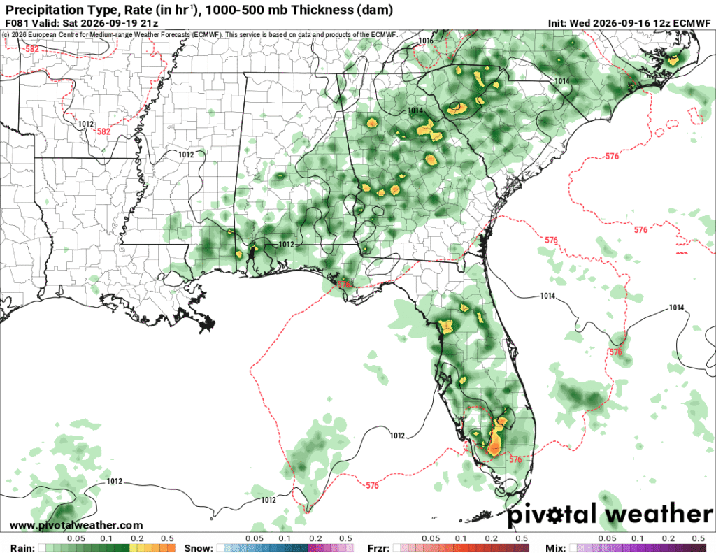
Fortunately and unfortunately, the drier feeling air isn’t going to stay for very long. We’re back to more humid conditions as the weekend progresses. Dewpoints will return back to the 70s thanks in part to that Bermuda low I mentioned earlier. We can expect a hot afternoon on Saturday and with more southerly winds to bring in moisture. The rain looks to move in towards the late afternoon hours into the evening, so we may have to contend with that as many of the universities play home games this weekend.
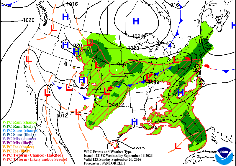
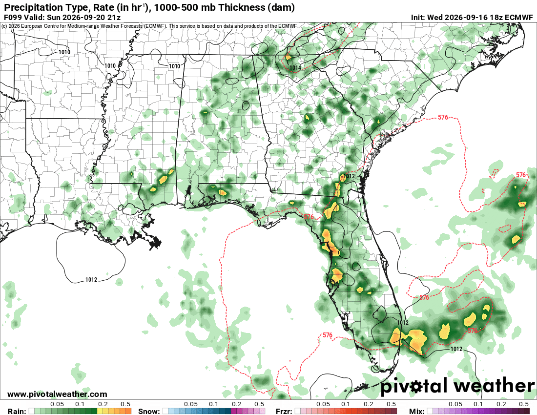
Sunday is a similar story as the Bermuda low moves further west into the Gulf. More showers and thunderstorms are possible into the afternoon and evening hours, moving northwest from the coast. Another hot day is likely with highs in the mid to upper 90s. The heat index will likely top out over 100 as well. Be careful outside if you’re going out in the afternoon!
By next week, we’ll start off with some possible showers before another front moves in and might even cooling down the temperatures a bit (we can only pray!).