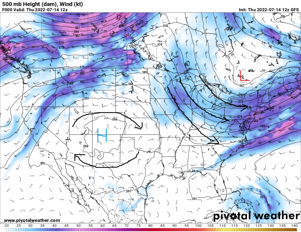
A high pressure system continues to sit in the Four Corners region of the United States, with this area being on the eastern periphery of this system. The influence of this ridge has been noticeably weaker over the last couple days due to troughing over the southeastern US, which has allowed for the heavy rains that some may have received up to this point.
By this weekend, the high pressure ridge does look to build back east again, which would help to suppress thunderstorms and dry us out a bit. But eventually by next week, the ridge does look to retreat west again and raise those chances for seasonal showers and thunderstorms.
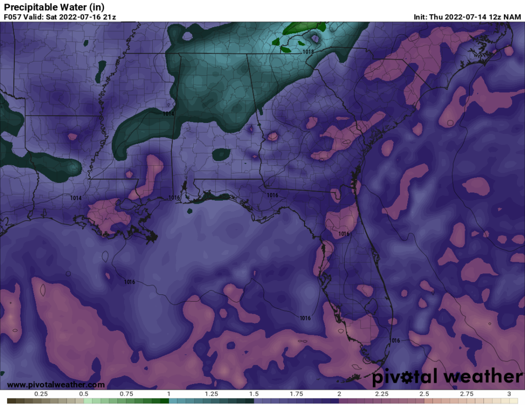
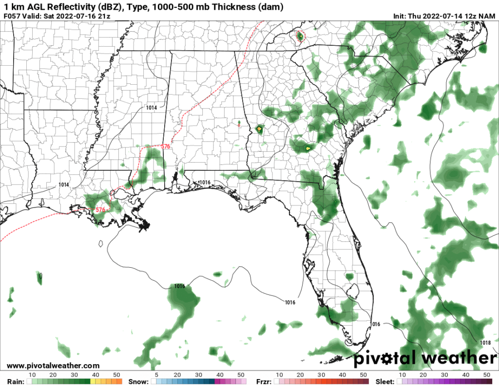
Thunderstorm activity looks to reduce, although not completely die out, through today and this weekend with the aforementioned high pressure ridge building back over the southeastern US. This may be especially true the further north you go, where the upper-level high may be more stout. Nonetheless, areas of relatively isolated development will be possible depending on how the air interacts with existing outflow boundaries from the previous day’s storms. Localized flash flooding may be possible given PW values of 1.5 to 2 inches as well as the outside chance of damaging winds from collapsing thunderstorms.
Temperatures will remain fairly seasonal throughout the weekend and next week. High temperatures regionwide look to be in the upper 80s, although those who receive any showers or thunderstorms throughout the day may stay in the upper 70s. Heat indices aren’t expected to be too terribly high throughout the weekend and next week either, with heat indexes in the low to mid 90s across the area.

Rain chances will return by mid next week with the high pressure ridge moving back west, as well as an upper-level low moving southeast towards the southeast US. This will offer just enough lift to sustain potentially scattered showers and thunderstorms to the area. The main threat with any of these storms will be localized flash flooding, with PW values in the neighborhood of 1.5 to 2 or potentially 2.25 inches, very similar to conditions currently present over the area.
Day to Day Forecast
Friday
Partly cloudy, with showers and thunderstorms likely. High temperatures in the mid to upper 80s. Low temperatures in the mid to upper 70s. Chance of rain 70%.
Saturday
Mostly sunny, with showers and thunderstorms possible. High temperatures in the upper 80s. Low temperatures in the mid to upper 70s. Chance of rain 50%.
Sunday
Mostly sunny, with showers and thunderstorms possible. High temperatures in the upper 80s to low 90s. Low temperatures in the upper 70s. Chance of rain 50%.
Monday
Partly cloudy, with showers and thunderstorms possible. High temperatures in the mid to upper 80s. Low temperatures in the upper 70s. Chance of rain 50%.
Tuesday
Mostly sunny, with showers and thunderstorms possible. High temperatures in the mid to upper 80s. Low temperatures in the upper 70s to low 80s. Chance of rain 40%.
Wednesday
Mostly sunny, with a stray shower or thunderstorm possible. High temperatures in the upper 80s to low 90s. Low temperatures in the upper 70s to low 80s. Chance of rain 30%.
Thursday
Partly cloudy, with showers and thunderstorms possible. High temperatures in the upper 80s to low 90s. Low temperatures in the upper 70s to low 80s. Chance of rain 50%.


