Hello everybody, they’re going to be some good news that there will be a sunny and calmer weather for today. The high-pressure ridge is starting to build up near the Southeast to provide sunny weather to party cloudy throughout the day. There will be a possibility for a stary shower or thunderstorms for today. For the temperatures for today, the low temp will be in the mid 70s and the high temp will be in the mid 90s degrees.
For the dewpoint temperature for today, it will be around upper 60s to low 70s for the rest of the day. In short, there will be clear skies with sunny weather then starting to be cloudy and hot temperatures in the afternoon.
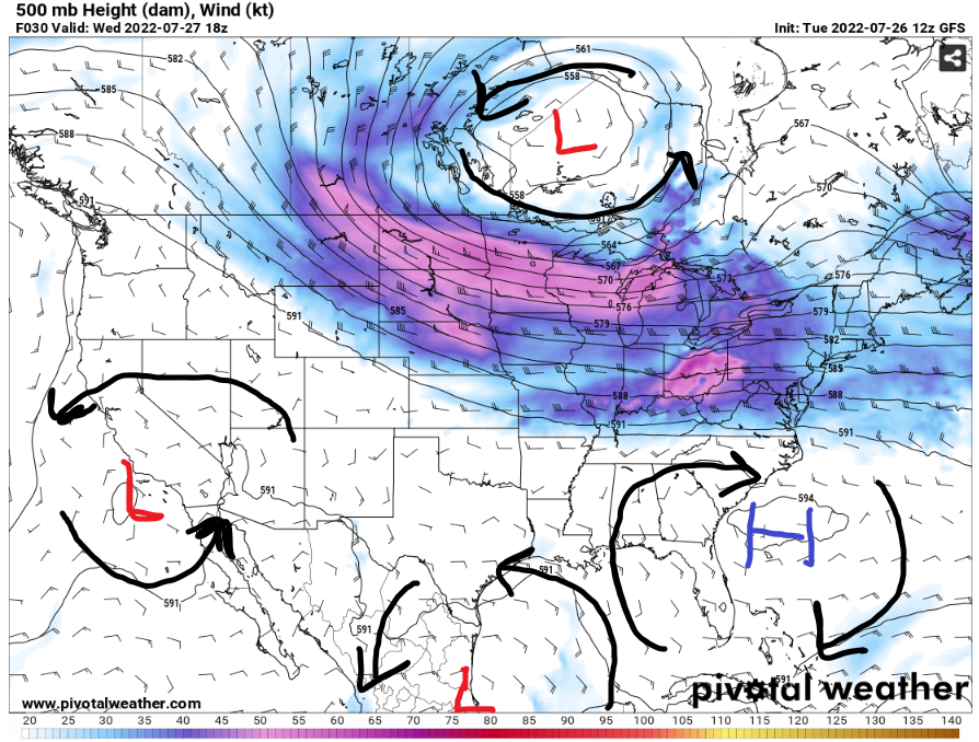
The high-pressure system will try to take control in the southeast and of Atlantic Ocean to bring in drier and sunny weather in the southeast. Meanwhile, there will be a low-pressure system near the east coast of Mexico and Texas will start to develop stormy weather in the Gulf of Mexico. With the storms developing in the Gulf of Mexico, there will be some stray showers or thunderstorms will move up to Alabama and Mississippi.
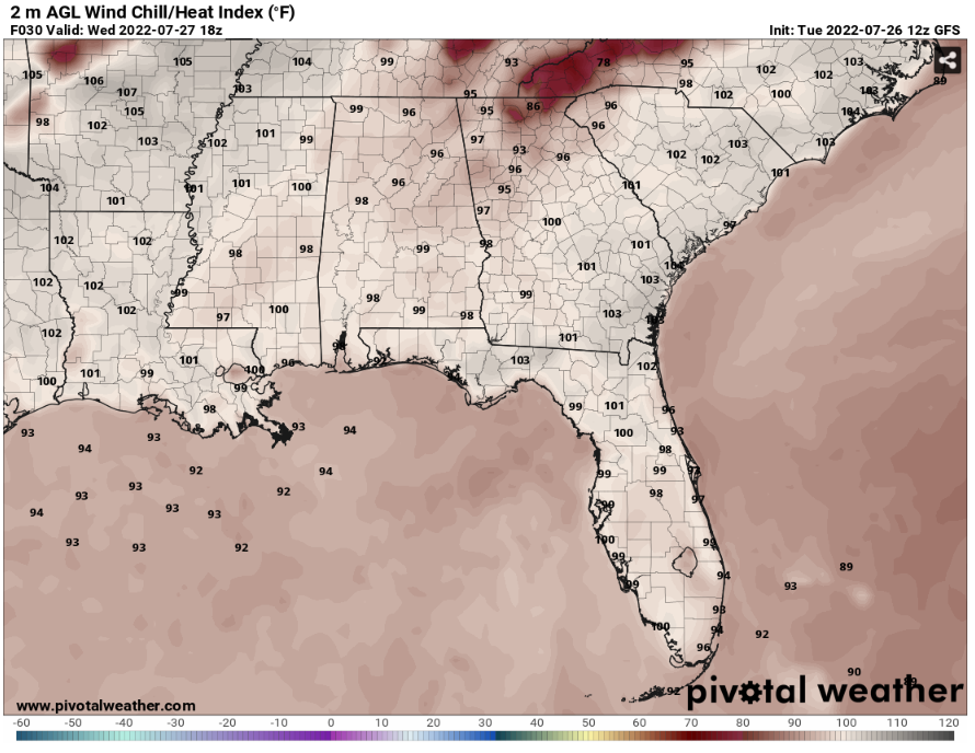
With the high pressure finding a new home in the southeast, expected to find above average temperatures and heat index values in the next few days. For today, the heat index values will be climbing up to low 100s degrees with the help of the high humidity and temperatures.
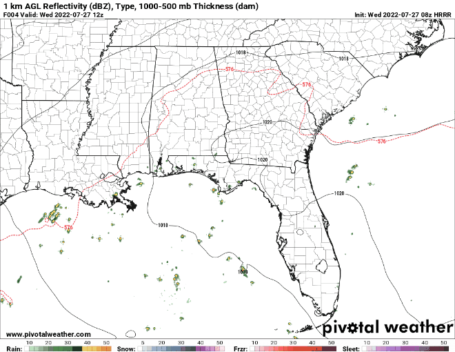
Most of the thunderstorm’s activity is starting up in the Gulf of Mexico. The storms traveling to the gulf coast will starting to weaken with the sinking air from the high pressure in the Southeast. There will be a less than 10% chance for a stray thunderstorms and shower will happen throughout the day in our area.
Day to Day Forecast
Wednesday
Mostly sunny in the morning to party cloudy in the afternoon and evening with a possibility of a stray shower or thunderstorm. The high temperature for today will be in the mid 90s. The heat index values will be in the low 100s. There will be a 10-percent for a stray shower or thunderstorm.
Thursday
Mostly sunny with few clouds with a possibility of a stray shower or thunderstorm. The high temperature for today will be in the mid 90s. The heat index values will be in the low 100s. There will be a 20- percent for a stray shower or thunderstorm.
Friday
Partly cloudy to overcast with a possibility of scattered showers or thunderstorms. The high temperature will be in the low 90s. The heat index values will be in the upper 90s. There will be a 40- percent for scattered showers and thunderstorms.
Saturday
Partly cloudy, with a possibility of scattered showers or thunderstorms. The high temperature will be in the low 90s. The heat index values will be in low 100s. There will be a 50- percent for scattered showers and thunderstorms.
Sunday
Mostly sunny with few clouds in the afternoon with a possibility of stray shower or thunderstorm. The high temperature will be in the mid 90s. The heat index values will be in the upper 90s. There will be a There will be a 20- percent for a stray shower or thunderstorm.
Monday
Sunny to Party cloudy with a possibility of stray shower or thunderstorm. The high temperature in the low 90s. The heat index values will be in the upper 90s. There will be a 20- percent for a stray shower or thunderstorm.
Tuesday
Mostly sunny skies to scattered showers or thunderstorms in the afternoon. The high temperature in the mid 90s. The heat index values in the upper 90s. There will be a 40- percent for a scattered showers or thunderstorms.


