Tropical heat and moisture will continue to linger around for a while longer, as the area remains under the influence of a weak high pressure system off to the west. Temperatures look to remain fairly consistent, with daily highs in the low to mid 90s and lows in the low to mid 70s. Along with this and dew point temperatures in the upper 60s to mid 70s, the heat index is expected to remain in the upper 90s and low 100s through next week and into next weekend.
After next weekend, some indications of a deepening trough over the eastern US are being picked up by the GFS and, to some extent, the Euro models. Should the pattern hold together, it could mean more wet weather for the SE US.
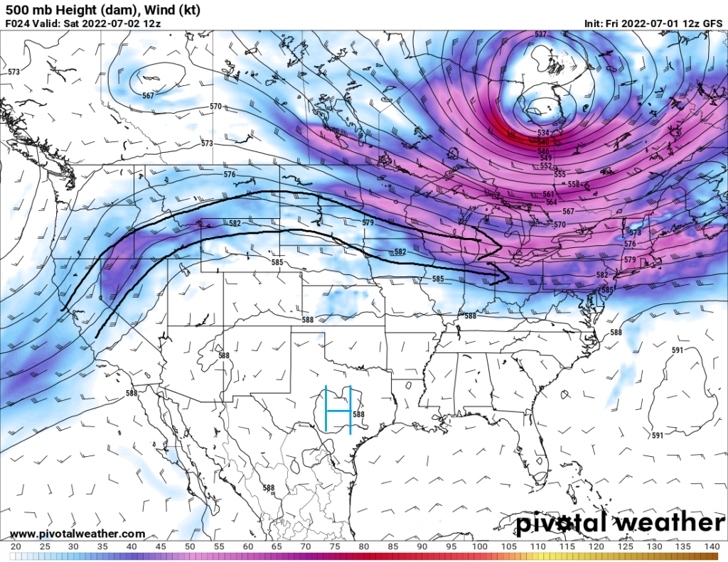
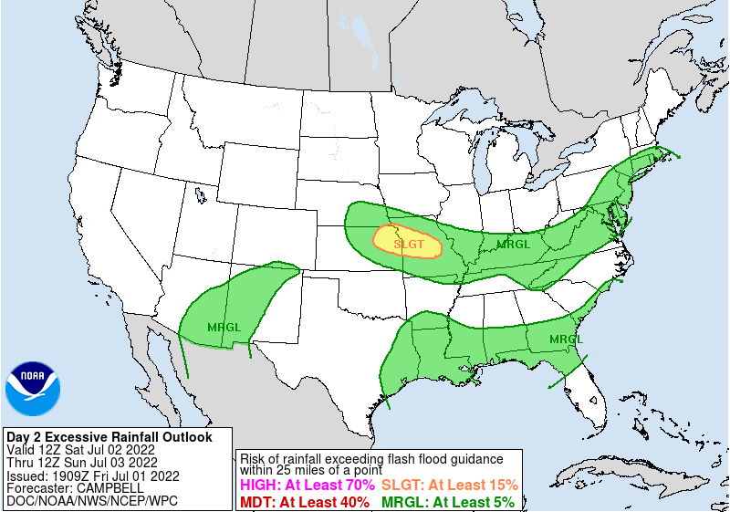
Sounding like a broken record by now, scattered showers and thunderstorms are possible for the better part of this weekend into next week. Some of these storms may still bring heavy rainfall, with PW (Precipitable Water) values in the atmosphere remaining near or over two inches. Local flash flooding may be possible for areas that do see any heavy rainfall, with the WPC maintaining a marginal risk for excessive rainfall for the area.

Temperatures look to remain tropical with the aforementioned high pressure system still holding influence over the region. Heat indices are not expected to reach critically high temperatures, but nonetheless, caution should be exercised for those outdoors in the heat. The high pressure system responsible for the continued heat looks to hang around for the week into this next weekend.
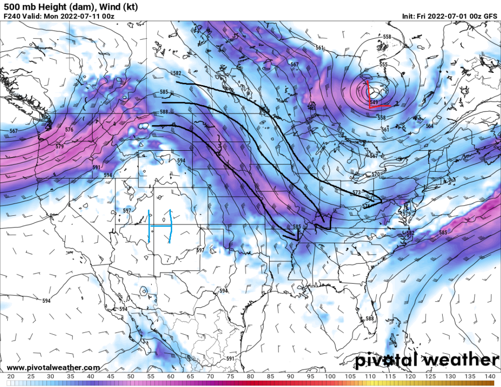
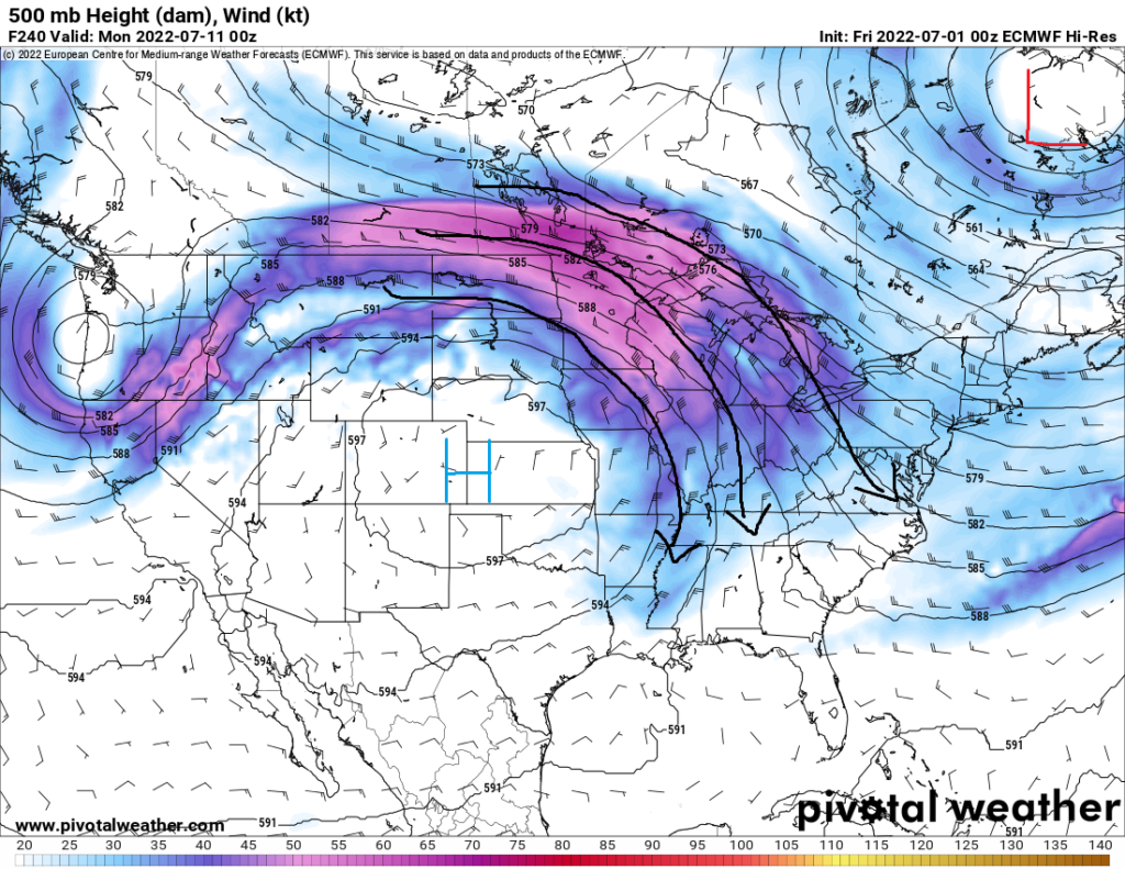
By next weekend into early that week, a pattern change may be on the way for the area. Both the GFS and, to a lesser extent, the Euro models are showing an intensifying longwave trough over the eastern United States. This would bring more northerly flow in the upper levels, which in turn could lead to a front or two making its way down towards the gulf. Consequently, this would bring additional rounds of showers and thunderstorms to the area for that week should the pattern hold through the coming days.
Day to Day Forecast
Saturday
Mostly cloudy, with scattered showers and thunderstorms. High temperatures in the upper 80s to low 90s. Low temperatures in the low 70s. Chance of rain 80-percent.
Sunday
Partly cloudy. High temperatures in the upper 80s to low 90s. Low temperatures in the mid 70s. Chance of rain 30-percent.
Monday
Mostly sunny. High temperatures in the upper 80s to low 90s. Low temperatures in the low to mid 70s. Chance of rain 30%.
Tuesday
Partly cloudy. High temperatures in the upper 80s to mid 90s. Low temperatures in the low to mid 70s. Chance of rain 30-percent.
Wednesday
Partly cloudy. High temperatures in the upper 80s to low 90s. Low temperatures in the low to mid 70s. Chance of rain 20-percent.
Thursday
Sunny. High temperatures in the low 90s. Low temperatures in the mid 70s. Chance of rain 20-percent.
Friday
Sunny. High temperatures in the upper 80s to mid 90s. Low temperatures in the mid 70s. Chance of rain 20-percent.


