When we get into these kinds of patterns, sometimes it can be tough as a forecaster to do a good job at explaining the forecast. We are still stuck in out Northwest flow (below on the left) which means that we will have a chance – albeit not a great one – each day for clusters of storms to ball up and plow southeast toward the Gulf. At the surface (below, on the right) we have a southerly and southwesterly flow which means (1) the sea-breeze storms are still possible and we continue to pump in Gulf moisture.
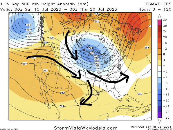

But it isn’t just a linear forecast where we say, “more storms possible” every day. Because, with a northwest flow like this, the sea-breeze storms have a bit of a tougher time staying together because they end up getting ripped apart in the mid-levels a bit. And the clusters of storms coming in from the northwest will follow a similar path in the mid-levels, sure, but at the surface, the main catalyst for ascent is lingering outflow boundaries, sea breeze, and pressure perturbations left over from ‘who knows what’ so there isn’t a big ‘tell’ (for you poker fans) from the atmosphere about what will happen, specifically, at a given spot on the ground, each day.

So, as best we can, we look things over and try to offer as best a forecast as we can, every day.
Today, for instance, despite not having a lot of computer model support for rain, I tend to think we will have a good handful of showers and storms across the area. Then tomorrow, I think that the edges of where the storms fall apart today will be the spots where storms are most likely to develop tomorrow.
And tomorrow, the chance for rain along the periphery of the storms today may offer a decent shot for coverage.
So far, it looks like the risk for technical severe weather is low. But I still think there will be brief heavy rain, plenty of lightning and thunder, some gusty wind at times, as maybe even some small hail. The tornado threat is very low, but given how I think the outflow boundaries will align, I think it is probably higher than ‘normal’ for this time of year.
The good news is that any tornado that forms would be very brief and rather weak. On the ground for less than 10 minutes with wind probably less than 70mph. Not even “Hurricane Force” wind.
Things should even out a bit on Monday and new data suggests we may stay dry through the end of next week.
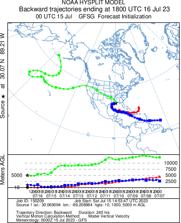
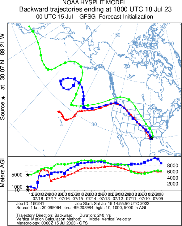
The HySplit model above shows where the air is coming from each day. Tomorrow and Monday it shows that the air near the surface is coming from the tropical Atlantic or even South America, while the air aloft is coming from Alaska – a good combo to get thunderstorms!
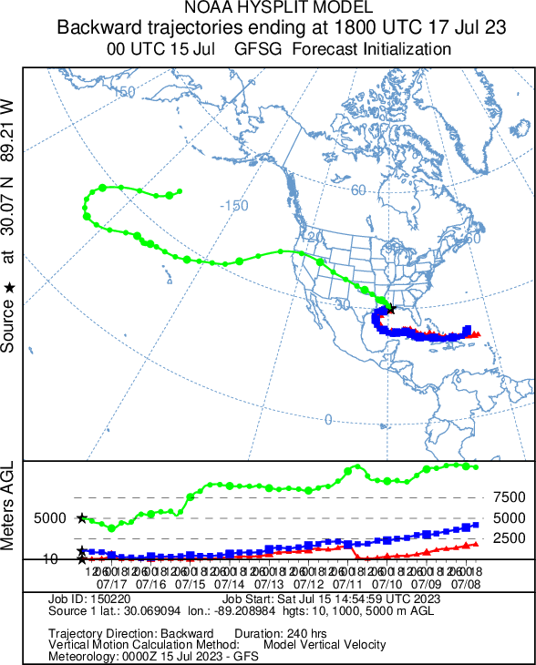
By Tuesday of next week, all of the air – at nearly every level – is coming from the Pacific Ocean. Not a good combo for making thunderstorms.
So that should leave us a bit drier.
[wpcode id=”41149″]
REGIONAL DAY TO DAY FORECAST
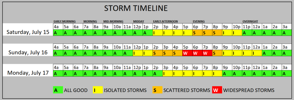
Today: Sunny. A chance of showers and thunderstorms this afternoon. Highs in the upper 90s. West winds 5 to 10 mph. Chance of rain 30 percent, especially north of HWY 98 and east of I-59. Heat index values up to 108.
Tonight: Mostly clear. Humid. Lows in the upper 70s. Southwest winds 5 to 10 mph.
Sunday: Mostly sunny with storms possible – especially south of HWY 98 and west of I-59. Humid with highs in the lower 90s. West winds 5 to 10 mph. Chance of rain 60 percent. Heat index values up to 107.
Sunday Night: Mostly cloudy with a chance of showers and thunderstorms in the evening, then partly cloudy after midnight. Lows in the mid 70s. West winds 5 to 10 mph. Chance of rain 30 percent.
Monday: Mostly sunny with a few storms possible. Humid with highs in the mid 90s. Northwest winds 5 to 10 mph. Chance of rain 30 percent. Heat index values up to 106.
Monday Night: Partly cloudy in the evening, then clearing. Lows in the lower 70s.
Tuesday: Sunny with a few storms possible. Highs in the upper 90s. Chance for rain around 20 percent. Heat index values up to 110.
Tuesday Night: Mostly clear. Lows in the mid 70s.
Wednesday: Sunny. Highs in the upper 90s. Heat index values up to 110.
Wednesday Night: Mostly clear. Lows in the mid 70s.
Thursday: Mostly sunny with a few storms possible. Highs in the upper 90s. Chance of rain 20 percent. Heat index values up to 110.
Thursday Night: Mostly clear. Lows in the mid 70s.
Friday: Mostly sunny with a isolated storms possible. Highs in the upper 90s. Chance of rain 30 percent. Heat index values up to 110.


