As we start the day we watch Hurricane Calvin nears closer and closer to the Hawaiian islands. We are also watching a disturbance following closely in the favorable Pacific. On the flip side the Atlantic remains pretty quiet with a Subtropical Storm in the middle of the ocean. Let’s look at all these storms and their developments!
[wpcode id=”41149″]
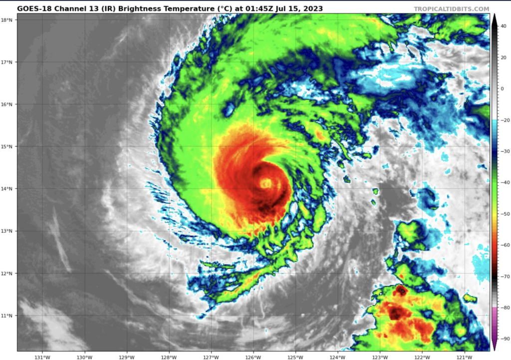
Hurricane Calvin
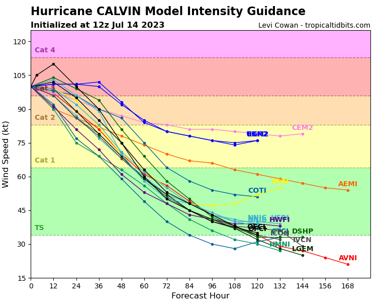
Hurricane Calvin is moving its way across the Pacific as it builds in intensity. Currently Hurricane Calvin is sustaining winds up to 125 mph. This makes Calvin a category 3 level storm. It is moving west-northwest at around 16 mph and is expected to continue on a similar path. The minimum pressure in the cyclone is 955mb. The hurricane is headed towards Hawaii and is currently around 2,000 miles east-southeast of Hilo, Hawaii. The favorable air conditions and warm sea temperatures will allow Calvin to keep some intensity for a day or two.
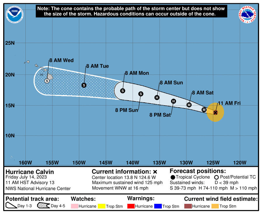
Hurricane Calvin will decrease in intensity as it moves towards Hawaii. This is good news as the islands won’t get hit with as serve storms. However the storm will cause high surf around the islands and dangerous rip currents. Heavy rainfall and strong winds are still expected for the islands though not at hurricane levels. Most likely it will hit the big island at tropical storm level or lower and will start to lose its intensity as it goes over the land. It will eventually dissipate after it hits Hawaii because of the strong shear that will kill the storm.
[wpcode id=”41149″]
Pacific and Atlantic Developments
Following behind Hurricane Calvin is a disorganized set of showers that is possible to form early next week. It only has a 20% chance of cyclone development within the next seven days. It’s currently in the southwest off the coast of Mexico. This large area of low pressure has a lot of storms that is moving west-northwestward. It will not have any formation in the next two days but it’s something to look at.
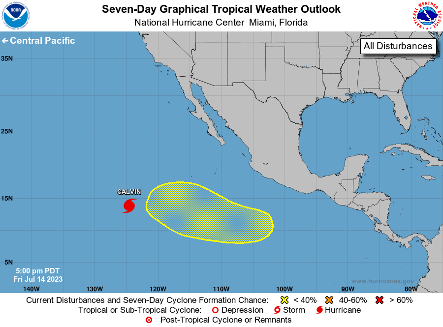
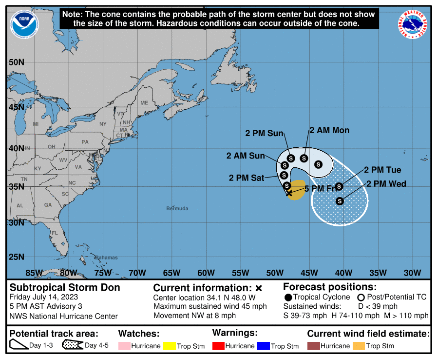
Across the way in the Atlantic, we don’t see any impacts along the US coast but far out in the North Atlantic is Subtropical Storm Don. Don is currently sustaining winds around 45 mph. Don’s path will be very small and be very circular in the area. Don will have very limited effects.
[wpcode id=”41149″]
Extended Outlook
Hurricane Calvin will be the biggest interest over the next couple days. As we see that move through the Pacific, the other disturbance following behind may develop and be worth watching. However in the Pacific we will continue to see this pattern of busy action due to favorable conditions such as moist, warm air and sea temperatures. In the Atlantic we still see this pretty still area that has little chances for any major developments. We may see some tropical action off the coast of Africa that nears the Caribbean but it will fall apart as it gets near the Gulf of Mexico. This is due to high wind shear and the dry air. These factors will stop any developments from building in intensity for the next two weeks.
[wpcode id=”41149″]
Conclusion
Hurricane Calvin will be the one to watch for the next week days and into next week. Calvin will most likely settle a bit in intensity as its path is headed towards Hawaii. The Pacific has a high chance for more developments as the Atlantic stays relatively quiet. The Pacific will remain rather favorable for building up some tropical storms while the Atlantic will kill most of the storms that come its way. Be sure to keep updated on Calvin and its path as it m makes its way across the ocean!


