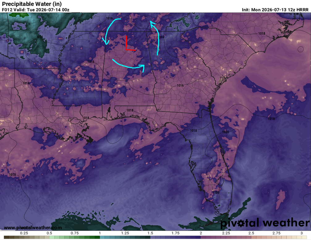
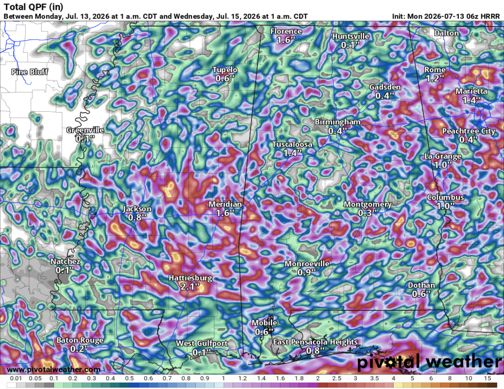
A stationary front has established itself across the Southeast which brought us some needed rain… but just a little too much too quick. We’re not escaping that possibility for the next couple of days as we’ve already had some rain this morning. More thunderstorms are possible this afternoon and tomorrow as the low pressure system rotates around and works itself like a convection oven to produce more storms. By midweek, that front will hang around but move further east undercut by a high pressure system in the northwestern Gulf, and for us that means mostly dry and hot.

Today
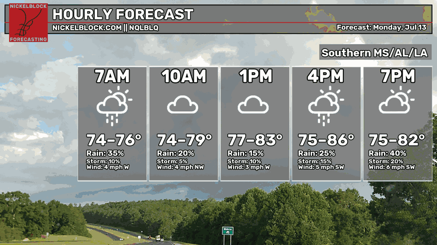
Yep! Highs in the mid 80s today! But of course, we know why. On and off rain will be possible today throughout most of the Pine Belt/Coastal South. A few storms may bring some flash flooding if they pop up quickly. Expect some gust fronts to form more storms during the afternoon/evening. Otherwise, it’s going to be mostly cloudy and damp today. Lows will be in the mid 70s with storms possible in parts of central Mississippi eventually dissipating overnight.

Tomorrow
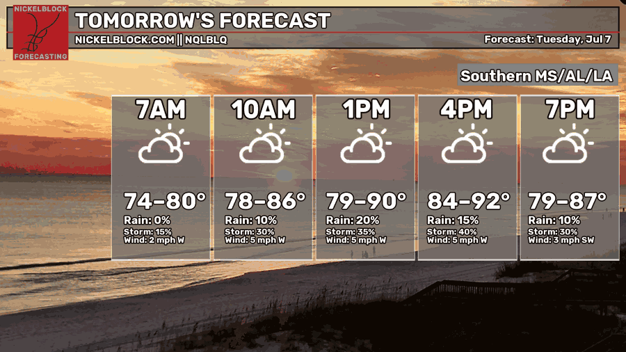
With the low pressure system moving west, this will bring more rain to the Deep South as the amount of available moisture will collide with the low pressure system. The rotation from the low will help drive more storms around it and eventually move southward into our area. Flash flooding is possible again with developing thunderstorms, especially in the afternoon/evening. Highs will be back in the upper 80s/low 90s with partly to mostly cloudy skies. Storms will eventually die down after sunset and lows will fall into the mid 70s.
Wednesday
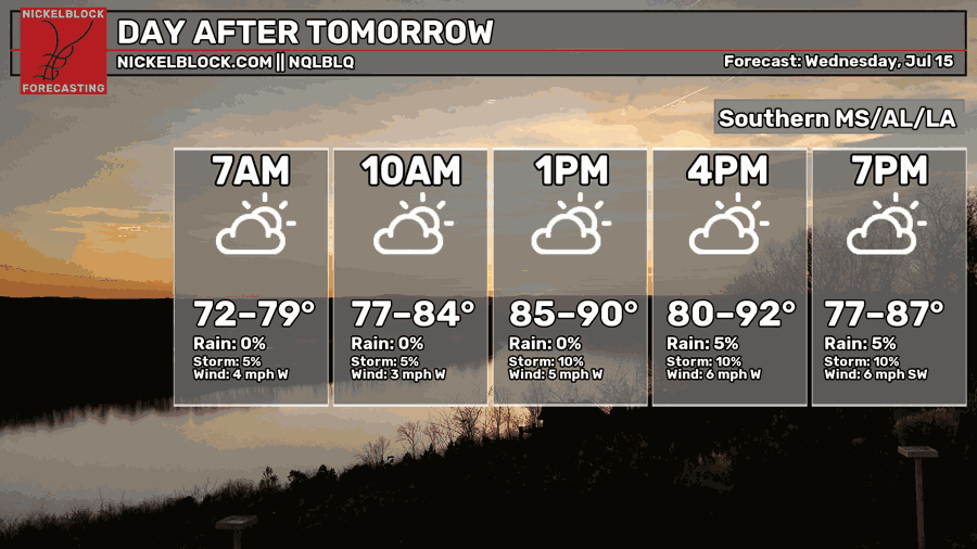
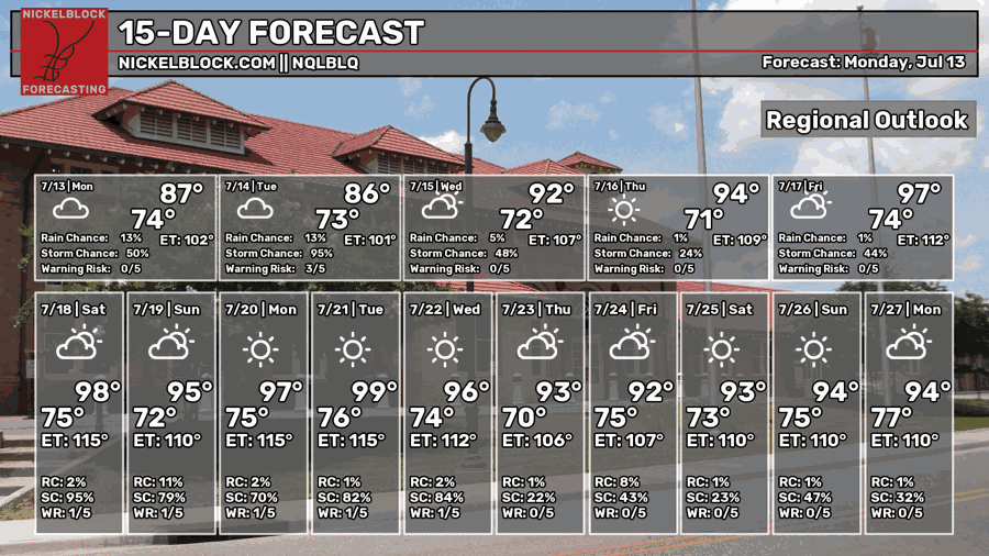
A high pressure system is developing behind the low which will begin to dry out our chances of rain later in the week. A few areas in the north will see some rain and likely move the system south bringing thunderstorms to the Pine Belt again. It’ll be a hotter day with highs in the low 90s possible. Afterwards, the rain will dissipate and we’ll have another average warm night.
Heading to the Weekend
Conditions will dry up by Thursday with temperatures on the rise. The rain will begin to disappear from the forecast for the next few days. Despite that, it’s still going to be hot. Heat indices will begin to rise towards the weekend with the experienced temperature reaching the mid 100s in some areas. A heat advisory is not out of the question. By the end of the weekend, we may see a few more storms move in on Saturday evening into Sunday. Otherwise, hot and humid! Be careful out there, wear your sunscreen and drink plenty of water and electrolytes if you’re outdoors.