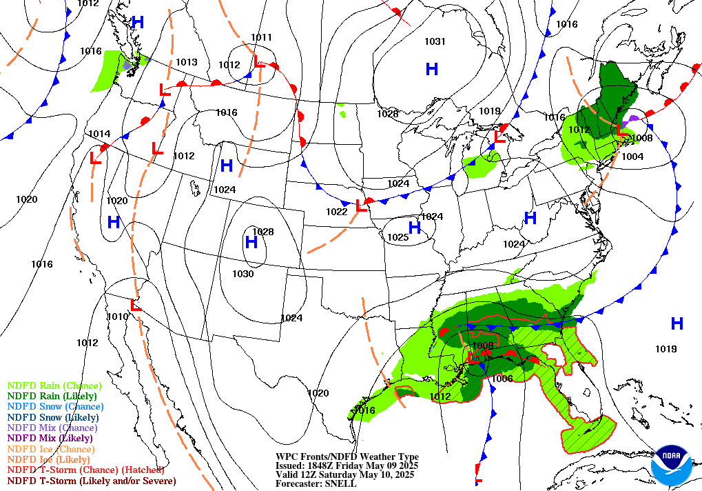
Happy Friday everyone! Summer heat is continuing to dominate as we are looking at an Excessive Heat Risk throughout the local forecast region with temperatures soaring into the 100s. I hope you all are either staying indoors with plenty of air conditioning or staying cool by pool this holiday weekend in celebration of the 4th of July this Tuesday. Temperatures will feel even closer to 110 to 115 degrees so be careful stepping outside for even a couple minutes.
Heat Dome Lingering Around

The mid-level ridge over the Central US is continuing to create a heat dome over the South Central. As the week progresses, this ridge will slowly shift west Luckily with this dry air, any severe weather will be very unlikely. However, for the time being, this heat will remain for the next couple days with temperatures likely to persist into the 90s next week. This heat risk in place today will be seeing slightly higher warnings to the west towards Texas.
Rain to End the Weekend and Start the Week
We will be see some small possibility of scattered thunderstorms throughout the end of weekend. Some mid-level moisture from the Gulf Stream will make it way into the region by Sunday that will elevate the risk for thunderstorms. While the local area has had a nice respite from thunderstorms and rain the past couple days, rain will be coming our way by Sunday, mostly popping up in the form of late afternoon showers. As the upper-level ridge begins to move out, mostly zonal flow will allow for afternoon convection to create a lot of these pop-up storms. With dry air still lingering at the surface, this will create some buoyant afternoon storms.

Extended Outlook
Looking further out into next week, we will most likely see the mid-level ridge eventually break down and bring some much needed relief in terms of temperature to the area. With that, we will see some greater chances for thunderstorms as we head into the start of week with the greatest chance of precipitation currently on Monday. Precipitation will likely continue all throughout the week.
Regional Day-To-Day Forecast
Today: Sunny with Excessive Heat Risk in place. Temperatures in the high 90s to low 100s but will feel closer to 110 degrees. Winds picking up in the afternoon from the West
Tonight: Clear skies all night. Temperatures reaching into the mid 70s overnight. Winds will continue to be relatively calm around 5mph from the South
Saturday: 10% chance of thunderstorms and showers in the afternoon but otherwise sunny. Excessive Heat Risk still in place with temperatures in the low 100s. Winds around 5 mph from the Southwest
Saturday Night: Mostly clear with temperatures in the mid 70s. Light winds out of the South-Southwest
Sunday: 10% chance of thunderstorms but otherwise sunny. Temperatures reaching the mid 90s with slight risk for heat exhaustion still place as temperatures will continue to be in the high 90s . Winds from the Southwest around 5 mph
Sunday Night: Partly cloudy with temperatures in the mid to upper 70s. Winds from the West around 5mph
Monday: 30% chance of afternoon thunderstorms but otherwise partly sunny with temperatures in the mid 90s. Winds from the West around 10 mph
Monday Night: Partly Cloudy. 20% chance of afternoon thunderstorms. Temperatures in the upper 70s overnight. Winds from the Southwest around 5 mph
Tuesday: Mostly cloudy. Slight chance of thunderstorms. Temperatures in the low 90s. Winds from the South Southwest around 10 mph
Tuesday Night: Partly cloudy, Slight chance of thunderstorms. Temperatures in the mid to low 70s. Winds from the Southwest around 10 mph
Wednesday: Sunny with temperatures in the upper 90s expected. Winds from the West around 10 mph
Wednesday Night: Mostly clear, overnight temperatures in the mid 70s. Winds from the Southwest around 10 mph

