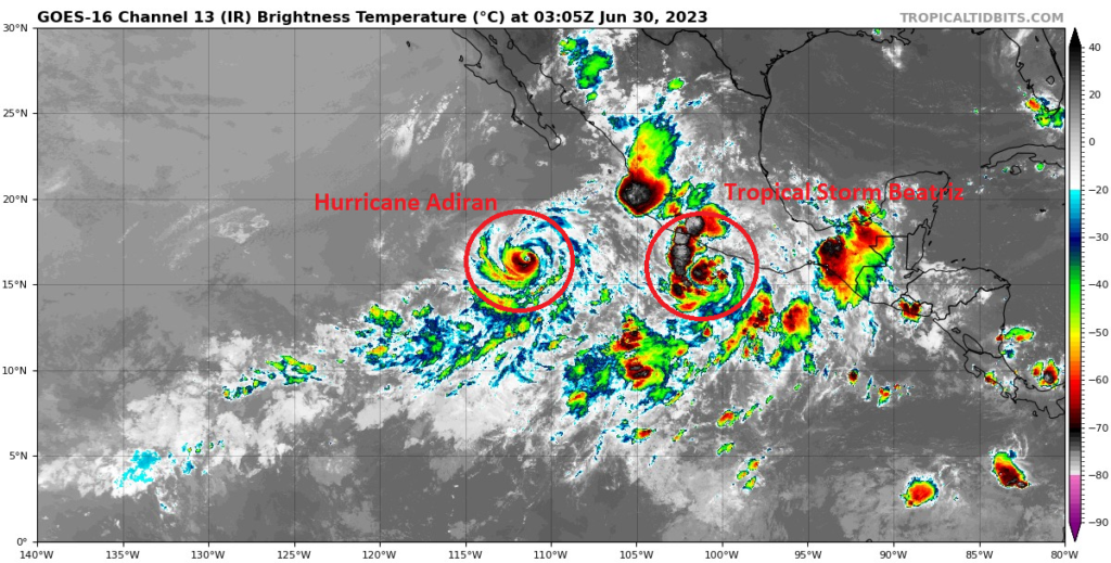
When the East Pacific woke up, it woke up quickly. Hurricane Adrian is currently strengthening in the open waters of the Pacific as it’s window for intensification begins to close. Behind, Tropical Storm Beatriz may take a quick swipe at the Western coastline of Mexico as it rapidly intensifies into a Hurricane. Over in the Atlantic, the remains of Cindy are still highlights with a low chances of redevelopment, but otherwise the Atlantic remains overall hostile for storm chances.
[wpcode id=”41149″]
Current Tropical Conditions
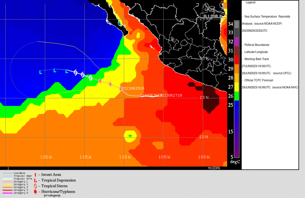
The East Pacific has awoken after its longer then normal slumber. Hurricane Adrian, a high end Category 1 hurricane at 90 mph continues to churn across the East Pacific today, but it’s period of intensification is quickly coming to an end as easterly shear and SSTs along the track begin to cool as Adrian tracks northwest at 8 mph. This cooling trend is depicted in the graphic below. Currently, Adrian is located within reasonably warm SSTs of 29-30 degrees Celsius. Over the next few days, these SSTs cool by several degrees and as a result the storm weakens. This is a typical path for Hurricanes this time of year as the waters are still far too cool for prolong travel across the Pacific and upper level flow doesn’t promote more northerly tracks in this portion of the Pacific where Adrian is located. Adrian should remain a Category 1 storm as further intensification from it’s current state isn’t expected.
Behind Adrian is Tropical Storm Beatriz. Currently, Beatriz is located just off the Western Coastline of Mexico about 100 miles South-southwest of Acapulco. Beatriz is expected to parallel the coastline of Mexico bringing heavy rainfall, dangerous tropical storm to hurricane force winds, and dangerous storm surge to the Mexican states of Guerrero, Michoacan, Colima, and Jalisco.
The current presentation of Beatriz would point to an organizing storm. Convective banding is developing around the center and to the west of the storm. Current forecast tracks are difficult to resolve as the center of Beatriz is proving difficult to locate. the HAFS and ECMWF bring the center of Beatriz on shore within the next 36-48 hours while GFS, HWRF, and HMON keep the center off shore. Currently tracks are more in line with the ECMWF as it seems to handling the angle of approach the best. Additionally, the forward motion of Beatriz is expected to slow as the ridge located to the north begins to weaken.
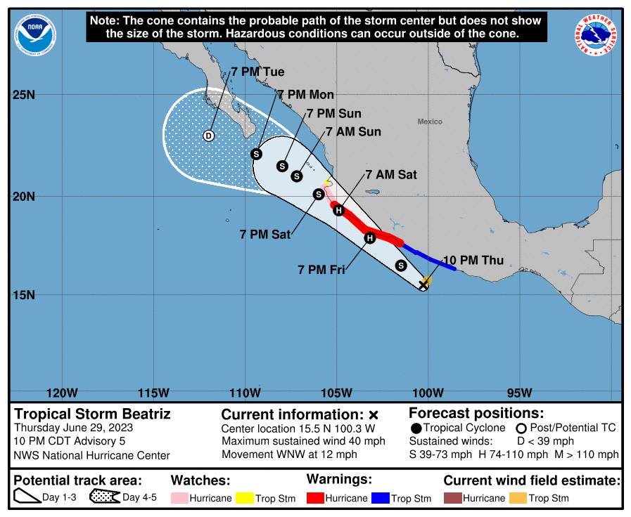
The environment ahead of Beatriz appears favorable for strengthening. Low vertical wind shear, high mid-level humidity, and SSTs around or greater then 30 degrees celsius all point to a storm that may undergo rapid intensification. There is a great deal of uncertainty with intensity forecasts as a rule, but if Beatriz is able to keep the center of the storm off shore and utilize it’s environment a strike as a high end category 1 is possible. If Beatriz remains off shore totally, the surge and winds will still be dangerous especially along the coastline and travels should take caution.
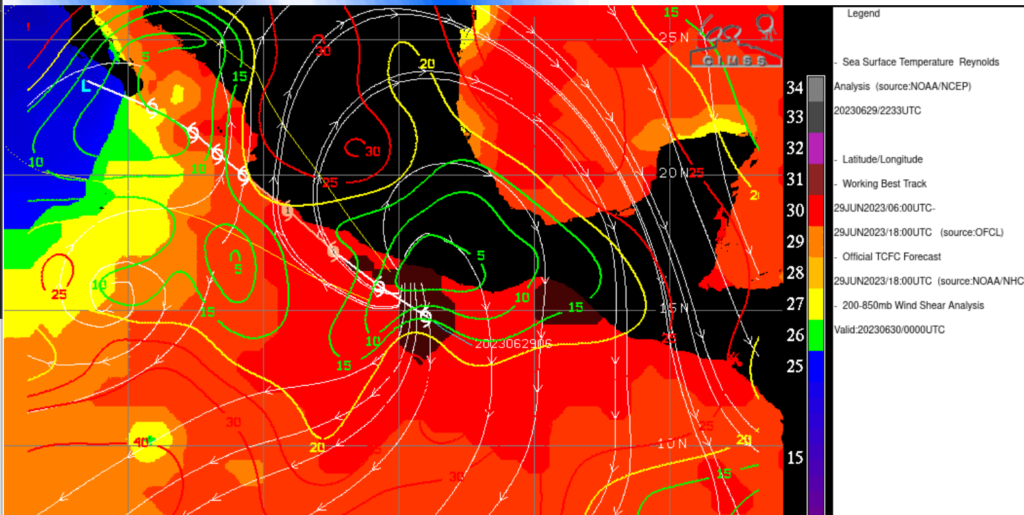
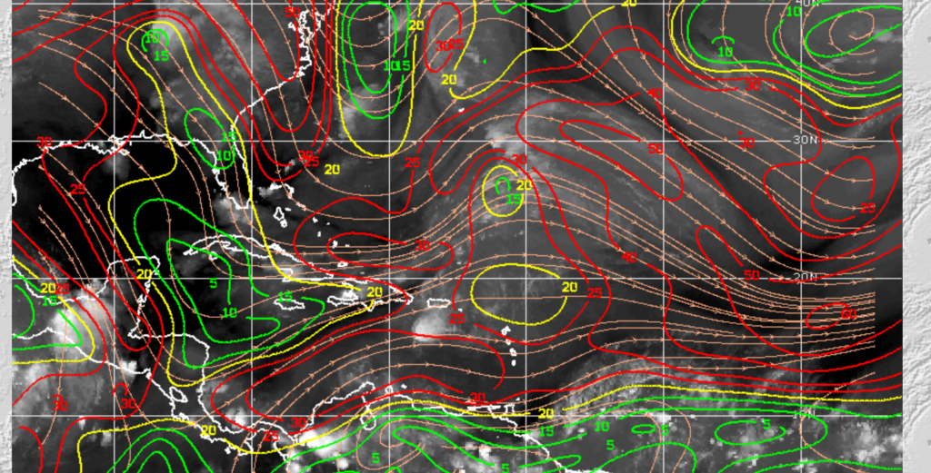
In The Atlantic, it remains quiet after the recent activity. This is due to high levels of shear present over the Caribbean and Saharan dust present over the main development region working to shred or mute most any activity. Until these hostile actions reduce, we shouldn’t expected storm development outside the low chance given to a region near Bermuda associated with the remains of Cindy. Conditions over that region appear very unfavorable with high wind shear, no real surface convergence development is very unlikely.
[wpcode id=”41149″]
Conclusion
The East Pacific remains active at this time. Those along the western coastline of Mexico should monitor the progression of Beatriz as its proximity to the coastline and rapid development. Hurricane Adrian will continue to churn out in East Pacific these next few days. The Atlantic will continue to remain quiet in the short term. Conditions look very favorable in the Pacific for storm development while the Atlantic remains quiet.


