Our mild and wet St. Patrick’s Day is coming to a close in terms of the rain. Most areas topped out around an inch or so with even a special marine warning off the coast of Mississippi. The cold front is just behind this system which will give us a significant change in temperature. Temperatures will dip around freezing overnight on Monday with some areas possibly reaching below 30 degrees further north. A strong high pressure system from the northern Plains will reside over much of the eastern US which will keep us dry for the next few days.
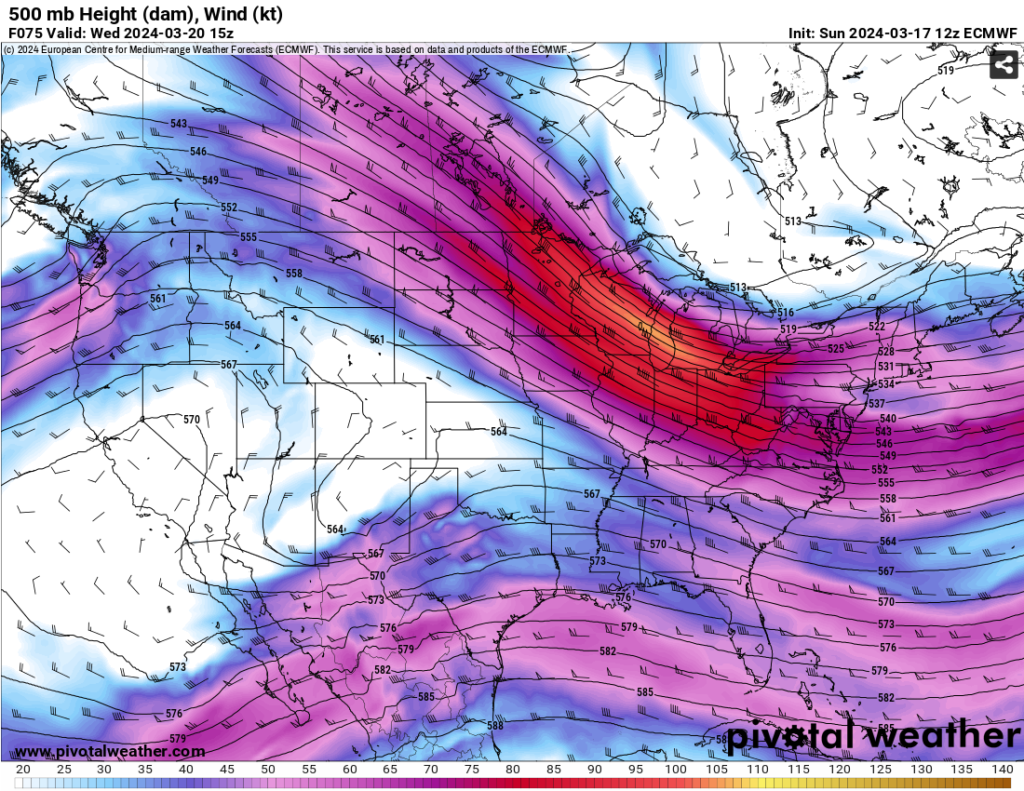
Around mid-week, we’ll see a change in the conditions as a closed upper-level trough in the western US will push towards the southeast from Wednesday into Friday. The amplitude of the trough looks to weaken by the time it reaches us as the main jet stream will pass through by Tuesday. At the surface, a long cold front moving from Canada will move far south into the southern US. Along with this, another surface low is developing over the southwestern US which will move east (related to the trough I mentioned earlier).

The surface cold front I mentioned earlier will affect the southwest low and push it south the further east it goes. Areas of east Texas, Arkansas, and southern Louisiana will likely see most of the rain before it trails further south. That’s not to say Mississippi won’t see any of the rain as some of the leftovers will likely come early Friday before the low moves out to sea. We’ll see a brief dry slot during the weekend with some mild but blustery weather Saturday and a slightly more humid Sunday.

Another thing of note, and while it’s still over a week away, is another chance for heavy rain on Monday. Another shortwave will develop out of the southwest and seems a bit stronger than the first one I mentioned. Models are still out of agreement on how far south the low pressure will land, but we’ll keep an eye on it. One more system that caught my eye was next Wednesday. I know it’s quite a ways away, but looking at how stout the system looked, it’s definitely worth keeping tabs on it as the models get closer.
Anyways, to summarize the week coming up:
Monday-Wednesday: Temperatures will cool significantly due to the cold front, highs will range around the 60s with some strong northern winds on Monday. Some frost will develop overnight into Tuesday and temperatures will gradually warm up as the winds shift from west to south.
Thursday and Friday: We’ll have some prominent rain west of the Mississippi River and in some areas of southeastern Louisiana while there will be more scattered rain chances across Mississippi and Alabama going into Friday.
Saturday and Sunday: We’ll see a brief period of dry weather with a quick cold front before we get a possible chance of rain and thunderstorms on Monday.
[wpcode id=”41179″]
Regional Day-to-Day Forecast
Tonight – Cloudy, with a low in the upper 40s. North wind 5 to 10 mph.
Monday – Mostly cloudy, then gradually becoming sunny, with a high in the low 60s. North northwest wind 5 to 10 mph increasing to 10 to 15 mph in the afternoon. Winds could gust as high as 25 mph.
Monday Night – Frost developing in the early morning hours. Otherwise, mostly clear, with a low in the low 30s. North northwest wind 10 to 15 mph decreasing to 5 to 10 mph after midnight. Winds could gust as high as 20 mph.
Tuesday – Widespread frost, mainly before sunrise. Otherwise, sunny, with a high in the low 60s. Calm wind becoming west around 5 mph in the afternoon.
Tuesday Night – Partly cloudy, with a low in the upper 30s. West wind around 5 mph becoming calm in the evening.
Wednesday – Mostly sunny, with a high near 70. West wind around 5 mph.
Wednesday Night – Partly cloudy, with a low in the mid 40s. South wind around 5 mph becoming calm after midnight.
Thursday – A 20 percent chance of rain starting in the afternoon. Mostly cloudy, with a high in the upper 60s. Light southeast wind increasing to 5 to 10 mph in the morning.
Thursday Night – A 40 percent chance of rain. Mostly cloudy, with a low in the upper 40s. East southeast wind 5 to 10 mph.
Friday – A 20 percent chance of rain. Partly sunny, with a high in the upper 60s.
Friday Night – Partly cloudy, with a low in the upper 40s.
Saturday – Mostly sunny, with a high in the lower 70s.
Saturday Night – Mostly clear, with a low in the mid 40s.
Sunday – Mostly sunny, with a high in the mid 70s.
[wpcode id=”41149″]


