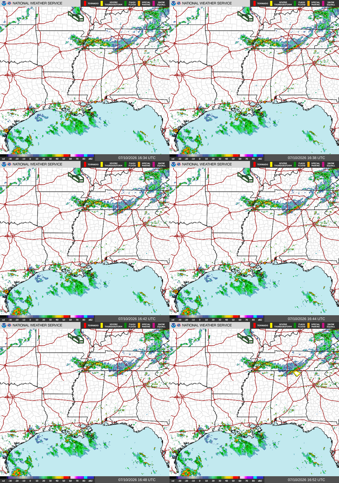
Currently on our radar as of noon CDT, we have a few scattered storms in southern Louisiana, but most other places look pretty quiet. The storms in Louisiana are moving stationary to slightly northwards.
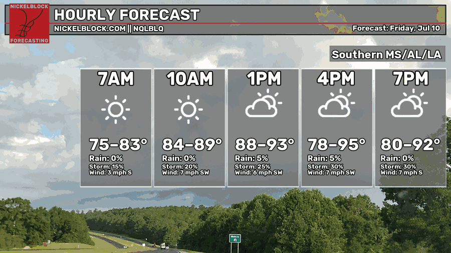
Temperatures today are expected to rise into the mid low-mid 90s for most places, which was also forecasted in yesterdays forecast. Make sure to drink plenty of water, wear cool clothing, and limit your outdoor time if you aren’t going to be by a body of water.
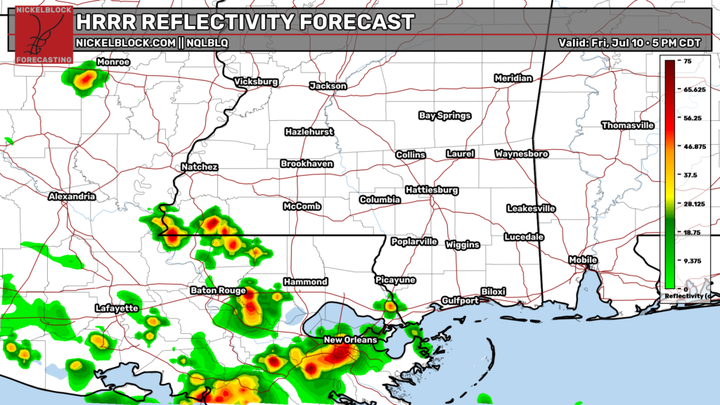
By this evening, these storms will have made their way slightly further to the north and to the east due to the force of the low level winds coming off the gulf. The HRRR model shows New Orleans and Baton Rouge being the two major cities most likely to see thunderstorms today. While there is no guarantee that these two cities will get hit directly by any storms as shown by the HRRR, what this does mean is that the general area between New Orleans and Baton Rouge has en elevated chance of storms tonight.
Most of these storms should be gone by 9 tonight, and most areas outside of Southern Louisiana and southwest Mississippi are unlikely to see any significant storms. Not much of the forecast from yesterday has changed.
Tomorrow
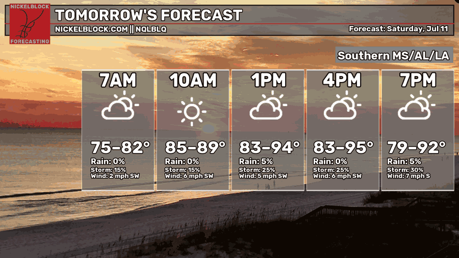
Temperatures will again rise into the hot low-mid 90s tomorrow for most places, while morning lows will only fall into the mid and upper 70s. Much like today, be sure to stay hydrated, wear appropriate clothing, and limit your outdoor time.
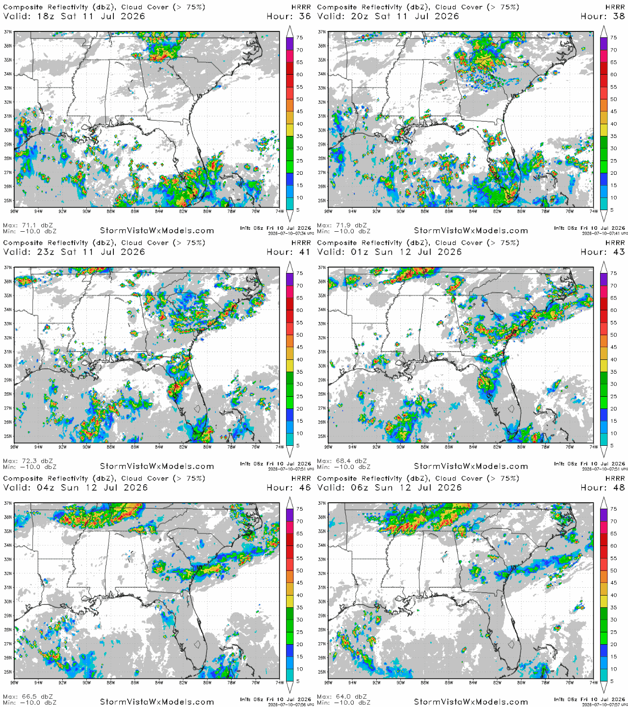
Some more scattered thunderstorms are in the forecast for tomorrow, mostly for areas closer to the coastline. This is mostly due to the sea breeze, which will help storms rise in areas just north of the coast. South-central Louisiana appears to be the hotspot for storms tomorrow, with the HRRR hinting at multiple cells forming between Baton Rouge and Alexandria. Most storms appear to be gone by 9 tomorrow night.
Rainfall totals will likely be insignificant for most, with Louisiana (the hotspot) receiving no more than a quarter inch. Places hit directly by a thunderstorm may get more rainfall than that, however. Overall, not much has changed in the forecast.
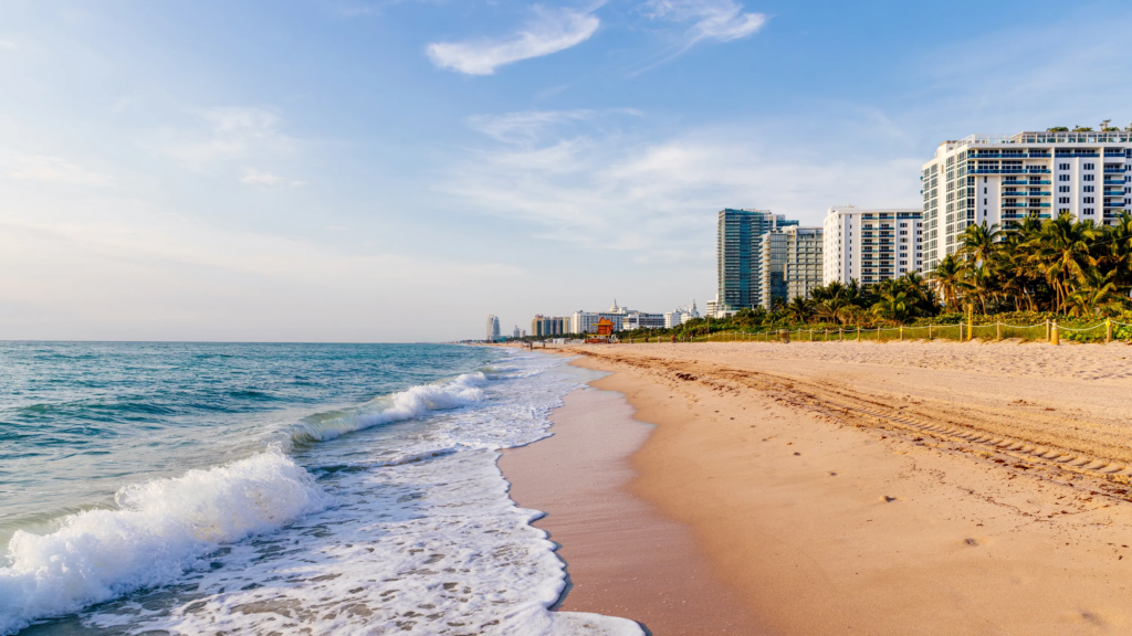
Cloud cover looks to be pretty sparse for most areas tomorrow, so tomorrow will make an excellent weekend beach day!