Get ready for a pretty cold night tonight. I’m sure pleaces like The Weather Channel are calling this some kind of “Arctic Blast.” And usually I’d say, “that’s a bit of hyperbole” but this time it actually carries some weight.
Looking at the 850mb maps (thanks to Storm Vista for the archived maps from last week), it shows that this cold originated along the northern coast of Canada and Alaska, and then barreled south across Canada and into the southeast.

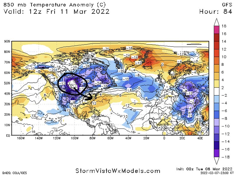

The air has been heavily modified due to the lack of snow cover across the Plains, but it will still be pretty cold by the time you wake up tomorrow morning. On top of that, there will be a fair bit of wind, too. So get ready to feel a bit of bite from the breeze.
The cold air won’t stick around long. But it will be cold enough overnight tonight that you’ll want to protect the Plants by bringing any plants that can’t handle the cold inside, or cover them up. I’m sure a few of the ‘warmer-blooded plants’ have started to bud out a bit, so you may want to cover those up, too, if possible.
The good news is we should keep enough of a breeze to prevent too much frost from developing. The bad news is that the wind will be very cold, so any plants that would be killed off by temperatures below freezing, won’t likely make it overnight without some kind of mitigation strategy used.
Tomorrow, afternoon, though, it will warm back up nicely. Most folks should top out around 60.
Sunday night may feature another round of 30s, though, with the outside shot for a frost. So, don’t bring the plants back out quite yet.
By Monday though, things will be warm enough that you can bring everything back out.
Then we wait for the next round of showers and storms as we head into the St. Patrick’s Day weekend.
Day to Day Forecast
TODAY
Sunny and breezy. Much cooler with highs in the upper 40s. North winds 10 to 15 mph with gusts up to 30 mph. Wind chill values in the 30s most of the day.
TONIGHT
Clear. Freeze likely. Frost possible after midnight. Still a bit breezy. Cold with lows in the mid 20s. North winds around 5 mph. Gusts up to 20 mph in the evening.
SUNDAY
Mostly sunny. Not as cool with highs around 60. Southeast winds around 5 mph.
SUNDAY NIGHT
Increasing clouds overnight. patchy frost possible. Chilly. Lows in the mid 30s.
MONDAY
Partly sunny. Highs in the upper 60s.
MONDAY NIGHT
Passing clouds with showers possible. Lows in the lower 50s.
TUESDAY
Mostly cloudy with a chance for showers. Highs in the lower 70s. Chance of rain 70-percent.
TUESDAY NIGHT
Partly cloudy in the evening, then becoming mostly cloudy. Lows in the lower 50s.
WEDNESDAY
Mostly sunny. Highs in the lower 70s.
WEDNESDAY NIGHT
Mostly clear. Lows in the upper 40s
THURSDAY
Partly cloudy. Highs in the upper 70s.
THURSDAY NIGHT
Mostly clear in the evening, then becoming partly cloudy. Lows in the mid 50s.
FRIDAY
Partly sunny with a chance of showers and thunderstorms. Highs in the mid 70s. Chance of rain 40 percent.


