As I’m sure many of you are aware, the big weather story across the gulf coast this week is rain… and tons of it!
Yesterday and today, a slow moving frontal boundary has dropped significant rainfall on our area. This frontal boundary is extended from potential tropical cyclone 1, which formed this morning north of Brownsville, TX.
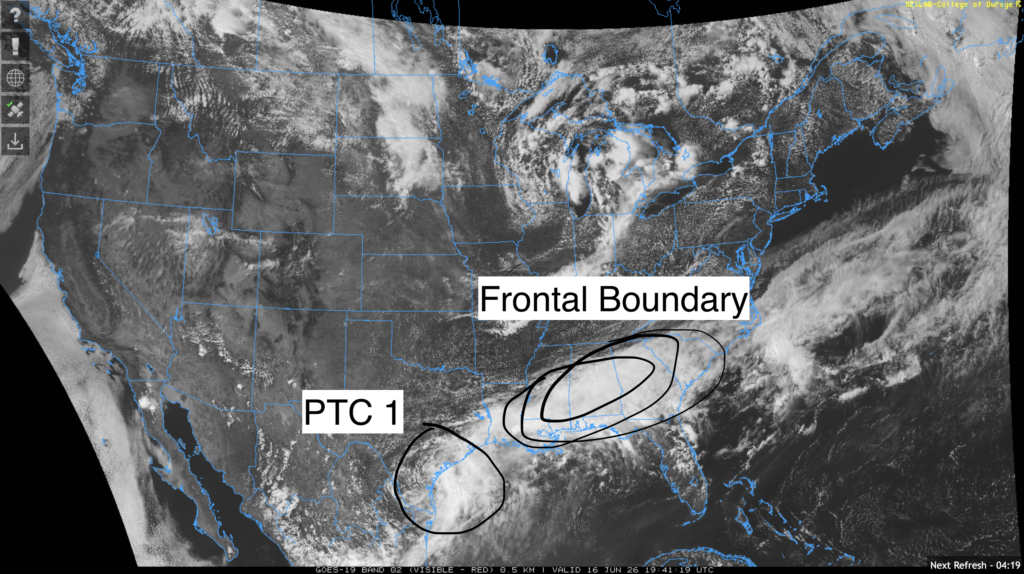
Once the frontal boundary passes through the area, PTC 1 itself will make its way east, dropping even more rain on us!
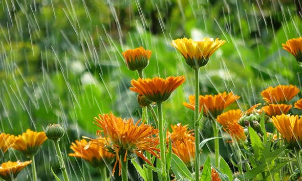
This means that no watering will be necessary for a little while. Also, remember to not distribute pesticides or fertilizers in your garden before a heavy rain event, as they will wash away and pollute your local rivers and streams!
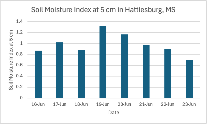
The soil across our region will be plenty wet by the end of this week and this weekend. The graph above represents the soil moisture index in Hattiesburg (I chose Hattiesburg since it’s in the middle of our area). The soil moisture index ranges from 0 (completely dry) to 1 (completely saturated). Values over 1 would indicate that runoff or percolation will occur.
For context, soil moisture index values between 0.35 and 0.75 are considered optimal for plant growth! Needless to say, no watering will be necessary for at least a week, unless you have shallow potted plants that sit in the sun.
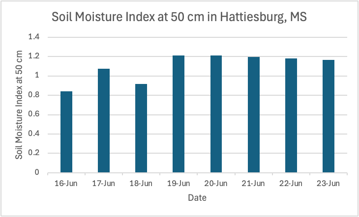
If we go a little deeper into the ground, the soil moisture index values are even higher! This is likely explained by all the recent rain we’ve had in the past month or so.
Soil moisture index values greater than 0.8 indicate that plant growth may be inhibited because the roots of the plant cannot get enough oxygen, so it’s important that over the next couple of weeks you go light on the watering and let your plants dry out a bit.
Luckily for us, the next couple of weeks look a bit drier. Some models are hinting at ridging west of us, which would likely bring closer to average high temperatures, and daily storms that are aren’t too strong or widespread. This pattern may allow for your plants to dry out a bit.


