Spoiler alert, It’s gonna be hot. But some lucky locations might get a cool down. Unfortunately Mother Nature’s way to cool down is a thunderstorm.
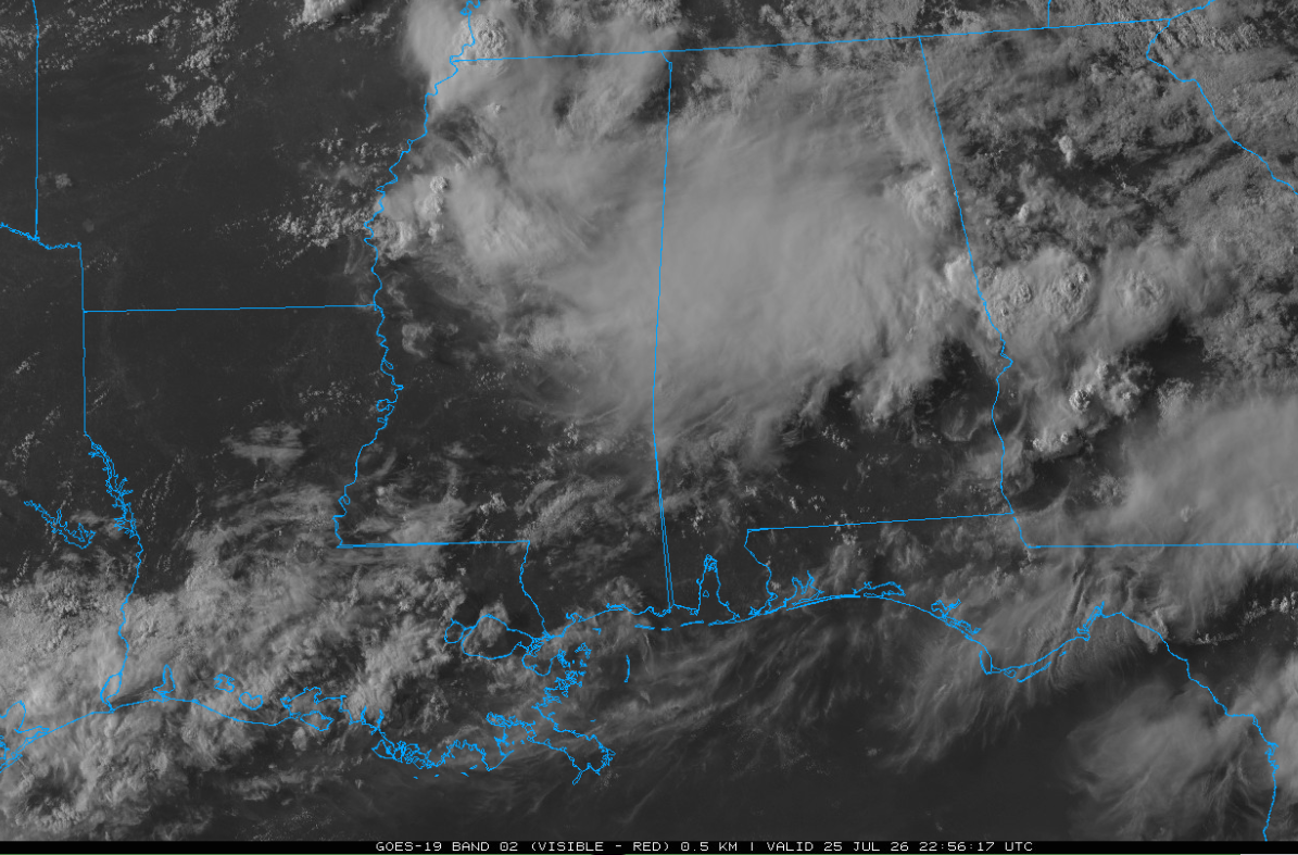
And there’s a few of them out there. Most of the storms will dissipate with the loss of daytime but a few could persist into the evening hours, especially over Georgia.
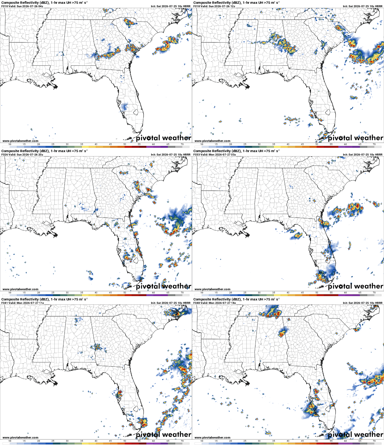
Storms will be possible again tomorrow and into Monday, mainly for locations further east. They likely won’t be anything crazy but enough to drop the temperature and throw out some lightning.
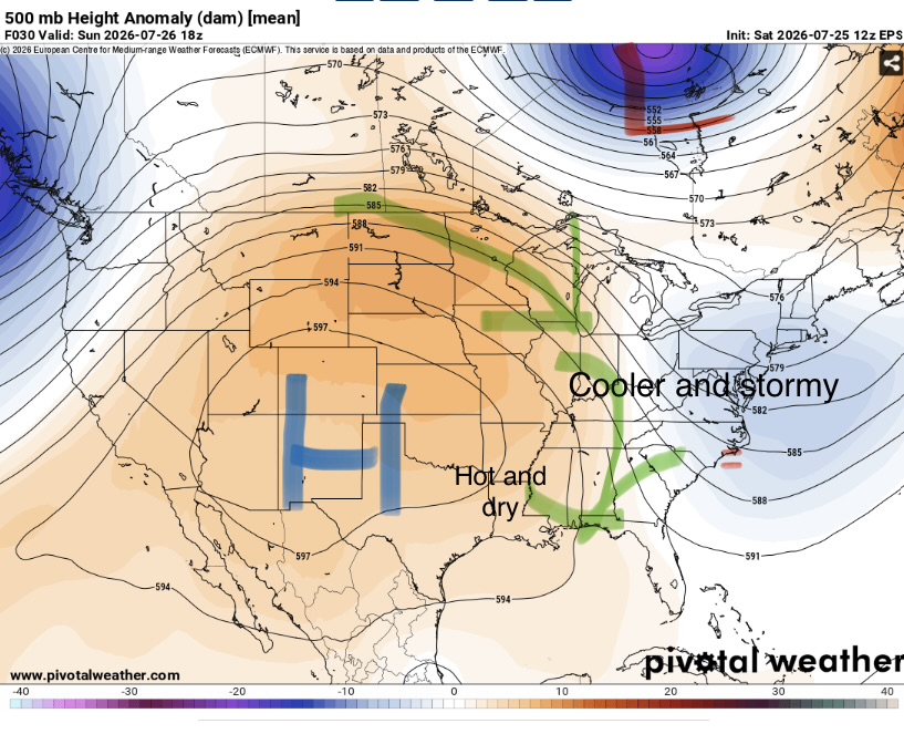
This is due to the position of the ridge. Areas to the east will be feeling the lift of a trough while to the west towards the lower Mississippi valley the ridging will be dominant and keep convection surpressed.
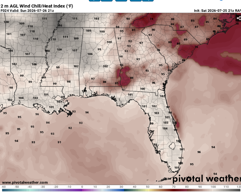
The main story will still be the heat. These temperatures will be hazardous to anyone exposed to them for a while but especially for the elderly and those with preexisting conditions. Heat indexes will peak above 105. Make sure to take frequent breaks in the AC and drink plenty of fluids if you must be outside.
Overall, a fairly typical summer heat wave and all the fun that comes along with it.
Airport Forecasts
Houston (KIAH/KHOU)- Mostly fine. There may be an isolated storm of two tomorrow that could cause a quick delay for lightning or microbursts.
Shreveport (KSHV)- It’ll be very hot and muggy but no interruptions are expected.
Baton Rouge (KBTR)- Another sauna but there shouldn’t be any disruptions.
New Orleans (KMSY)- Might be some clouds but it isn’t expected to storm.
Jackson (KJAN)- Very hot but should be all good to fly.
Mobile (KMOB)- Afternoon thunderstorms are possible tomorrow and Monday. They probably won’t be severe but they might cause some delays for lightning or downbursts.
Birmingham (KBMH)- Off and on thunderstorms over the next 48 hours. It won’t storm the whole time but there may be a few delays for lightning and microbursts.
Tallahassee (KTLH)- Afternoon storms possible each of the next two days. They won’t be super strong or long lived but they may be enough to cause some lightning or downburst delays.
Atlanta (KATL)- A few storms possible from around sunrise through the mid afternoon. This could lead to a few delays for lightning or downdrafts.
Highways
I-10 – Mostly chill. There could be a few storms in the Florida panhandle during the dinner hour tomorrow.
I-20 – Storms are possible across Alabama tomorrow morning and then during the mid day on Monday. Make sure to use caution when encountering water on pavement.
I-49 – No issues anticipated.
I-55 and I-59 – A spot shower or two possible across Mississippi tomorrow but most locations will remain dry.
I-65 – A few storms possible tomorrow morning and then again during the mid day on Monday. Be careful of ponding on roadways.
I-75 – Off and on showers across Georgia. These won’t cover the whole state and most locations will be dry at any given time but there will be pockets of heavy rain.
City Forecasts
Houston, TX
Tonight- Partly cloudy with a low in the upper 70s. No rain.
Tomorrow- Mostly sunny with a high in the upper 90s. Isolated afternoon thunderstorms.
Monday- Sunny with a high in the upper 90s. Dry.
Shreveport, LA
Tonight- Mostly clear with a low in the mid 70s. No rain.
Tomorrow- Sunny with a high in the upper 90s. Dry.
Monday- Sunny with a high in the upper 90s. No precip expected.
Baton Rouge, LA
Tonight- Partly cloudy with a low in the mid 70s. No rain.
Tomorrow- Sunny with a high in the mid 90s. Dry.
Monday- Mostly sunny with a high in the upper 90s. No precip expected.
New Orleans, LA
Tonight- Mostly cloudy with a low in the upper 70s. No rain.
Tomorrow- Mostly sunny with a high in the mid 90s. No precip expected.
Monday- Mostly sunny with a high in the mid 90s. Dry.
Jackson, MS
Tonight- Partly cloudy with a low in the mid 70s. Dry.
Tomorrow- Mostly sunny with a high in the mid 90s. No rain.
Monday- Mostly sunny with a high in the upper 90s. No precip expected.
Birmingham, AL
Tonight- Scattered showers and storms likely. Mostly cloudy with a low in the mid 70s.
Tomorrow- Scattered showers likely in the morning with isolated thunderstorms possible later in the afternoon. Partly sunny with a high in the low 90s.
Monday- Isolated storms possible. Mostly sunny with a high in the mid 90s.
Mobile, AL
Tonight- Partly cloudy with a low in the upper 70s. No rain.
Tomorrow- Increasing clouds with a high in the mid 90s. Scattered afternoon thunderstorms possible.
Monday- Mostly sunny with a high in the mid 90s. Isolated afternoon storms possible.
Tallahassee, FL
Tonight- Partly cloudy with a low in the mid 70s. No rain.
Tomorrow- Increasing clouds with scattered afternoon storms possible. Highs will be in the mid 90s.
Monday- Mostly sunny with a high in the mid 90s. Isolated afternoon thunderstorms possible.
Atlanta, GA
Tonight- Partly cloudy with a low in the mid 70s. Scattered thunderstorms possible.
Tomorrow- Scattered showers and storms possible before mid afternoon. Partly sunny with a high around 90.
Monday- Mostly sunny with a high in the low 90s. An isolated storm or two is possible.


