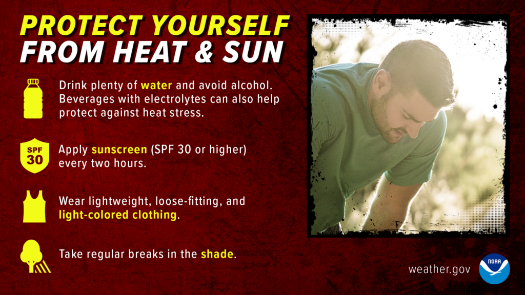
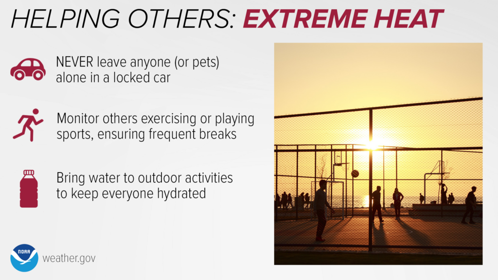
It’s going to be hot for the next few days; high temperatures and humidity will combine to create dangerously hot conditions. Make sure you are taking care of yourself, your pets, and your peers! Drink plenty of water, have someplace to cool down, and take breaks when outdoors.

Today
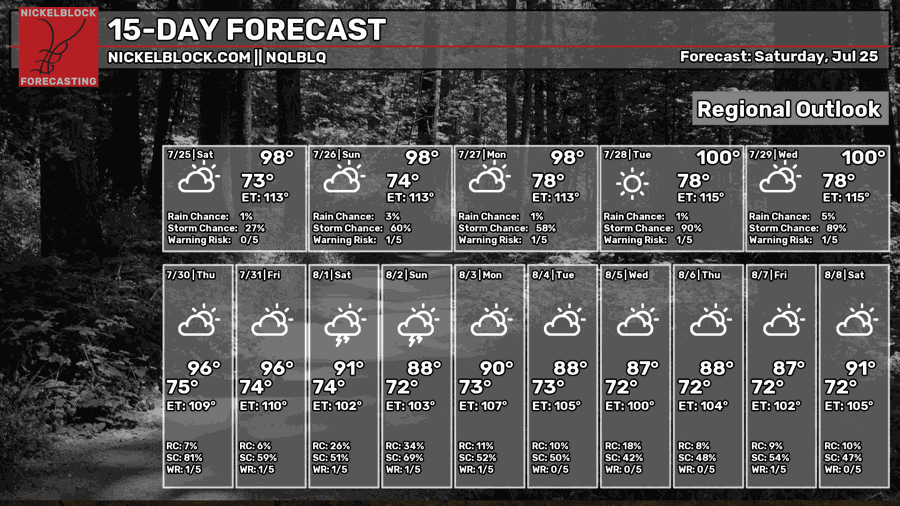
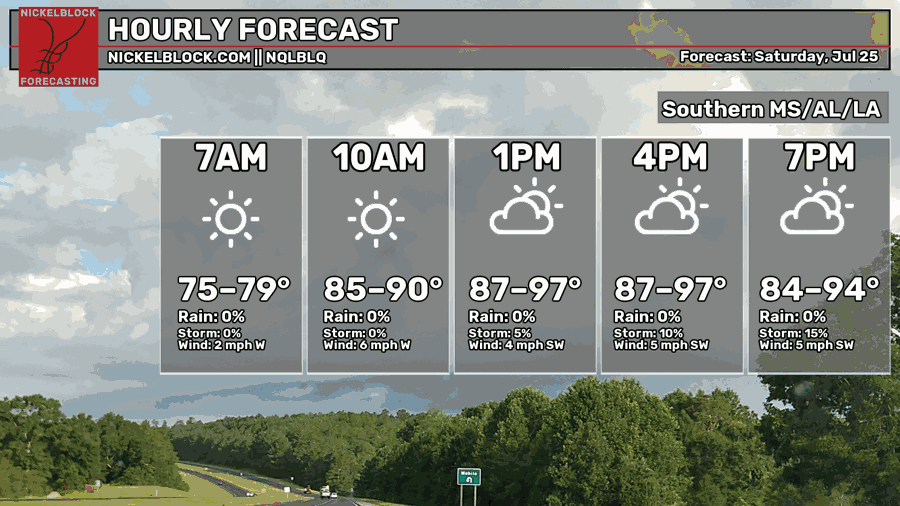
Going to be very warm and humid with highs in the upper 90s! The chances of showers and thunderstorms remain low. Calm winds are coming out of the west-southwest at around 2 to 6 mph.
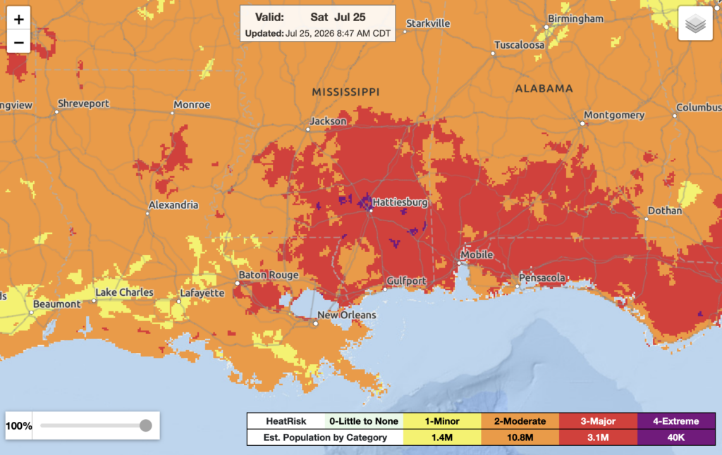
High humidity will make the outside feel much warmer than it really is. The heat indices in most areas are already in the mid-80s. As we progress throughout the day, the heat indices will only continue to increase. Make sure to stay hydrated, have somewhere to cool off, and take breaks if you’re doing outdoor activities.
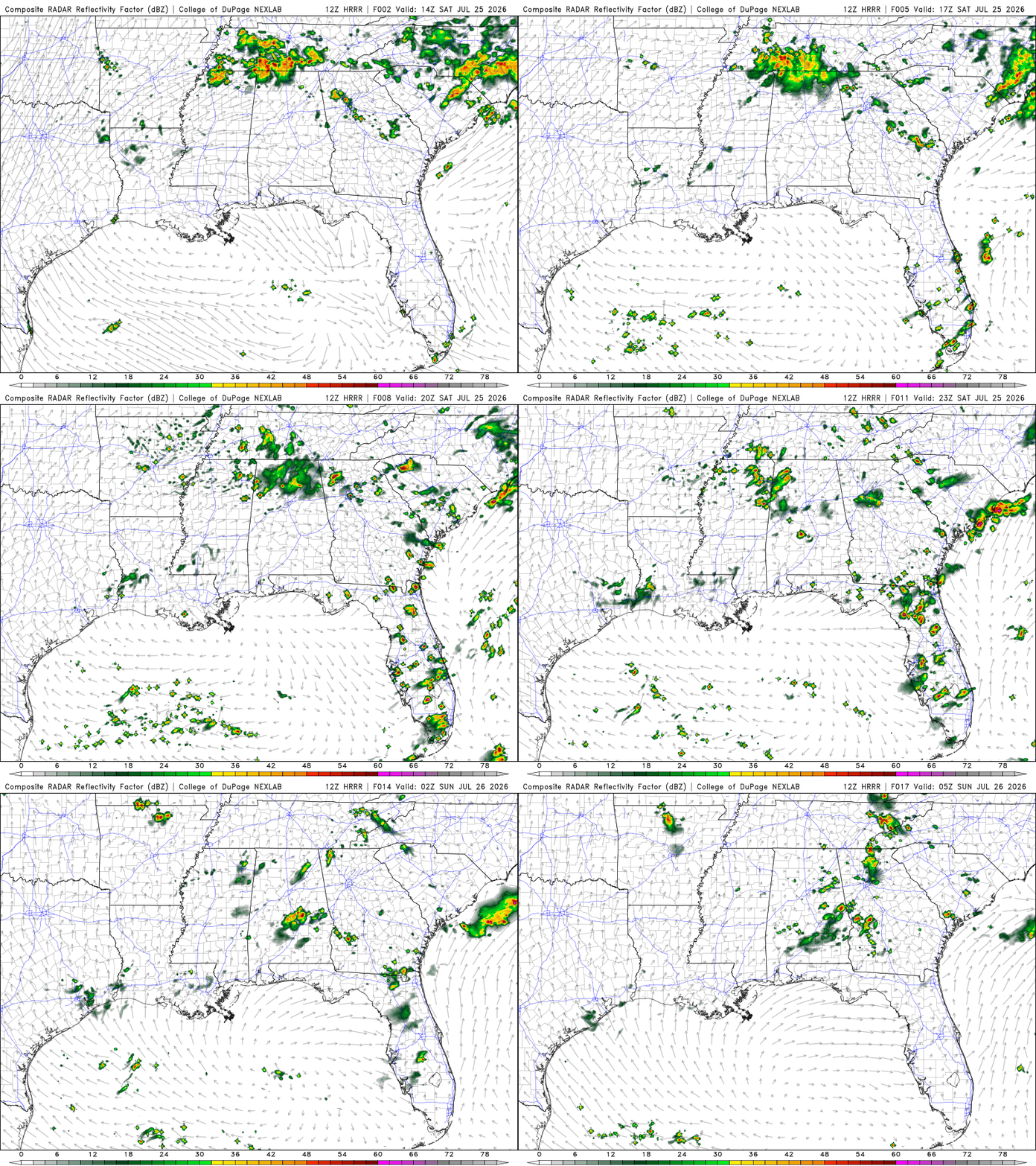
Brief showers in southern LA and MS are possible in the evening. An isolated thunderstorm or two is possible in southern AL around late afternoon/ evening.
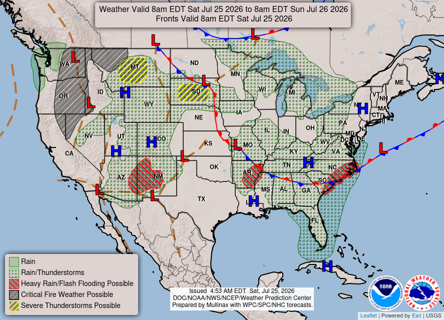
The area of high pressure over the LA/ MS border will keep the air very warm and moist from the Gulf moisture.
Tomorrow
More warm, humid conditions, with highs remaining in the upper 90s. A slightly higher chance of showers and thunderstorms when compared to today. Will be relatively calm winds coming out of the west-southwest.
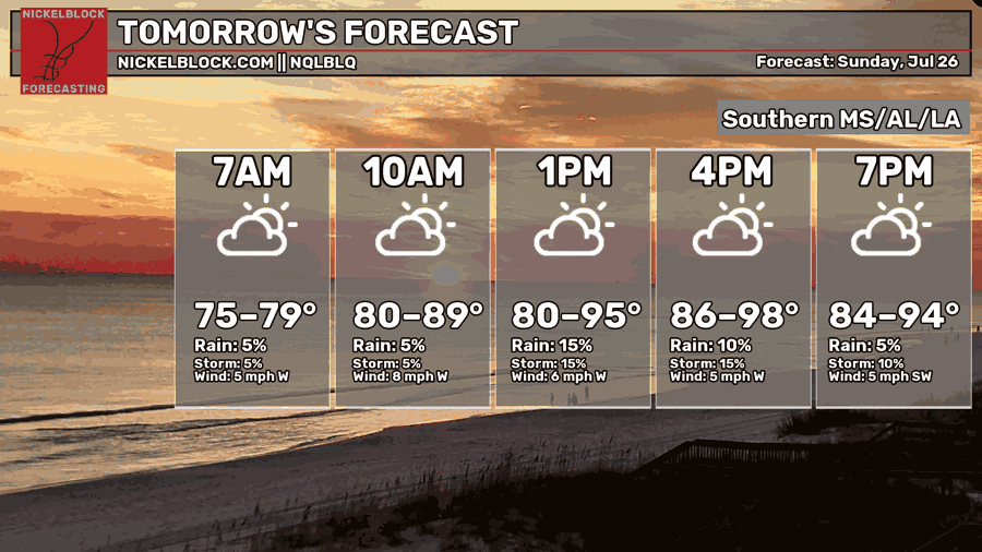
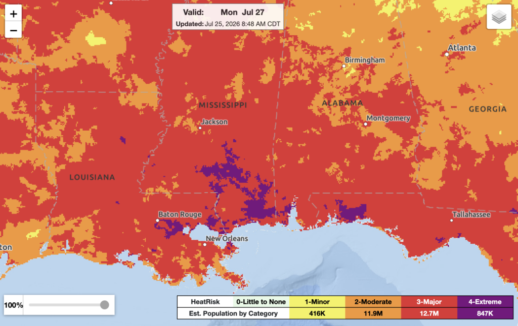
A lot of our region will be under a major threat of heat-related impacts, which will affect anyone without cooling/ hydration as well as health systems and industries. Continue to stay hydrated, have somewhere to cool off, and take breaks if you’re doing outdoor activities.
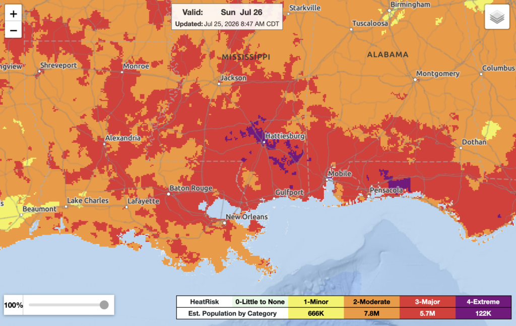
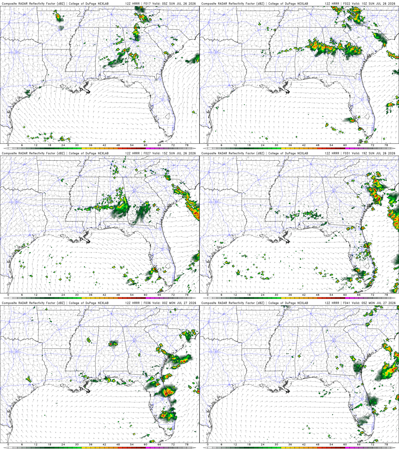
Southern AL and MS could see a line of thunderstorms moving in from the north around late afternoon/ early evening.

Monday
Another warm and humid day with highs in the upper 90s. Slightly higher chance of showers and thunderstorms when compared to the past two days. The highest chances for showers and thunderstorms will be around late afternoon/ early evening. Calm winds coming out of the west.
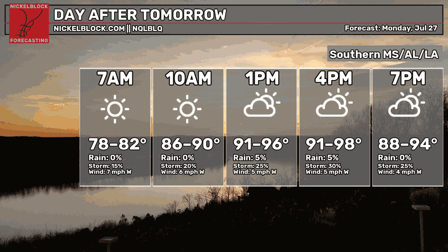
Again, a lot of our region will be under a major, even extreme threat of heat-related impacts, which will affect anyone without cooling/ hydration as well as health systems and industries. Also, it will be a long duration of extreme heat with no overnight relief. Continue to stay hydrated, have somewhere to cool off, and take breaks if you’re doing outdoor activities.

Extended Forecast
The CPC outlook had our area experiencing above-average temperatures and near-normal precipitation.


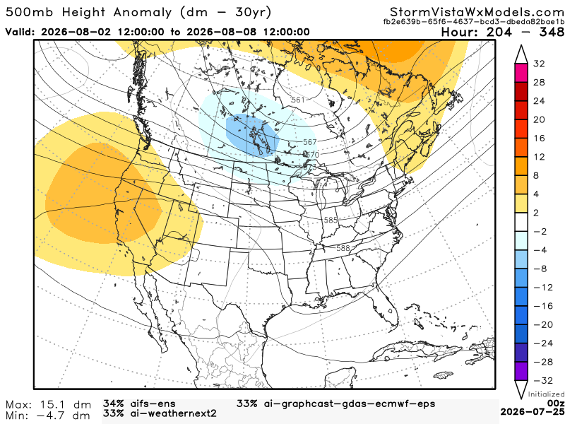
This 500mb height anomaly model has a blend of the 3 most accurate models over the past 7 days. The model runs from August 1, 7 am to August 7, 7 am. Based on the blend, I would probably agree with CPC. The temperatures, while still hot, will cool down due to the shortwave trough sitting near the northwestern Gulf. Also, the shortwave trough will bring scattered thunderstorms that could be severe in the Deep South. So, near-normal precipitation does make sense because the storms shouldn’t be prolonged.