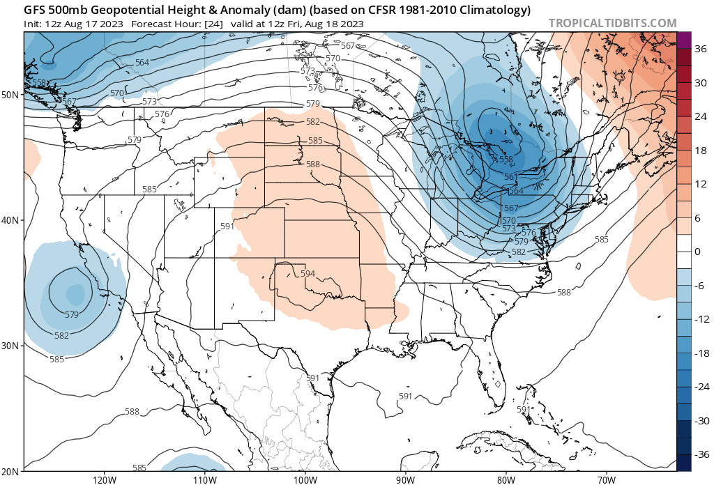
As upper-level ridge builds really strong over the Upper Midwest this weekend, our local area is looking to be high and dry this week while precipitation is looking low amidst drought conditions in the future.
[wpcode id=”41149″]
Heat and Fire Risk Throughout the Weekend
There will be extended heat risk for our area throughout the weekend. Underneath this swirling heat dome will be sufficiently dry conditions for clear skies and high temperatures.
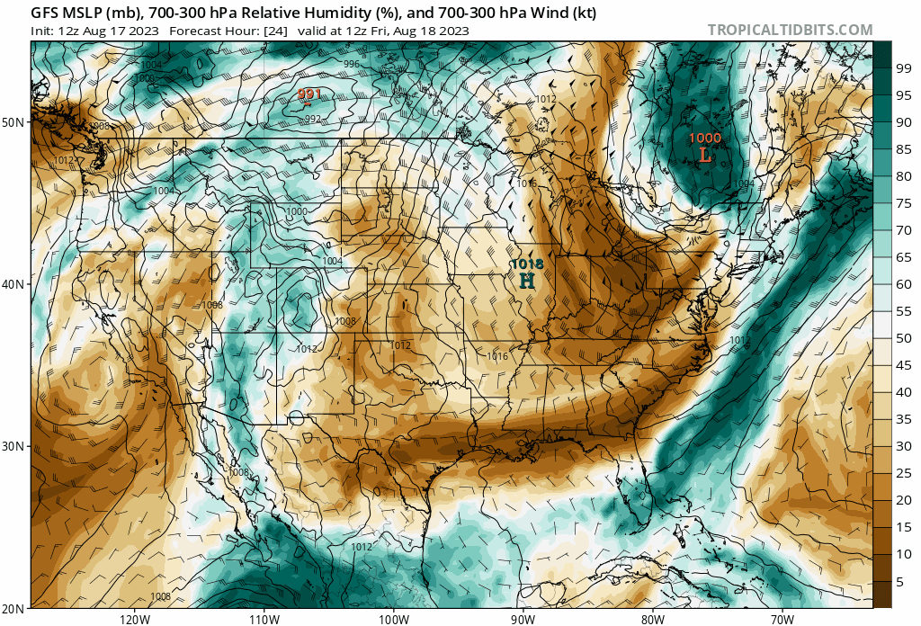
While Hurricane Hilary travels up the West Coast, being pulled up along the west side of this high pressure system, significantly dry conditions will prevail all throughout the Central US extending into the Southeast. For us here the Southern MS/LA/AL region, this will be mean extremely warm temperatures and even a risk of fires breaking out with such low humidity throughout today especially. High temperatures will top 105 in Louisiana while Central Mississippi and Alabama will be sitting in the high 90s. And this heat isn’t going anywhere as it spreads further into the Central Midwest where temperatures will hit 115 with the ‘feels like’ index reaching into the 120s.

[wpcode id=”41149″]
Extended Outlook
Southwestern Louisiana and parts of Southeastern Texas have been under an extreme drought this summer with an 1-2 week outlook of below average precipitation centered around the area. With moderate to abnormally dry conditions extending further into the Southern Mississippi and Alabama, most of the our forecast area will be under a risk of fires this week with the coming weeks continuing to be dry.
During this time, please take the utmost care to prevent accidental fires and adhere to local burn bans.
[wpcode id=”41149″]
Regional Day-To-Day Forecast
Today: Sunny. High temperatures in the upper 90s to low 100s. West winds around 5 mph.
Tonight: Clear. Low temperatures in the upper 70s. West winds around 5 to 10 mph.
Saturday: Sunny and hot. High temperatures in the low 100s. West winds around 5 mph.
Saturday Night: Mostly clear. Low temperatures in the upper 70s. Northeast winds at 5 to 10 mph.
Sunday: Sunny. High temperatures in the upper 90s to low 100s. East winds around 5 to 10 mph. Chance of rain 20% along the coast.
Sunday Night: Mostly clear. Low temperatures in the upper 70s. East winds around 10 mph.
Monday: Sunny and hot. Chance of showers and thunderstorms in the afternoon along the Gulf coast. High temperatures in the upper 90s to low 100s. Northeast winds around 10 to 15 mph. Chance of rain 30%.
Monday Night: Partly cloudy. Chance of showers and thunderstorms. Low temperatures in the upper 70s. East winds around 15 mph with gusts up to 25 mph. Chance of rain 20%.
Tuesday: Sunny. Chance of showers and thunderstorms. High temperatures in the upper 90s to low 100s. East winds at 10 to 15 mph. Chance of rain 20%.
Tuesday Night: Partly cloudy. Chance of showers and thunderstorms. Low temperatures in the upper 70s. Southeast winds around 5 to 10 mph. Chance of rain 20%.
Wednesday: Sunny. Chance of showers and thunderstorms. High temperatures in the upper 90s to low 100s. Northeast winds around 5 to 10 mph. Chance of rain 20%.


