Howdy!
It is going to be HOT for the next two weeks with a chance for some isolated showers and thunderstorms! It is important to make sure you hydrate and take the proper precautions when spending extended periods of time outdoors. For the next couple of days, we are in a drier weather pattern, but moisture returns through the weekend into next week.

TODAY/TONIGHT
There is not much going on currently based off the NOAA satellite and NWS radar. A few isolated showers here and there, with little cloud coverage over the region.
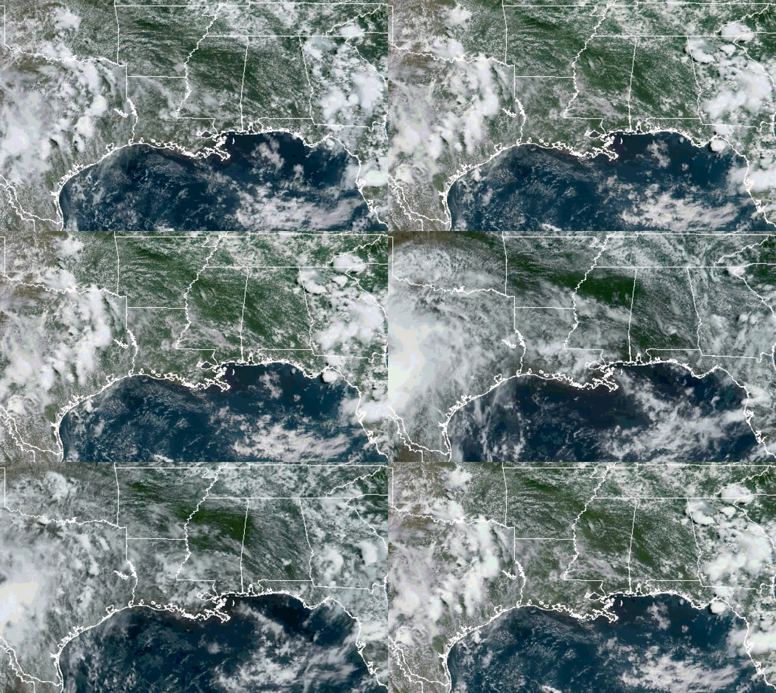
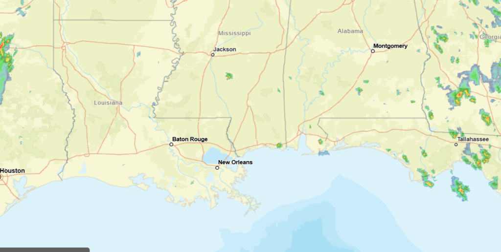
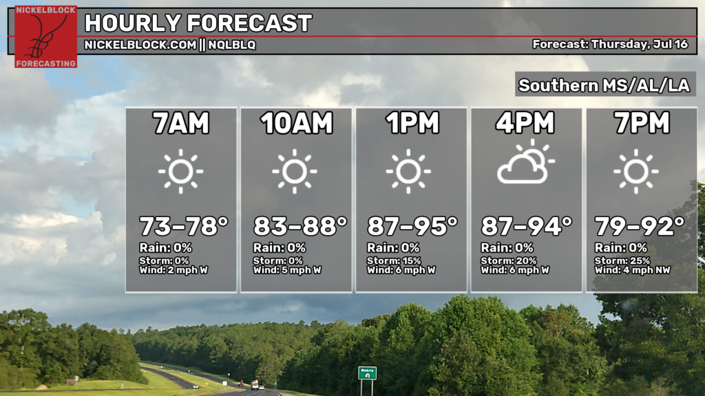
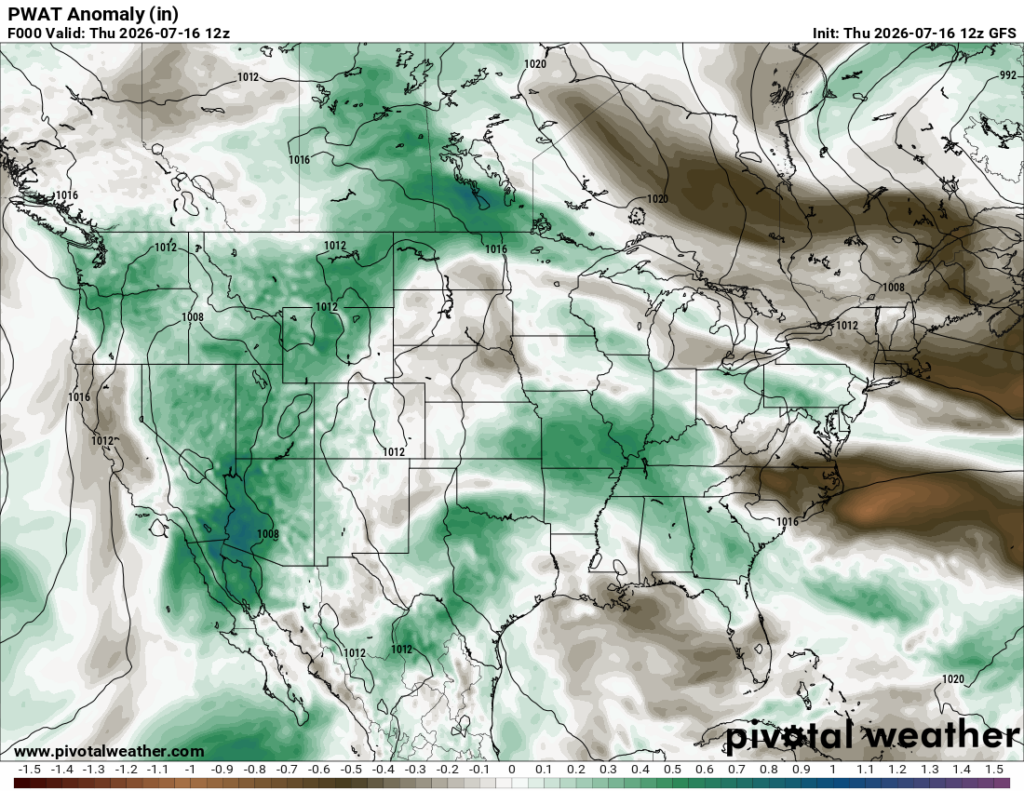
Temperatures are currently in the upper 80s to low 90s, humidity levels a little lower than normal, ranging from around 45% in Pensacola to around 69% out in Baton Rouge. The highs today will reach the upper 80s to mid 90s. We are in a drier pattern this week through the weekend, so rain will be limited. Below on the PWAT anomaly graphic, we can see how it is a bit drier than it normally is (indicated with the light brown).
A ridge covers a majority of the country currently, high pressure over the region and the gulf as well. An upper-level low embedded in the ridge has been over west Texas, producing high amounts of rainfall and dangerous amounts of flooding. The flood risk has been high recently not just for Texas, but also in our region as well. For today, the WPC has highlighted high risk of flooding for a portion of west Texas.
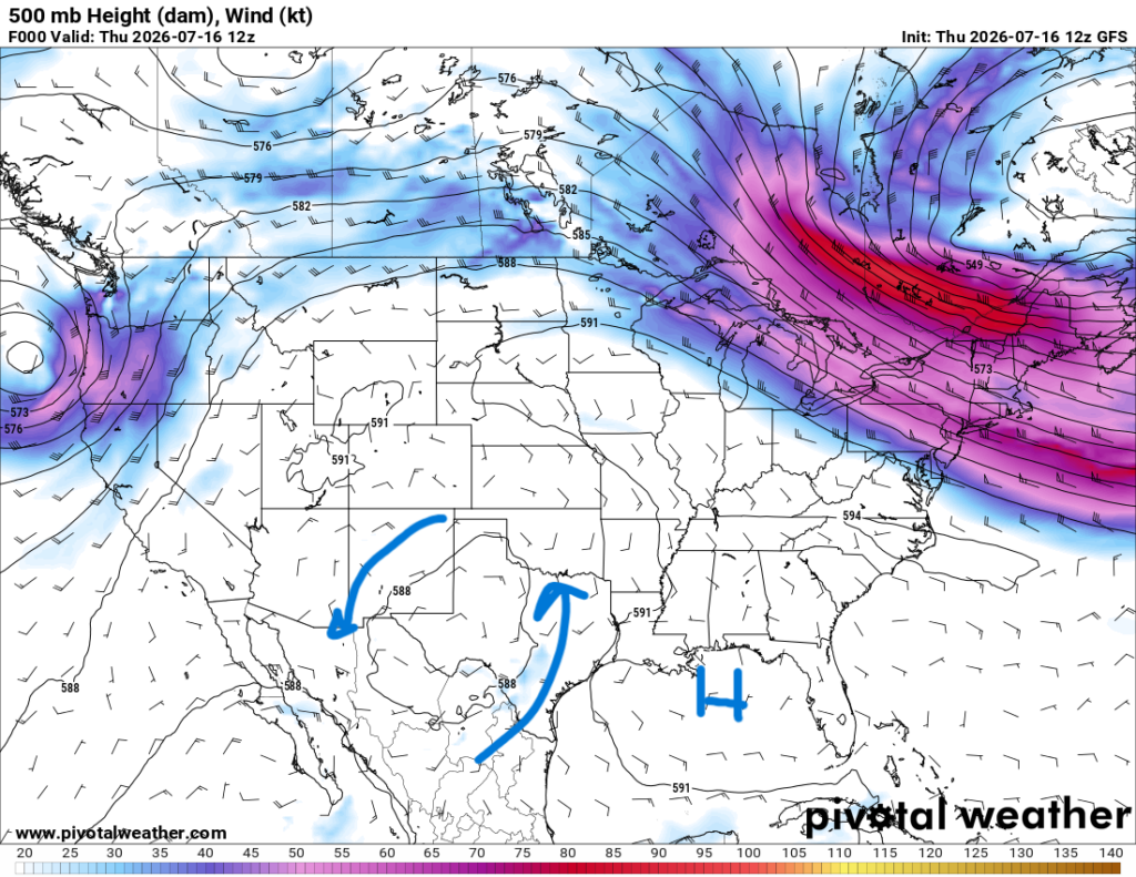
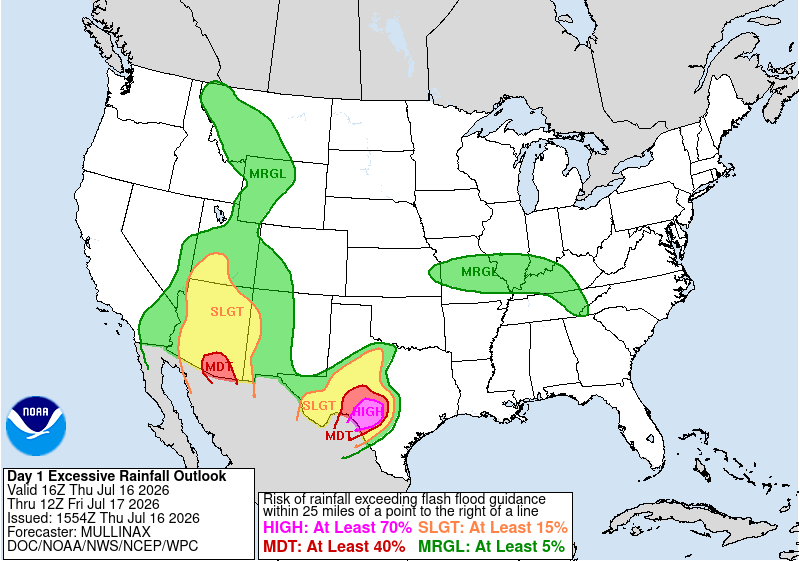
Typically, around 80% of flood damage occurs in a high risk area, so it is almost guaranteed that someone in this area will experience some sort of flood damage. Also, around 30% of flood-related deaths happen in a high-risk area, reminding us all that it is important to take these warnings seriously and prepare as much as possible.
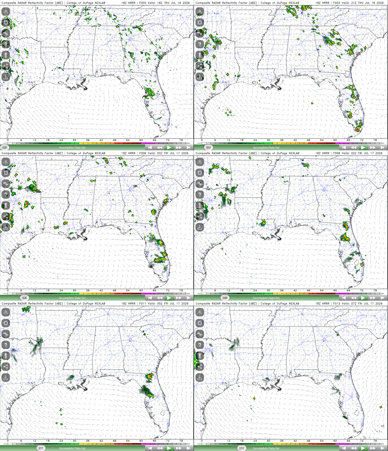
For our region, though, there is no risk for excessive rainfall (as we are in that dry pattern), so a break from the rain will be in store for the rest of the week. Isolated showers and thunderstorms cannot be ruled out today, southern Louisiana seeing the greatest chance (see below).
TOMORROW
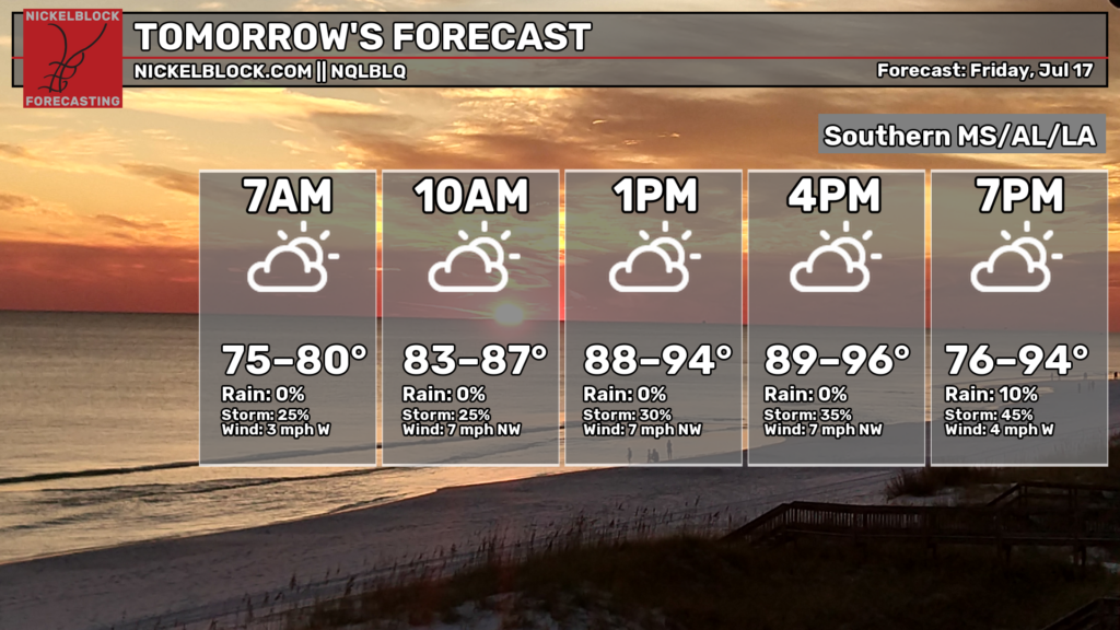
Highs tomorrow will range from the upper 80s to mid 90s, the dry period continuing on with some isolated showers and thunderstorms in the afternoon possible.
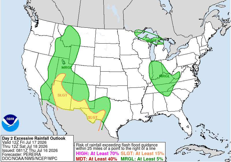
This dry pattern will push through the weekend, portions of west Texas into New Mexico, Arizona, and Utah at a slight risk for excessive rainfall, so the possibility of flooding is still possible for these areas tomorrow, although not as high.

SATURDAY
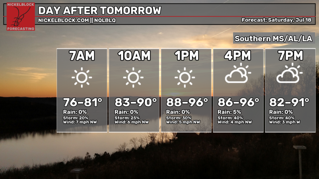
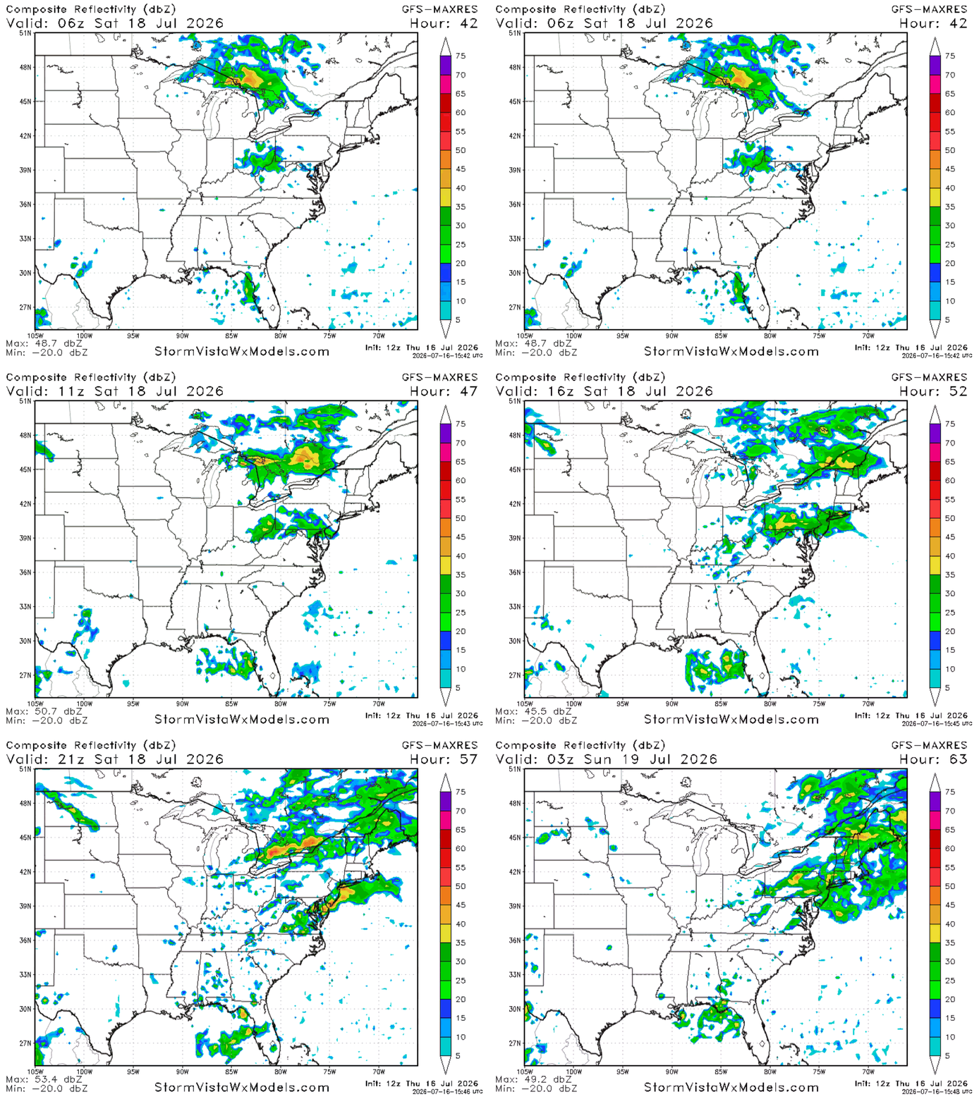
Highs for Saturday remain in the upper 80s to mid 90s, the highest temperatures being to the western portions of the region. There will be limited chances of rain, but we will see an increase in moisture as a low/trough builds to the southeast that may support some scattered showers over the eastern portions of the region. The upper-level ridge will still be dominant, keeping temperatures hot and slightly above normal.
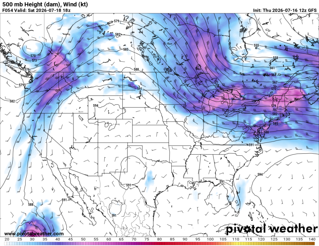
The GFS model below suggests that the greatest chance to see showers and thunderstorms will be in the afternoon, a good portion of the region seeing rain at some point in the day. No excessive rainfall or severe weather is expected.

EXTENDED OUTLOOK
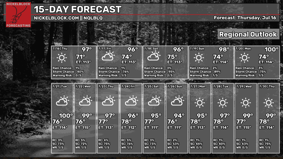
The heat is here to stay and will not be leaving for the next two weeks! Upper-level ridging will dominate the upper-level pattern, ensuring conditions are hot and humid with that increase in moisture over the weekend. Highs will stay in the mid to upper 90s, heat indices reaching above 100 for much of the region going into next week. This raises concern over heat stress and health issues, so make sure to take care of yourself moving forward!
Isolated showers and thunderstorms remain possible in this moist and hot environment, main chances being in the afternoon.
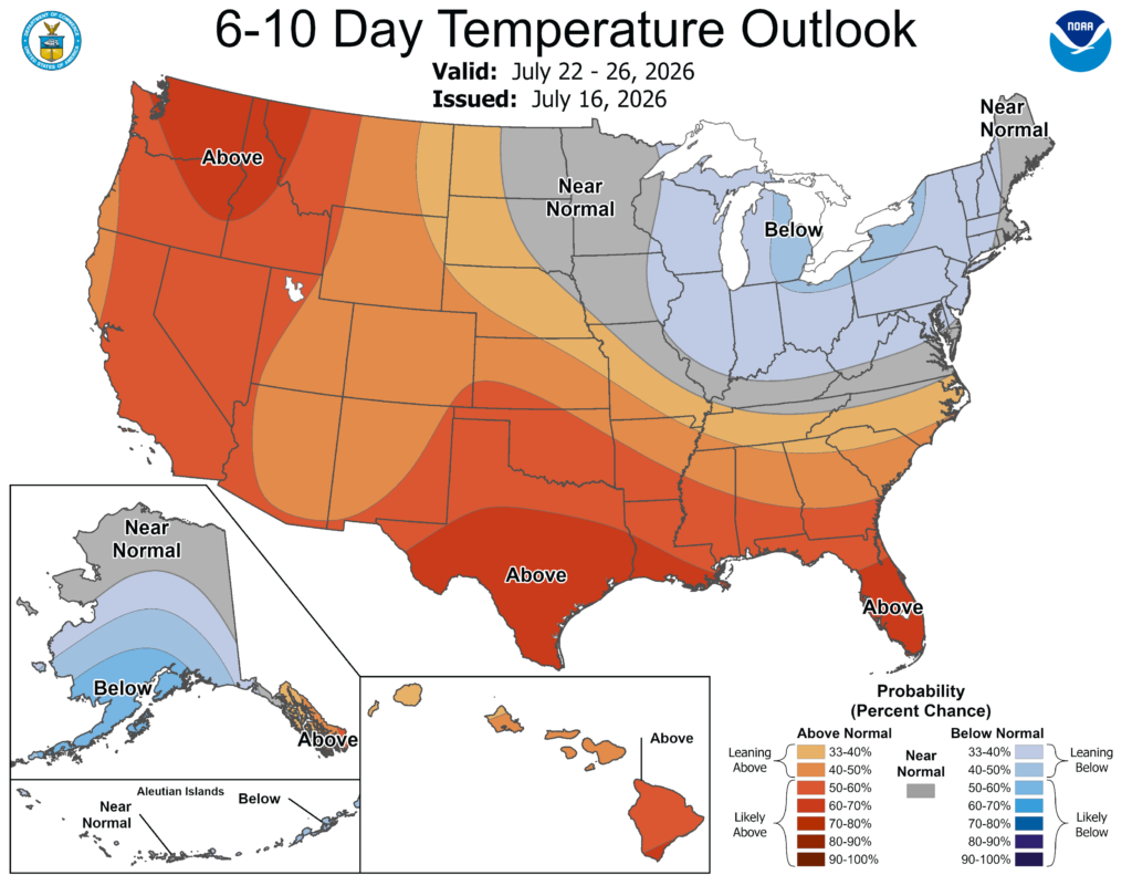
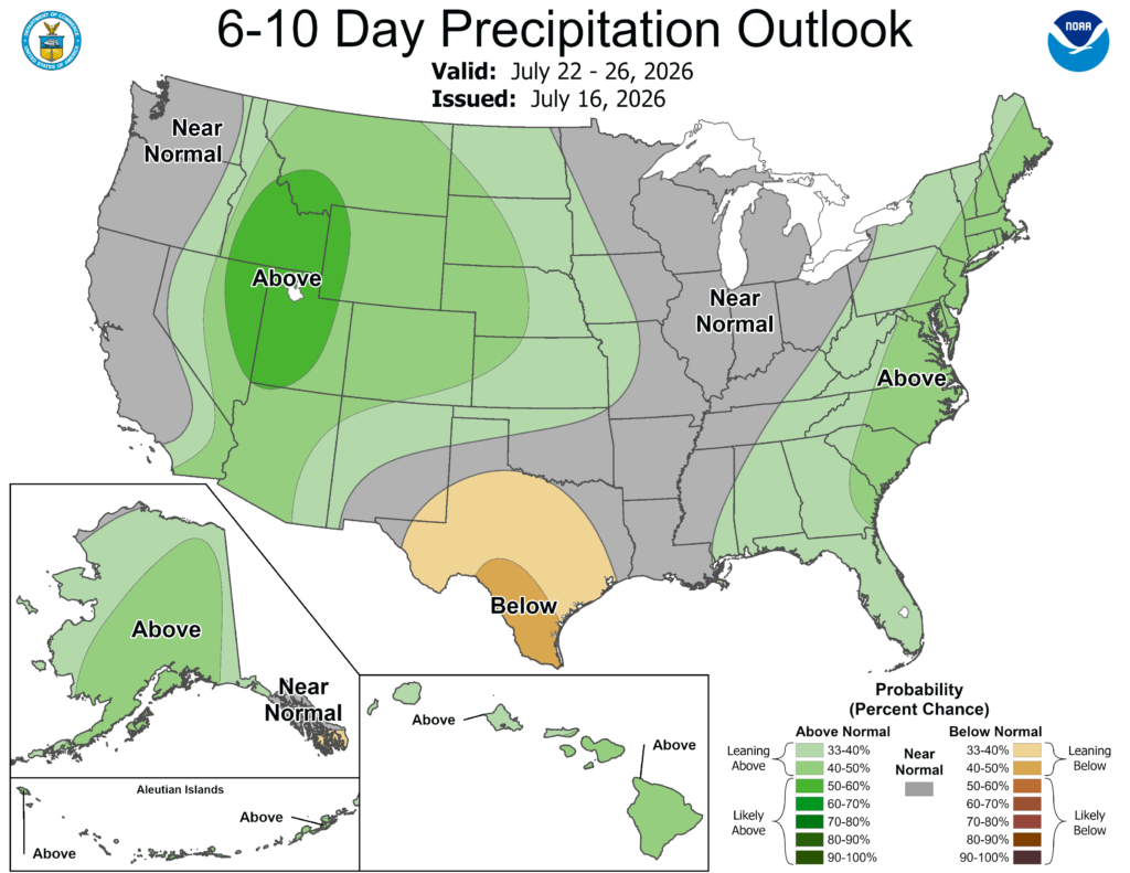
Temperatures will be above normal for the next 10 days, with precipitation chances being mainly near normal for Louisiana, Alabama and Mississippi being slightly above normal for this time period (based off the SPC outlooks).
Make sure to prepare for this heat and take care of yourself and others! Have a good rest of your Thursday!
Also, make sure to watch my video below for more weather talk!


