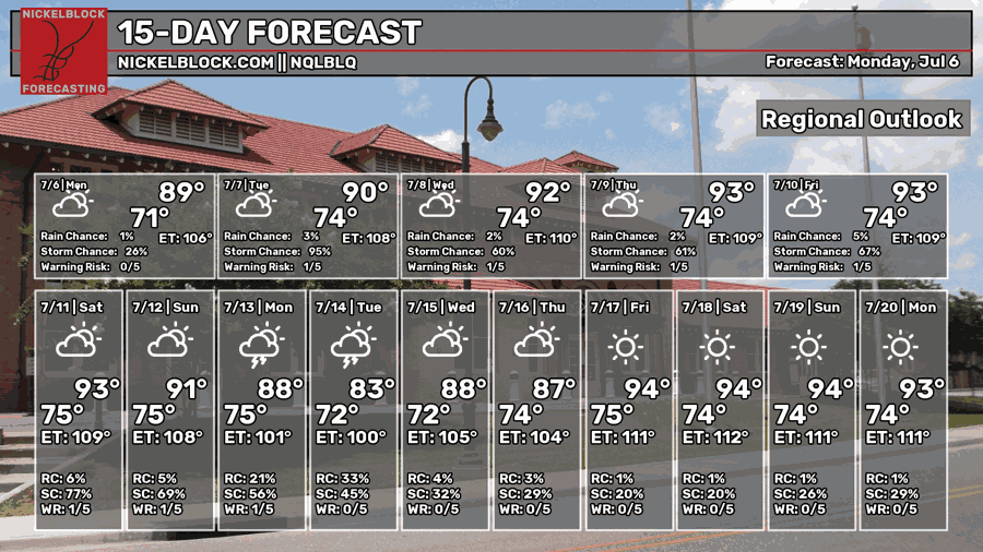
I hope you all had a great Independence Day Weekend! The heat was a bit overwhelming this year, but the thunderstorms yesterday afternoon definitely cooled us off for the better. The good (or bad, depending on who you are) news is that we’ll have a few more of those afternoons ahead! The bad news is it’s still hot and that’s not going away anytime soon. Experienced temperatures will still be in the low to mid 100s during the day, so still disgustingly hot.

Today’s Setup
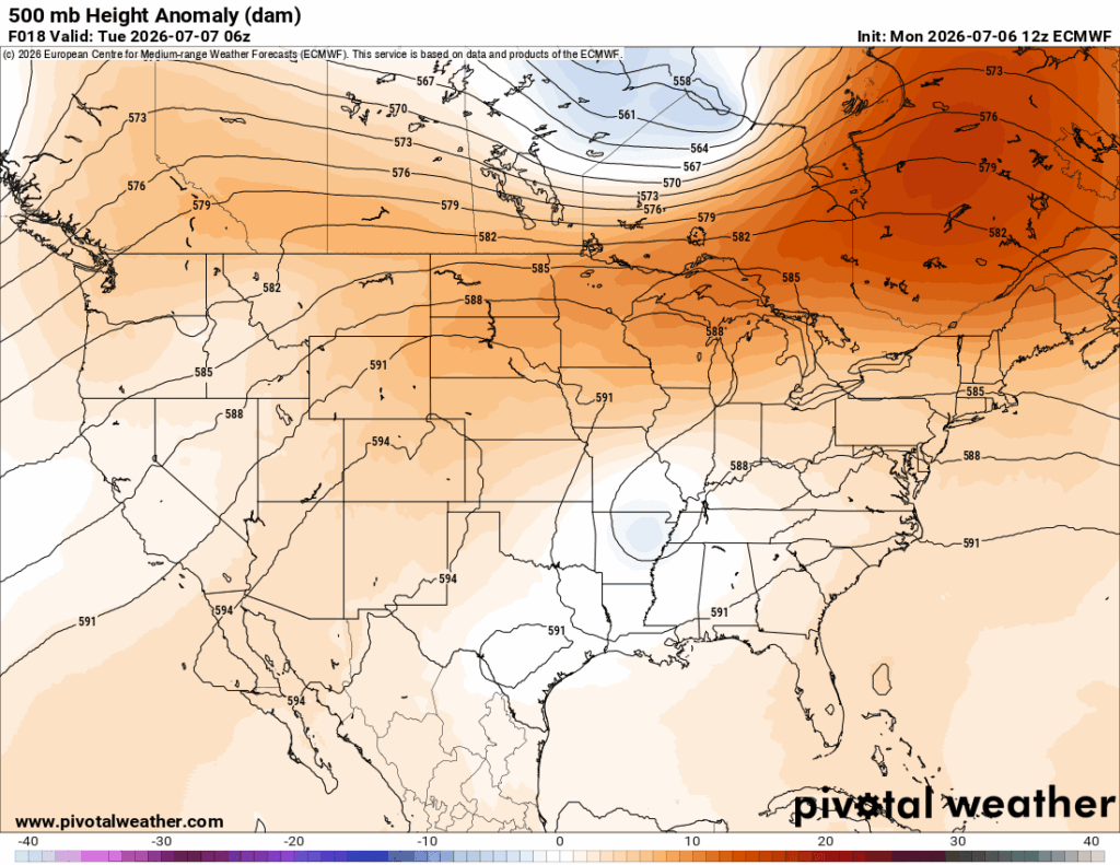
Looking at the 500mb map above, you’ll notice a shortwave trough over the ArkMizzou area. While this isn’t a strong trough by any means, it will provide some dynamic movement to a few developing MCS systems during the day and overnight tonight and Tuesday morning.
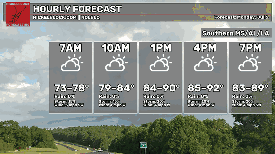
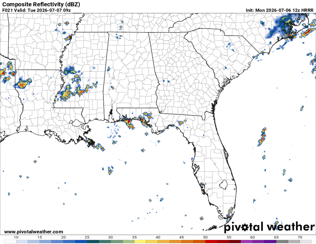
For today, it’s going to be another hot one with temperatures in the low to mid 90s. The heat index will reach the low 100s with partly cloudy skies. A few thunderstorms are possible into the afternoon. Most of these will develop moving towards the east southeast. Overnight, an MCS (below) will develop around the ArkLaMiss line and move southeast with severe weather possible in that region. Afterwards, the severity will wane as it moves through the southeastern portion of Mississippi. Expect some rain in the early morning hours before we wake up in the morning. Lows will be in the low to mid 70s.

Tomorrow
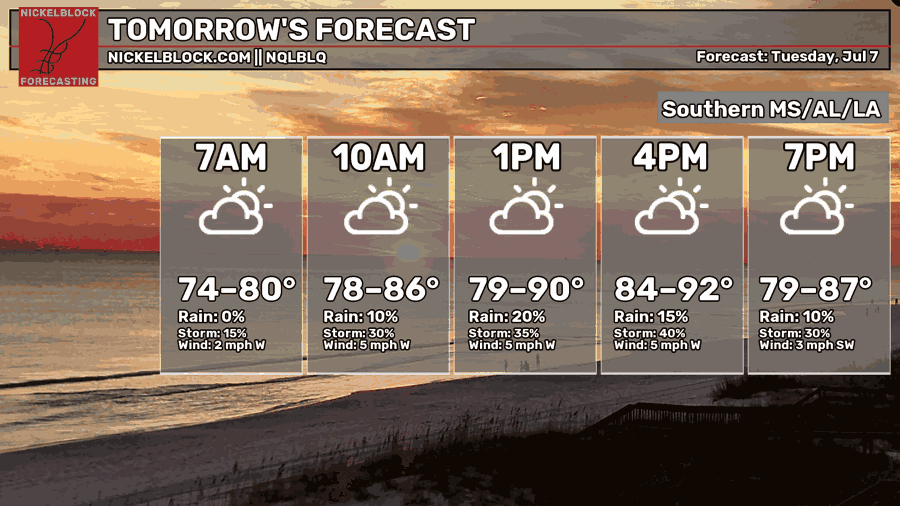
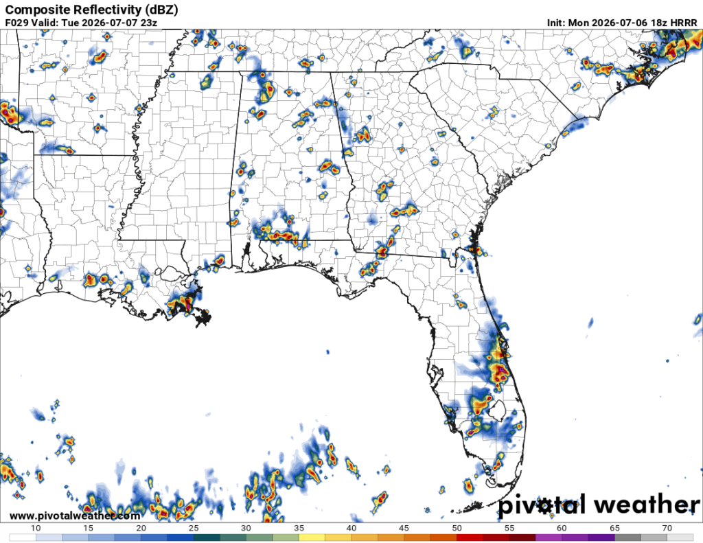
Speaking of that MCS I mentioned, it may come into contact with the sea breeze according to the model guidance. This could mean that sea breeze storms may be inhibited a bit. More storms may develop further inland, but coastal storms will be more dependent on the MCS moving further south. Either way, spotty thunderstorms are possible, but isolated in the afternoon. It’ll be another hot one with highs in the low 90s and partly cloudy skies. Heat indices will be in the low 100s again. Overnight, temperatures will reach the low to mid 70s.
Wednesday
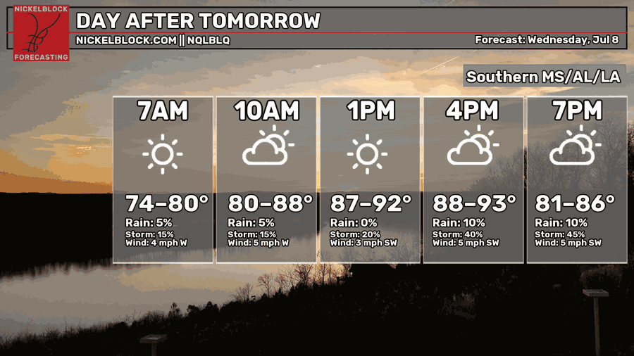
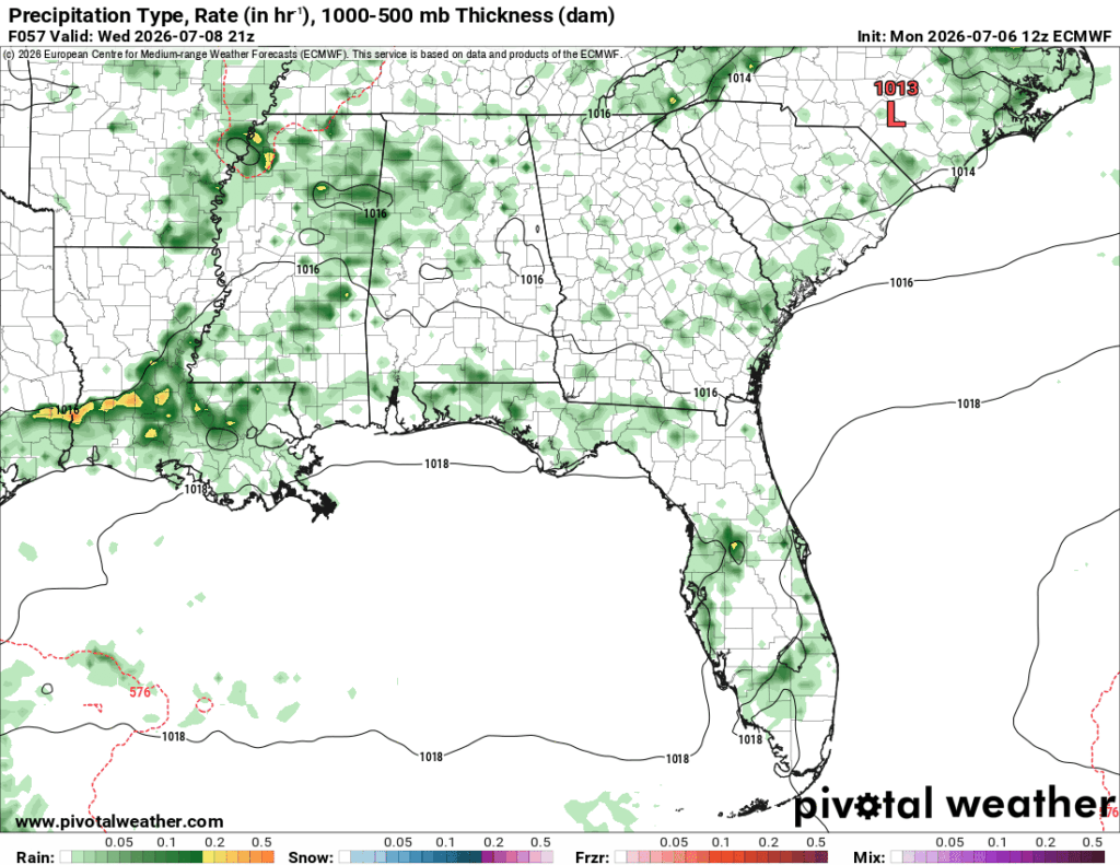
Temperatures begin to rise a bit more starting Wednesday as the high pressure system centers in the Gulf. Sea breeze thunderstorms are possible in the afternoon with more pop-up thunderstorms to our north. Temperatures will reach the mid 90s during the day with heat indices in the mid 100s. Hotter than today and tomorrow, but not overbearingly hot like what we experienced in the past few days. Overnight, we’ll reach the mid 70s.
Heading to the Weekend
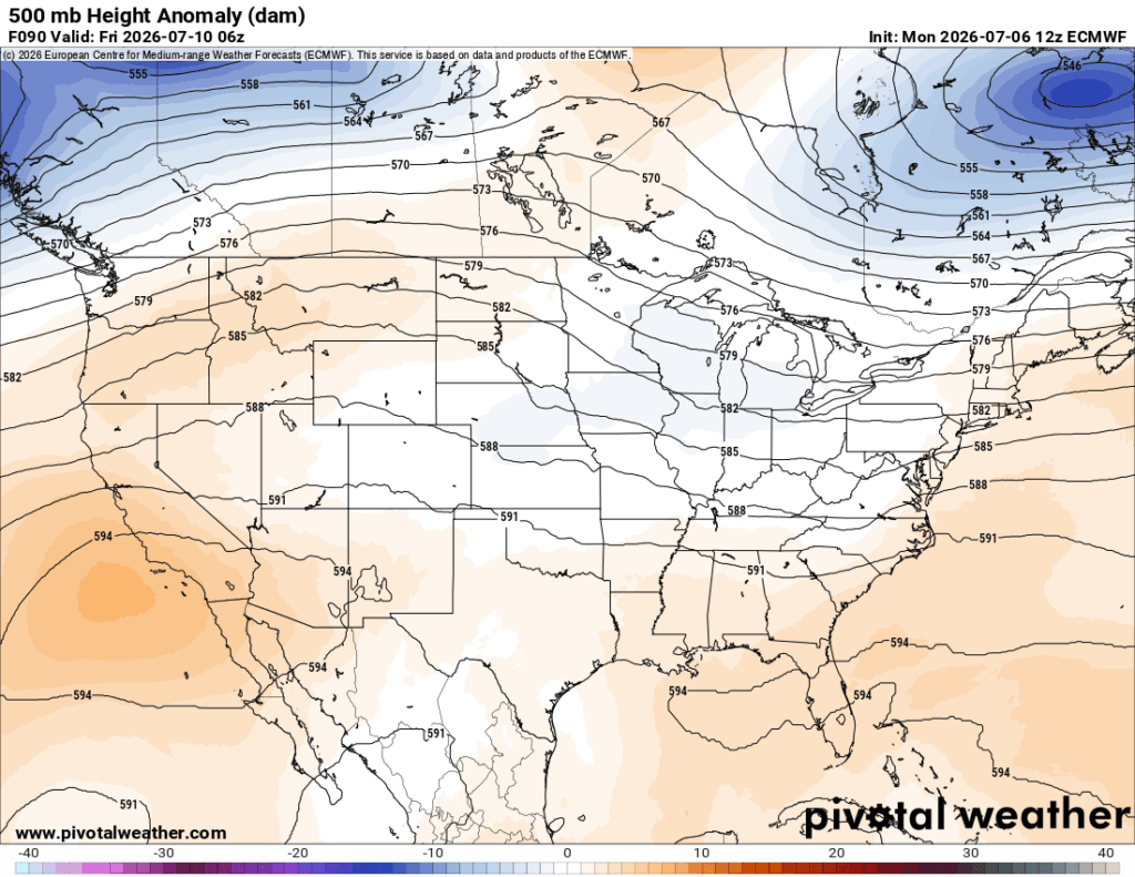
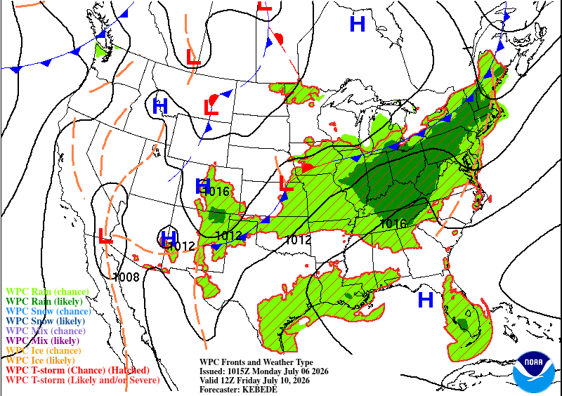
Looking at the two maps above, they align with each other pretty well. A ridge at the upper levels and a surface ridge mean that a pretty potent high pressure system will develop. What this means for us is more heat and less rain for a few days. Pop-up showers will develop, sure, but it’ll take a lot more energy to get these storms moving. I don’t doubt the sea breeze will get a few of these storms moving into the Pine Belt in the afternoon.
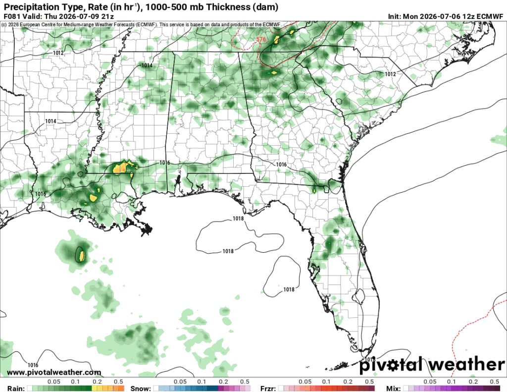
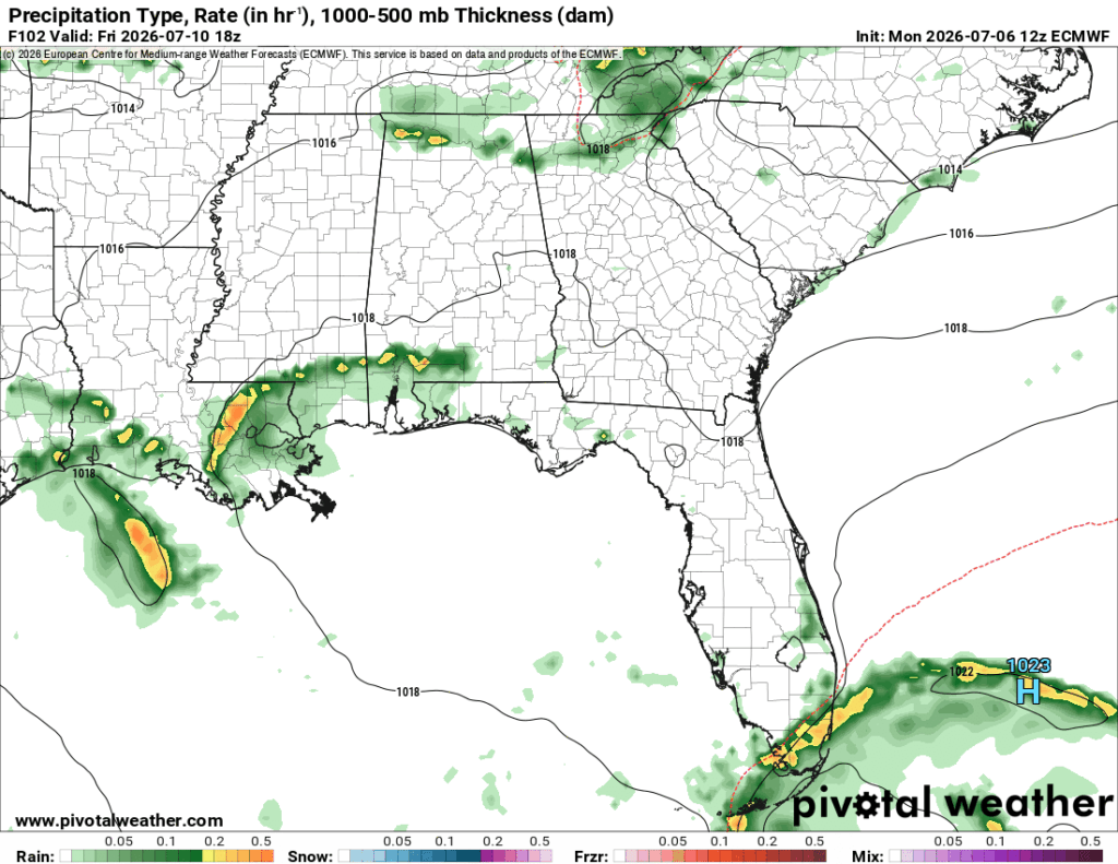
Otherwise, the heat index is going to climb a bit towards the mid 100s, so expect some sweltering days towards the weekend. Keep that in mind if you’re going to be outside, and bring plenty of water and electrolytes with you.

Extended Look
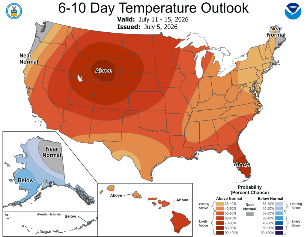
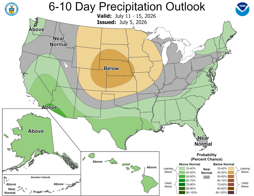
A large section of the Rockies and Plains will be under a large surface high bringing above average temperatures and below average precipitation. Towards our neck of the woods, we have an above average precipitation and above average temperatures. Nothing out of the ordinary, but there are a couple of reasons why.
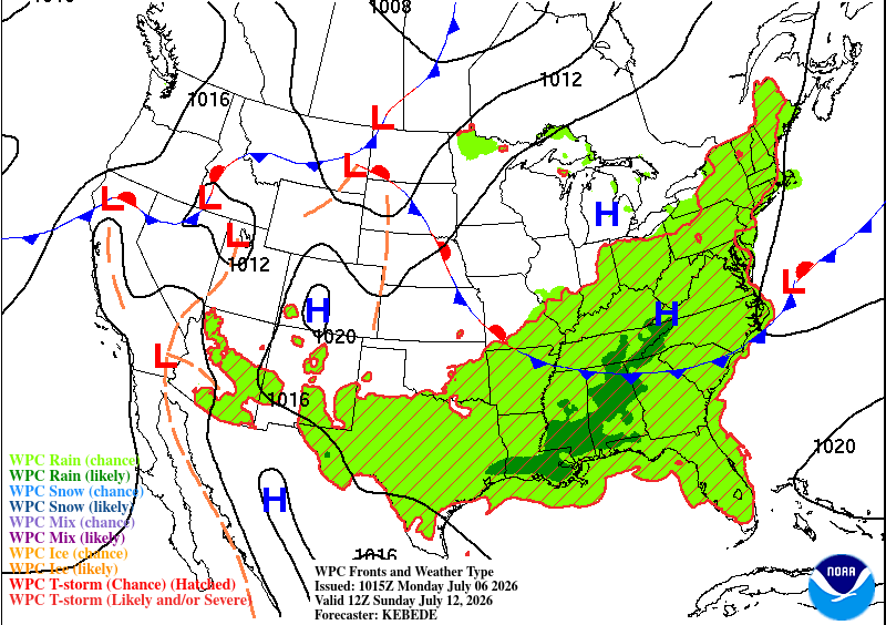
The big reason for an above average precipitation metric is because of the incoming stationary front from the northern plains/Midwest. This will increase some of the moisture flow and move a few more storms from the north to our area. On the flipside, the warmer temperatures are due to the subtropical high in the Gulf/Atlantic compressing the air more increasing the heat. So it’s a mixed chance of us receiving higher heat and a few more storms over the weekend into the early week next week.