Hurricane Dora and Invest 97E keep the Pacific busy while the Atlantic is still quiet even as we get into August. Hurricane Dora is remaining its category 2 status and moving westward while Invest 97E moves up along the Mexican coast. Let’s take a look at both storms tracks over the weekend.
[wpcode id=”41149″]
Hurricane Dora
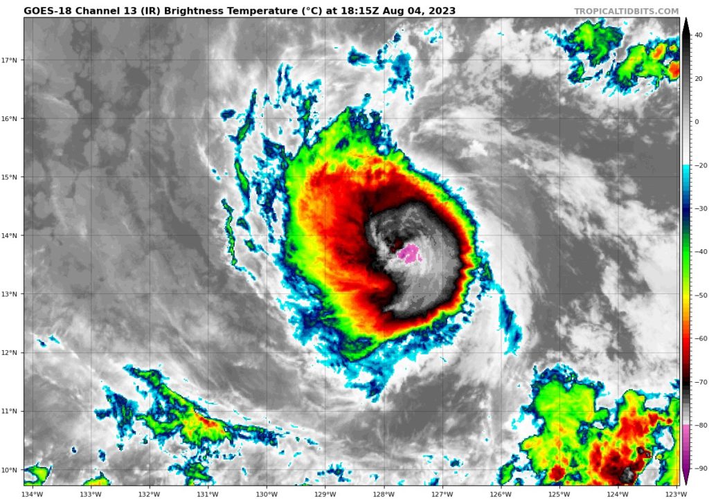
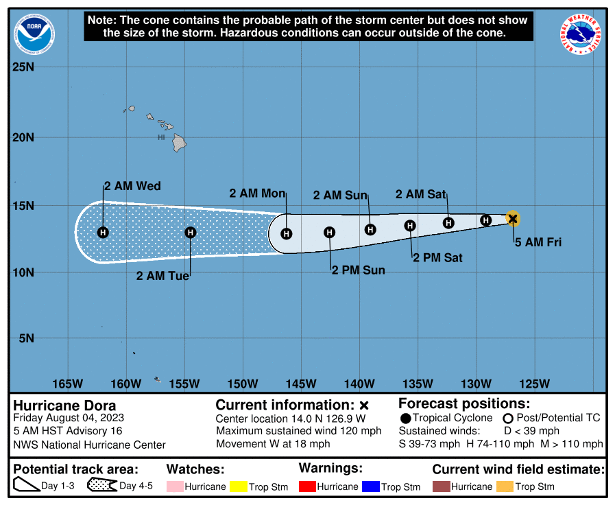
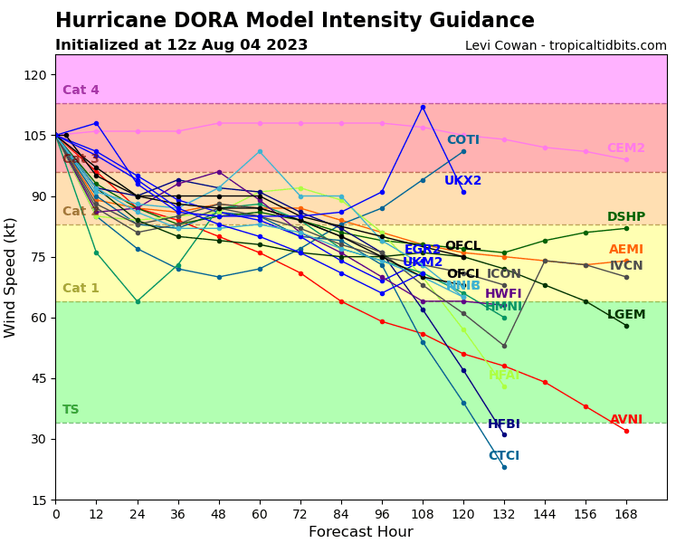
Hurricane Dora is spinning throughout the Eastern Pacific and making its way westward south of Hawaii around 18 mph. This category 2 storm is sustaining winds around 110 mph with a minimum central pressure of 964mb. Dora is set to not hit Hawaii and just stay a Hurricane well below any lands. Dora’s intensity is likely to weaken in the next 4 days to a category 1 storm.
[wpcode id=”41149″]
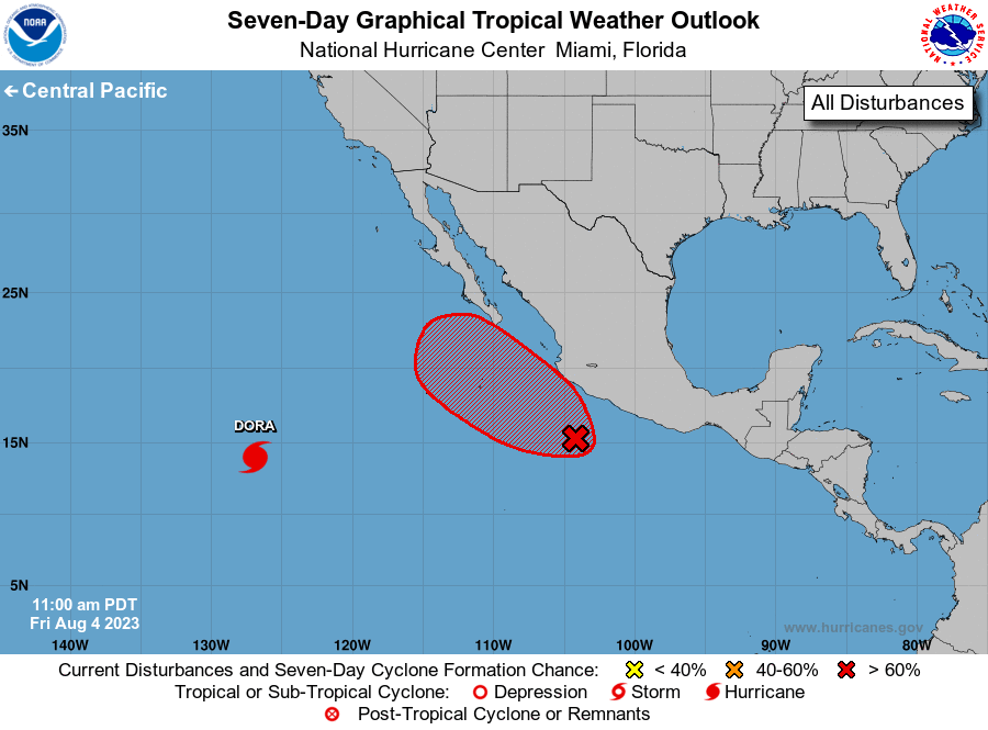
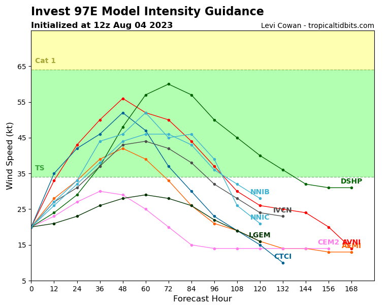
Invest 97E
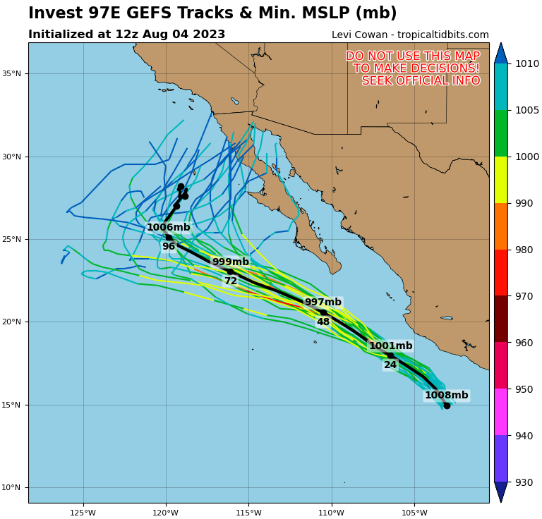
Invest 97E is developing in the eastern Pacific off the southwest coast of Mexico. The area of low pressure is brining showers and thunderstorms to the nearby coast. The environment of moist warm air will be favorable for this storm to develop. There is a 80% chance of development within the next 2 days and 90% in the next 7 days. This system will move along the coast of Mexico up towards the Baja California peninsula. This system is likely to only get up to Tropical Storm status over the weekend most likely lasting a few days. This storm could bring some strong waves and rain to the coast.
[wpcode id=”41149″]
Short Term Outlook
Looking at the next week we will see Hurricane Dora move across the Pacific south of Hawaii as it starts to weaken. Invest 97E will be the one to watch as it strengths along the Mexican coast. However the track of 97E seems to come more west and avoid much of the mainland with only some showers coming to the mainland. Early next week the system will start to dissipate as it moves out west away out towards the ocean. This area will remain moist and hot and potential storms could form late next week.
[wpcode id=”41149″]
Extended Outlook
Looking ahead past this week we will see the eastern Pacific remain pretty active with conditions staying favorable for much of August. Moist warm air will keep the Pacific bustling for the foreseeable future. On the other hand the Atlantic will stay quiet for the next two weeks but for mid August the Atlantic conditions may start to become more favorable for cyclonic action. The El Niño season has kept the area quiet but this may change soon. This will be something to watch as we head deeper into August.
[wpcode id=”41149″]
Conclusion
Hurricane Dora will continue its path through the Pacific avoiding Hawaii. It will start to weaken and dissipate this week and will be no threat. As for Invest 97E it will most likely stay away from mainland Mexico as it develops into a Tropical Storm this week. This system won’t last long and weaken as the week progresses. As for the Atlantic it is quiet for the time being. Be sure to stay updated on all the Tropical Updates!


