The ever apparent “heat-dome” dominating the South Central is looking to stick around for the time being as many of begin to think “Is this the new normal for summertime for in the South?” Meanwhile, thunderstorms and intense wind speeds are widespread across the Great Plains this weekend.
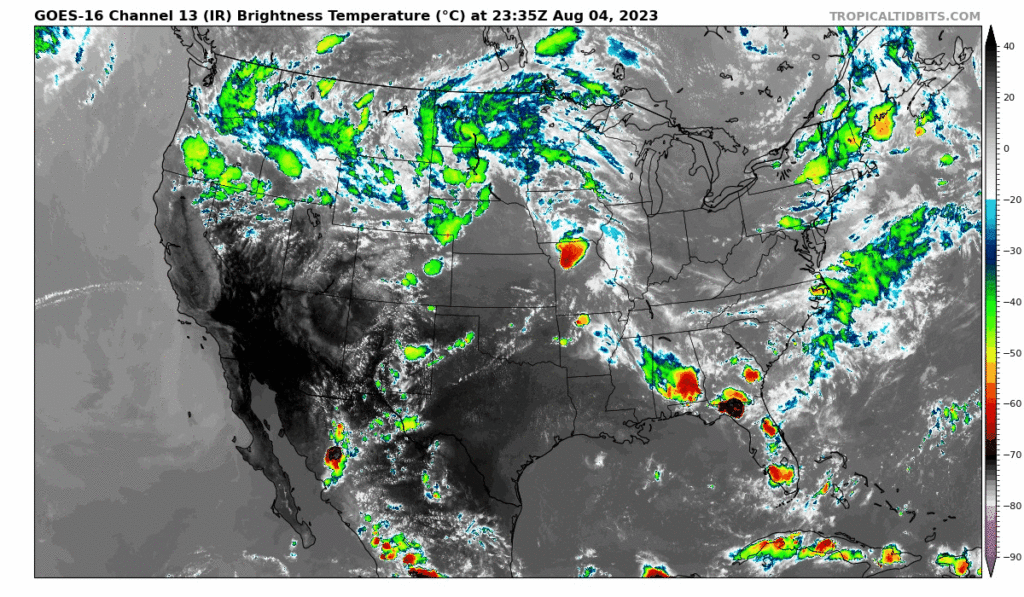
Heavy Rain Throughout the US
As that cold front that brought severe thunderstorms to New England along the Eastern Coast moves out, several more front are developing throughout the US from the Pacific Northwest down to Florida. The strongest risk for severe weather will be Northwestern Kansas into Nebraska and Central Missouri.

Clusters of storms are likely across the Central US in the Upper Midwest today. This will bring heavy rain and possible flash flooding as these systems pass through the area along these fronts. The Central Plains especially today are at risk with moderate convection likely. With mid and upper level winds through the central valley keeping strong, lapse rates can get steep as the day goes on leading to the atmosphere getting more unstable.

The rest of the Pacific Northwest will be under a spread of scattered thunderstorms from the local low pressure systems over Eastern Montana and Western Washington. The areas of strong localized vorticity will develop storms from the ample amounts of moisture being deposited into the region from the Pacific.
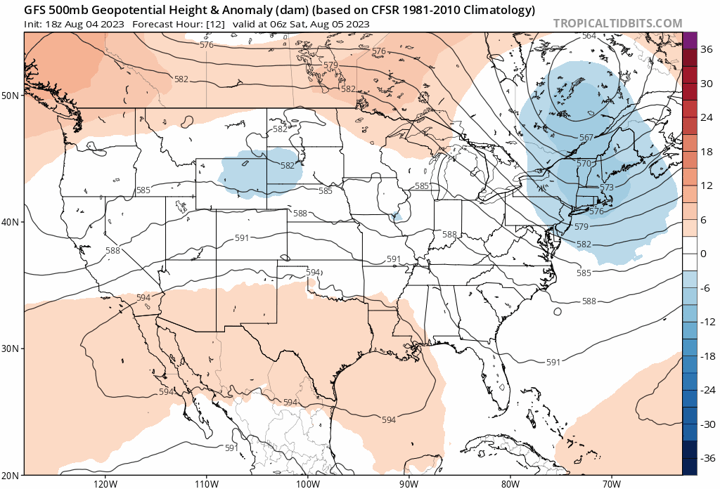
And Where Its Not Wet… Its Hot
That upper level high over the South Central will bring clear skies and hot temperatures across the South Central US as the eastern trough will amplify throughout the start of next week. This will bring some slight relief to the northern edges of the Southeast states while this intense heat remains in place for the Summer. Especially with clear skies stretching the Texas plains atop this high pressure, heat indices will cross 110 degrees in some parts across Texas and Louisiana with Arizona feeling even hotter around 115 degrees.
Extended Outlook
As this record breaking summer continues, the future looks bleak for any relief. The Pacific Northwest Excessive heat will continue to be in place throughout the South Central US extending from Arizona to Louisiana looking forward to the start of next week. The 500 mb ridge will slowly migrate back west
Conclusions
It is difficult to say when the South will get back to temperatures that feel less like 100 degrees and get back to a cooler… let’s say 80? For now, this has become the new normal for Summer in the South until the much needed Autumn coolness. Thunderstorms across the Great Plains this weekend will break out as enhanced flow through the Plains create the perfect atmosphere for storms.


