Increasing clouds today ahead of a front that will try to push through tomorrow, but then lift back northward. As it moves north, it will allow for some very warm and humid air to plow into the area.
And that will hang out through Thursday afternoon when the next front kicks through. That will spark off some showers and storms. And those storms will have the potential to turn severe.
This morning the CIPS Analogs data actually came back with higher grades. That is some good news as a forecaster because it means our data is more accurate. Our grades jump from 10-out-of-15 and 11-out-of-15 to a range between about 11.5-out-of-15 to about 12.5-out-of-15.

And looking at the outcomes, it shows that the threat for widespread severe weather is slightly lower and shunted slightly more inland.

What is causing this?
….THAAAHH BLOOOBBBBBBB

Okay, jokes aside, some of you long-time readers/viewers may recall over the years that blobs of storms along the coast or just offshore have saved the region from significant severe weather in the past because the storms, basically, suck up all the good ingredients for severe weather. That robs places just north of the blob from dealing with severe weather.
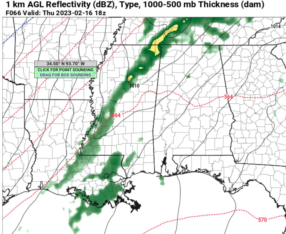
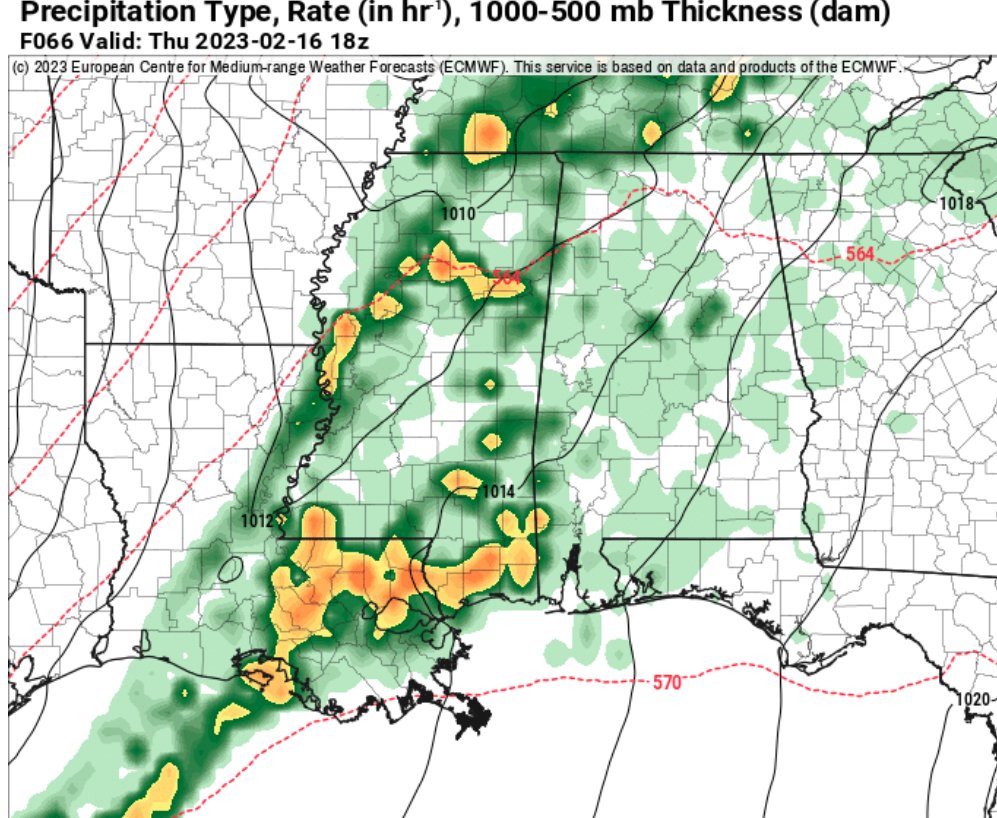
And the blob is shown on the NAM, Euro, and GFS in some form or another. Looking at the estimated radar images below, the NAM shows a smaller one down near New Orleans. The Euro shows a wider one that runs from Baton Rogue to Mobile, and the GFS has it all the way south of Morgan City and out into the Gulf. So, the placement, size, and depth are all different, so there is still a bit of uncertainty about how much this will or won’t impact the forecast.

But it doesn’t change much for places farther inland, like north of I-20.
For now, the forecast is mostly unchanged. While this new data is good to see I don’t know that it changes what my forecast is yet. If this new trend continues, then I’ll jump on board. But for the moment, I’m hesitant to jump on this train.

Once we get through Thursday night, things clear out just in time for the weekend!
REGIONAL DAY TO DAY FORECAST
Today
Partly sunny. Highs in the mid 70s. South winds 15 to 20 mph.
Tonight
Mostly cloudy with a chance of showers. A slight chance of thunderstorms after midnight. Not as cool with lows in the lower 60s. South winds 10 to 15 mph. Chance of rain 50 percent.
Wednesday
Mostly cloudy with a slight chance of thunderstorms. A chance of showers, mainly in the morning. Highs in the upper 70s. South winds 10 to 15 mph. Chance of rain 50 percent.
Wednesday Night
Cloudy with a 20 percent chance of showers. Lows in the mid 60s. South winds 10 to 15 mph with gusts up to 25 mph.
Thursday
A chance of thunderstorms. Showers. Some thunderstorms may be severe. Highs in the lower 70s. South winds 15 to 20 mph with gusts up to 30 mph. Chance of rain 90 percent.
Thursday Night
Cloudy. A chance of showers and thunderstorms in the evening, then a slight chance of showers after midnight. Some thunderstorms may be severe. Lows around 40. Chance of rain 50 percent
.Friday
Mostly sunny. Much cooler with highs in the lower 50s.
Friday Night
Mostly clear in the evening, then becoming partly cloudy. Cold with lows in the lower 30s.
Saturday
Mostly sunny. Highs in the upper 50s.
Saturday Night
Partly cloudy. Lows in the upper 30s.
Sunday
Mostly sunny. Not as cool with highs in the upper 60s.
Sunday Night
Mostly cloudy. Not as cool with lows in the upper 40s.
Washington’s Birthday
Partly sunny. Highs in the mid 70s.


