Hello everybody, it starting to heat up today as the high-pressure ridge slowly moving to the east. In the morning, it will get cloudy, and a stray thunderstorm or shower will be going through Mississippi. Then in the afternoon, it will be partly cloudy to sunny and hot weather throughout the day. The temperature low for today will be in the low 70s and the high will be in the low 90s to mid 90s. Meanwhile, the dew points will be in low to mid 70s throughout the day.
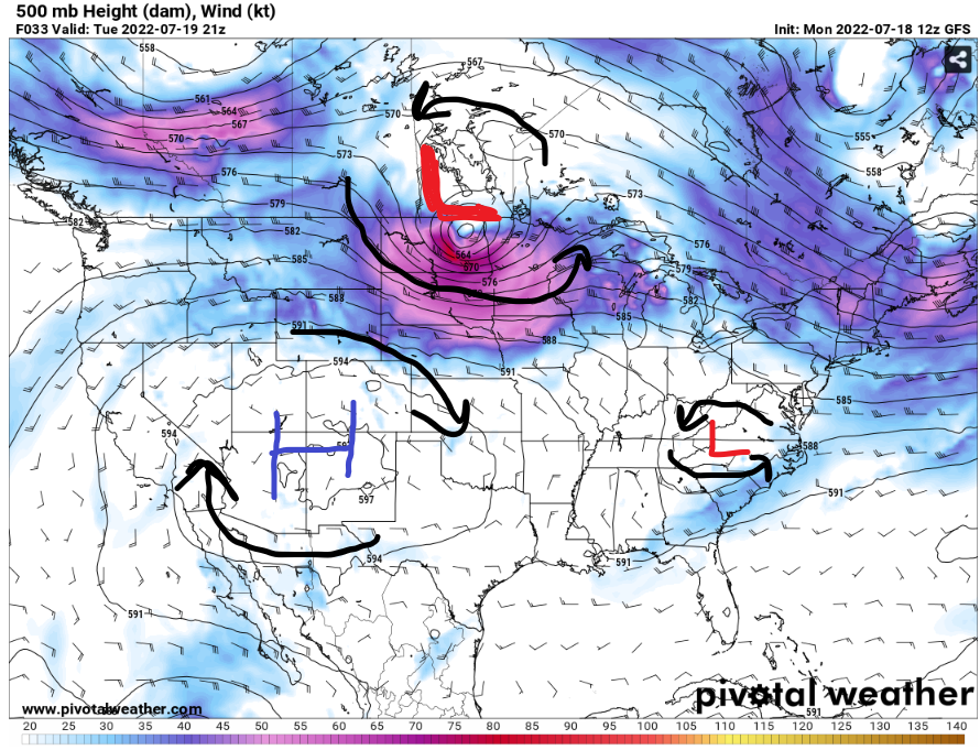
There will be a low pressures system in the Southeast to bring some rain relief for the hot weather in some of the states. It will move towards the east coast to allow the high pressure to move back in the area. Meanwhile, the strong low-pressure system in North Dakota might be strong enough to move the high pressure to the east in the next few days. This will cause some hotter weather in Mississippi.
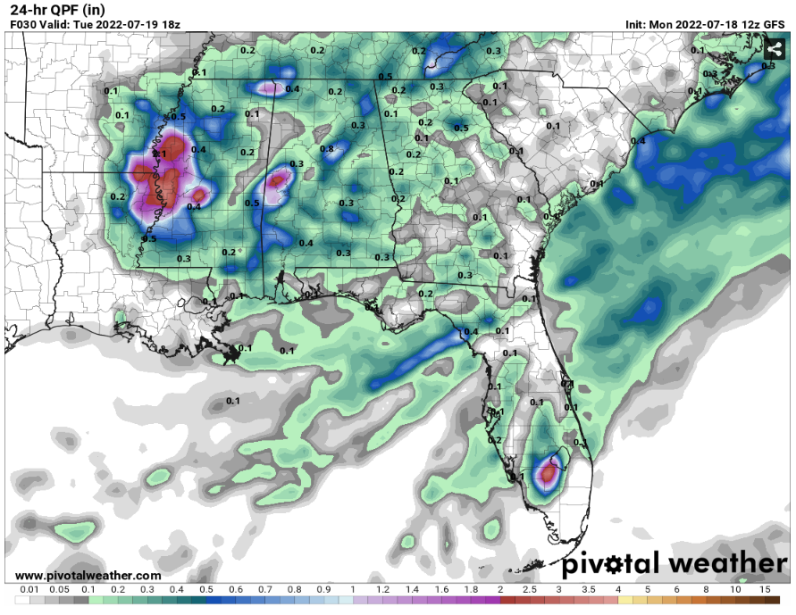
With the storms happening in the morning, there will be good amount of rainfall in the western part of Mississippi. The estimate rainfall from this 24 QPF will be up to 4 inches of rain in the western Mississippi. The southwest Mississippi will receive up to .3 to 1 inches of rain.
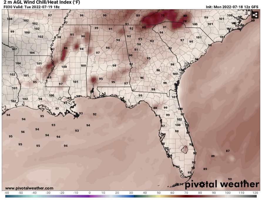
GFS Wind chill/ Heat Index // Courtesy: Pivotal Weather 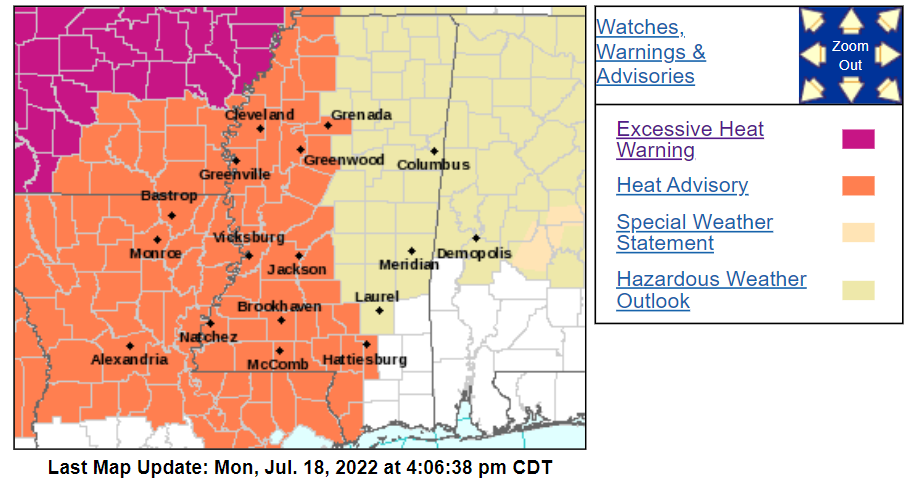
Watches, Warnings, & Advisories // NWS Jackson Forecast Office
Even though with rain in the morning, it is still not enough to prevent the dangers of the hot summer weather in the afternoon. The heat index values will go up to upper 90s to low 100s degrees. With the high dew points and temperature, southwest Mississippi will be under a heat advisory for today. Be safe, during the hot weather and stay hydrated.
Day to Day Forecast
Tuesday
Cloudy with a stray thunderstorms and shower in the morning. Partly cloudy to sunny in the afternoon, with the temperature high in the low to mid 90s. The heat index values will be up to low 100s. There will be a 10% chance for a stray shower or thunderstorm.
Wednesday
Partly cloudy to sunny throughout the day with a stray shower or thunderstorm possible. The temperatures high will be in the mid to upper 90s. The heat index values will be up to low 100s. There will be a 10% chance for a stray shower or thunderstorm.
Thursday
Partly cloudy throughout the day with a stray shower or thunderstorm possible. The temperature high will be in the mid 90s. The heat index values will be up to low 100s. There will be a 20% chance for a stray shower or thunderstorm.
Friday
Partly cloudy throughout the day with scattered showers or thunderstorms possible in the afternoon. The temperature high will be in upper 80s to low 90s. The heat index values will be up to low 100s. There will be a 40% chance for scattered showers or thunderstorms.
Saturday
Partly cloudy to sunny throughout the day with a stray shower or thunderstorms possible. The temperature high will be in mid 90s. The heat index values will be up to low 100s. There will be a 10% chance for a stray shower or thunderstorm.
Sunday
Mostly sunny with few clouds throughout the day with a stray shower or thunderstorms possible. The temperature high will be in mid to upper 90s. The heat index values will be up to low 100s. There will be a 10% chance for a stray shower or thunderstorm.
Monday
Mostly sunny in the morning with scattered showers or thunderstorms possible in the afternoon. The temperature high will be in mid to upper 90s. The heat index values will be up to low 100s. There will be a 30% chance for scattered showers or thunderstorms.


