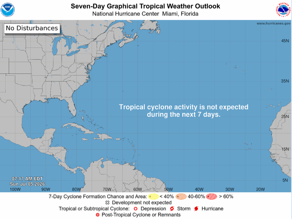
I hope everyone had a safe and happy Fourth of July! Another thing to be excited about: no tropical cyclone activity is expected for the next 7 days!
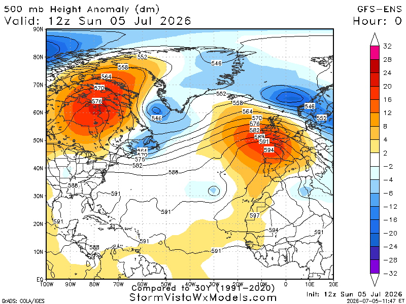
The below 500 mb height anomaly demonstrates the atmospheric pressure patterns in the middle of the atmosphere (around 18,000 feet). The red/orange represents above-average heights, meaning ridging or high pressure, while the blue shows below-normal heights associated with troughing or lower pressure.
Looking at today’s chart, an area of above-average heights is present across parts of the Atlantic, signaling a mostly stable upper atmosphere. While the ridge isn’t exceptionally strong across the entire Atlantic, it does create a favorable environment for tropical waves moving west from Africa. Overall, the large-scale pattern is fairly neutral, suggesting tropical development should remain limited for the time being, with any potential systems depending more on local factors such as warm sea surface temperatures, high moisture, and low wind shear.
While there are no immediate threats to the United States, it’s the time of year when we begin watching tropical waves coming from Africa more closely. Any disturbances that develop over the next few weeks will be closely monitored as they move westward across the Atlantic.
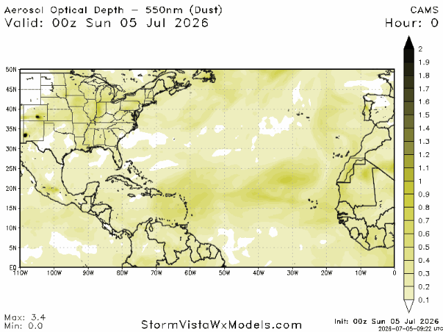
Another factor helping keep the tropics relatively quiet is the presence of Saharan dust. Large plumes of dry, dusty air move westward off Africa and across the Atlantic. This dust suppresses thunderstorm development by drying out the atmosphere, making it harder for storms to organize, and it can also contribute to increased wind shear. While it won’t completely prevent tropical development, Saharan dust often acts as a natural inhibitor of storm formation, especially during the early part of hurricane season.