The first Day 1 SPC outlook is available for the Wednesday night / Thursday morning severe weahter threat. And the SPC bumped up the risk a level.
Model data show that there may be a brief window of opportunity for a few low-end severe storms to push across the Gulf Coast Wednesday evening and into the overnight hours and into Thursday morning. Storms look to produce heavy rain, gusty wind, some brief localized flooding, and the potential to produce brief and weak tornadoes. There is also the outside shot for a bit of small hail in these storms.
That said, the data is generally showing a pretty meager setup based on historical data.
— Nick Lilja (@NickLilja) December 23, 2020
The Karrie Meter is barely registering with this one. We will have to see how things shake out. pic.twitter.com/ehnAfvnksr
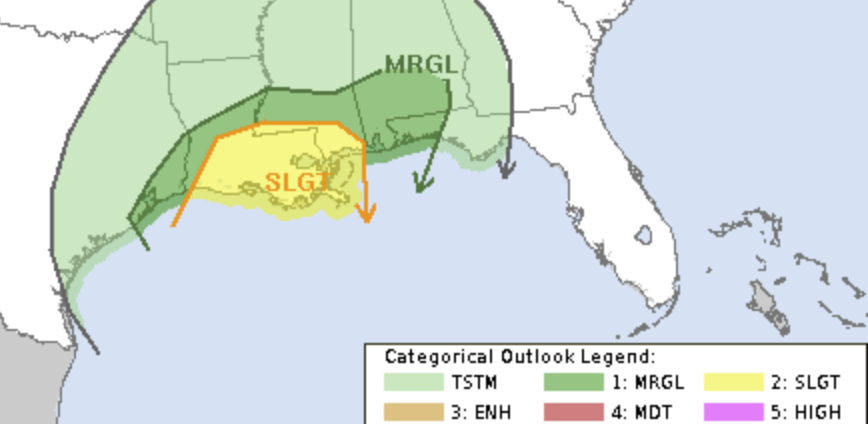
From the Storm Prediction Center
The Storm Prediction Center increased the severe weather risk across the Gulf Coast to a Slight Risk. That is a “2” on the 1-to-5 scale where “5” is the highest risk. The SPC notes that the strongest lift is forecast to occur after 00Z in Louisiana, Mississippi and Alabama. This is going to be where strengthening low-level convergence will coincide with increasing divergence aloft.
Scattered, non-severe storms are possible during the afternoon from southeast TX into LA preceding the cold front where heating and moisture advection will result in an uncapped air mass. Storms are expected to intensify after 00Z, near the TX/LA border, becoming numerous along the front overnight. The most favorable combination of surface-based effective parcels as well as low-level SRH should develop across southern LA during the late evening, then across far southern MS, AL and into the western FL Panhandle by 12Z Thursday.
The main threat is expected to be damaging gusts with the linear structures along the front, but any isolated or embedded cells may produce a tornado as effective SRH increases to around 300 m2/s2, while maintaining modest mid-level lapse rates which will boost updraft intensity.
spc.noaa.gov
Karrie Meter
The Karrie Meter has never shown much for this event. Truly, finding numbers above “3” has been difficult.
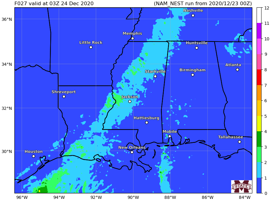
You can see that as the line starts to develop, the numbers ahead of the line aren’t very robust and even along the line (lighter blue) numbers are still between “1” and “2” from the coast of Louisiana, back north through Tennessee.
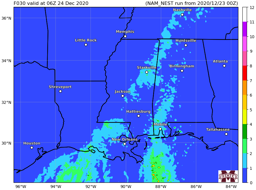
By midnight, numbers are still on the low end of the scale.
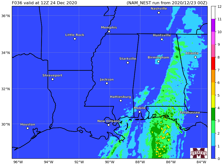
In fact, by this point, the atmosphere starts to become a bit more conducive across parts of southern Alabama. By 6am, the threat has migrated all the way toward the Florida panhandle and southeastern Alabama.
The Bottom Line
Between 6pm (Louisiana), midnight (Mississippi) and 6am (Alabama and Florida) a line of storms will move across the area. The line will have some heavy rain, gusty wind (up to 60mph), and maybe some small hail. It may also spin up a few brief and weak tornadoes. Particularly in Louisiana, southern Mississippi,southern Alabama, and the Florida panhandle.
But this is not a “major” severe weather outbreak, by any means. This is your typical, run-of-the-mill cold front moving through the Gulf Coast in December situation. That means not everyone will see a severe storm. And even fewer people will have a chance to see a tornado.
The line of storms is going to pack some pretty gusty wind, though. Even if it isn’t “severe” it will still be strong enough to knock down tree branches, blow down fences, and toss any loose items in the yard (Christmas decorations) down the road.
Rainfall totals look to top out around two inches. Most spots will see about an inch.
Then behind the rain, much colder air plows into the area. With wind gusts – with no rain around – up to 30mph.


