Good morning, folks! Things are relatively quiet now across the country, but that may come to a change by next week as the synoptic-scale patter gets a bit more exiting.
General Synoptic Picture

Analyzing the 300mb map above, there isn’t much exciting to note. The flow is mostly zonal across the continent, with the one exception being the upper-level trough working its way off the Maine coast early this afternoon. Generally speaking, when the pattern is wavier, there is more exiting weather to talk about, but in the summer, wavier across the country aren’t as common as the Polar Front moves northward into Canada.
Apart from the relatively zonal flow, we can also gain some insight from where they may be some disturbed weather based on the purple contours, which plot divergence. As it sounds, divergence is basically when air is moving apart – it’s important because upper-level divergence is a good indicator of vertical motion. And, if we look at current water vapor imagery, we can see that this is true!
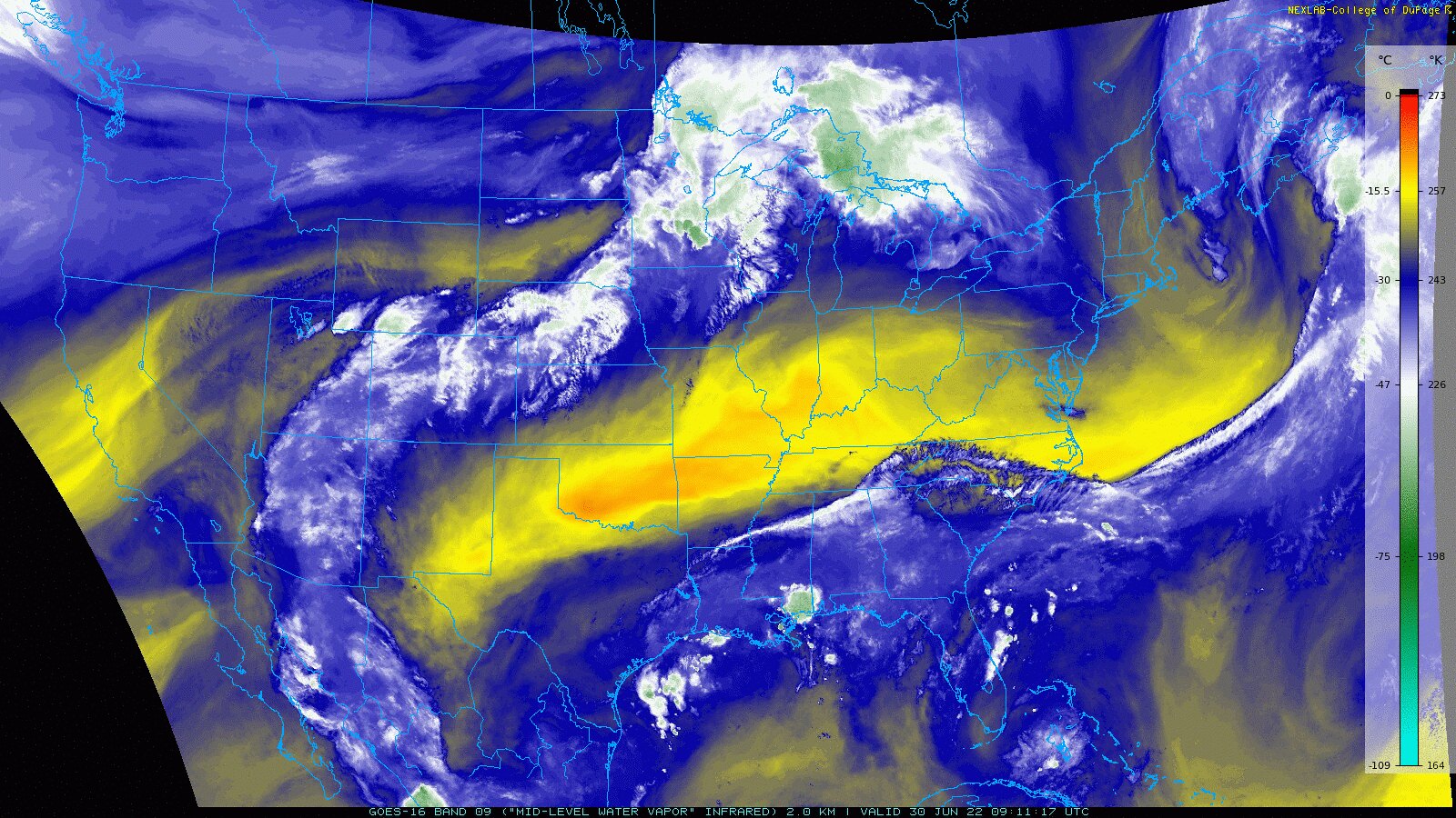
The region where there is more water vapor in the atmosphere, as shown by the blue and green colors, is where the areas of greatest divergence are in the 300mb map. You can even see the swirl associated with the aforementioned upper-level ridge exiting Maine.
Upper-level Trough in the Pacific Northwest
While the pattern stays relatively quiet through the end of the week, come Sunday an upper-level low arrives in the Pacific Northwest.

Both the American and European ensemble outputs are in good agreement with the timing and the position of the upper-level low as it arrives Sunday afternoon, with the GFS ensembles showing a slightly more amplified trough.
So what does this mean? Upper-level troughs are associated with lower geopotential heights, which means that the air in that column is cooler – so when the upper-level low gets comfortable over the Pacific Northwest early next week, expect some below average temperatures and potentially unsettled weather.


Once again, both the American and European ensemble members are in agreement that the western third of the continental United States will experience some below average temperatures as the upper-level low moves over the Pacific Northwest.

As far as chances for precipitation, a large region of 500mb positive cyclonic vorticity will enter the Pacific Northwest with the arrival of the upper-level low, supporting the vertical motion that will lead to widespread cloudiness and rain.

The upper-level low wont move much, however, in fact it will likely retrograde back off the Pacific Northwest Coast slowly but surely.
Continued Ridging for the Central US and a Small Cooldown for the Northeast
One thing that you may have noticed, particularly in the last graphic, is that the greatest 500mb height anomalies are the positive ones in the center of the country. If we’ve learned anything over the past two weeks, it’s that this pattern likes to bring the heat. In fact, if we look at the temperature 5-day temperature anomalies, we notice a pretty sizeable region of above average temperatures across the Central US.

The only exceptions to this warm-up are in the West, which is thanks to the upper-level low that we discussed earlier, and in the Northeast. This anomaly can be explained by taking a look at the upper-levels again.
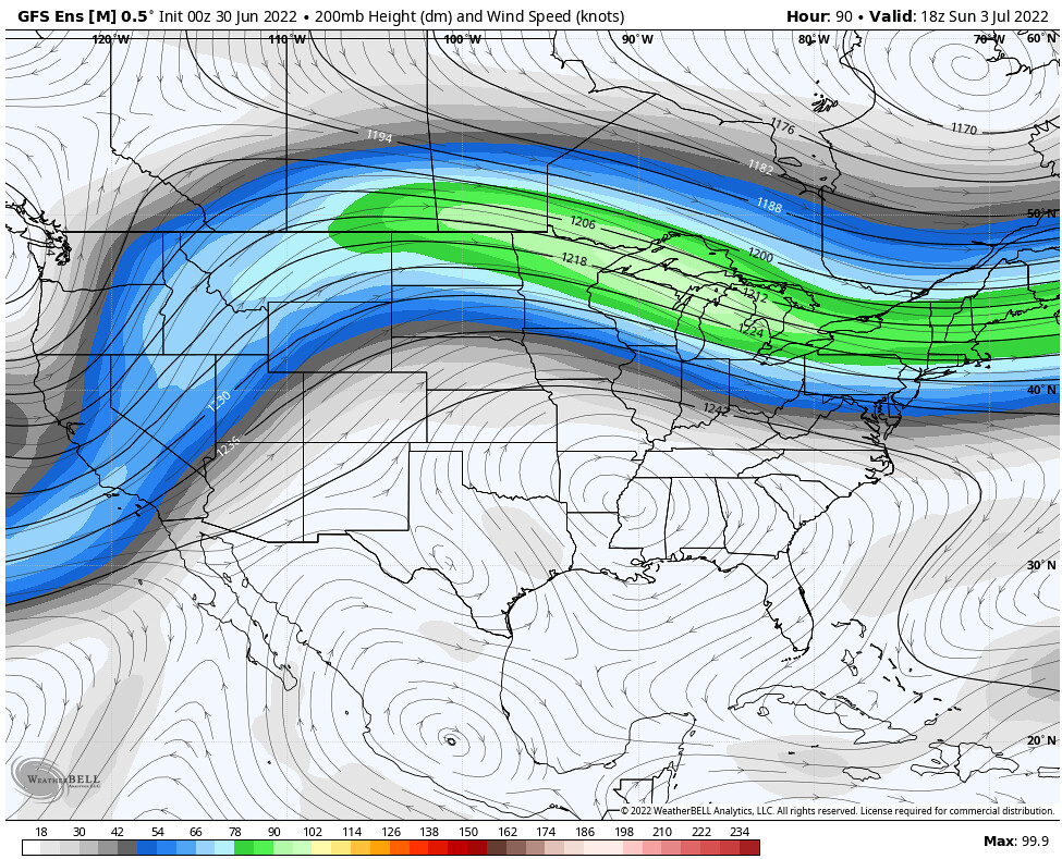
Another general rule of forecasting is that to the north of the jet stream is the cooler polar air, and to the south is the warmer, tropical air. This north-south temperature gradient is actually the cause of the jet stream in the first place. So, identifying the jet stream as the blue- and green- colored swath in the image above, we can see that the Northeast will move into a region of troughiness on Sunday, with the jet stream slightly sagging southward, bringing in some cooler air.
Summary
While there aren’t many significant changes coming to the country anytime soon, even in this zonal pattern there are still features to keep forecasters on their toes. Generally, we can expect some below average temperatures in the coming days for the Pacific Northwest and the Northeast, with a large region of above-average temperatures for the Central US.

As far as our chances for precipitation across the country, some enhanced precipitation is likely across portions of the Northwest as a result of the upper-level low, as well as some slightly above average precipitation chances for the Great Lakes and the eastern third of the US due to the proximity to some shortwave disturbances riding around the jet stream, and some excess tropical moisture. For much of the western half of the country, precipitation is likely to be below average as a result of limited moisture and the sinking air under the influence of the building high-pressure


