When looking at this image, there are three notable systems to take into consideration. The most notable one, Potential Tropical Cyclone Two, is just to the north of Venezuela. This system is expected to become a tropical storm very soon. Behind that, to the north of French Guiana, is a tropical wave that is currently disorganized. The third system, Invest 95L, is located off the coast of southeast Texas.
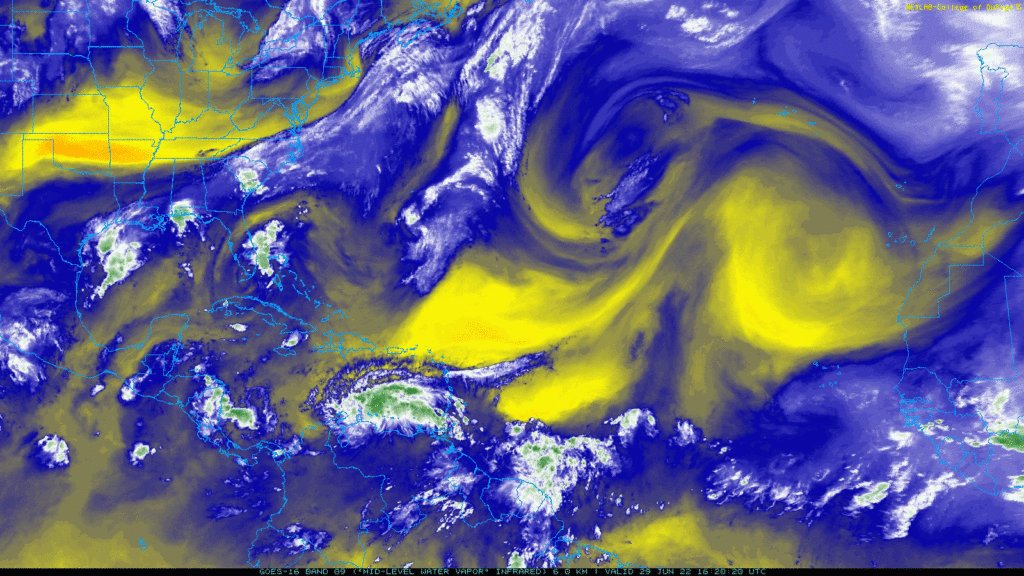
Off the coast of Western Sahara, there is a notable ridge in place, and to the west of that ridge is an area of lower isoheights (a trough). There is also a smaller ridge of high pressure located to the east of a cluster of storms off of Florida’s Atlantic coast.
Potential Tropical Cyclone Two, being south of the smaller ridge, should be blocked off to the north at the moment because of that, as tropical cyclones tend to steer away from high pressure systems. Additionally, weaker tropical cyclones tend to have stronger flow from east to west than from north to south, so this system should track toward the west towards Central America over the next few days.
The system north of French Guiana, meanwhile, may be steered a bit to the north as it tries to find the “gap” between the two ridges. At the same time, since it is weak, it will also retain a fair amount of east to west flow. This will likely result in a track toward the northwest over the next few days.
The system off the coast of Texas, according to the National Hurricane Center, is expected to impact Texas’s coast today. The weak ridge off Florida’s coast should be enough to steer it toward the northwest. The NHC gives it a 40-percent chance of becoming a tropical depression, but it should not become anything more than that. Still, it has the potential to dump heavy rain.
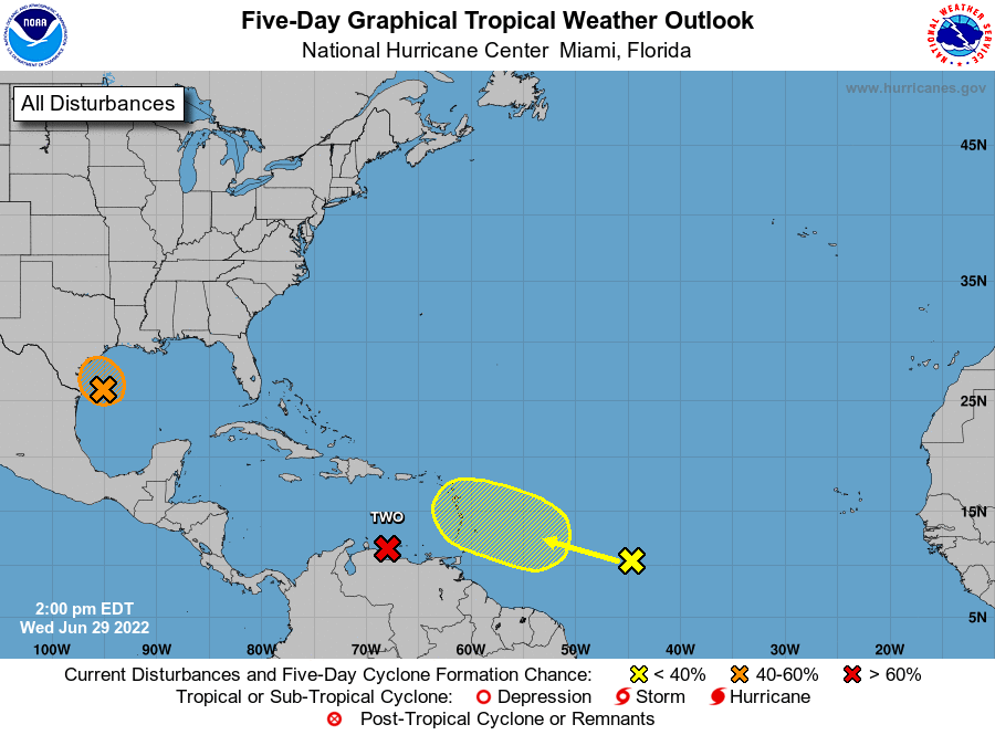
As you can see, the system off the coast of French Guiana is expected to move toward the northwest, and the Texas system is expected to track northwest towards Texas and reach the coast later today.
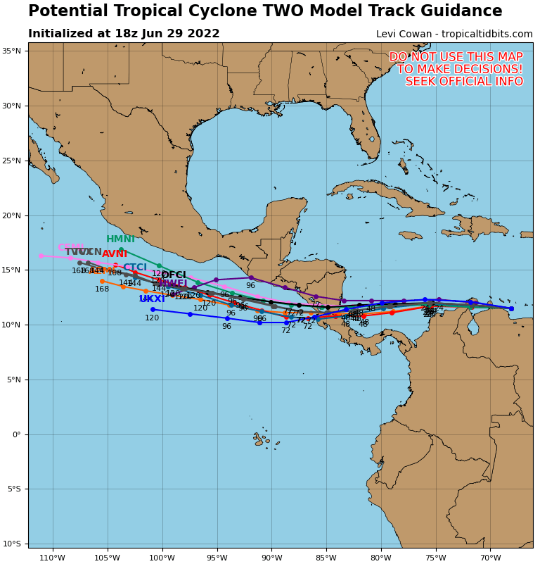
Tropical tidbits has provided a “spaghetti” model, or model overlaying the projected tracks of Potential Tropical Cyclone Two, based on different models. The general idea is that it will track east and hit Nicaragua or Costa Rica. With this in mind, how strong will the storm get?
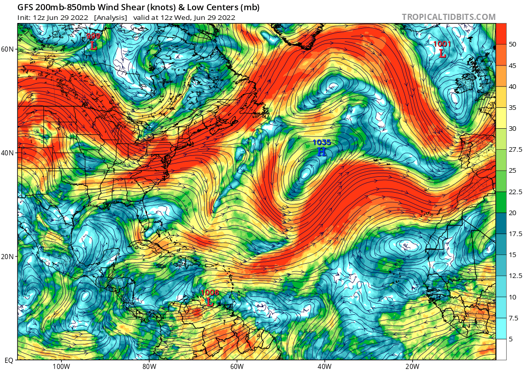
For Potential Tropical Cyclone Two, there appears to be limited wind shear over its forecast trajectory, which gives it a possibility to strengthen. Low wind shear allows tropical systems to strengthen. The Texas system also has a low wind shear environment, but since it is about to reach land, it will not have time to strengthen very much.
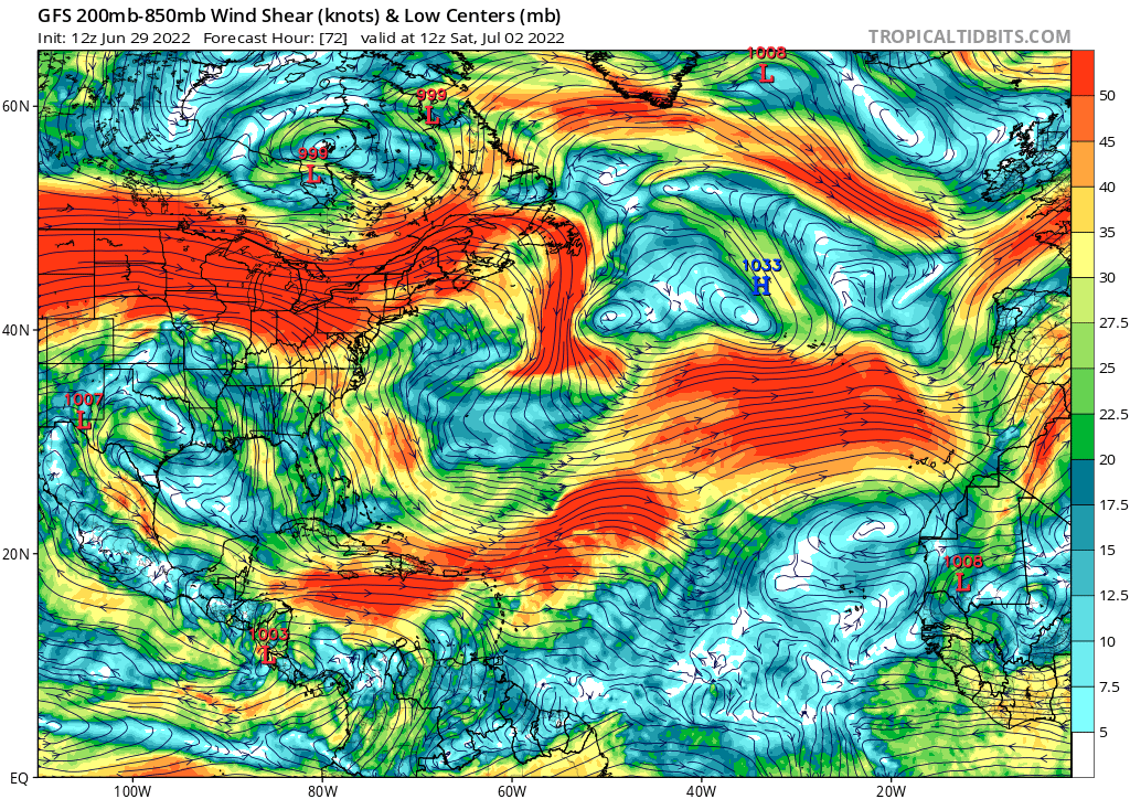
By Saturday, Potential Tropical Cyclone Two should have made landfall. When looking at the wind shear for Saturday, we see that there is higher shear in the general direction that the French Guiana system is heading. This will hurt development chances for the system, which is one reason the NHC does not list a high development chance for it over the next few days.
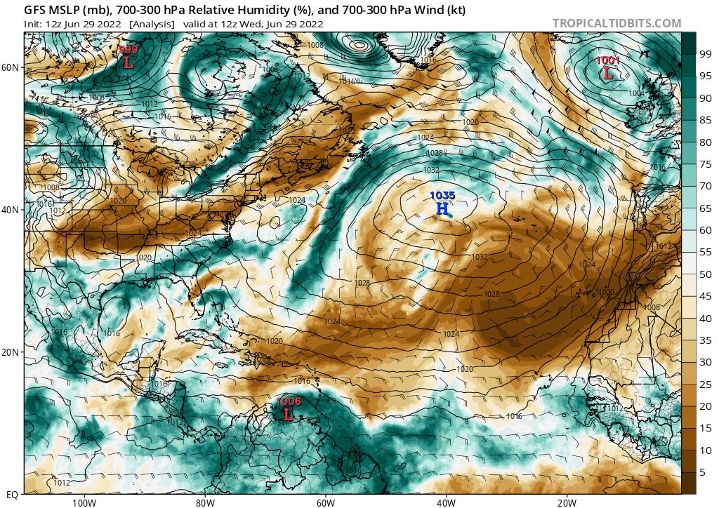
Another limiting factor in both of these systems is moisture. Potential Tropical Cyclone Two is forecast to move westward over an area of drier air, which will starve the system of fuel and inhibit strengthening. The French Guiana system is also expected to head into an area of drier air, which will limit its chance to strengthen.
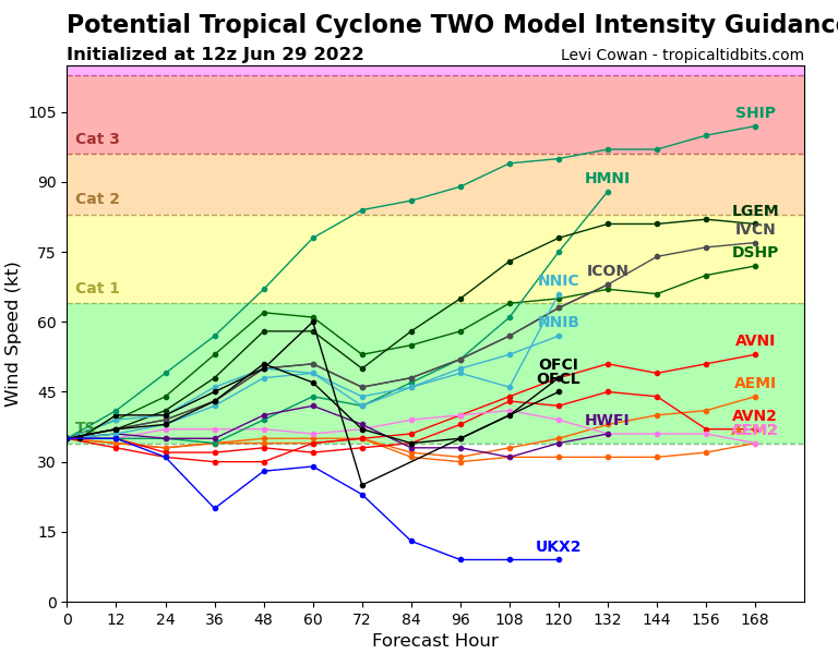
Because of the lower moisture environment, most models do not project Potential Tropical Cyclone Two will strengthen beyond a tropical storm, or at most, a Category 1 hurricane. The NHC projects that this system will remain a tropical storm.
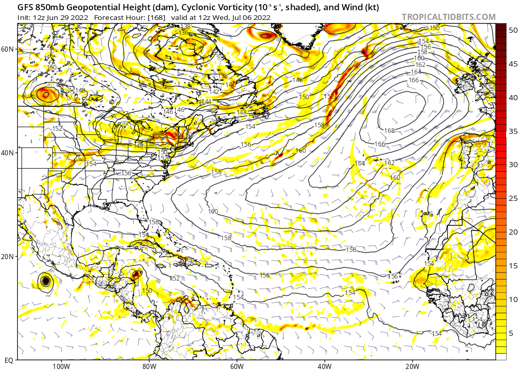
As we look into next week at the vorticity, which is the measure of spin in the atmosphere, we see an area of high vorticity tracking northwest off the coast of Central America. The GFS model seems to indicate a system may form next week there. However, it is too soon to tell if this will be the case. It is best to keep watching the NHC’s forecasts and be alert for any new systems that develop.


