Hello everyone, the high-pressure ridge still remains in the west to provide hot temperatures near the southeast. Meanwhile, a cold front coming down to the southeast for a possibility of storms throughout the day. For the temperatures for today, the low temp will be in the low 70s and the high temp will be in the low 90s. Throughout the day, it will be mostly cloudy with showers and thunderstorms happening in the morning and early afternoon. The dewpoints temperature will be around upper 60s to low 70s for today. In short, it will be a rainy morning with a muggy and hot temperatures in the afternoon and evening.
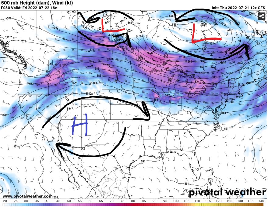
A barrage of low pressures system will be going through northern United States and southern Canada. Meanwhile, the high pressure remains strong and rebuilding near the four corners states. There will be a slight movement to the east in the next few days as the low pressures system starting to merge together to get stronger in Southern Canada.
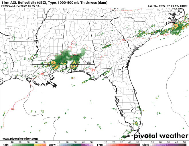
From the HRRR AGL Reflectivity, there is a vague line of storms trying to represent the cold front coming down to the southeast. It will bring in a cluster of storms to Mississippi in the morning, then a stray showers or thunderstorms might appear in the afternoon and evening hours.
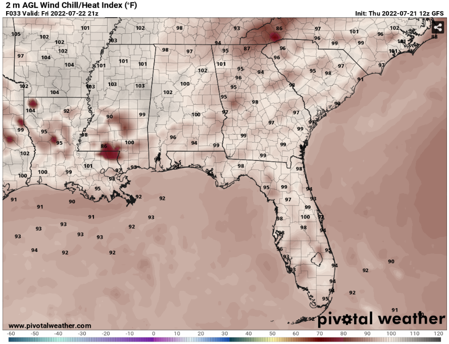
It seems like the heat index values might reach up to 100 to 105 degrees with the high dew point and temperature. There will be some places that might not have to go that high of a heat index with the clusters of storms bring in some relief to the temperatures. Stay aware of the hot weather by staying cool in an AC room and stay hydrated in this heat.
Day to Day Forecast
Friday
Mostly cloudy for today, but with scattered showers and thunderstorms in the morning. The high temperature will be in the low 90s. The heat index values will be in mid 90s to low 100s. There will be a 50-percent chance for scattered showers and thunderstorms.
Saturday
Mostly cloudy to partly cloudy throughout the day, with a possibility of scattered thunderstorms and showers. The high temperature will be in the low 90s to mid 90s. The heat index values will be in the upper 90s. There will be a 40-percent chance for scattered showers and thunderstorms.
Sunday
Sunny to partly cloudy throughout the day, with a possibility of a stray shower or thunderstorm. The high temperature will be in the mid 90s to upper 90s. The heat index values will be in the upper 90s. There will be a 20-percent chance for a stray shower or thunderstorm.
Monday
Sunny to mostly cloudy throughout the day, with a possibility of a stray shower or thunderstorm. The high temperature will be in the upper 90s to low 100s. The heat index values will be in the 100 to 105 degrees. There will be a 30-percent chance for a stray shower or thunderstorm.
Tuesday
Sunny to partly cloudy throughout the day, with a possibility of a start shower or thunderstorm. The high temperature will be in the mid 90s. The heat index values will be in the upper 90s. There will be a 20-percent chance for a stray shower or thunderstorm.
Wednesday
Sunny to partly cloudy throughout the day, with a possibility of a start shower or thunderstorm. The high temperature will be in the mid 90s to upper 90s. The heat index values will be in the upper 90s. There will be a 20-percent chance for a stray shower or thunderstorm.
Thursday
Mostly sunny with few clouds through the day, with a with a possibility of a start shower or thunderstorm. The high temperature will be in the upper 90s. The heat index values will be in the low 100s. There will be a 20-percent chance for a stray shower or thunderstorm.


