The Setup
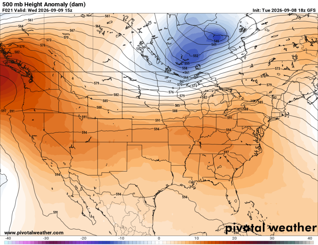
A strong upper-level low is spinning across central Canada, with a trough dipping southward into the northern United States. Farther south, a broad ridge remains stretched across much of the southern half of the country, including the Deep South.
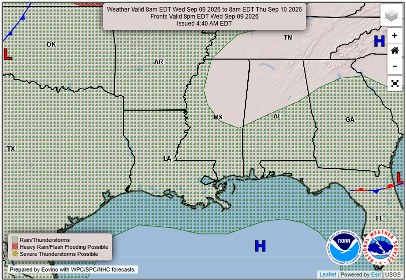
That ridge will keep the overall pattern fairly quiet, warm, and humid across Mississippi, Alabama, and Louisiana. A few afternoon showers and thunderstorms may still develop where enough moisture is available, but coverage should remain limited. There is no organized severe-weather risk expected across the region over the next several days, which is good news!

Tomorrow’s Forecast: Wednesday, September 9th
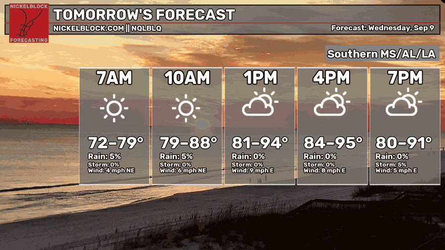
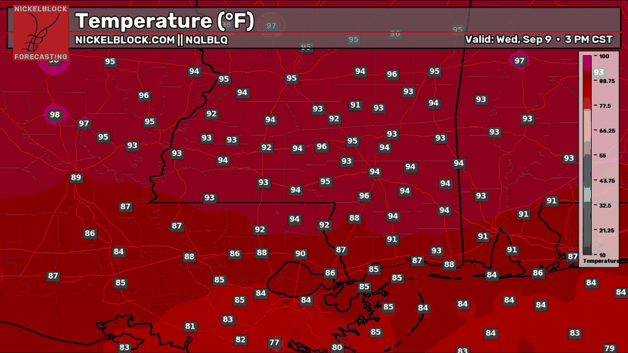
Wednesday is looking mostly dry across the region as drier air settles in behind today’s disturbance. We’ll start the morning with plenty of sunshine, followed by a few more clouds during the afternoon. Most of us should get through the entire day without seeing any rain.
The only exception may be right along the coast, where some leftover Gulf moisture and the sea breeze could spark a stray shower. Even there, rain will be very hit-or-miss. Temperatures will climb into the lower to middle 90s inland, while coastal areas stay in the middle to upper 80s. It will still feel quite humid, with heat index values near 100 to 105 degrees in a few spots.

Thursday’s Forecast: September 10th
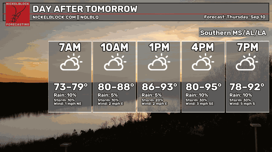
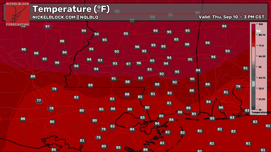
Thursday will be another mainly dry and hot day, with a mix of sunshine and clouds from morning through the afternoon. The ridge will begin to weaken slightly, allowing a little more Gulf moisture to work back into the region, but rain chances will remain low for most of us.
A few isolated showers may develop near the coast early before additional spotty activity becomes possible later in the afternoon and evening. Most locations will still miss out on the rain entirely. Highs will range from the middle 80s near the coast to the lower and middle 90s farther inland.
Extended Local Outlook
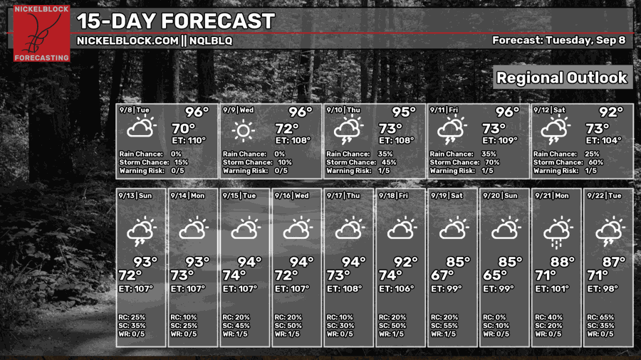
Looking ahead, the ridge will gradually weaken as we move toward Friday and the weekend. This will allow more Gulf moisture to spread inland while a frontal boundary approaches from the north. Scattered afternoon showers and thunderstorms should become more common Friday through Sunday, although neither day looks like a complete washout.
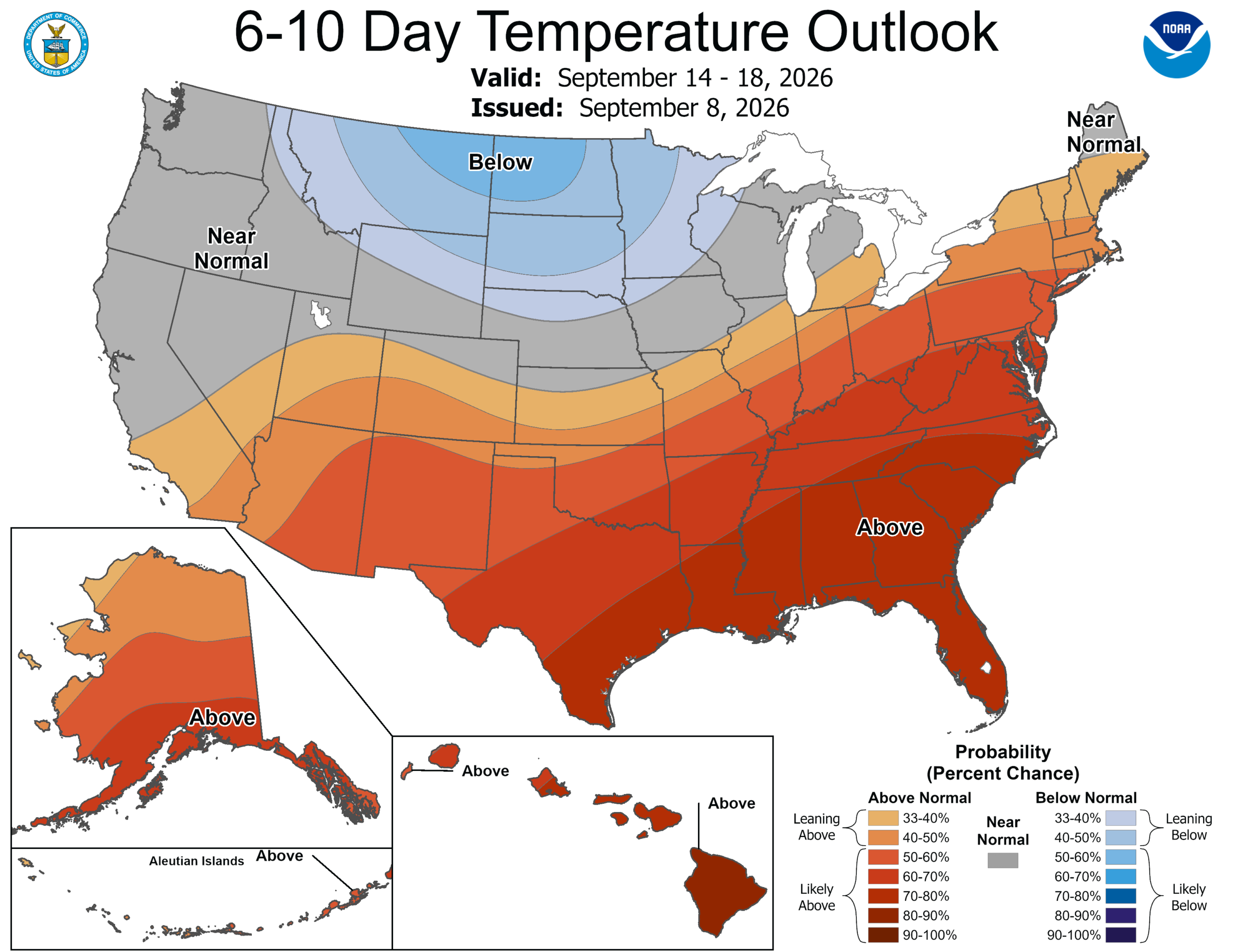
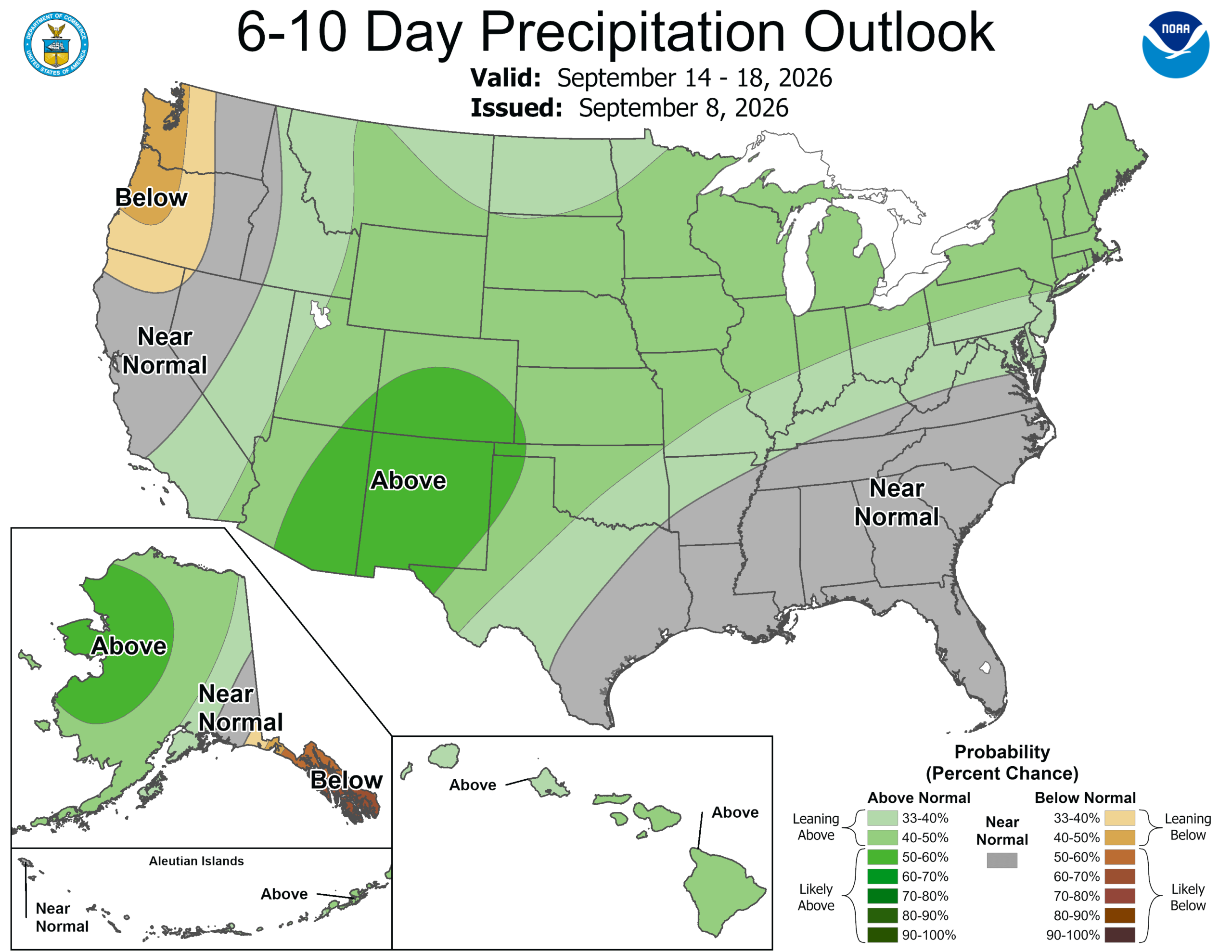
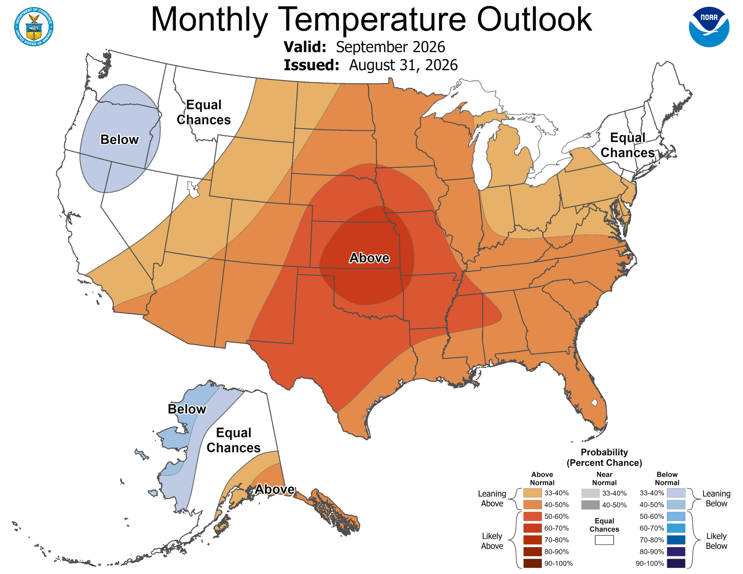
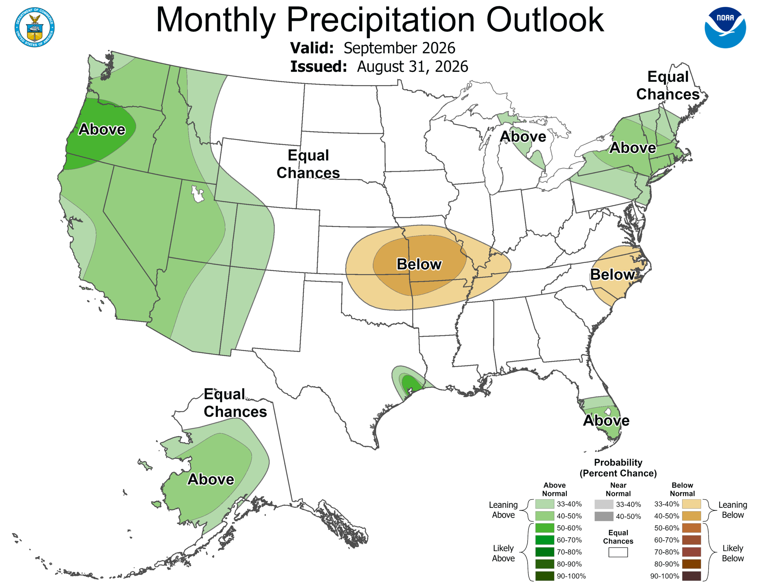
The CPC expects temperatures to run warmer than normal through the middle of September and for the month overall. Rainfall should stay close to what we typically see this time of year, with no clear sign of a much wetter or drier pattern.