
Hello, everyone; I hope your week is going well. We have quite a lot of info to cover in this forecast, so let us get started. Looking down south, the oppressive heat continues, with recorded highs possible today. Looking out west, some severe storms are possible, with an enhanced risk possible in northeastern Colorado and the Nebraska Panhandle. Areas of Kansas and parts of the deep south can expect a slight risk of severe weather. Looking to the Pacific, there are two named storms that we are keeping an eye on. Hurricane Dora is located south of Hawaii, while Tropical Storm Eugene is located to the west of Baja California.
The Heat Continues
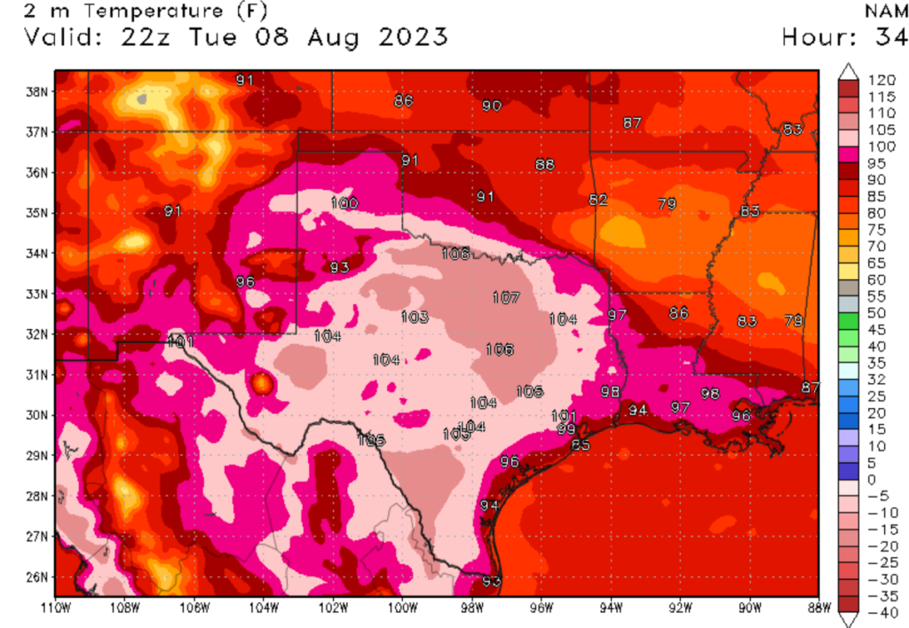
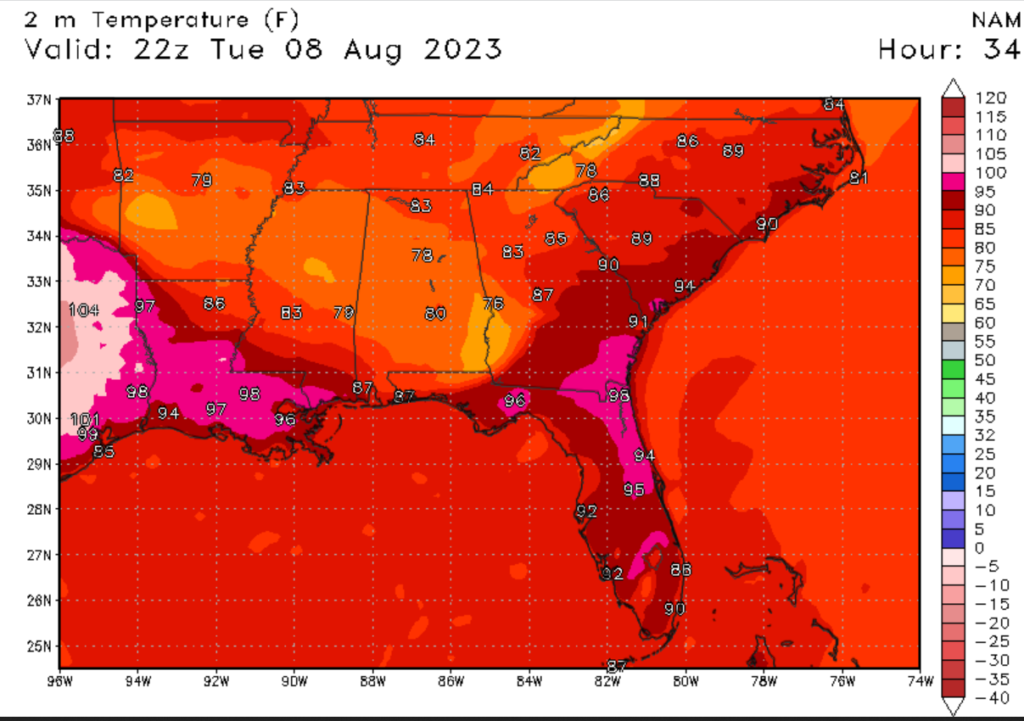
If you have been in the Southeastern United States, you’ve probably been sweltering in the relentless heat. Unfortunately, the heat is expected to stick around today. Cities from El Paso to Miami can expect above-average temperatures today. These high temperatures are being caused by a massive ridge of high pressure, dominating the Southern United States for the last month. Areas in Texas and Parts of the Gulf Coast can expect afternoon high temperatures of 100 degrees Fehernhight (38 degrees Celcius). Heat index values could reach as high as 110 degrees Fehernhight (43 degrees Celcius). Heat advisories and heat warnings could be issued, with the most likely areas along and south of Interstate 20. Areas of West Texas and other desert areas can expect high fire danger, with red flag warnings likely to be issued. Some areas inland can expect cooler weather today primarily due to a cold front moving through the region, bringing rain and possibly severe thunderstorms.
Severe Weather Expected
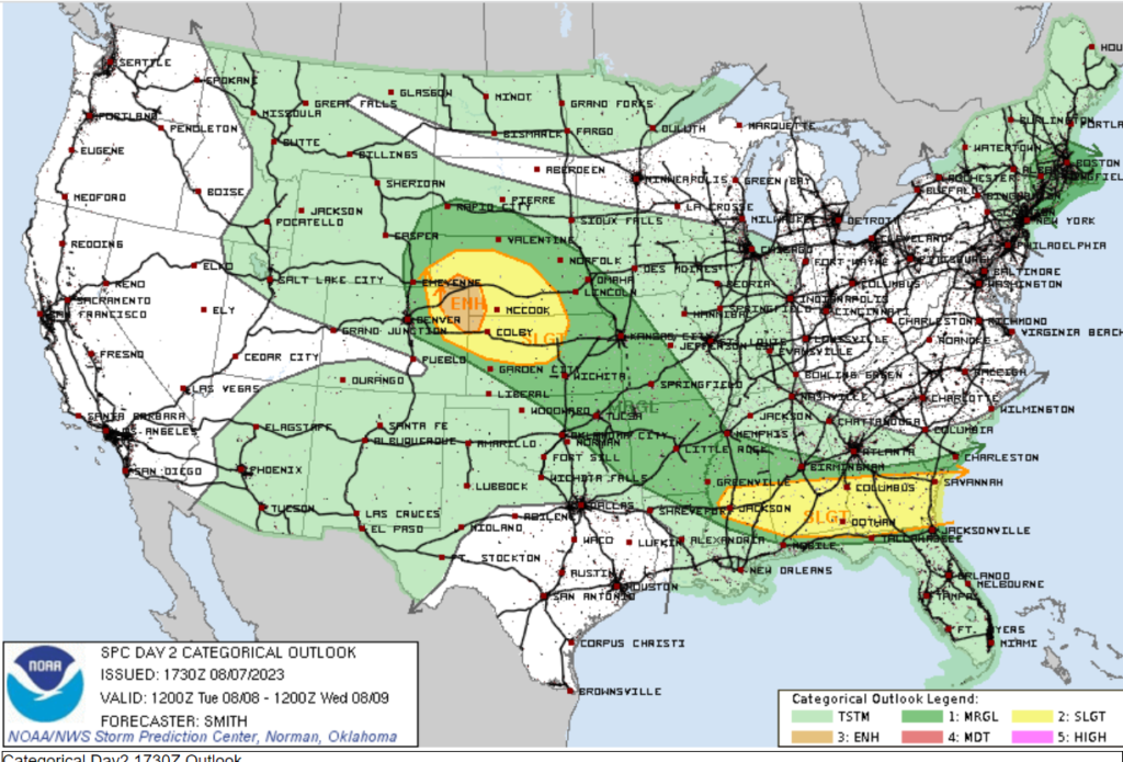
Speaking of severe weather, we have a chance of thunderstorms today. The two primary areas of severe weather will be the High Planes and the Deep South. The severe weather in the Deep South is being caused by a cold front moving through the region. The front and high temperatures will cause differential heating ahead of the front, causing convective thunderstorms development. The primary threat from these storms will be high winds, but deadly lightning will also be around. Looking at the high planes, there is an enhanced risk of severe storms. A steep lapse rate, high dew points (in the 60s), and a moist boundary layer will support MLCAPE values of around 2500 j/kg. The primary threats will be damaging winds, large hail, and isolated tornados. Luckily, the region of enhanced risk severe weather will be in a sparsely populated region. If you are in a region threatened by severe weather, please take proper thunderstorm precautions.
Two Hurricanes in the Pacific
Looking at the tropics, we have two active named storms, both located in the Pacific. As of 5 AM (on August 7th) Hawaiian Time, Hurricane Dora is a category 3 hurricane with sustained winds of 115 MPH. Dora is located around 800 miles south of Honolulu, Hawaii, or 1400 miles east of Johnston Island, Atol. Dora is moving in a westward direction and is expected not to impact any major population centers. As of 8 AM (on August 7th), tropical Storm Eugene has sustained winds of 45 MPH. Eugene is located 400 miles off the coast of Baja California. Eugene is moving in a northwest direction and is expected to weaken in the next couple of days. If you want more information on these storms, please check out the tropical outlook on NickelBlock Forecasting.
Extended Outlook
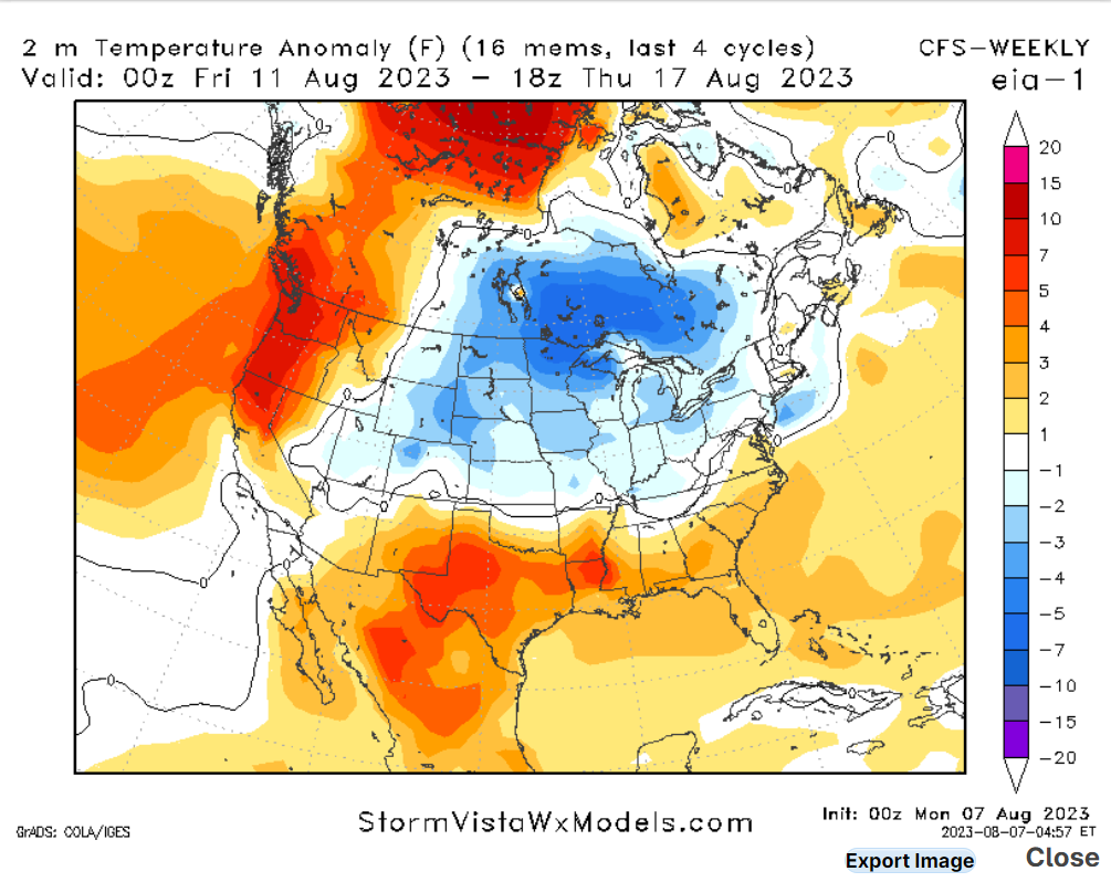
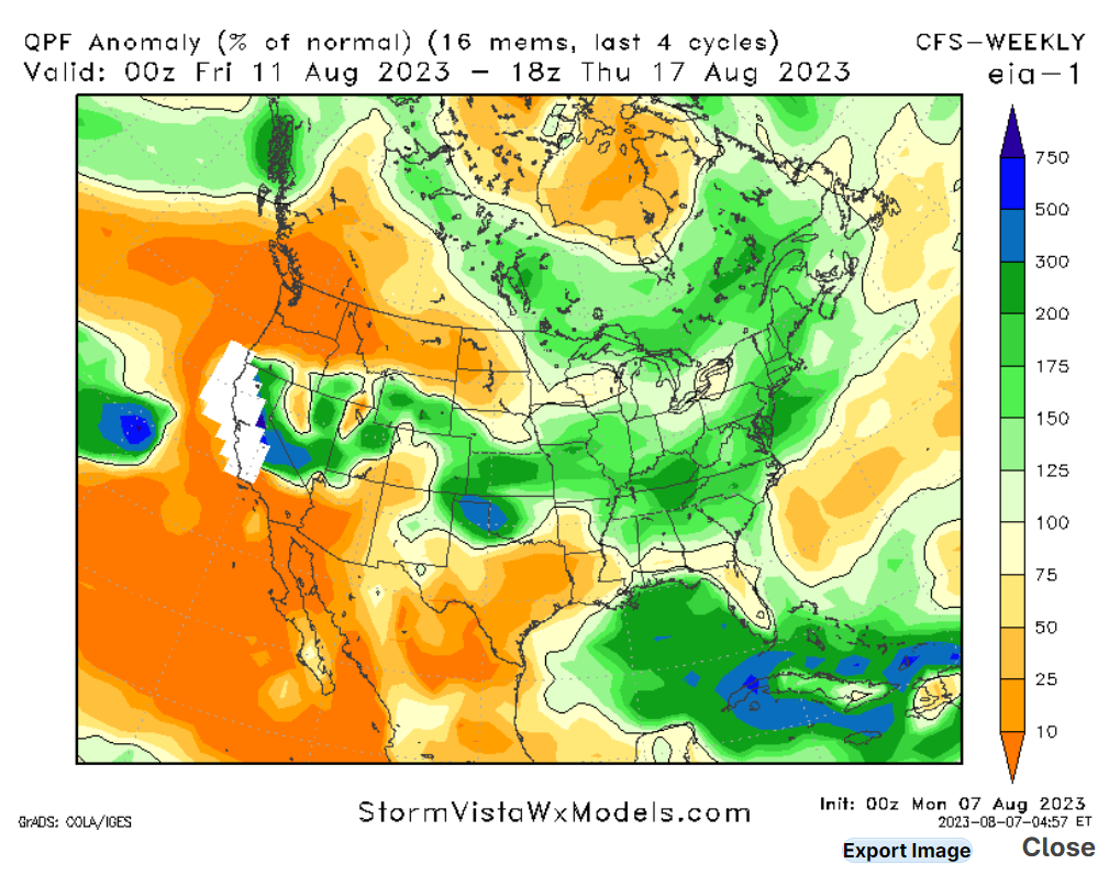
Looking into the extended outlook, not much relief is expected. Areas of Texas and the Pacific Northwest can expect above-average temperatures with below-average precipitation. The Mid-level ridge of high pressure is expected to move westward, causing temperatures to rise in the West.
Conclusions
The sweltering heat baking the South will persist into tomorrow, with the South Central and Deep South seeing the worst of the heat. Areas in the South that don’t see the heat could see severe weather, along with areas of the High Planes. As for the tropics, Dora will continue to move westwards, while Eugene is expected to weaken.


