
Hello everyone; I hope you are having a great start to your work week. We have had some interesting weather in the last couple of days, and it looks like this trend will continue tomorrow. Areas in the Southwestern U.S. have had to deal with an oppressive heat wave the last few days, and it looks like this heat wave will move east. Areas in New England have dealt with heavy rains for over a week now. The rainfall chances should be lower tomorrow and Wednesday before picking back up later this week. In tropical news, a tropical cyclone is making its way to Hawaii; however, it looks to weaken as it approaches the Islands.
The Relentless Heat
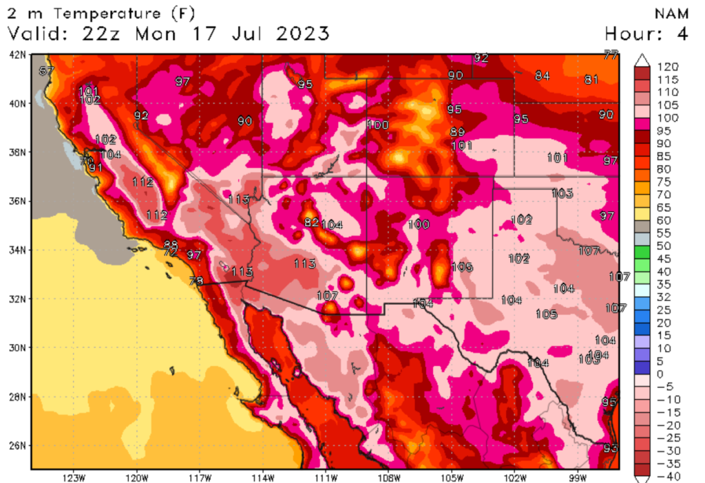
If you live in the Southeastern United States, you probably have been dealing with oppressive heat; as of this writing, it is 97 degrees Fehernhight (36 degrees Celcius) in my home city of Denver, Colorado. Not only will this heat is expected to stick around, but it’s expected to move eastwards. Areas such as Dallas, Houston, Oklahoma City, and Wichita are expected to see highs in the 100s, with heat indexes even higher. If you don’t know, this heat is being caused by a persistent high-pressure system, which is expected to reach its maximum strength this week. Overnight lows aren’t providing much relief, with some areas seeing lows only in the mid-90s. Rember that heat can kill, so take proper heat-related precautions. The good news is that early models are showing the summer monsoon season could start in the next couple of weeks, bringing rainfall to this scorched region.
More Flooding in the East
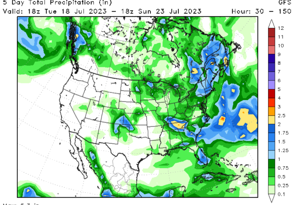
Quite a different story has unfolded in the east, with flooding continuing throughout parts of the Northeastern United States. Several states are currently under flood alerts as rounds and rounds of rain continue to batter the region. This is being caused by a Greenland High, causing low pressure systems to become stuck in the Northeast. Some areas of the Northeast have seen 300% of their average rainfall for the month of July. Looking at this week, the rainfall chances tomorrow should be lower before picking back up later this week, with some areas expected to see more flooding conditions. Those in the warned area should be prepared for flooding conditions and should take necessary precautions to protect life and property.
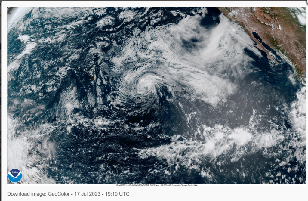
Hurricane Calvin

Those who have been modeling the tropics have probably noticed the active hurricane pattern this year. This is caused by the El Nino pattern in both the Pacific and Atlantic Oceans. The trend continues with our latest named storm, Tropical Storm Calvin. This storm, at one point, had been a hurricane but has weakened considerably over the last couple of days. As of 5 AM Hawaiian Alution Time, the center of Calvin is located at latitude 17. 1 North and longitude 142.3 West and is moving west at 17 mph (14.7 knots). The track of the storm put it close to making landfall on the Island of Hawaii (Big Island). High surf and heavy rains are expected to be the primary threats to the Island. If you want more information on the storm, please check out the hurricane outlook pages on NIckelBlock Forecasting.
Extended outlook
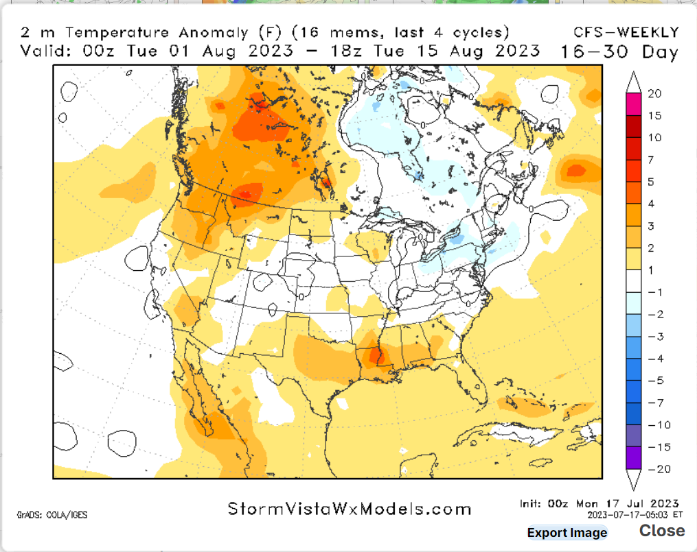
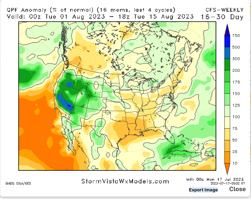
Looking into our extended outlook, one thing that catches my eye is a flip in the patterns we have seen for the last couple of weeks. Areas of the Southern U.S. should see a cooling trend as the high pressure system is expected to weaken. This will allow the monsoon season to begin in the Southwestern U.S., bringing much-needed rainfall to the region. Areas in the Northeast should start to see a dryer pattern as dryer air is expected to move into the region. Overall if you are done with the current weather patterns, you will be in luck later this month.
Conclusions
The United States has been in a quite unusual weather pattern, with relentless heat in the West and flooding rains in the East. I am forecasting this trend to slow and possibly flip in the next couple of weeks. Rember to stay safe and be weather ready this summer.


