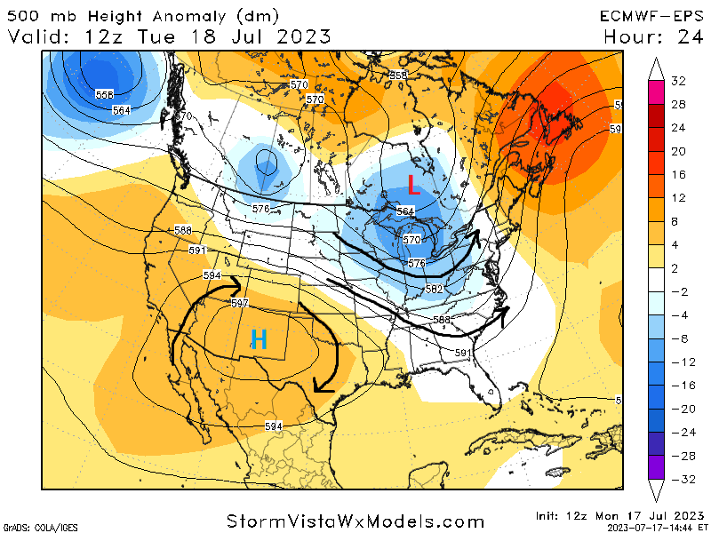
Heat, heat, and more heat will prevail across the region over the week, as a strong ridge of high pressure originating in the southwestern US will build over the coastal Southeast today through Friday. This will help to keep us relatively dry and temperatures up in the mid 90s to low 100s throughout our area. By the weekend fortunately, troughing from the north will push southward and help break down this high-pressure system and allow for more westerly flow aloft. This will help to curtail the run of high temperatures and increase rain chances throughout the area by the weekend and into early next week.
[wpcode id=”41149″]
Short-Term Outlook
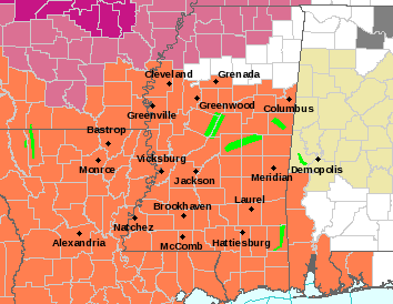
Today and tomorrow will start the string of hot temperatures across the area lasting through the work week. The aforementioned high pressure will expand and spread across the Gulf Coast, driving our temperature upwards around the upper 90s to low 100s. Heat indices throughout the short-term will hover around the 100 degree to 105 degree mark over the next couple days. As such, a Heat Advisory has already been issued for today until 8pm CDT. Extra precaution should be taken to protect yourselves from the heat and prevent heat-related illnesses, whether this be accomplished by taking frequent breaks from outdoor activities, staying well hydrated, and cooling off in any air-conditioned buildings if possible.
[wpcode id=”41149″]
Extended Outlook
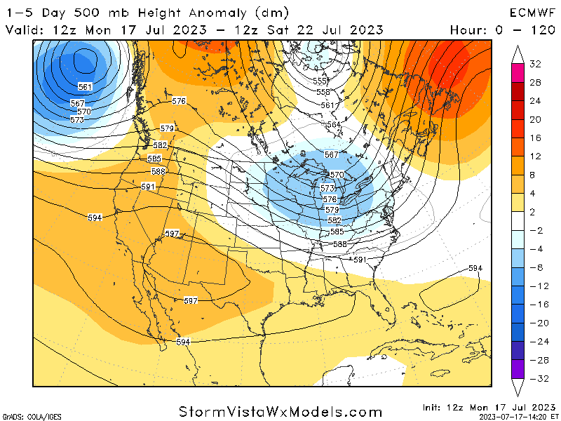
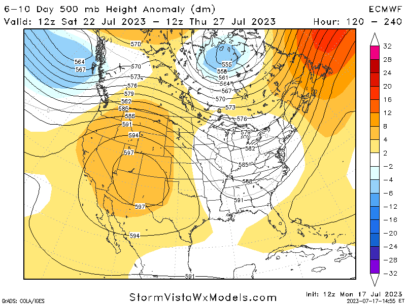
This heat will stick around through Friday before a change in the overall synoptic pattern arrives by the weekend. Until then, high temperatures and moist air will pose a substantial risk for heat-related illnesses. By the weekend, westerly flow aloft in response to a trough moving in from the north and will help reduce our temperatures back down the mid 90s. Plus, in addition to this, this renewed westerly flow will help rekindle opportunities for scattered showers and thunderstorms across the region. It remains to be seen where specifically will see the best chances for thunderstorms this weekend, but so far the most likely day for any precipitation will be on Saturday. Early next week may see the heat return a bit as high pressure tries to creep back in somewhat, however rain chances should not be completely suppressed during this time.
[wpcode id=”41149″]
REGIONAL DAY-TO-DAY FORECAST
Today: Mostly sunny and hot. High temperatures in the mid 90s to low 100s. Heat indices may reach up to 107 degrees.
Tonight: Mostly clear. Low temperatures in the mid 70s to low 80s.
Wednesday: Sunny and hot. High temperatures in the mid 90s to low 100s. Heat indices may reach up to 105 degrees.
Wednesday night: Clear skies. Low temperatures in the mid 70s to low 80s.
Thursday: Sunny and hot. High temperatures in the upper 90s to low 100s. Heat indices may reach up to 105 degrees.
Thursday night: Clear skies. Low temperatures in the mid 70s to low 80s.
Friday: Sunny and hot. High temperatures in the mid 90s to low 100s. Heat indices may reach up to 105 degrees.
Friday night: Mostly clear skies. A stray shower or thunderstorm is possible. Low temperatures in the low 70s to low 80s. Chance of rain 20%.
Saturday: Mostly cloudy, with a chance of showers and thunderstorms. High temperatures in the upper 80s to mid 90s. Chance of rain 50%.
Saturday night: Partly cloudy skies, with a chance of showers and thunderstorms. Low temperatures in the low to mid 70s. Chance of rain 40%.
Sunday: Partly cloudy skies, with a chance of showers and thunderstorms. High temperatures in the low to mid 90s. Chance of rain 40%.
Sunday night: Partly cloudy skies. A stray shower or thunderstorm is possible. Low temperatures in the low to upper 70s. Chance of rain 20%.
Monday: Mostly sunny skies. A stray shower or thunderstorm is possible. High temperatures in the mid 90s to low 100s. Chance of rain 20%.
Monday night: Mostly clear skies. Low temperatures in the mid 70s to low 80s.
Tuesday: Partly cloudy skies. A stray shower or thunderstorm is possible. High temperatures in the low to upper 90s. Chance of rain 30%.


