After a while, this oppressive heat gets very tiring. Luckily, some relief is on the way for the Southeast in the form of rainfall as we head into the weekend. Temperatures will still reach the upper 90s in most places and possibly hit the triple digits in more inland areas. This is still in thanks to the upper-level high pressure ridge in the western side of the region over northeast Texas.
This pattern coupled with a trough just offshore of the east coast has helped bring some drier conditions recently to keep any showers and storms to be very isolated in nature. These drier conditions will change into the weekend with moisture returning.
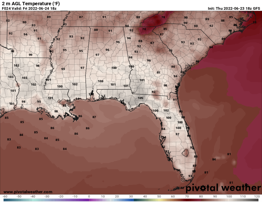
Temperatures at 2 PM EDT om Friday showing triple digits possible. || Courtesy: Pivotal Weather
Temperatures Friday will still be plenty of hot alongside dewpoints in the upper 60s to allow heat indices up to 110F in some areas. Because of this, the National Weather Service has issued a Heat Advisory from 10 AM EDT to 9 PM EDT. Remember, avoid being outside during the hottest parts of the day if you can. If outside for long periods of time, hydrate and take plenty of breaks in the shade or air conditioning. Also, never leave children or pets in the car alone. Always check before locking your car and walking away.
Unfortunately, there have been five recorded child heatstroke deaths in vehicles this year according to the National Safety Council. As we go into next week, that ridge will move back to the west ushering lower temperatures, relative to our recent 100 degree days, in the upper 80s and low 90s for the region.
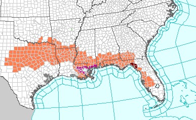
Heat advisories in orange across the Southeast for Friday. || Courtesy: National Weather Service
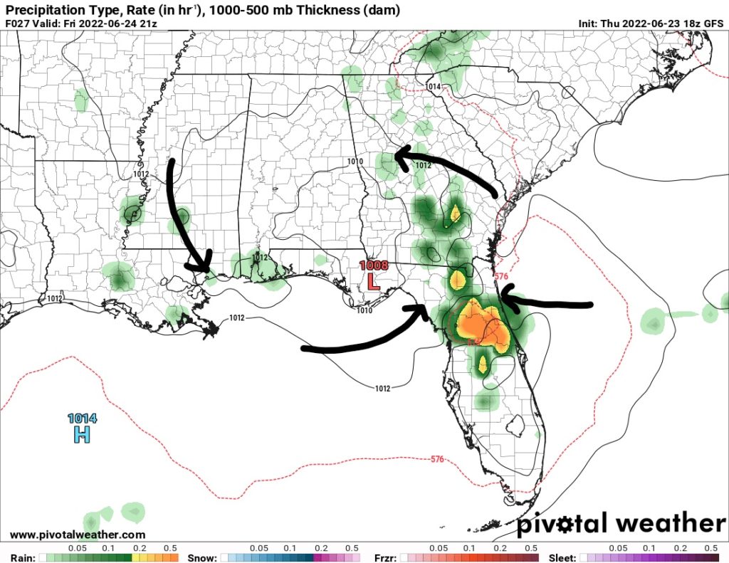
Now, lets talk about rain and thunderstorms. A weak surface low is forecasted to move southwestward from the Carolinas into the Florida Panhandle. This will help trigger convection over the region with the help of daytime heating and increasing moisture.
Florida will see the most of this rainfall over the I-75 corridor with the sea breeze kicking off the convection. the Storm Prediction Center has a marginal risk for severe weather over south Georgia and down the I-75 Corridor until just south of Lake Okeechobee. The risk for downbursts with 60+mph winds is possible with the stronger storms. The rest of the region could see isolated to scattered storms in the late afternoon.
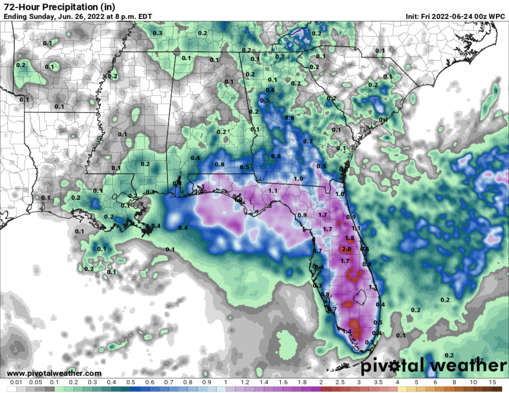
Surface low over the Florida Panhandle aiding in convergence of winds (black arrows) over the state’s spine (left). 72-hour precipitation suggesting locally heavy rainfall over Florida (right). || Courtesy: Pivotal Weather
Day-to-Day Forecast
Dallas, TX
Friday
Saturday
Sunday
High: 104
High: 104
High: 103
Low: 81
Low: 80
Low: 79
Precip: None
Precip: None
Precip: 20-percent
Houston, TX
Friday
Saturday
Sunday
High: 98
High: 98
High: 96
Low: 77
Low: 77
Low: 79
Precip: 20-percent
Precip: None
Precip: None
New Orleans, LA
Friday
Saturday
Sunday
High: 99
High: 97
High: 96
Low: 84
Low: 82
Low: 81
Precip: 20-percent
Precip: 20-percent
Precip: 30-percent
Little Rock, AR
Friday
Saturday
Sunday
High: 98
High: 101
High: 97
Low: 78
Low: 78
Low: 74
Precip: None
Precip: None
Precip: 40-percent
Memphis, TN
Friday
Saturday
Sunday
High: 97
High: 100
High: 99
Low: 74
Low: 77
Low: 73
Precip: None
Precip: None
Precip: 40-percent
Birmingham, AL
Friday
Saturday
Sunday
High: 97
High: 96
High: 95
Low: 75
Low: 74
Low: 72
Precip: None
Precip: 30-percent
Precip: 30-percent
Atlanta, GA
Friday
Saturday
Sunday
High: 92
High: 90
High: 90
Low: 72
Low: 71
Low: 72
Precip: 40-percent
Precip: 40-percent
Precip: 20-percent
Author of the article:
Brandon Lashbrook
Brandon is a degreed meteorologist with a Bachelors in Meteorology from Florida State University. At FSU, he worked on the FSU Weather show. Originally from Tampa Bay, FL, he will be at Fox 44/NBC 33 in Baton Rouge, LA as the weekend meteorologist in September.