An active pattern of weather remains in the cards across much of the country over the next week. Severe thunderstorms are possible for areas in the northern US today, before moving southeast to include areas in the central Plains and Midwest on Friday.
Additional chances for showers and thunderstorms are being monitored as an approaching upper-level low will enter the Pacific Northwest and will make its way across eastward across the northern US. Monsoon rains continue to drench the Four Corners region and will pose a flood threat for the near future.
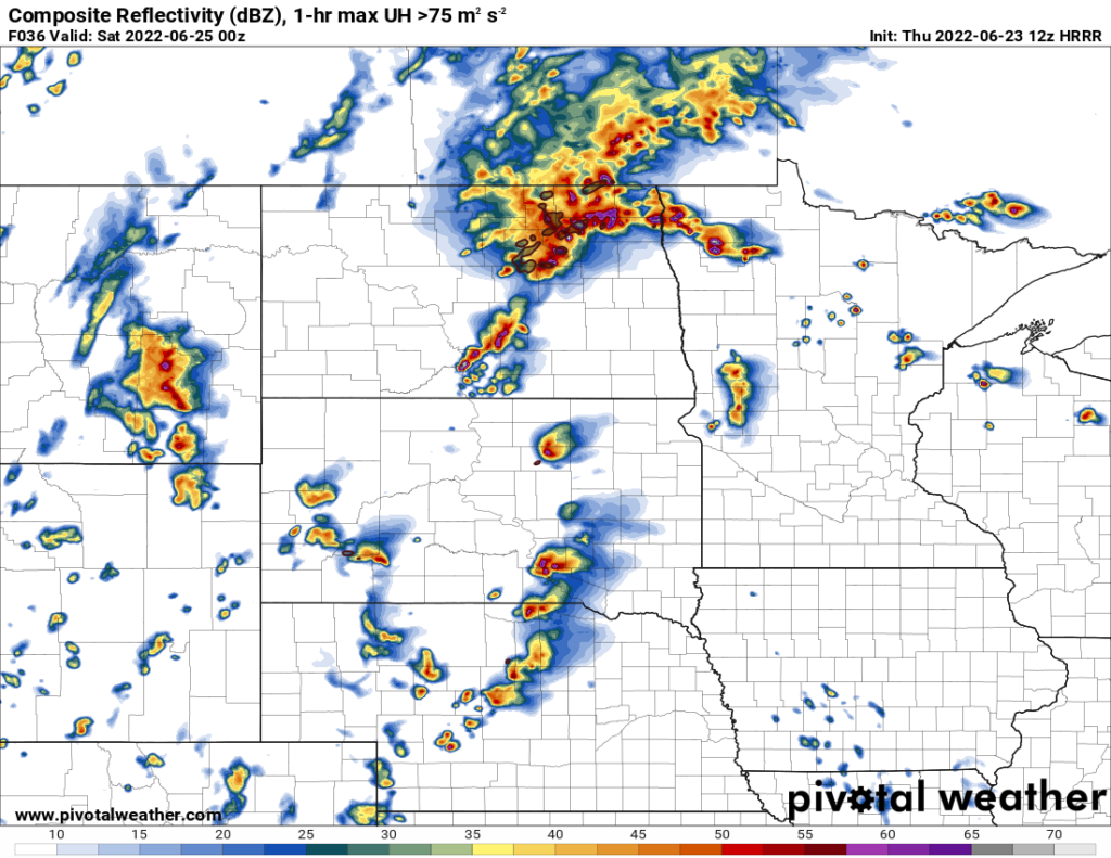
Northern US
Severe thunderstorms will be possible across the eastern Dakotas and western Minnesota today. An approaching shortwave from the Pacific Northwest will traverse through the area and will be the primary initiator for these storms. Ample moisture streaming up from the south, with dew point temperatures in the upper 60s to low 70s, should begin to pool in front of the cold front by the afternoon. Temperatures in the upper 80s to low 90s, as well as significant cooling with height, will provide more than enough buoyancy to support powerful storm updrafts.
While not significant, there is enough wind shear in place, with southerly winds at the surface and westerly winds aloft, conducive for rotating thunderstorms. That being said, large hail and damaging wind gusts will be the primary hazard with these storms, although a brief tornado cannot be ruled out. Additional severe thunderstorms are possible further south into Nebraska and Iowa with possible hazards being large hail and damaging winds.
Following the departure of this system, more calm conditions will arrive to the region before another low-pressure system enters from the Pacific Northwest on Monday and moves through the northern US on Tuesday. An increase in potential for showers and thunderstorms will be possible, but further data and evaluation will be needed for the severe potential of these storms.
Central Plains into the Midwest
Wet and rainy has been the theme for the central states as of late. Scattered showers and thunderstorms will continue to move through the region Today and Friday. On Saturday, a cold front associated with an upper-level low moving through Ontario will begin to push through in the afternoon. There is potential for severe thunderstorms, particularly in Kansas, Missouri, Iowa, and eastern Illinois, although marginal at the moment.
While wind shear may not be the greatest, the amount of instability present should be enough to support at least a couple severe thunderstorms capable of large hail and damaging winds. By Sunday, places in the Midwest may experience showers and thunderstorms as the cold front pushes east-southeast.
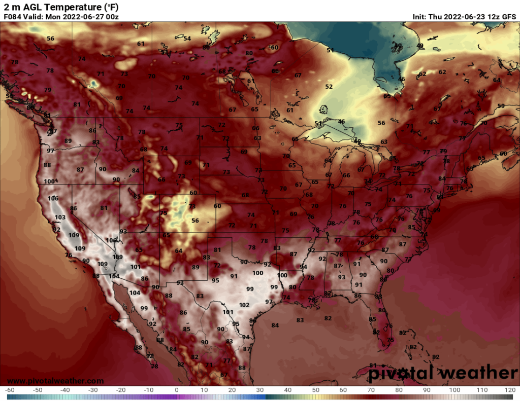
Temperatures will drop substantially behind the front, down to the mid to upper 70s, and should linger for a couple days before the summer heat returns by mid next week.
Desert Southwest
The monsoon rains are in full swing as repeated rounds of showers and thunderstorms are well on their way for the desert southwest. Moist air from the Gulf of Mexico continues to wrap around the high-pressure system in the southern US and deposited over the Four Corners states. Daily destabilization of the atmosphere will lead to continuous chances for rain over the next week.
Flooding is a concern, especially across New Mexico and Colorado. Total rainfall across the area may amount between 1-2 inches but higher amounts approaching 3 or possibly 4 inches are possible.


