Hey everyone! Let’s get into the national outlook for this week!
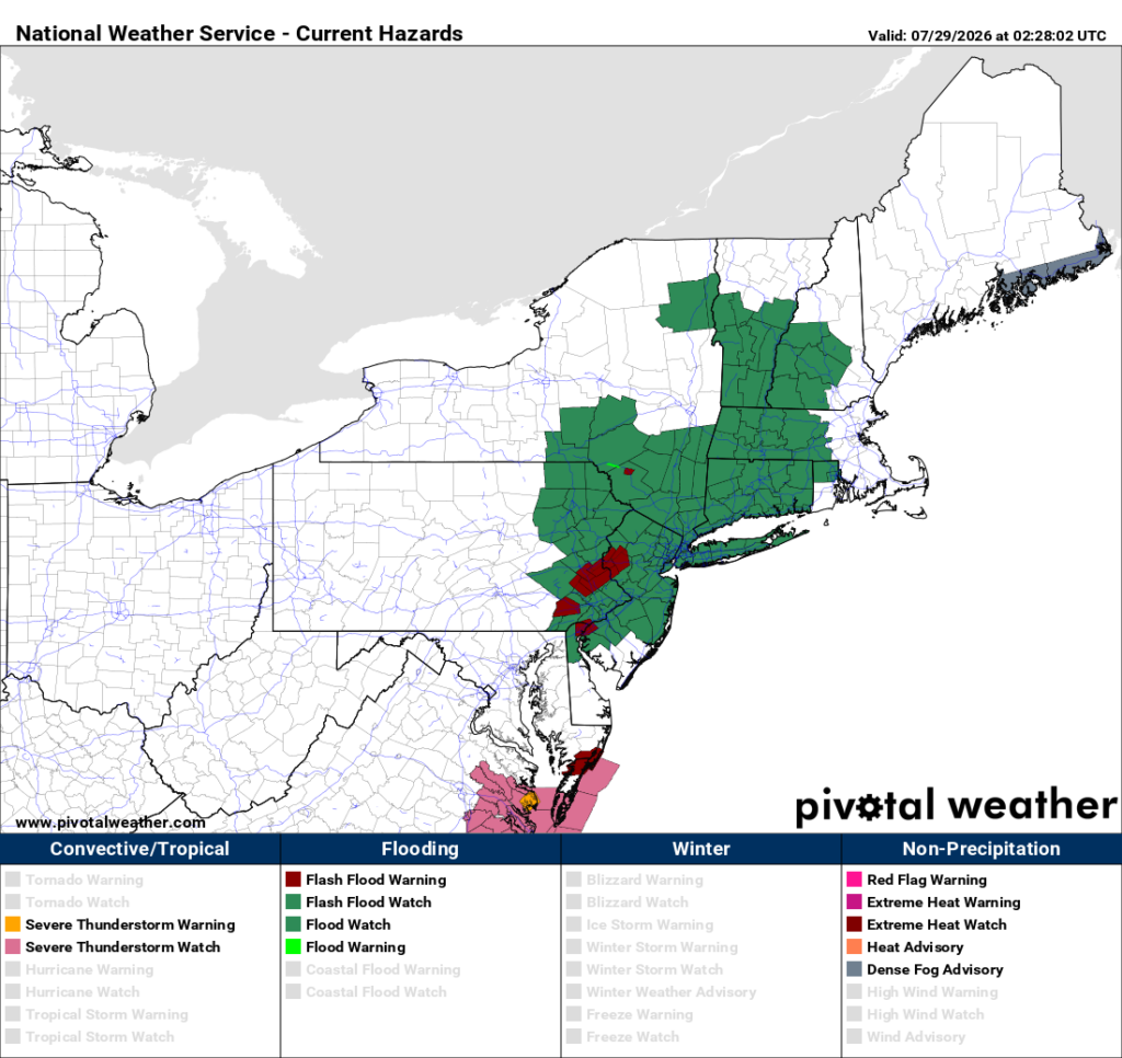
Tomorrow’s Overall Setup
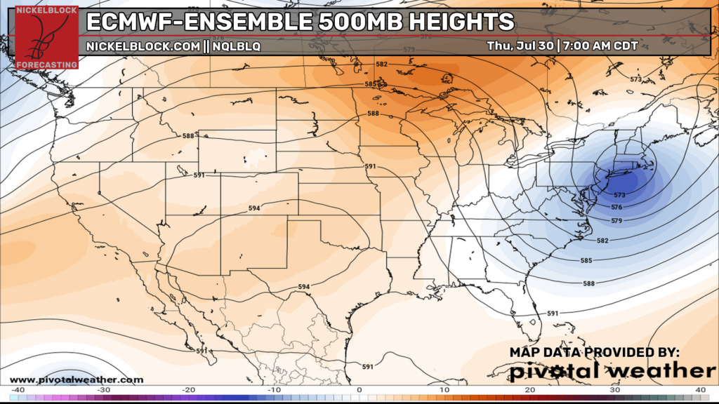
Tomorrow’s overall setup features a large trough over the Northeast, which is bringing all of the heavy rain and flooding concerns tonight. Meanwhile, ridging remains in place across the central and western U.S., bringing above-average temperatures through the week, with a few storm systems traveling around the edge of the ridge this week.
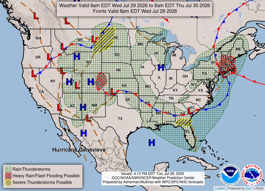
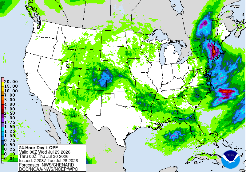
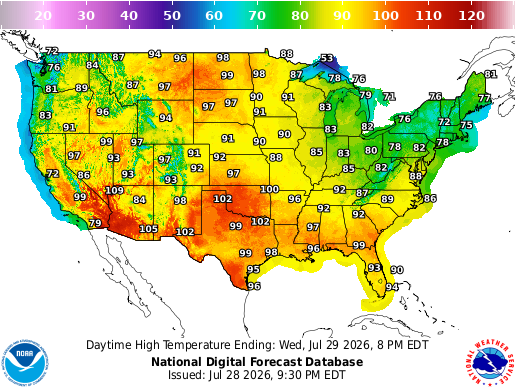
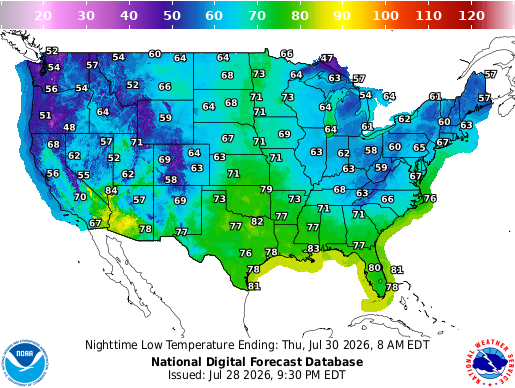
Rain and thunderstorms will be pretty widespread from the Rockies into the Plains, Midwest, and parts of the South tomorrow. The heaviest rain will stay focused across the Northeast, where flooding will continue to be a concern. Most of the rain will be over by the afternoon, so it’s more of a morning threat as the low moves off the coast. Temperatures will remain very hot across the Southwest and southern Plains, with many areas reaching the upper 90s and low 100s, while the Northeast stays much cooler under the trough and ongoing rain. A cool night for much of the northeast and Midwest as well, with some spots reaching the 50s for their low.
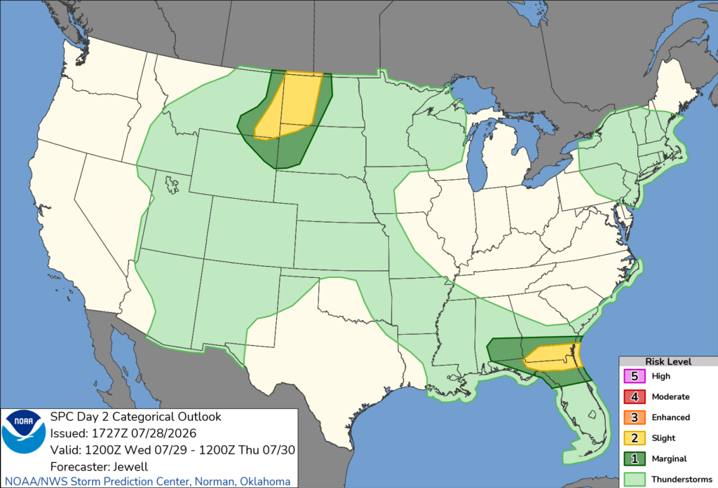
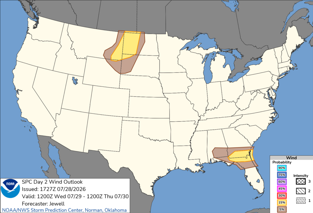
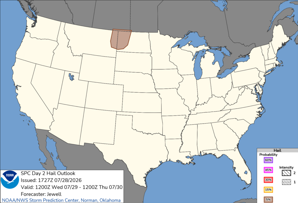
Wednesday’s severe weather threat will be focused in two areas. A Slight Risk is in place across southern Georgia and northern Florida, where damaging winds will be the main concern during the afternoon. Another Slight Risk stretches from eastern Montana into the western Dakotas, with damaging winds and some isolated hail possible later in the day.
Thursday’s Weather
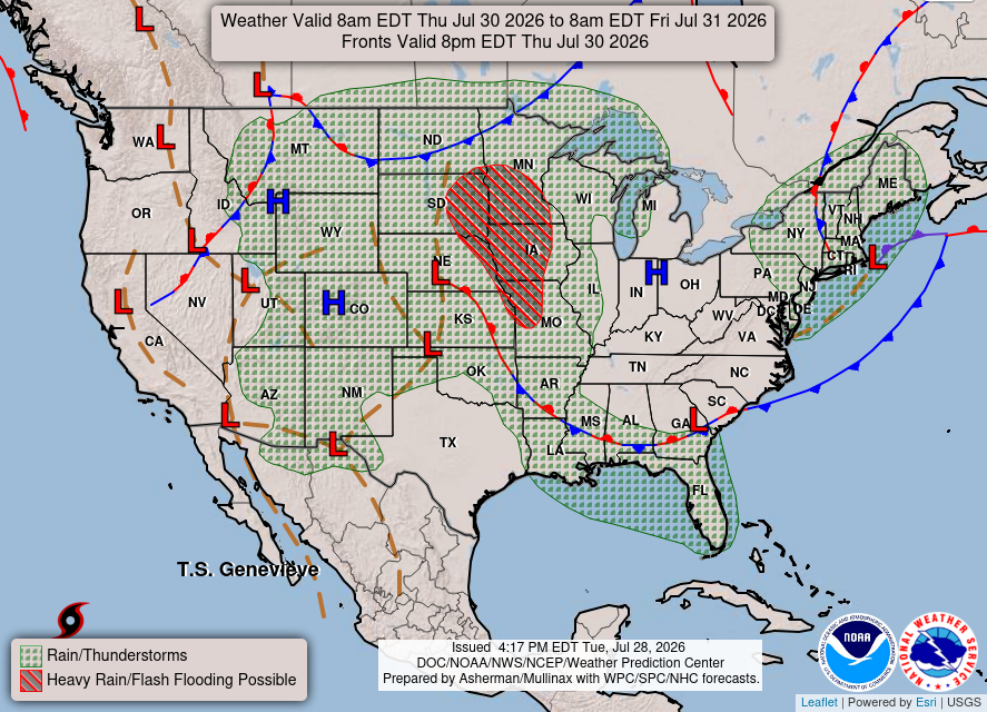
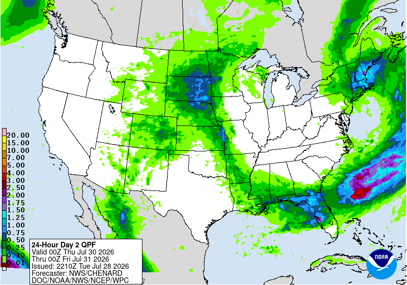
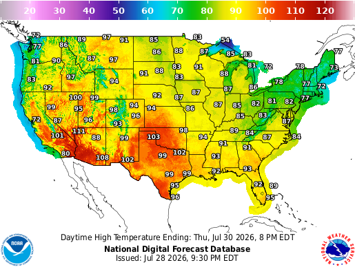
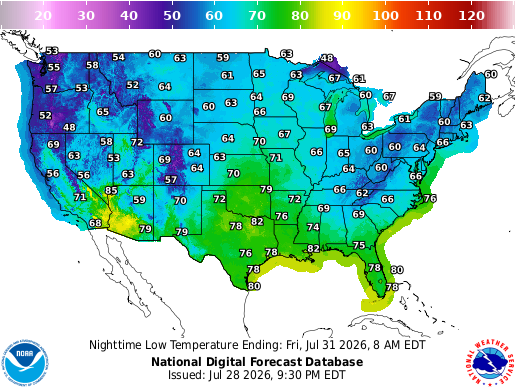
Thursday will bring another active day, with showers and thunderstorms stretching from the Plains and Midwest into the South and Northeast. The heaviest rain looks focused across parts of the northern Plains and Upper Midwest, with additional heavier downpours near the Gulf Coast and Southeast. Temperatures will stay very hot across the Southwest and southern Plains, while cooler conditions continue around the Great Lakes and Northeast.
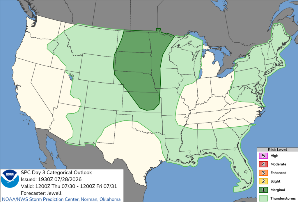
Thursday’s severe weather threat will be focused across the northern and central Plains, where a Marginal Risk is in place. A few storms could produce damaging wind gusts during the afternoon and evening. Storms may develop along a surface trough and cold front, with enough instability and wind shear to support a few stronger cells.
CONUS Weekly Temperature & Precipitation Outlook
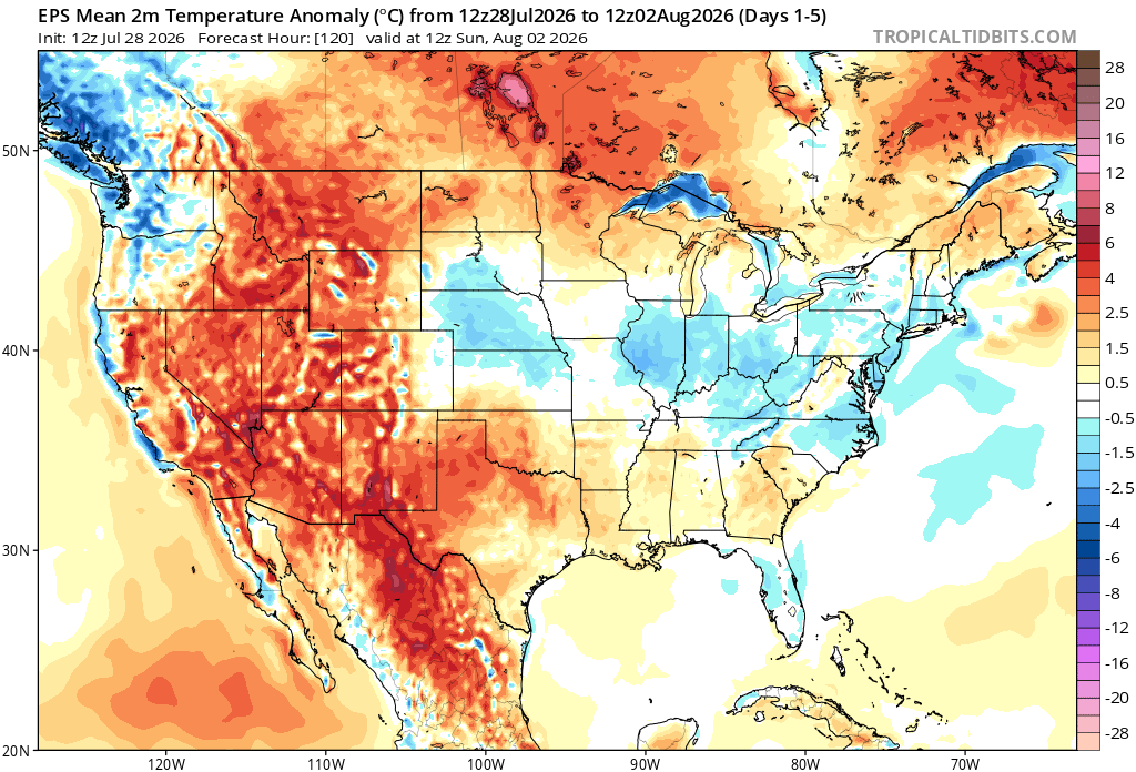
Here’s a look at the EPS modeled temperature anomalies through Sunday. Red indicates above-average temperatures on average for the week, white indicates average temperatures, and blue indicates below-average temperatures.
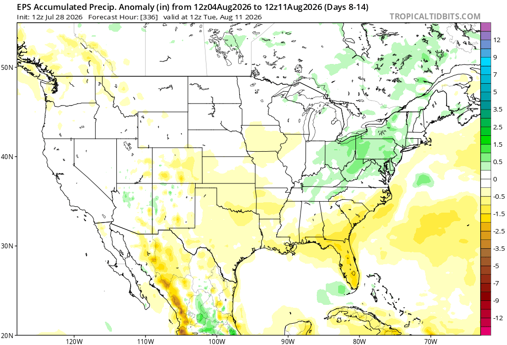
Here’s a look at the EPS modeled precipitation anomalies through next Tuesday. Green indicates above-average precipitation, white indicates average precipitation, and yellow indicates below-average precipitation. Let’s look into the details by region:
Weekly Outlook: Western & Central United States
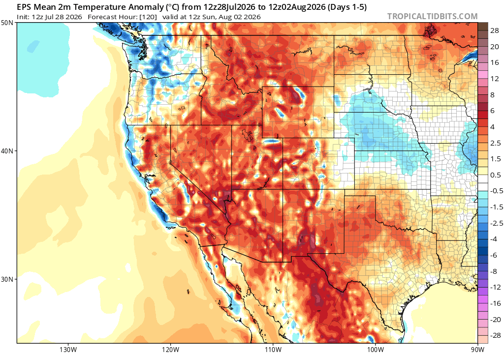
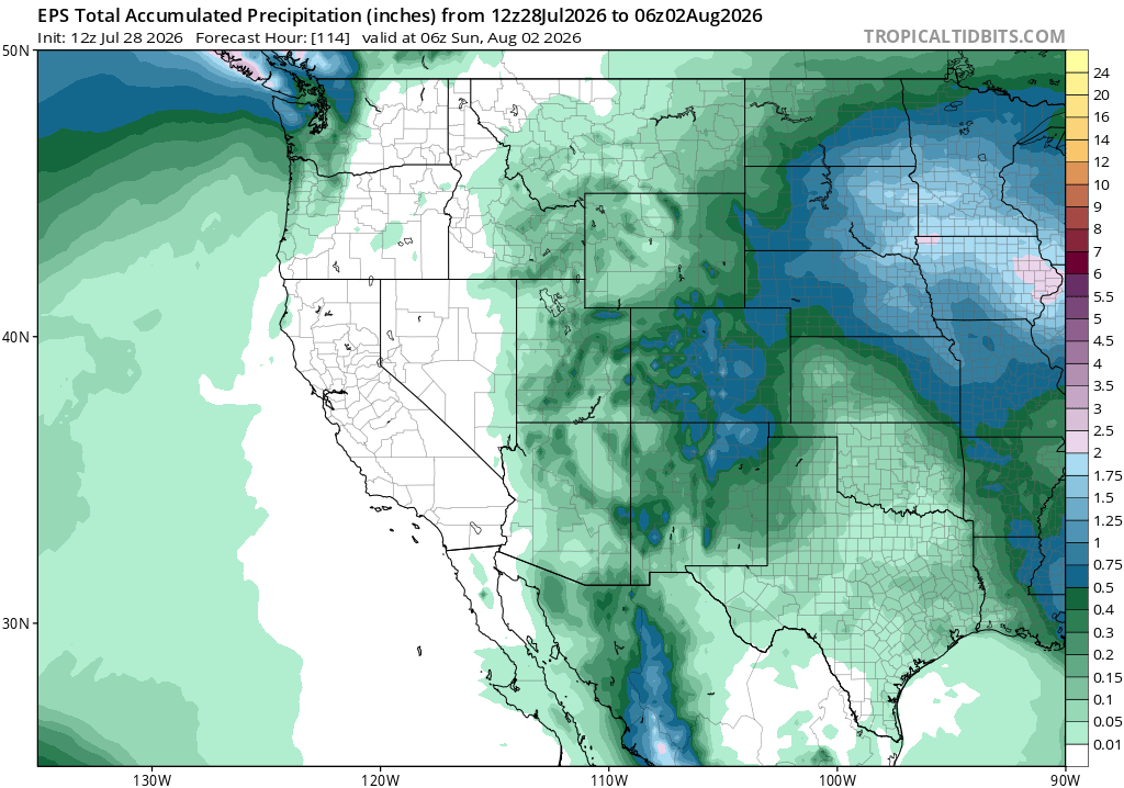
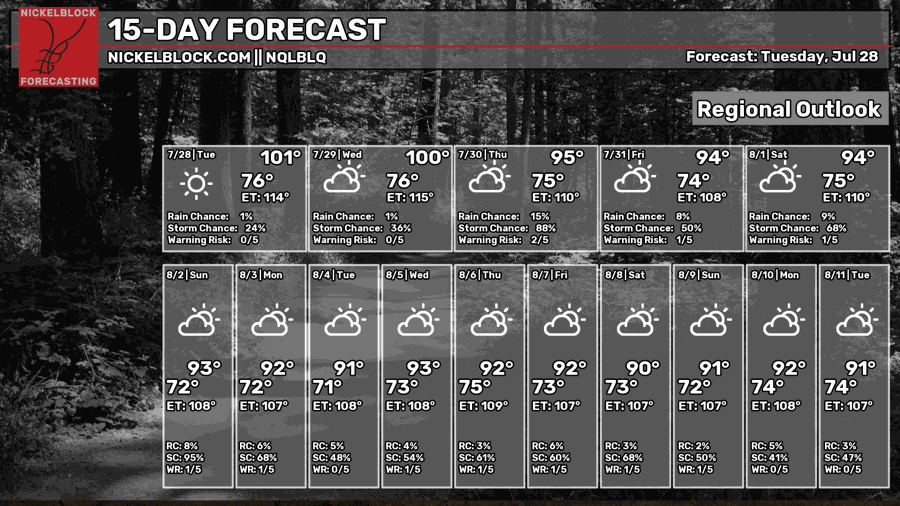
Much of the West and central U.S. will stay hotter than average through the week, with the largest temperature departures across the interior West and northern Rockies. Rain and thunderstorms will be most common from the central and northern Plains into the Upper Midwest, where a few areas could pick up several inches of rain. Some monsoon moisture will also continue across parts of the Southwest.
Weekly Outlook: Eastern United States
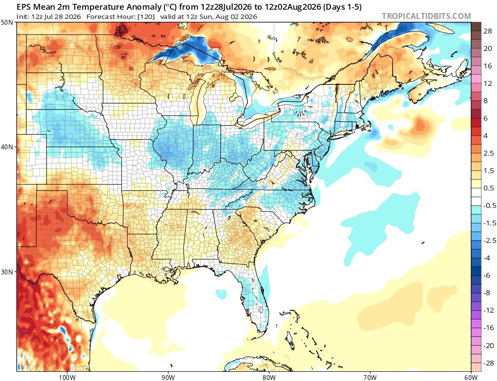
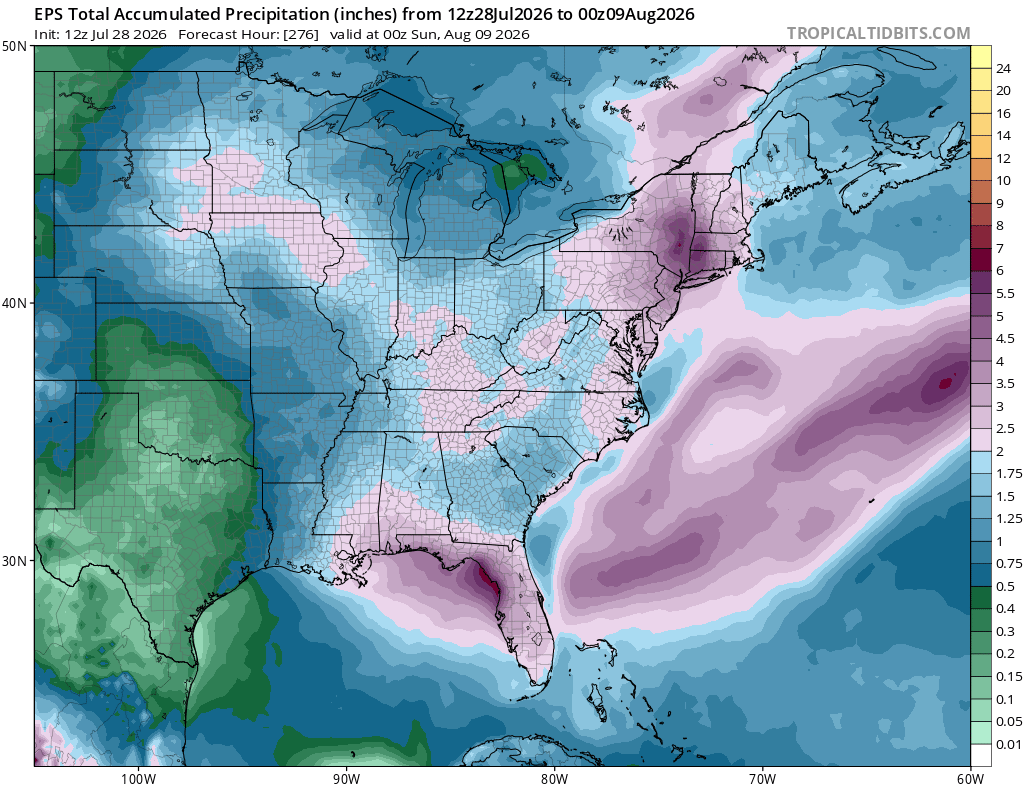
Much of the eastern U.S. will stay cooler than average through the rest of the week, especially across the Ohio Valley, Appalachians, and parts of the Southeast. Rain will remain widespread, with the heaviest totals focused from Florida into the Carolinas and up through the Mid-Atlantic and Northeast, although some of the Northeast totals include the heavy rain falling today.
Extended Outlook
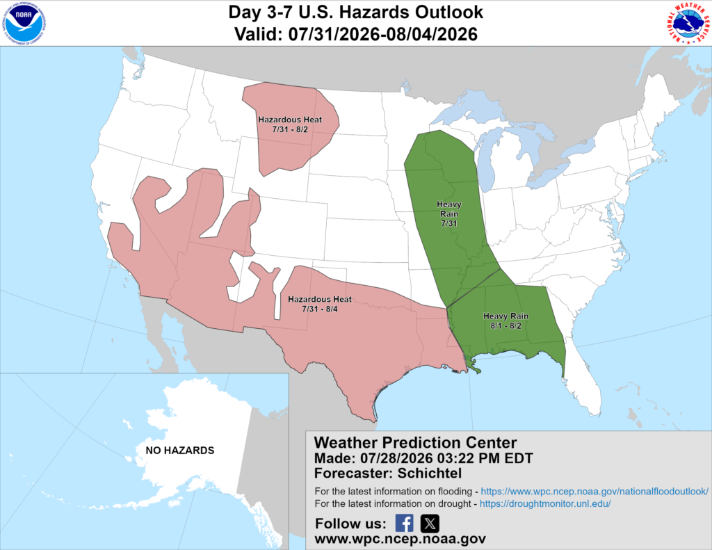
Above is a look at the U.S. Hazards Outlook from NOAA, highlighting areas of more impactful weather to be aware of over the next 3 to 7 days.
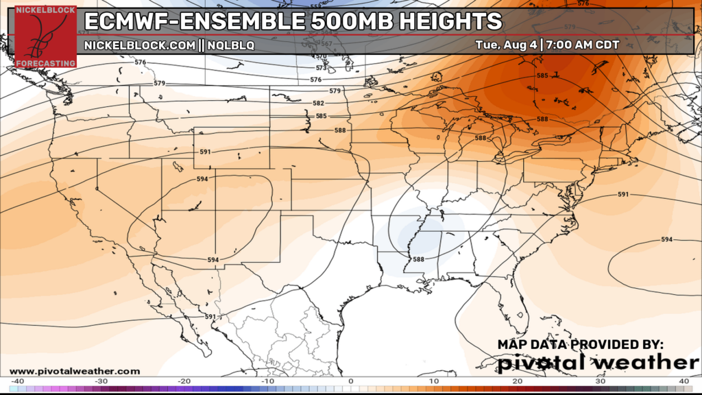
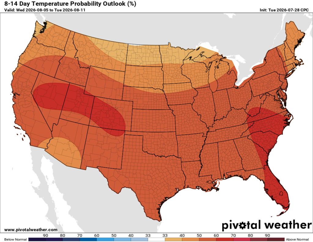
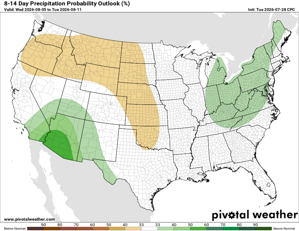
Looking ahead to next week, I think the biggest story will be the ridge building across the Great Lakes and Northeast, which should bring warmer-than-average temperatures to a large part of the country. The Southwest may stay active with monsoon moisture around, while the northern Plains could end up a little drier than normal.
Thanks for tuning in to this National Forecast! Tune in to our local, tropical, and regional forecasts to stay up to date on the latest!


