After a real close call, sparing Hawaii from a direct hit, Post-Tropical Storm Calvin will continue to head westward out into the open waters of the Central and Western Pacific Ocean. Further east in the Eastern Pacific, we have another area of interest that may end up developing into a tropical cyclone of some sort, albeit short lived. Out in the Atlantic Ocean, Tropical Storm Don is completing its loop and will look to eventually weaken and move off to the east towards Europe. There is another area of interest out here too, with a tropical wave off the coast of West Africa trying to organize and make its way westward. However though, conditions out here will limit development at least in the short-term.
Current Tropical Conditions
As mentioned, Calvin is continuing its move off to the west. As of 7:00pm CDT, Calvin is located 240 miles southwest of Honolulu, moving to the west at 19 mph and has peak winds of around 40 mph. As it continues westward, Calvin is expected to continue to dissipate as strong upper-level wind shear continues to tear it apart and very dry air chokes out any moisture left in the system. These factors should cause its eventual demise and prohibit any chance of redevelopment.
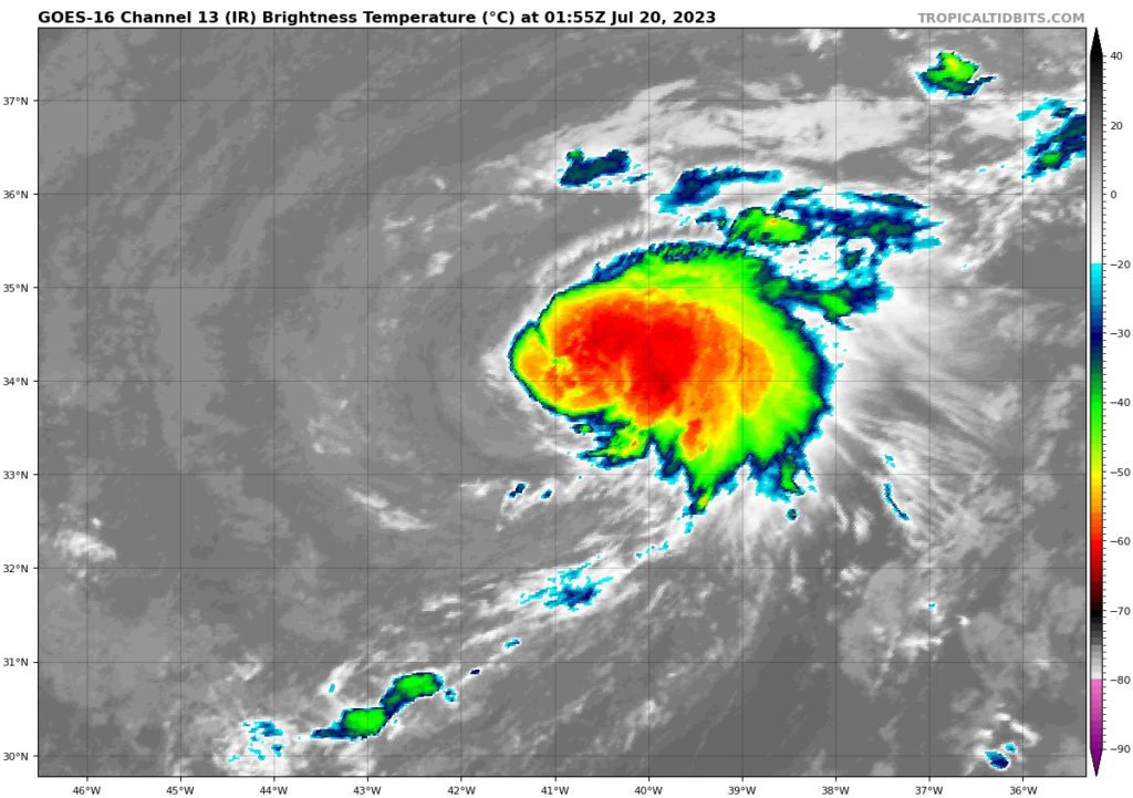
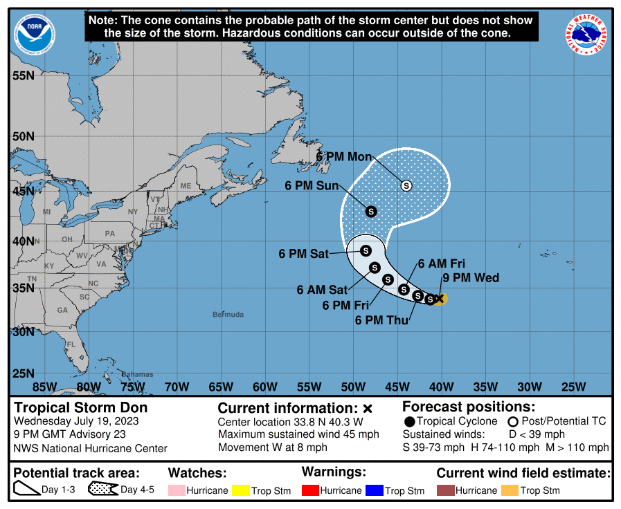
In the Atlantic, Tropical Storm Don is starting its turn back towards the northwest and complete its loop over the open ocean. As of 7:00pm CDT, Tropical Storm Don is located more or less in the middle of the Atlantic Ocean, moving west at 8 mph, with maximum sustained winds of 45 mph. Sandwiched between two high pressure systems, this will help push Don more northward over the next 3-6 days. Wind profiles and SSTs around this tropical cyclone will remain more favorable and allow it to maintain its intensity over the coming days, before weakening by early next week.
Extended Outlook
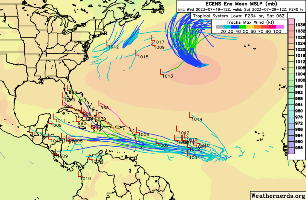
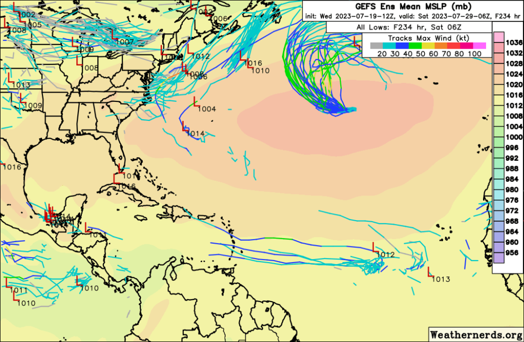
In the Pacific, another area of low pressure south of Baja California will look to organize over the next few days. The overall window this disturbance will have to work with is relatively small, but nonetheless, will allow for possible organization, with somewhat warm SSTs and weak to moderate wind shear. Eventually though by the weekend, development will look to shut down considerably due to the presence of much colder ocean temperatures and stronger wind shear off to the west. Overall in the long-term, conditions will remain conducive for continued opportunities of potential tropical development. Wind shear will be largely muted, albeit GEFS ensemble guidance suggests marginally stronger wind shear. Regardless, this in combination with a moist atmosphere and warm SSTs should leave this region favorable for tropical development over the next couple weeks.
In the Atlantic, things look a little more…interesting. A tropical wave off the coast of West Africa will try to become organized over the course of a week or two. Ensemble guidance is disagreeing between each other as to if this wave can get together, or if it does, how organized and intense it may be. Euro ensemble members are more aggressive with development and intensity, whereas GEFS ensemble members are more bearish and keeping the odds of development low. Looking at the forecasted conditions, upper-level wind shear across the Central and Western Atlantic will remain relatively modest, SSTs will remain warm to very warm, but dry air will permeate the region in front of this wave. This will leave the door open for perhaps the opportunity for tropical organization to occur, but this far out, the chance will still remain low. This, however, is always a fluid ordeal and may see sudden changes over the course of 12 to 24 hours on any given day.
Conclusion
Both Calvin and Don will continue to move in open waters away from land and progressively weaken over the course of this week. Once these storms weaken and/or dissipate, attention will turn back once again to the Eastern Pacific and Central Atlantic for more tropical development over the next 1-2 weeks. The Eastern Pacific, at least for the moment, will carry more favorable conditions to allow for any potential disturbance to organize, whereas things are still a bit hazy in the Central Atlantic. Some indications of an organized system developing are evident, but overall confidence and consistency is low at this time. Regardless, our attention will have to be had to both of these regions, where conditions may change suddenly and rapidly, especially as we get deeper into the 2023 Hurricane Season.


