Tropical Storm Arthur has finally passed through our area. Over the course of 3 days, our area received a lot of rain. Some areas have seen over 10 inches!
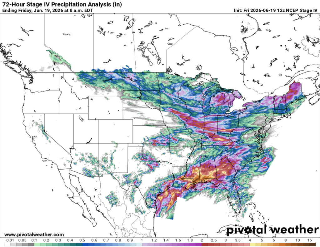
Southern MS and AL had an active day with several tornado watches, warnings, and flash flooding. The first round was around the late afternoon, then the second round around the late evening. Where I’m from in South Alabama, we experienced lots of lightning and flooding toward Midtown and Downtown Mobile.


Today
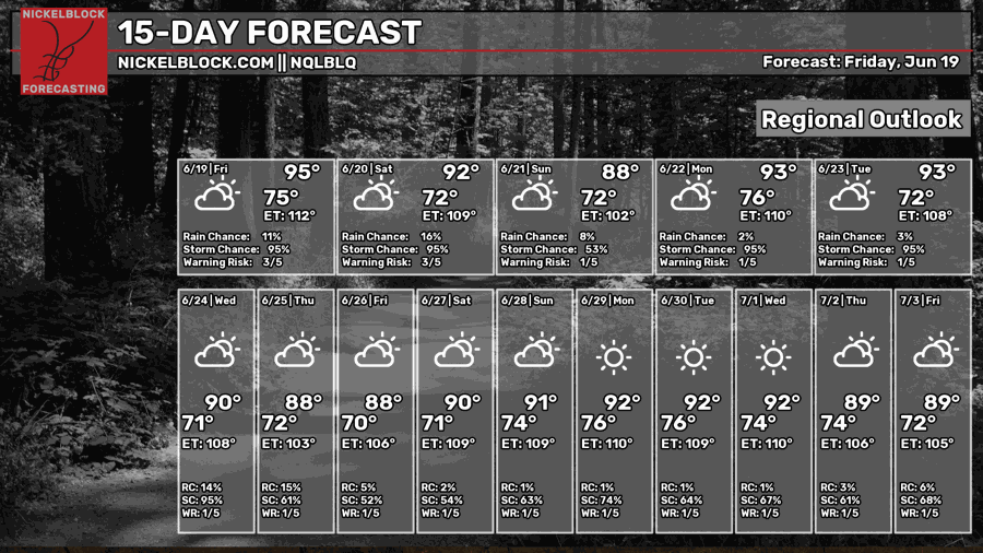
It is going to be a very hot and humid day. Highs in the mid-90s and lows in the mid 70s. Our chances of rain and thunderstorms will persist throughout the day. We’ll have relatively calm winds throughout the area, coming from the southwest.
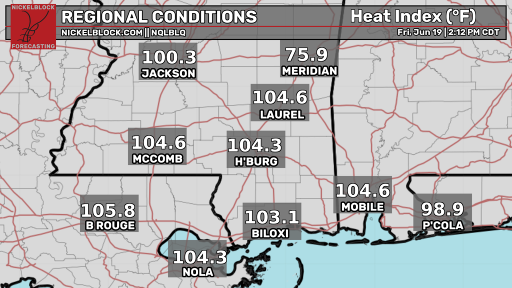
It feels like we’re in the triple digits across the south. The heat index will remain this way for the rest of the month… Make sure you guys are hydrating and staying cool!
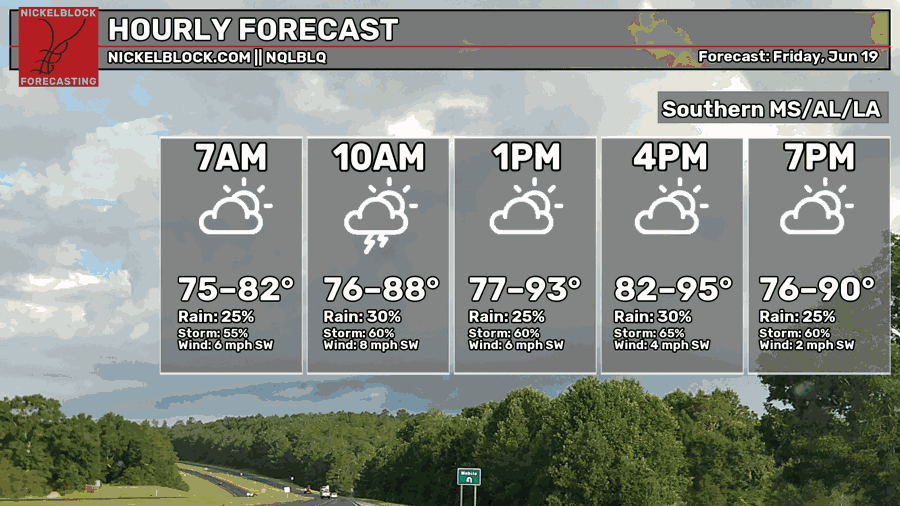
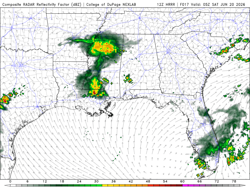
Right now, we have rain and thunderstorms in South Alabama that are moving Southeast. Should clear up around the evening, closer to 6 pm. A thunderstorm will push east now till around 8 pm, starting near the southern MS/LA border. Then another storm will form in the same area, lasting the rest of the night into the early morning hours.
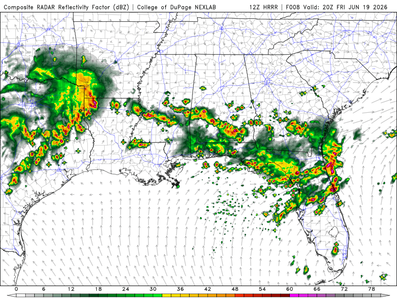
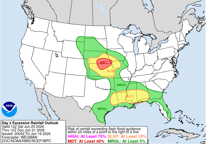
The SPC has southern MS, AL, and southeast AL in a marginal risk, meaning we could see damaging wind gusts, small hail, or a brief, weak tornado. The WPC has Southern MS and AL in a moderate risk for excessive rainfall, meaning widespread flash flooding is likely, and streams and rivers will run high and could pose a danger to infrastructure.


Unfortunately, the rain will continue even though we just saw a lot of rain from Tropical Storm Arthur. With the moisture from the Gulf, the southwest prevailing winds, and the lingering boundary, the ingredients are here to continue for thunderstorms and rain.
Tomorrow
Another hot and humid day with highs in the lower 90s and lows in the lower 70s. Thunderstorms and rain will continue throughout the day, with the highest chances during the afternoon.
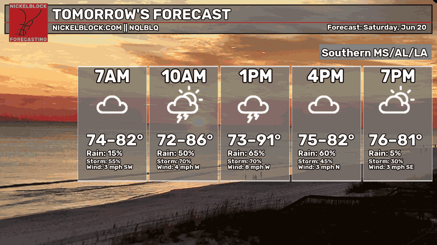
MS and AL will have isolated showers and thunderstorms in the early morning. This first storm system will push southeast through southern AL around the early afternoon. Followed by the second system coming from the LA/MS border around the late afternoon, mostly impacting Southern MS and AL. LA will start to experience rain and thunderstorms during the evening, most likely around 6 pm. Our area should be relatively clear toward 10 pm with some showers in Southern AL during the early morning hours.
SPC has our area under general thunderstorms and a slight risk for excessive rainfall, meaning localized flash floods are possible.

Sunday
While the high will be in the upper-80s, it will still feel very hot with heat indices in the triple digits. Our chances for rain and thunderstorms will be less than the past 2 days, but still there.

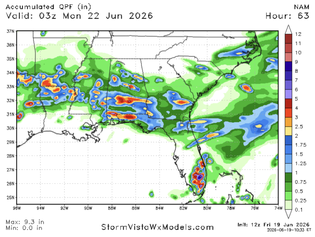
We will continue to pile on more rainfall. From this morning till Sunday at 10 pm, southern AL could see over 4 more inches on top of the total rainfall from the past few days!
Extended Forecast
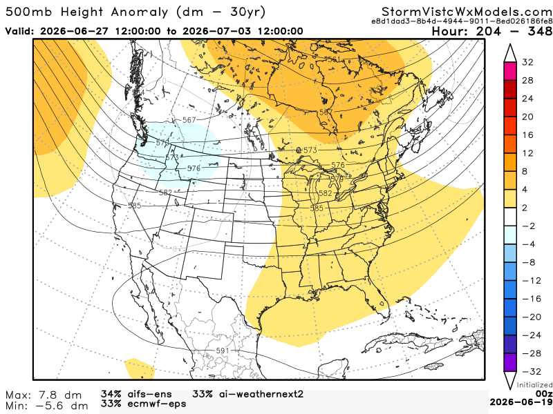
The CPC has our area leaning above normal temperatures with near-normal precipitation values.


This 500mb height anomaly model has a blend of the 3 most accurate models over the past 7 days. The model runs from June 27, 7 am to July 3, 7 am. Based on the blend, I would agree with the CPC. Our area is mostly zonal with a slight ridging pattern. This set-up brings us warmer temperatures with our normal summertime pop-up showers and thunderstorms, nothing widespread. Humidity will continue to be high, making the temperature feel like the triple digits.