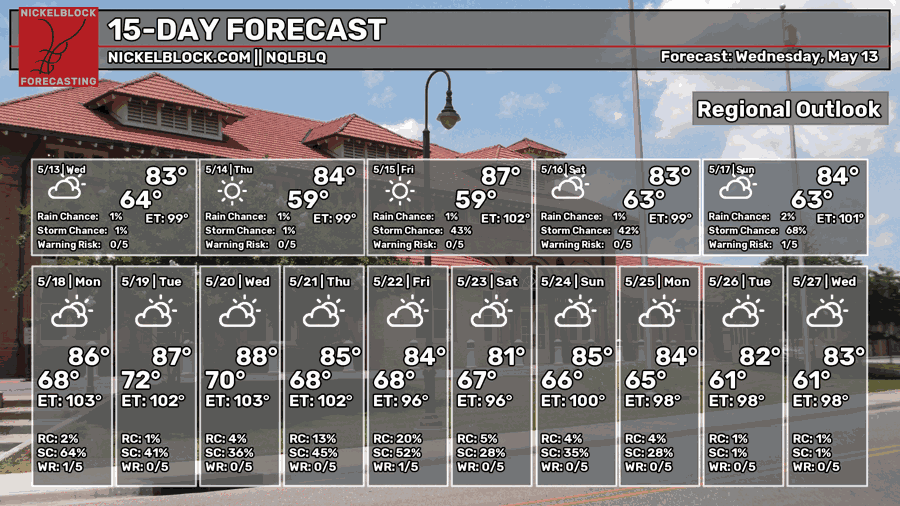
This week has been a remedy to the humidity and severe weather of last week and we’ll stay around the seasonal norms for the next several days! A few warm days here and there, but it’ll be a nice end to the week. Rain is possible for much of southwestern Mississippi and southeastern Louisiana this weekend as the atmosphere begins to shift a bit.

The Setup
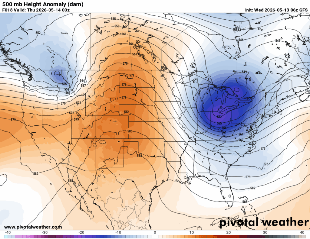
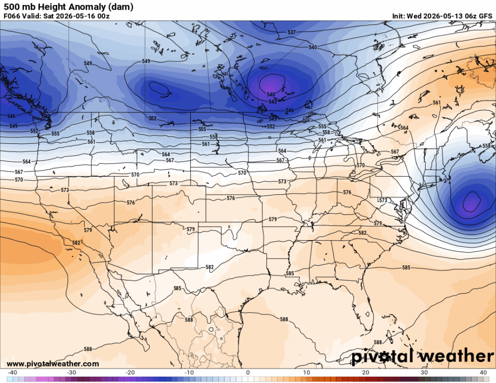
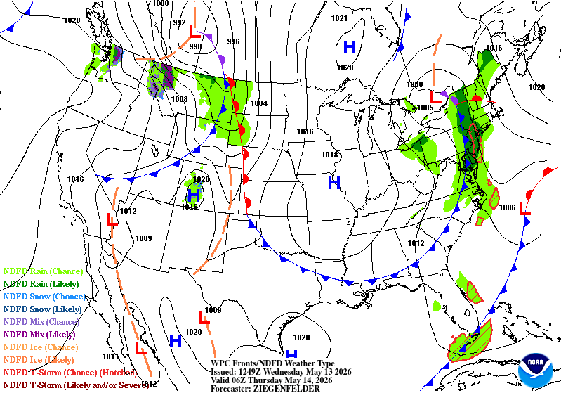
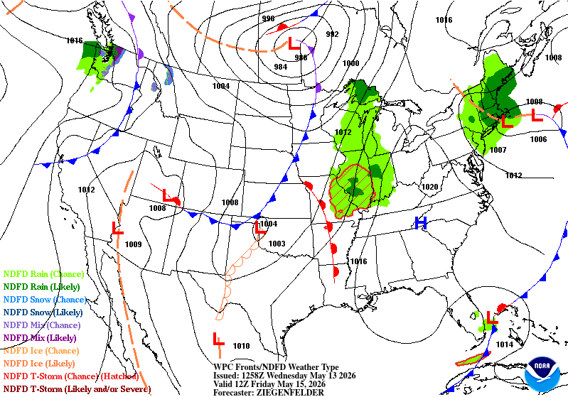
The upper atmosphere is beginning to lull as the amplified patterns (left) begin to dampen. The ridge you see in the Rockies/High Plains will fall apart before it reaches the eastern US. This will keep us in a more linear pattern for a little while (right).
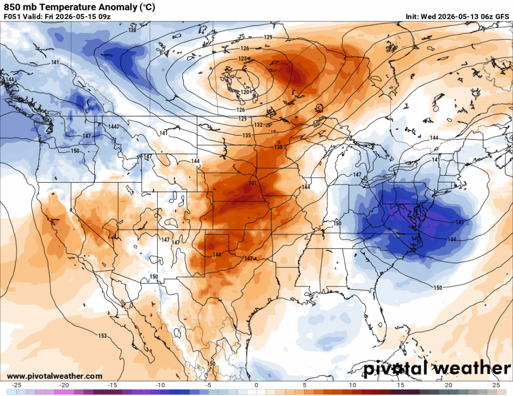
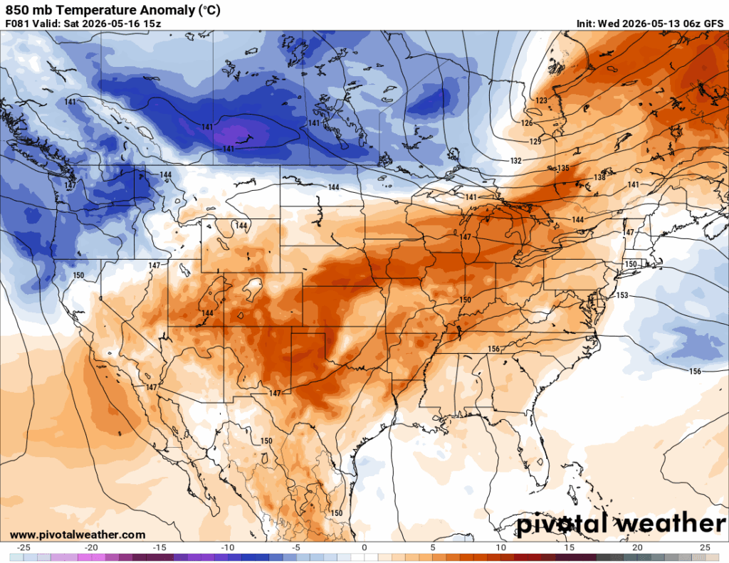
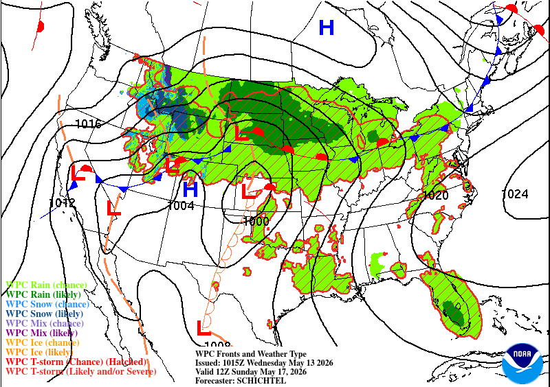
The mid levels (850mb level) show a more dynamic setup, but that also begins to fall apart over time. After the low pressure system moves out of the Atlantic coast (left), a mid-Atlantic high will grow into much of the eastern US and will inhibit incoming fronts from moving towards the lower Mississippi River valley and push it up towards the Midwest.
So what does this mean?? Basically, incoming fronts won’t be able to bring more rain to the Deep South. However, that doesn’t mean we won’t see rain at all! We may just have to wait for it.

Today
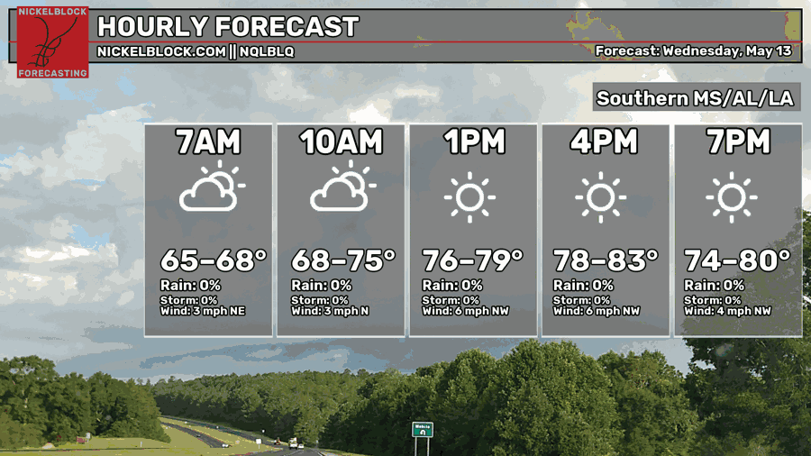
The North winds still prevail today keeping conditions dry and milder. Clouds will move out by the middle of the day and temperatures will reach the low 80s. Overnight, temperatures will fall into the upper 50s to low 60s with clear skies.
Tomorrow
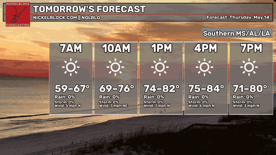
A cold front will move in tomorrow keeping conditions drier for the day as northerly winds still prevail. Sunny skies remain with temperatures in the low to mid 80s. Overnight, temperatures fall back into the low 60s with clear skies.
Friday
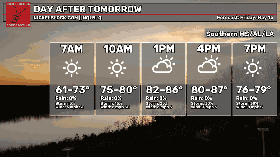
There will be a shift in conditions on Friday as the cold front dissipates and southerly winds move in. It’ll be a bit more humid and temperatures will warm up quicker than the past few days. Temperatures will reach the mid to upper 80s. Overnight, we’ll fall into the mid 60s with mostly clear skies.
This Weekend
Warm weather is expected on Saturday with the humidity slowly creeping up during the day. Highs will be in the low 80s with mostly sunny skies and clouds increasing by the evening. Overnight we’ll reach the mid 60s again.
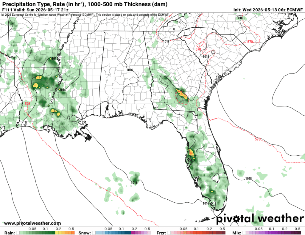
A slight, and I mean slight chance of rain is possible on Sunday. We’ll feel the humidity as south winds pull in from the Gulf. Most of the rain will be to our west in southwest Mississippi and Louisiana, but we may see a few showers/thunderstorms towards the western end of the Pine Belt. Over the next few days, rain chances will increase as the front from the High Plains evolves and eventually moves east by mid-week.


‘However, that doesn’t mean we won’t see rain at all! We may just have to wait for it.’ … Hopefully, that will be a LLLOOOONNNNGGGG wait!