The Setup
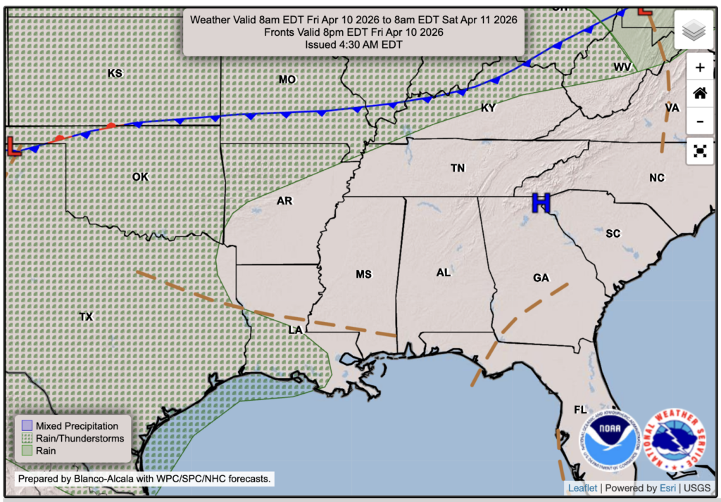
Aside from some coastal flooding concerns down the coast, we’re looking at a mainly quiet weekend ahead with fair weather, sunny skies, and warm temperatures. Much of the same, if I’m being honest. You can see by the brown striped lines in the WPC forecast chart for Friday that there is a surface trough over our region, which could bring some isolated showers, but it’s not too likely, and I think everyone will stay dry and mostly sunny tomorrow. For Saturday and Sunday, high pressure will dominate, promoting sinking air, so it will be a nice weekend with very little clouds!

Tonight’s Forecast
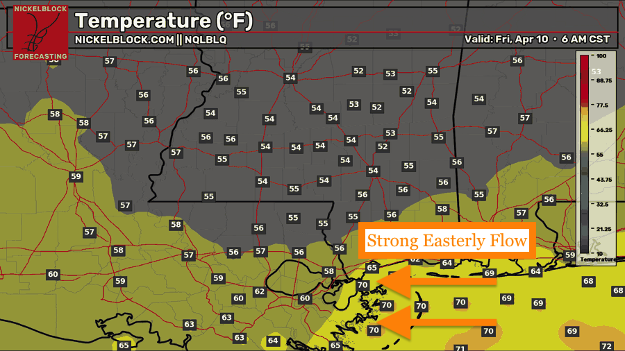
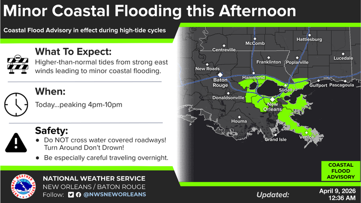
We’ll see a low in the low-to-mid 50s on the mainland and closer to 60 or 70 along the immediate coast, thanks to a strong easterly flow bringing in a milder airmass off of the northern Gulf. This easterly flow could also bring some higher-than-normal tides and lead to some minor coastal flooding. This threat is through around 10 PM tonight.

Tomorrow’s Forecast: Friday, April 10th
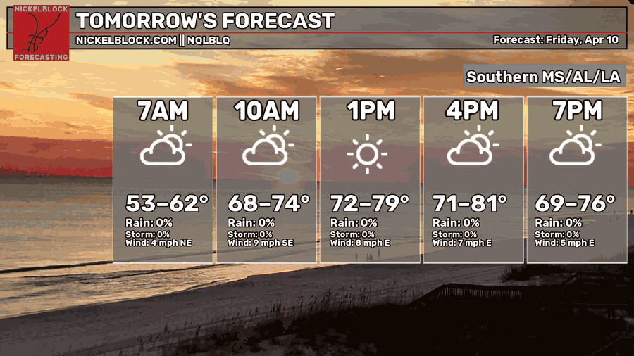
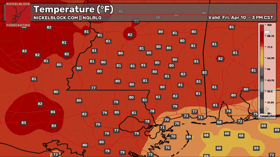
Expect a mix of sun and clouds for your Friday with temps near 80, closer to 70 for the MS coast. Our easterly flow will continue, so we won’t see a crazy moist Gulf airmass, but definitely not a dry northerly one either. Think somewhere in the middle, with low to moderate humidity for the day. As I mentioned earlier, if you see an isolated pop-up shower, do not be surprised, but it’s more likely than not that you won’t see any sort of rain, and you’ll have a dry Friday.
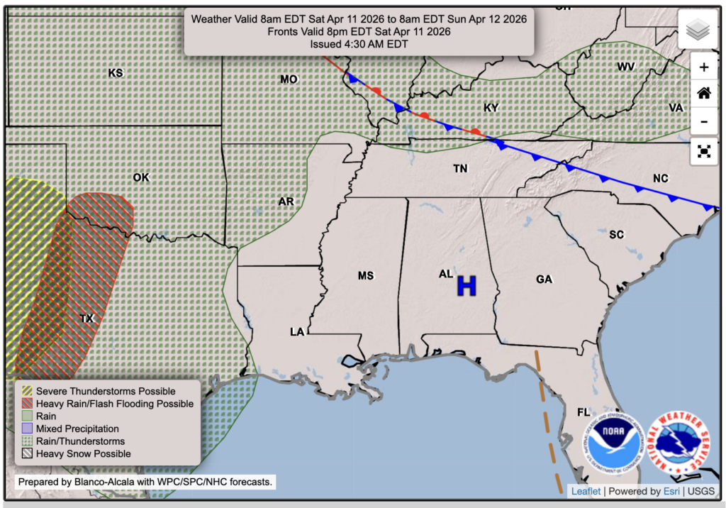
Weekend Forecast
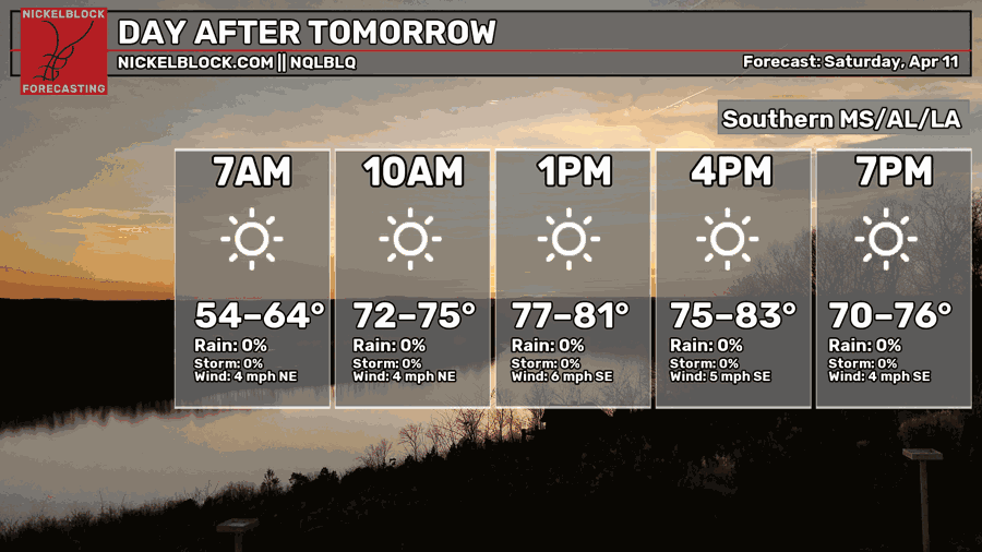
A very nice weekend is ahead, with mostly sunny skies under a high-pressure system and temperatures in the lower 80s for Saturday and Sunday. There isn’t any chance of rain, so all plans will be good to go! Enjoy the weekend!

Extended Local Outlook
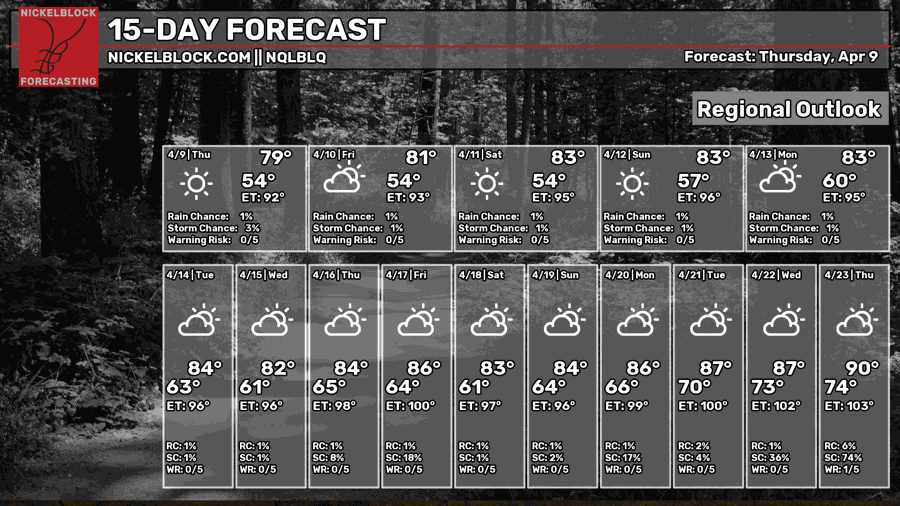
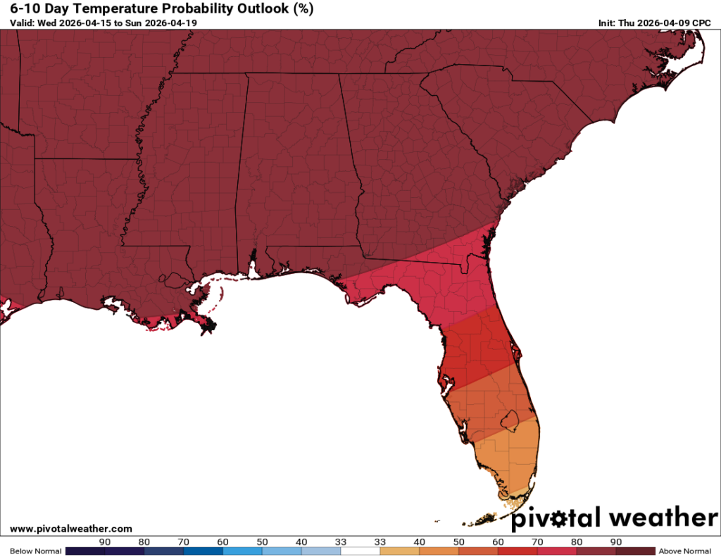
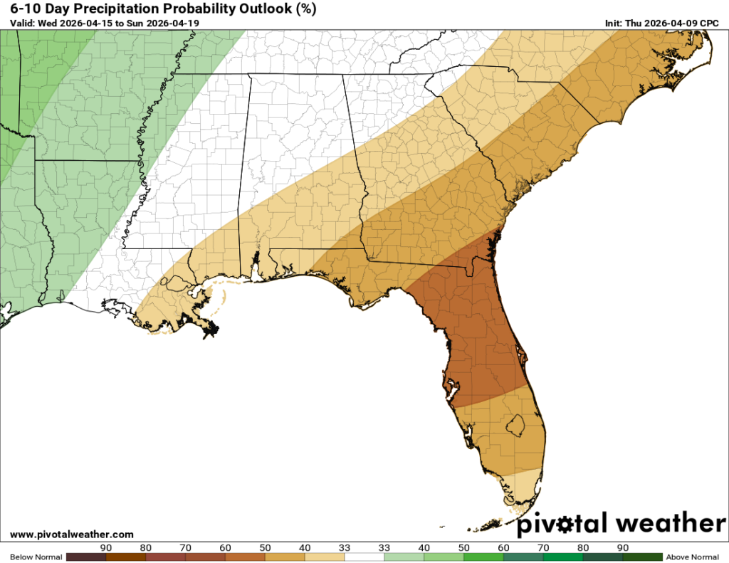
Looking ahead into next week, more above-average temperatures are to be expected, with temperatures in the low-to-mid 80s for each day, and even approaching 90 by the end of the 15-day forecast! Also, expect a near-to-slightly below average rainfall stretch, with a high-pressure and ridging pattern taking over and staying for the time coming.


