Just a quick forecast this morning! Showers and a few storms will kick through the area today. Severe weather is not expected north of I-10, but don’t be surprised if you hear a distant rumble of thunder.
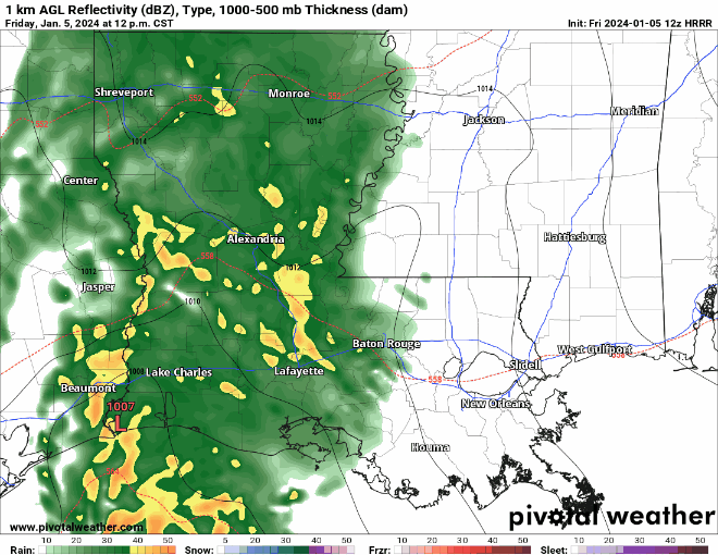
South of I-10/I-12 will feature a chance for some gusty wind and an outside shot for a brief tornado.
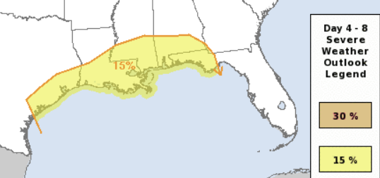
Once this kicks through, things calm down for a few days before we get back into a shot for storms on Monday of next week. The SPC is holding a Slight Risk for severe weather across the area.
REGIONAL DAY TO DAY FORECAST
Friday: Increasing clouds and a shot for rain. Highs in the lower 60s. East winds 15 to 20 mph with gusts up to 30 mph. Chance of rain 80 percent.
Friday Night: Cloudy with rain and rumbles of thunder overnight. Lows in the upper 40s. Southeast winds 15 to 20 mph, becoming southwest 10 to 15 mph after midnight. Chance of rain 90 percent.
Saturday: Mostly cloudy in the morning, then becoming mostly sunny. Highs around 60. West winds 5 to 10 mph.
Saturday Night: Partly cloudy in the evening, then becoming mostly cloudy. Lows around 40. West winds around 5 mph.
Sunday: Mostly sunny. Highs in the upper 50s.
Sunday Night: Mostly cloudy. Lows in the lower 40s.
Monday: Mostly cloudy. A chance of showers in the morning, then showers with a slight chance of thunderstorms in the afternoon. Breezy with highs in the mid 60s. Chance of rain 90 percent.
Monday Night: Showers with a chance of thunderstorms. Some thunderstorms may be severe. Breezy and not as cool with lows in the lower 50s. Chance of rain near 100 percent.
Tuesday: Partly sunny. A chance of showers with a slight chance of thunderstorms in the morning. Breezy with highs in the lower 60s. Chance of rain 50 percent.
Tuesday Night: Partly cloudy. Much cooler with lows in the mid 30s.
Wednesday: Mostly sunny. Highs in the mid 50s.
Wednesday Night: Partly cloudy. Lows in the mid 30s.
Thursday: Partly sunny. Highs in the lower 60s.


