More rain is expected for the first half of this week. We have an interesting setup of storms this afternoon, creating an interesting weather phenomenon. Also, there might be a chance of pattern later this week into early next week.

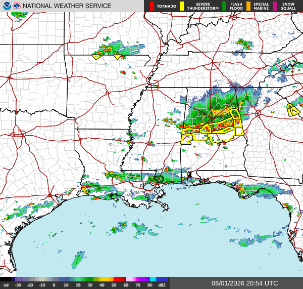
Here’s a look at the current radar. Models are already wrong about the specific placement. So the data shown may not fully align with our forecast.

Today
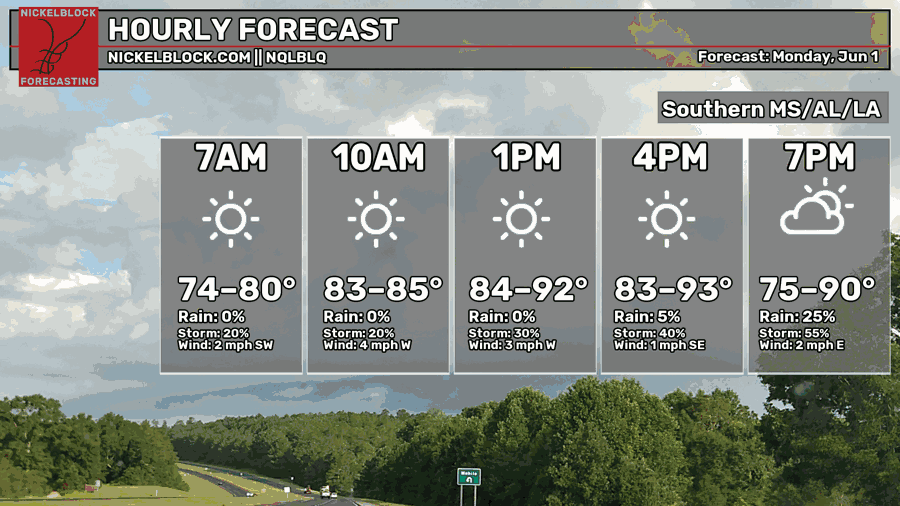
Another hot day out here in the Southern region. Highs in the low to mid-90s, but with the humidity, it feels like the upper 90s! We see the heat index over 100 in places inland of MS. The winds will remain calm, shifting from a SW to E direction by the end of today. Our chances for precipitation and storms will increase as we make it to the late evening and nighttime hours.
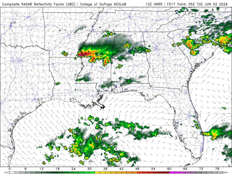
There’s a lot to unpack here. Here’s what’s important for us: LA will experience pop-ups until the late evening. Then remain dry through the night. This is from the Southeasterly winds, with the warm moisture from the Gulf fueling these storms. Same circumstances from Southern MS and AL, but the storms will be isolated around the late afternoon and early evening. Something interesting during the evening hours will occur in inland MS and AL. There’s a risk for southern Alabama to see rain and storms from the Mesoscale Convection System (MCS), with some sections of southeastern Mississippi, based on the current radar.
While this air is moving south, the southerly flow is causing the cold air to expand behind the storms that are developing. That area of cool air, think of it almost like a very localized cold front, is pushing south near North AL. All caused by the MCS, the organized thunderstorms that we are seeing. Pretty cool phenomenon!
You can even see the cool air pushing south during the late afternoon and nighttime hours (blue color), especially in Central MS. The storms pushing south will start to slow down and fall apart closer to the Gulf since there isn’t a big temperature difference between the MCS and the air out in the Gulf.
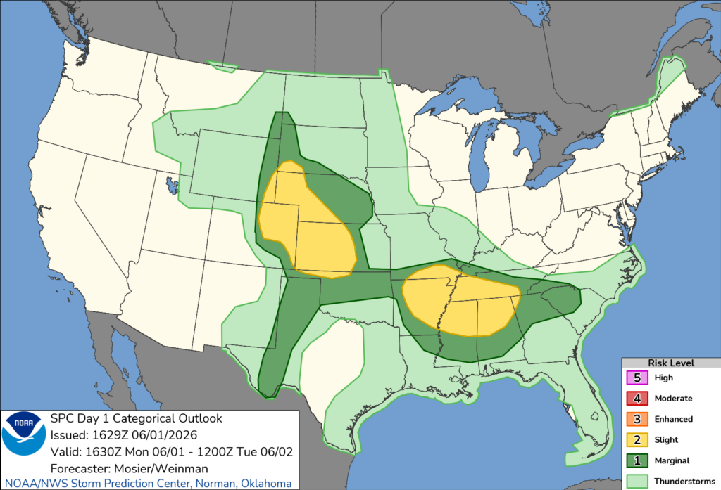
The SPC has parts of our area under a marginal risk, mostly thunderstorms, for gusty winds, hail, and heavy rain.

Tomorrow
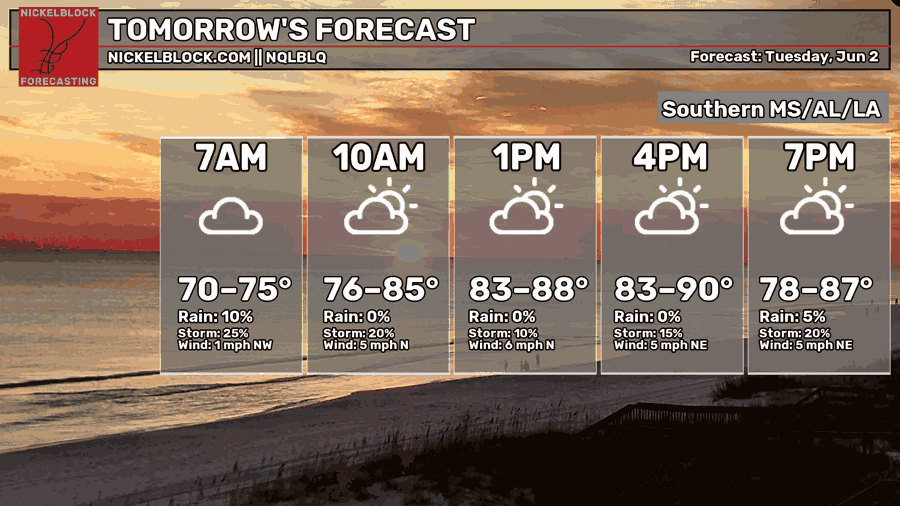
Continuing to feel the warm temperatures with highs in the lower 90s. The chances of precipitation are lower than yesterday but still prevalent. Calm northerly winds.
The storms I mentioned coming out of the north will clear out by the early morning hours, around 6 am. Around 4 am, the coast of Southern LA will experience showers and thunderstorms until around 9 am. The storms seem patchy and not very organized.
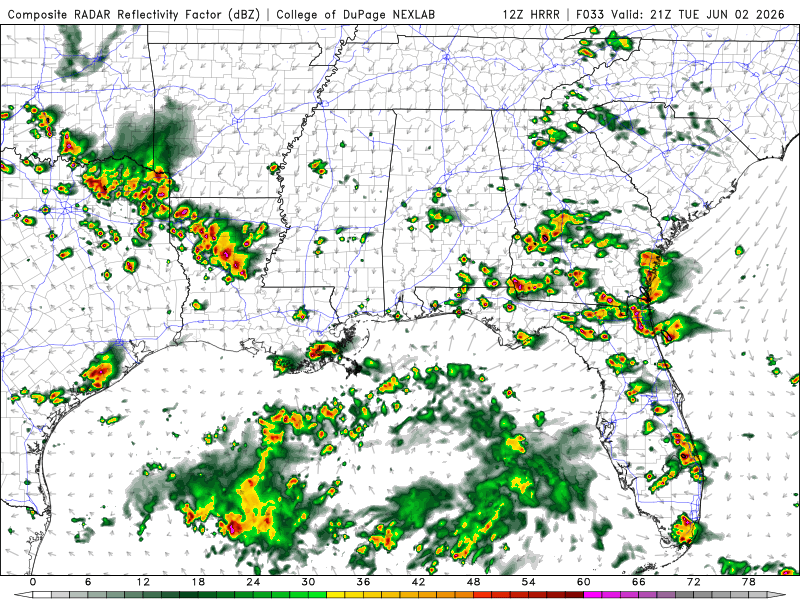
Around 4 pm, there’s a line of storms and precipitation that lingers around Southern MS and AL. It will fall apart around the nighttime hours to scattered showers and possible thunderstorms. Southwestern LA will see a line of showers and storms around the late evening that will start to clear out around the nighttime hours.
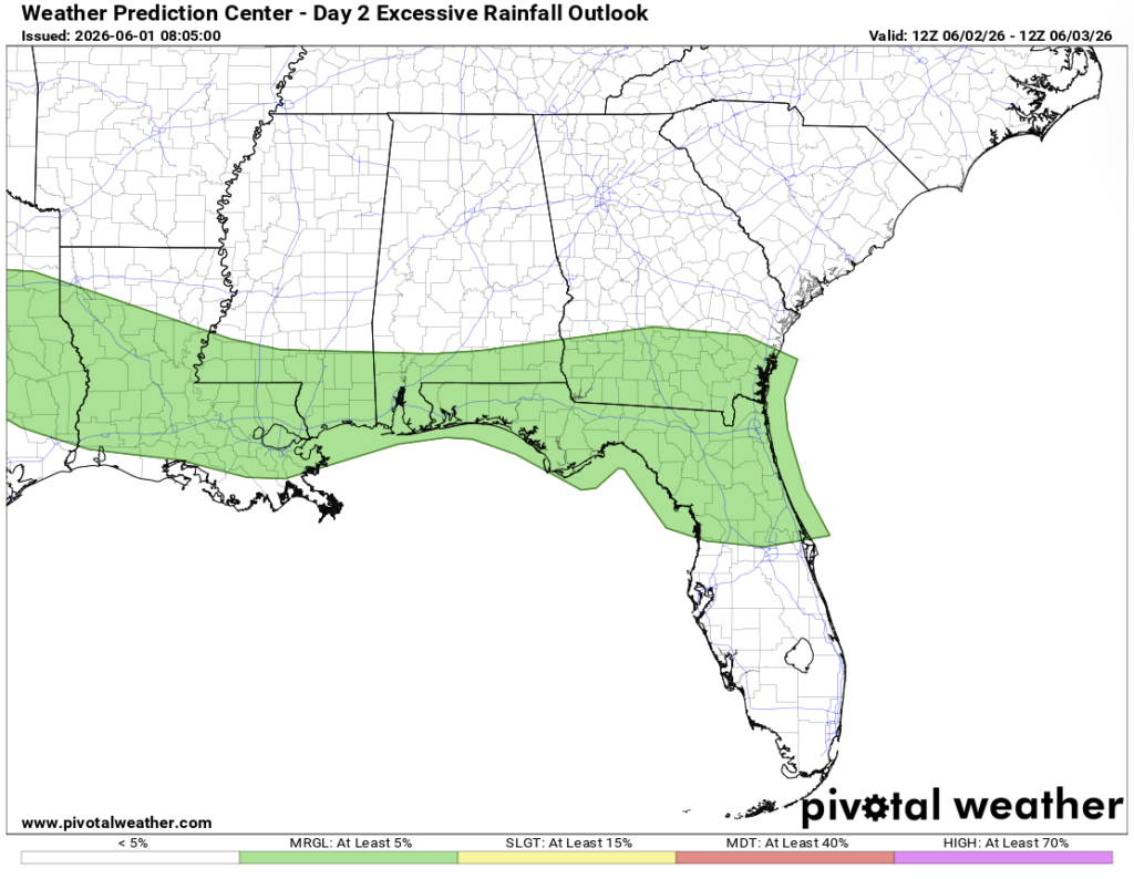
There is a risk, while marginal, of excessive rainfall across the south.
Wednesday
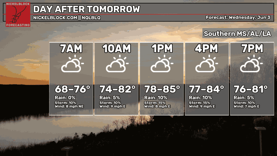
While still humid and hot, we will see a slight decrease in temperatures compared to the past 2 days. We’ll see highs in the mid-80s with a steady chance for showers and thunderstorms throughout the day.
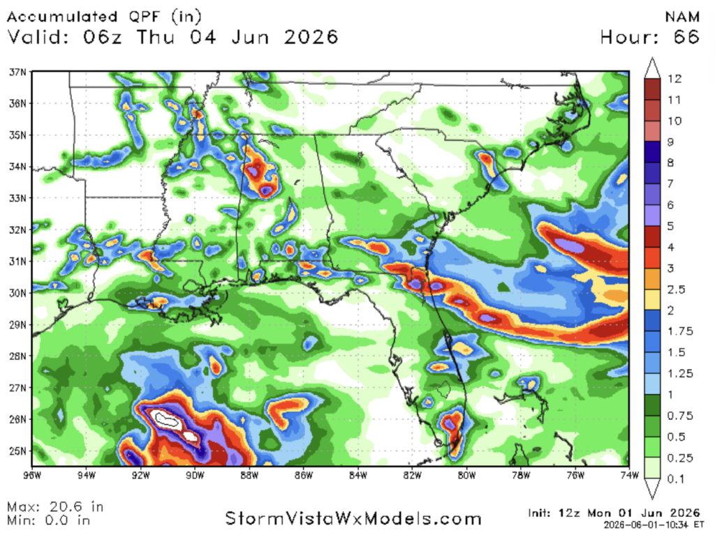
From today through Wednesday, we will pile on more rain. Areas in Southern LA and AL can see > 2.5 inches of rain. Heavy rain, flash flooding, and flooding are possible over the next 3 days. Stay up to date on your active alerts.

Extended Forecast
If we look into the future, we could start to see different weather patterns. We see a ridge right over the Southern region and a trough over the Pacific Coast down into Mexico. Below is the graphic with the 3 different possibilities blended into one outcome from Thursday to Sunday of this week.
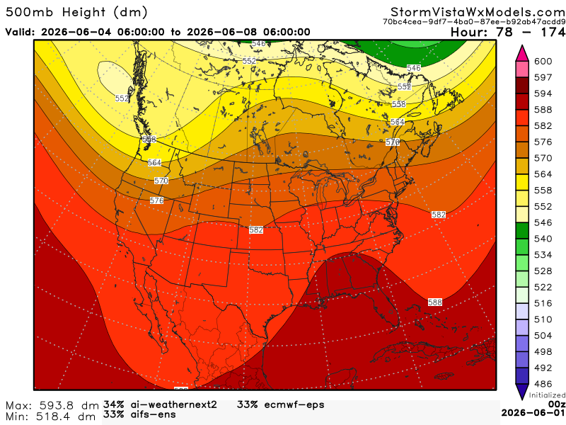
What does that mean for our area? We might see drier conditions and warmer air later this week into early next week. The trough can still bring in some Gulf moisture, so we can’t rule out pop-up showers and humidity.


The CPC has a similar outlook for our area, mostly above normal temperatures and near normal to slightly above precipitation.
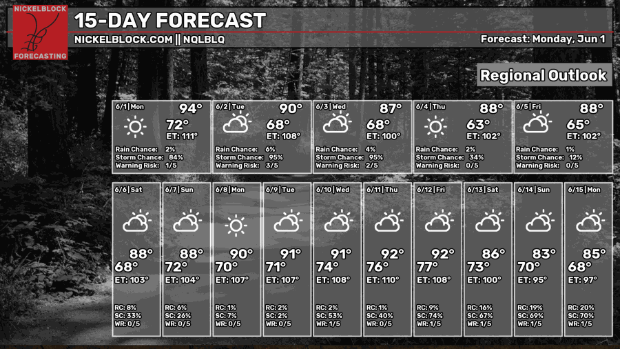
Looks like our 15-day forecast might agree with this outcome for the rest of this week into early next week.


