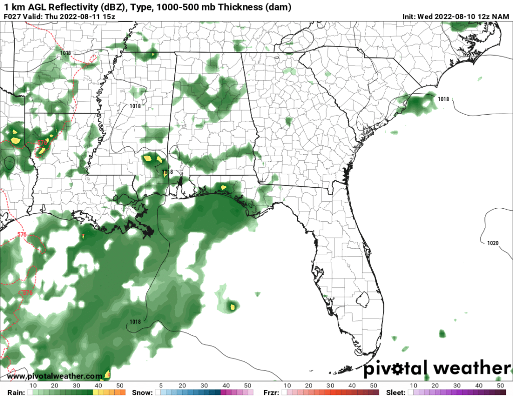
For the end of the work week, the temperatures will be down, and the rain chances will be high. In fact, for today, the highs might not get above 80, depending on the extent of the precipitation and cloud cover. The NAM and GFS models disagree on the temperatures, as the NAM forecasts more rain and lower temperatures than the GFS, so temperatures may be higher or lower depending on which model is correct.
The rain chances remain high tomorrow, with showers and thunderstorms forecast. The highs should stay below 90 on this day as well.
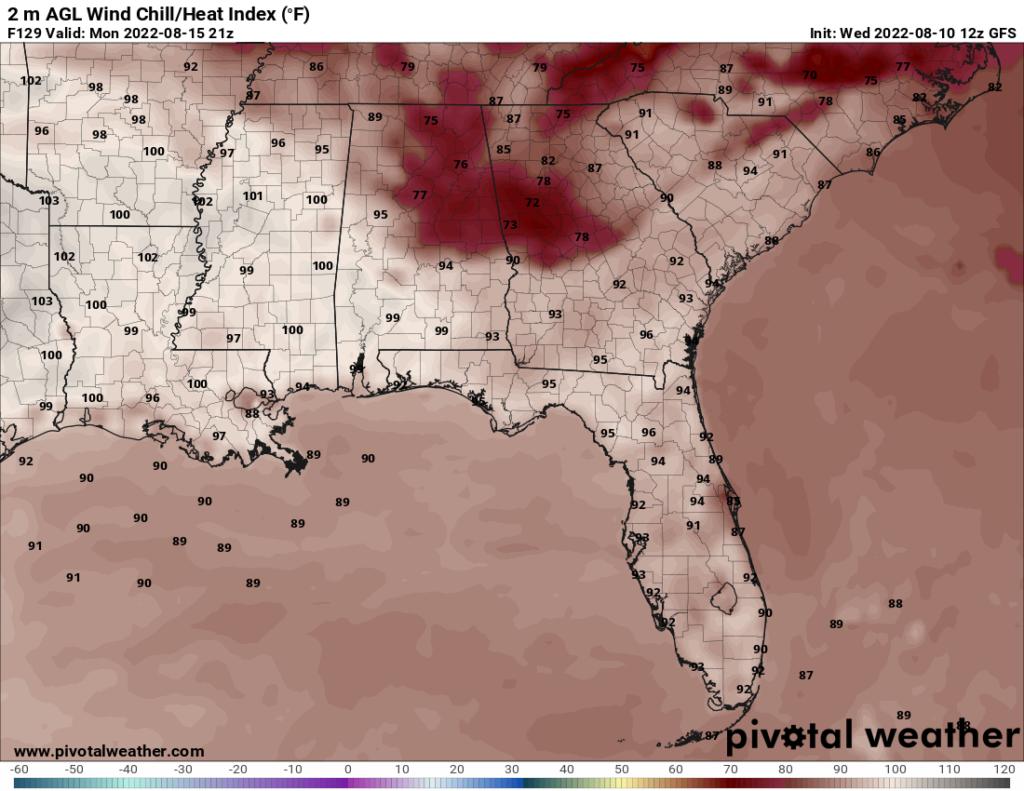
Starting this weekend, the temperatures go up again, and the rain chances go down. This continues into Monday, with Monday being the hottest day in this forecast period. Highs may reach the mid 90s, and the heat index may get into the upper 90s. Note that the map below is probably slightly higher than the actual heat index, as the GFS tends to overestimate temperatures in the Southeast during summer.
On Tuesday, a trough digs into the area, and an associated cold front moves in. The highs dip down to 90 or so, and the lows might dip below 70 on Tuesday and Wednesday. Additionally, on Wednesday, the humidity is low, which will make the weather much more pleasant than the typical summer day for this area.
Day to Day Forecast
Thursday
Mostly cloudy with showers and thunderstorms. Highs around 80. Chance of rain 80 percent.
Thursday Night
Mostly clear. Lows in the lower 70s. Chance of rain 20 percent.
Friday
Partly cloudy with a chance of showers and thunderstorms. Highs in the upper 80s. Chance of rain 70 percent.
Friday Night
Mostly clear. Lows in the mid 70s. Chance of rain 20 percent.
Saturday
Mostly sunny. Highs around 90. Chance of rain 20 percent.
Saturday Night
Clear. Lows in the lower 70s. Chance of rain 10 percent.
Sunday
Mostly sunny. Highs in the lower 90s. Chance of rain 10 percent.
Sunday Night
Mostly clear. Lows in the mid 70s. Chance of rain 10 percent.
Monday
Mostly sunny. Highs in the mid 90s. Heat index in the upper 90s. Chance of rain 10 percent.
Monday Night
Partly cloudy. Lows in the upper 70s. Chance of rain 20 percent.
Tuesday
Partly cloudy. Highs around 90. Winds N at 10 mph. Chance of rain 20 percent.
Tuesday Night
Mostly clear. Lows in the upper 60s. Winds N at 5-10 mph. Chance of rain 10 percent.
Wednesday
Mostly sunny. Highs around 90. Winds N at 5-10 mph. Chance of rain 0 percent.
Wednesday Night
Mostly clear. Lows in the upper 60s. Chance of rain 0 percent.


