Happy Sunday everyone! More of the same weather is on the way through the last day of the weekend and into the work week. Scattered showers and storms are expected again for Sunday.
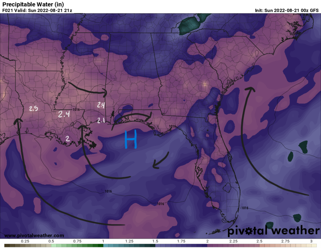
Thanks to a surface high pressure just off the coast, low-level winds will be out of the south. These winds will help increase moisture from the Gulf of Mexico. Precipitable water values will range from 2″ to 2.5″ across the coastal counties and parishes and inland. With such a high moisture content, isolated heavy rainfall and localized flooding could be an issue.
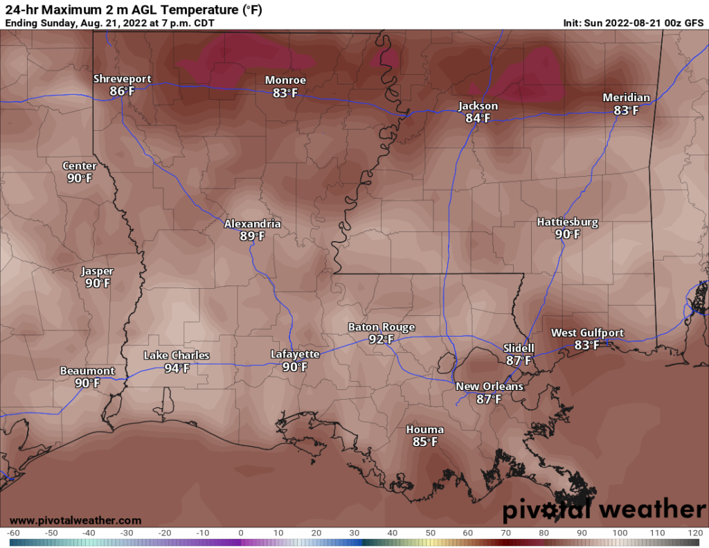
With dewpoints reaching the mid 70s and temperatures hitting the upper 80s, the atmosphere will begin to destabilize. Thunderstorms should begin to initiate as daytime heating kicks in around the early to late afternoon hours. Associated with some of the stronger storms is the potential for gusty winds that should remain below severe criteria. These storms will be scattered in nature and diurnally driven. Once the sun sets and temperatures cool down, storms will begin to dwindle.
As cloud cover will be substantial and showers and storms cover the area, temperatures will be kept in the upper 80s in the coastal areas. Temperatures may be a touch warmer more inland away from the marine influence. Low temperatures in the morning and into the night will be steady in the mid-to-upper 70s.
Into the beginning of the work week, southerly winds will continue to increase the moisture in the atmosphere and diurnally driven showers and thunderstorms will begin in the afternoon hours. Cloud coverage may increase as well to keep temperatures into the low-to-mid 80s by Tuesday.
Day-to-Day Forecast
Sunday
Mostly cloudy with a 80-percent chance of showers and thunderstorms beginning in the early to late afternoon. Highs in the upper 80s. Lows in the upper 70s.
Monday
Cloudy with a 80-percent chance of showers and thunderstorms beginning in the afternoon. Highs in the mid-to-upper 80s. Lows in the low-to-mid 70s.
Tuesday
Cloudy with a 80-percent chance of showers and thunderstorms beginning in the early afternoon. Highs in the mid 80s. Lows in the upper 70s.
Wednesday
Mostly cloudy with a 80-percent chance of precipitation. Highs in the mid 80s. Lows in the low-to-mid 70s.
Thursday
Partly cloudy with a 70-percent chance of precipitation. Highs in the mid 80s. Lows in the low-to-mid 70s.
Friday
Partly cloudy with a 70-percent chance of precipitation. Highs in the upper 80s. Lows in the mid 70s.
Saturday
Mostly sunny with a 60-percent chance of precipitation. Highs in the upper 80s. Lows in the mid 70s.


