Hello all and happy Sunday! For todays look at the forecast, we will continue to track the potential for heavy rainfall, as well as below average temperatures. With the region having seen rainfall prior to this week, flooding is a concern with the ground already being plenty filled with rainfall.
Firstly, we will take a look at the current synoptic conditions and then break down the corresponding conditions down at the surface.
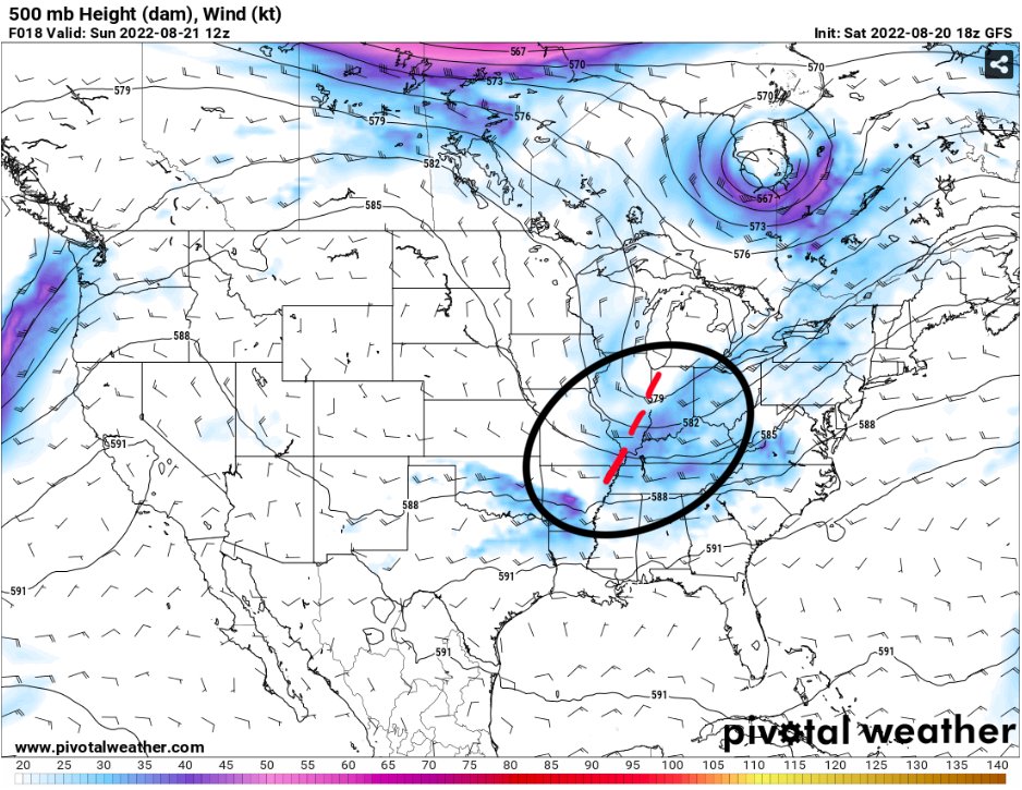
If we take a look at the 500MB map for today, we can see a trough currently centered near the Great Lakes region with its axis extending to the south. With the trough just to our north, our region is likely to feel its affects, and this will come in the way of increased chances for rainfall, with the accompanying cloud cover leaving temperatures below normal into the 80s for much of the week.

If we take a look at the precipitable water values for today, they are expected to remain above 2″ meaning any showers that form will have the potential for heavy rainfall. With there being plenty of lift provided by the trough to our north along with the tropical moisture in the region, these two features will lead to an already wet area being subjected to more heavier rain showers and thunderstorms.
We can see this result if we look at the HRRR reflectivity for Sunday afternoon…
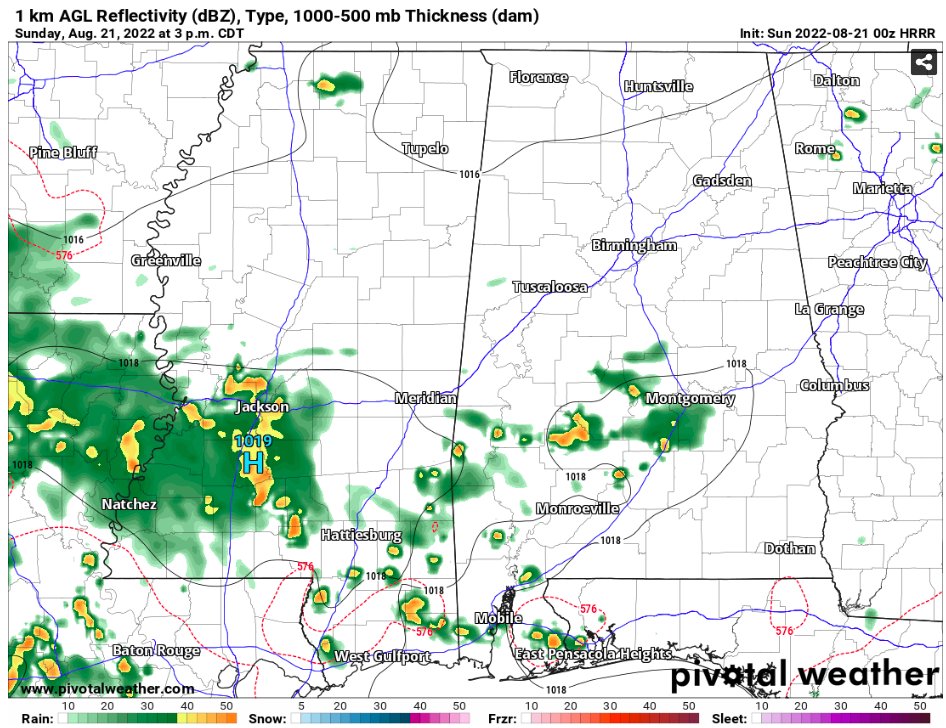
By the afternoon, the showers are already overspending the region, with the theme continuing for the rest of the afternoon and into the evening.

On Monday looking at the 500MB heights and vorticity, we can continue to see the trough moving through the Great Lakes region, as well as a frontal boundary lingering around the southeast, this combination should lead to high rainfall chances for Monday, along with a greater potential for flooding concerns. While severe storms aren’t expected, a thunderstorm is defiantly not out of the question.
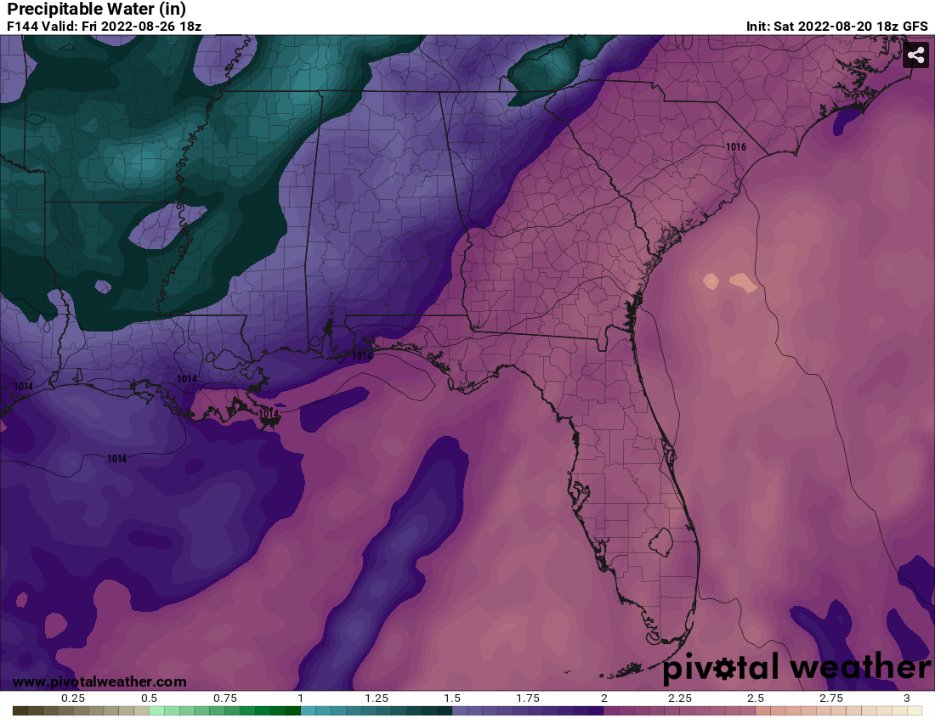
By the time we make it to the end of the week, the trough to our north will begin to lift out as well as a drier airmass taking shape over the region with precipitable water values down closer to 1.5″ compared to over 2″, making the surface conditions more comfortable. With this however comes with decreased cloud cover, which means we could see temperatures back closer to normal into the 90s.
Day-to-Day Forecast
Today
Mostly cloudy with a 70-percent chance of showers and thunderstorms. Highs in the mid 80s. Wind southwest at 5-to-10mph.
Tonight
Cloudy with a 50-percent chance of showers. Lows in the lower 70s. Wind southwest at 5mph.
Monday
Mostly cloudy with an 80-percent chance of showers and thunderstorms. Highs in the lower 80s. Wind south at 5-to-10mph.
Monday Night
Mostly cloudy with a 40-percent chance of showers. Lows in the lower 70s. Wind southeast at 5mph.
Tuesday
Cloudy with a 70-percent chance of showers and thunderstorms. Highs in the upper 70s to around 80. Wind southeast at 5-to-10mph.
Tuesday Night
Mostly cloudy with a 30-percent chance of showers. Lows in the lower 70s. Wind calm.
Wednesday
Mostly cloudy with a 70-percent chance of showers and thunderstorms. Highs in the mid 80s. Wind east at 5mph.
Wednesday Night
Mostly cloudy with a 30-percent chance of showers. Lows in the lower 70s. Wind calm.
Thursday
Mix of sun and clouds with a 50-percent chance of showers and thunderstorms. Highs in the mid-to-upper 80s. Wind east at 5-to-10mph.
Thursday Night
Partly cloudy with a 20-percent chance of showers. Lows in the lower 70s. Wind southeast at 5mph.
Friday
Mostly sunny with a 30-percent chance of showers and thunderstorms. Highs in the upper 80s to around 90.
Friday Night
Mostly clear with lows in the lower 70s.
Saturday
Mostly sunny with a 30-percent chance of showers and thunderstorms. Highs in the upper 80s to around 90.
Saturday Night
Mostly clear with lows in the lower 70s.


