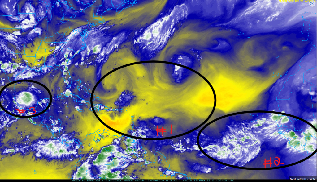
Hello everyone, the main event for today for tropical activity will be Potential Tropical Cyclone FOUR in the southwestern in Gulf of Mexico trying to become a tropical storm strength before it makes landfall. The Atlantic Ocean starting to show some tropical activity with tropical waves coming from the African coast.
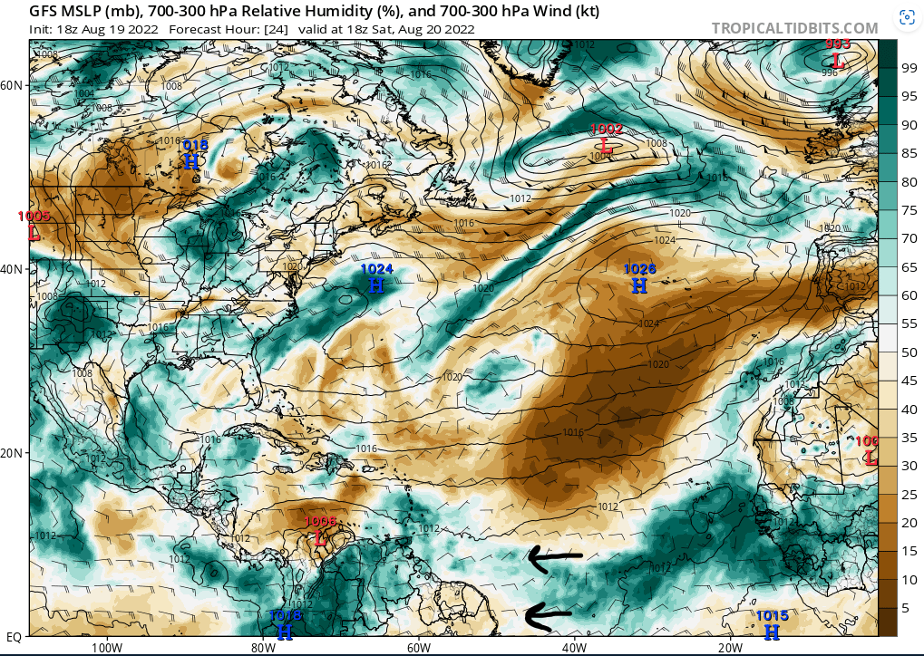
- The Saharan Air Layer (SAL) still remain an abundance of it throughout the Atlantic Ocean that is coming from northern Africa and southern Europe. It will be our safety net on preventing any threating tropical activity coming closer to United States.
2. There will be a burst amount of moisture coming from the coast of Africa to try filter out the SAL near the northeastern South America. Until a tropical wave take the advantage of this till it will form into something stronger.
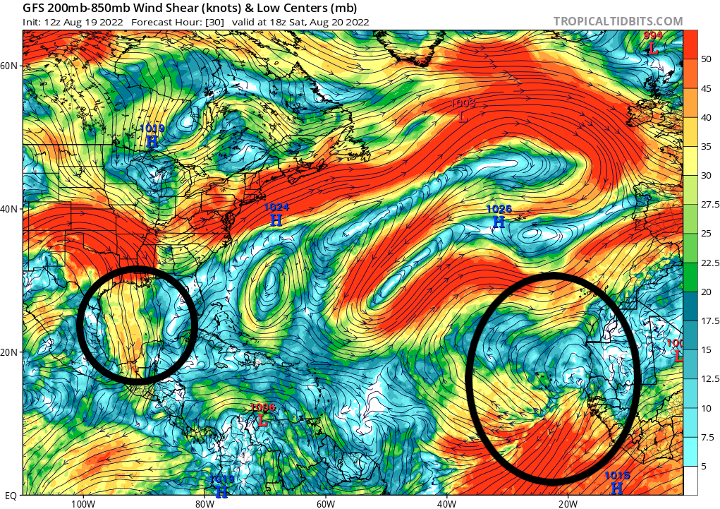
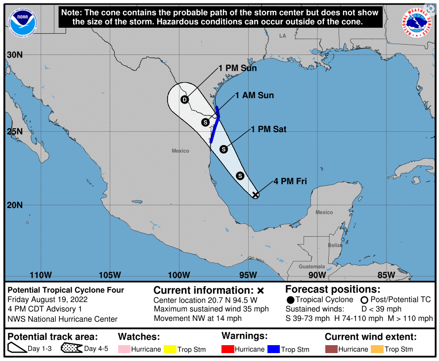
3. The Potential Tropical Cyclone FOUR is having favorable conditions in the Gulf of Mexico, but with it getting closer to the coast of Mexico and Texas will limit it tropical development.
Atlantic Ocean and Gulf of Mexico
The tropical waves off the coast of Africa showing signs of rotation, but it going to deal with heavy wind shear. The wind shear is tearing up the tropical waves to the northeast to the east. If it keeps up with the rotation and having more thunderstorms from Africa coast and to try to organize itself away from the wind shear. It has a slight chance to be something stronger, if it can avoid the Saharan Air Layer,
Meanwhile in the Gulf of Mexico, the Potential Tropical Cyclone FOUR will be dealing with light to moderate wind shear that slow its growth from being a tropical storm strength. With it so close to the land, it will eventually be making a landfall soon.
From the tropical waves off the coast of Africa, the Relative humidity is trying to go under the Saharan air layer to have a safe passage for the tropical waves coming from Africa. There is always a chance for the Saharan air layer to move it down south to cut off the needed moisture for the tropical waves. As long the high-pressure system is in northern Atlantic Ocean is moving the Saharan air from the northern Africa and southern Europe deeper in the Atlantic Ocean to dry out any tropical waves in its path.
Here will be more information about the timing on the Potential Tropical Cyclone FOUR going to make landfall in the northeast Mexico and southeast Texas. The timing on making the landfall will be on Saturday late evening. So far, the maximum sustained wind speed should be around 35mph and moving NW at 14 mph or more. For it to be a tropical storm, it needs to have sustain wind speed above 39 mph to 73 mph. If it still stays as a tropical depression, it will be expected for heavy rainfall and minor damage in northeast Mexico and southeast Texas. Be careful about any possible flash flooding and tropical storm or tropical depression high wind speeds in your area.
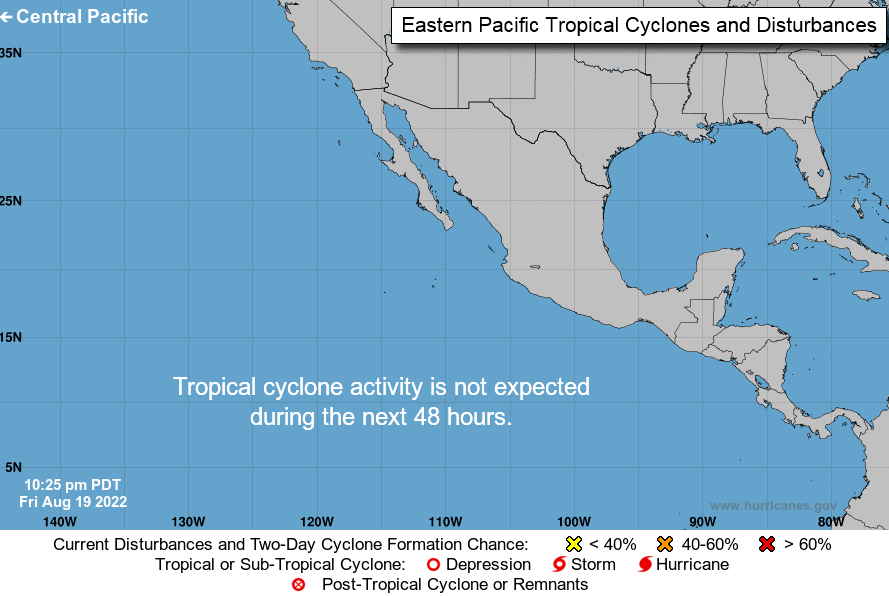
Pacific Ocean
As for right now, there will not be any further tropical activity will be happening in the Eastern Pacific Ocean in the short term. From the mid-level water vapor imagery for Atlantic Ocean, it might change if any possible tropical waves from the Isthmus of Panama and northern South America become stronger in the future.