Hello everyone, there will be scattered showers and thunderstorms with a higher chance in the afternoon and early evening as more moisture coming from the Potential Tropical Cyclone FOUR as it is getting closer to Texas to SE Mississippi and SW Alabama. In the morning, it will be mostly cloudy and a slight chance for rain with a low temperature in the 70s. In the afternoon and evening, there will be thunderstorms and showers coming from Louisiana to SE Mississippi and SW Alabama with a high temperature in the upper 80s. The dew points temperature will in the low 70s up to mid 70s throughout the day.
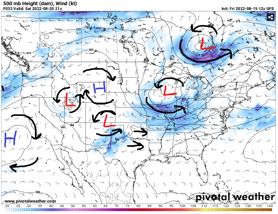
There are multiple systems going around the Southeast that can make an impact in the SE Mississippi and SW Alabama. With the trough in the Midwest lowering in the Southeast will drive the winds from southwest to west to guide the storms to the SE Mississippi and SW Alabama. The storms will be starting to develop in the Gulf of Mexico while moving southwestern throughout the weekend. There will be a low-pressure system in the Great Plains will be starting move to the Southeast and be another rain maker for SE Mississippi and SW Alabama in the next week.
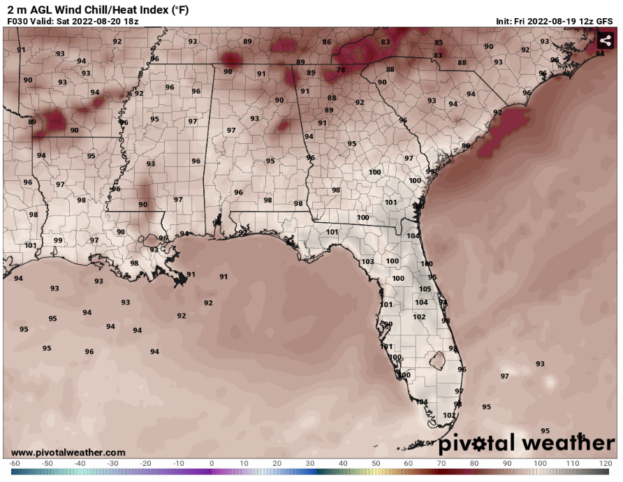
Around 4pm, the heat index values will up to upper 90s with the extra moisture from the Potential Tropical Cyclone FOUR coming into the Gulf of Mexico. Stay hydrate with the high heat index values during a cloudy day throughout the day.
Here is a visual update of the HRRR reflectivity for today rain forecast, as most of the rain will be moving from Louisiana to SE Mississippi and SW Alabama around 5pm CDT to the rest of the evening.
Day to Day forecast
Saturday
Partly sunny, with a 70 percent chance of scattered showers and thunderstorms in the afternoon. With a high temp in the upper 80s and a low temp in the low 70s. A Calm wind up to 5 mph to the southwest throughout the day.
Sunday
Partly cloudy with an 80 percent chance of widespread showers and thunderstorms in the afternoon. With a high temp in the upper 80s and a low temp in the low 70s. A Calm wind up to 5 mph to the northwest throughout the day.
Monday
Mostly cloudy to rainy with an 80 percent chance of widespread showers and thunderstorms in the afternoon. With a high temp in the low 80s and a low temp in the low 70s. A Calm wind up to 5 mph to the northwest throughout the day.
Tuesday
Mostly cloudy to rainy with a 70 percent chance of widespread showers and thunderstorms in the afternoon. With a high temp in the low 80s and a low temp in the low 70s. A Calm wind up to 5 mph to the west throughout the day.
Wednesday
Partly cloudy to rainy with an 80 percent chance of widespread showers and thunderstorms in the afternoon. With a high temp in the low 80s and a low temp in the low 70s.
Thursday
Partly cloudy to rainy with a 50 percent chance of scattered showers and thunderstorms in the afternoon. With a high temp in the mid 80s and a low temp in the low 70s.
Friday
Partly cloudy to rainy with a 70 percent chance of scattered showers and thunderstorms in the afternoon. With a high temp in the upper 80s and a low temp in the low 70s.


